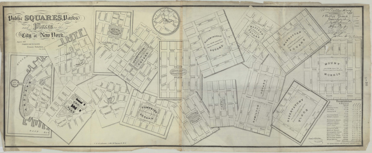
Public squares, parks, and places in the city of New York: compiled and surveyed by Francis Nicholson August 1838
Park maps covering various locales south of 125th Street in Manhattan, New York (N.Y.) Placenames given include Battery, Duane Park, The Park [at City Hall], Hudson Square, [Five Points Park], Washington Square, Tompkins Square, Union Place, Stuyvesant Square, Bloomingdale Square, Gramercy Park, Madison Square, Hamilton Square, Manhattan Square, Observatory Place and Mount Morris. Each map gives dimensions and acreage, shows layout of park walkways and surrounding streets. Endorsed by signatures of the “Committee on Land and Places” and John Ewen, Street Commissioner. Compass orientations vary. Scale is constant. Includes text. NYHS 1 copy soiled, cropped, mounted on cloth. Copy 2 (hand colored) soiled on verso: good condition. Encapsulated. 2 copies: M004027, M002426
Subjects
Places
- Abingdon Square (New York, N.Y.)
- Battery Park (New York, N.Y.)
- City Hall Park (New York, N.Y.)
- Columbus Park (New York, N.Y.)
- Duane Street Park (New York, N.Y.)
- Gramercy Park (New York, N.Y.)
- Madison Square Park (New York, N.Y.)
- Manhattan (New York, N.Y.)
- Stuyvesant Square (New York, N.Y.)
- Tompkins Square (New York, N.Y.)
- Union Square (New York, N.Y.)
- Washington Square (New York, N.Y.)
Map area shown
Genre
Thematic mapsRelation
Full catalog recordSize
40 × 101 cmDownload
Low Resolution Image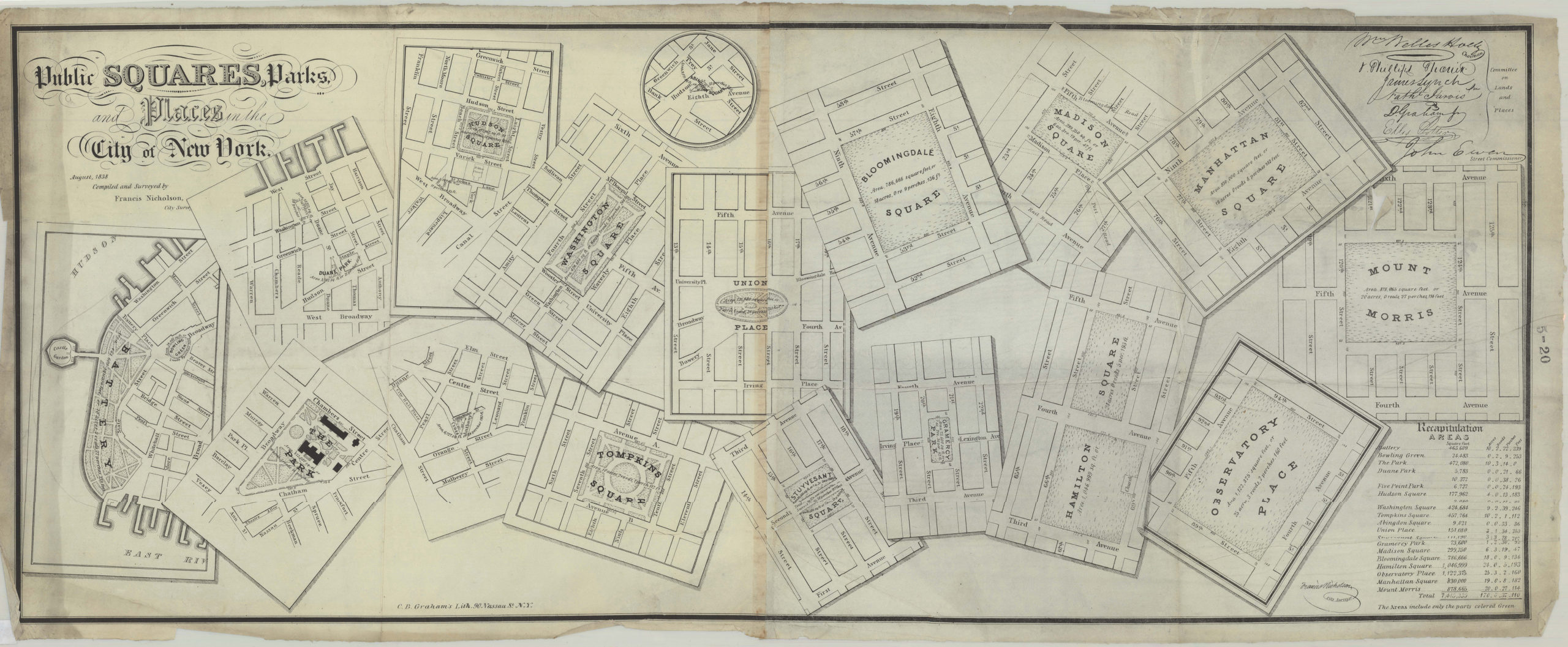
Creator
Nicholson, Francis,Publisher
Brooklyn Historical SocietyCitation
Public squares, parks, and places in the city of New York: compiled and surveyed by Francis Nicholson; August 1838, Map Collection, M-1838.Fl.F; Brooklyn Historical Society.Scale
Scale [ca. 1:4,000]