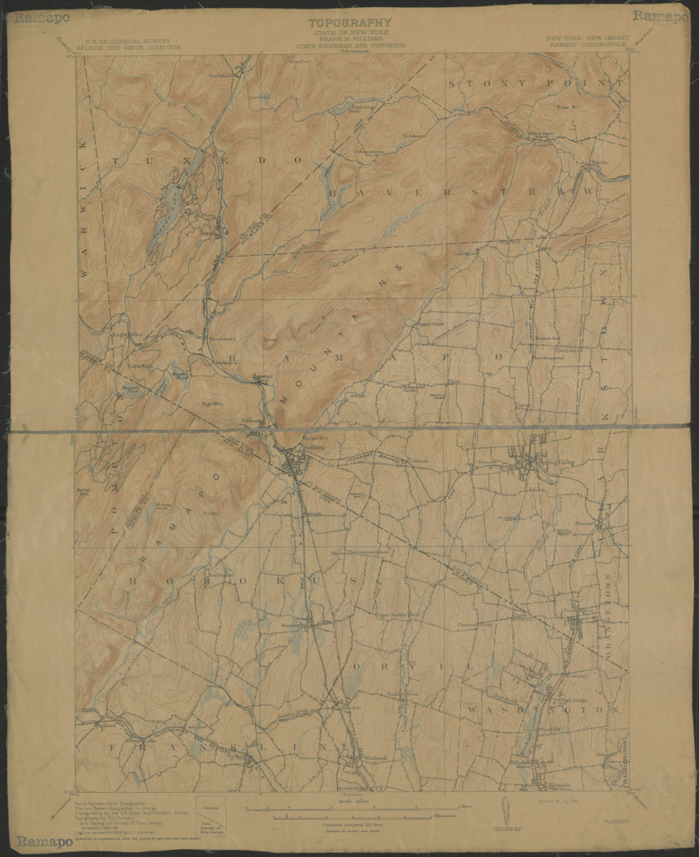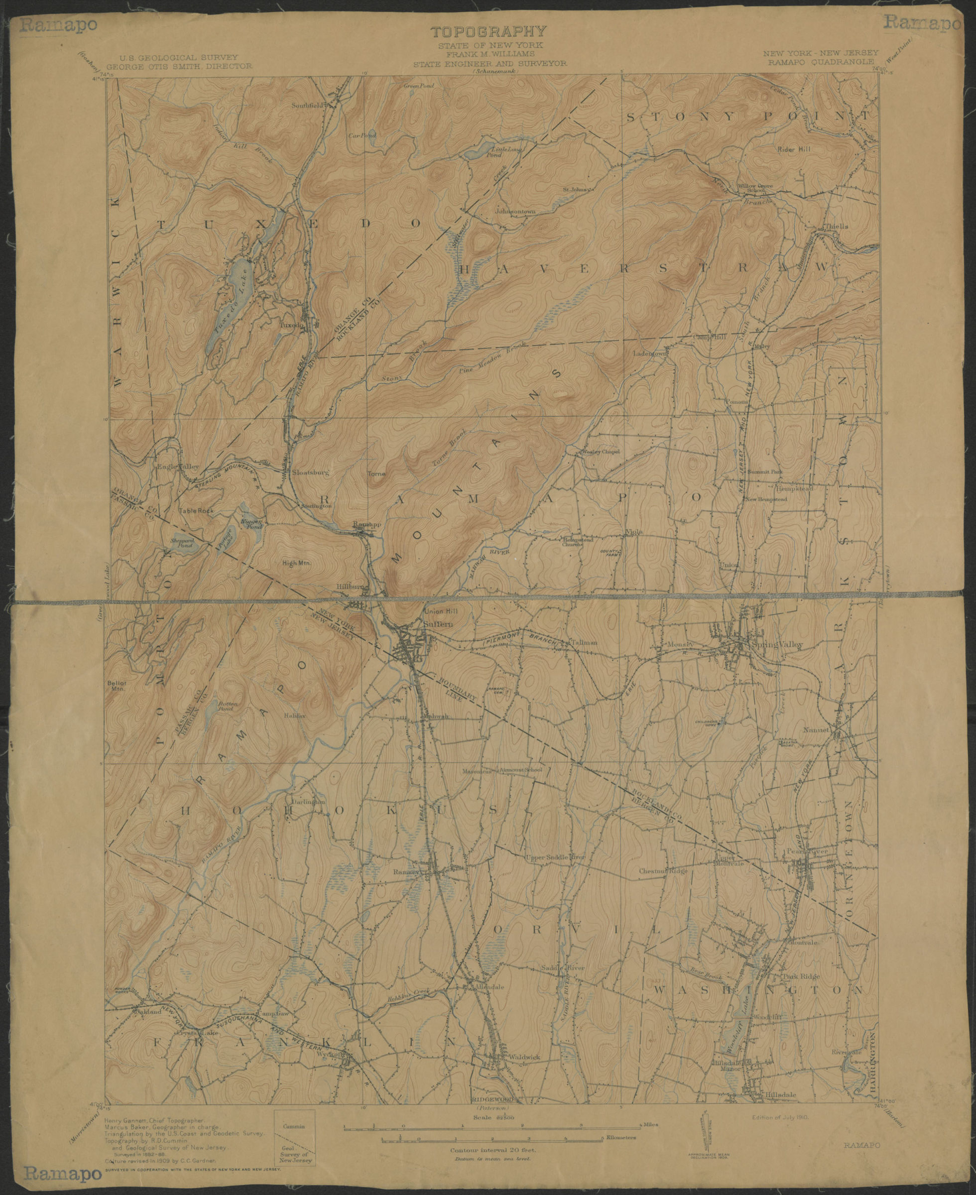
Ramapo Quadrangle, New York – New Jersey: U.S. Geological Survey 1910
Map No. USGS-1:62,500 (Ramapo).Fl
Shows portions of Rockland and Orange Counties in New York, and Bergen and Passaic Counties in New Jersey. Relief shown by contour lines and spot heights. “Surveyed in 1882-88. Culture revised in 1909 by C.C. Gardner.” “Henry Gannett, Chief Topographer. Marcus Baker, Geographer in charge. Triangulation by the U. S. Coast and Geodetic Survey. Topography by R.D. Cummin and Geological Survey of New Jersey.” “Surveyed in cooperation with the States of New York and New Jersey.” “Edition of July 1910.” Text and legend on verso.
Map area shown
Genre
Topographic mapsRelation
Full catalog recordSize
51 × 42 cmDownload
Low Resolution Image
Creator
Geological Survey (U.S.),Publisher
Brooklyn Historical SocietyCitation
Ramapo Quadrangle, New York – New Jersey: U.S. Geological Survey; 1910, Map Collection, USGS-1:62,500 (Ramapo).Fl; Brooklyn Historical Society.Scale
Scale 1:62,500Loading zoom image...