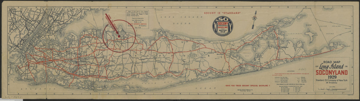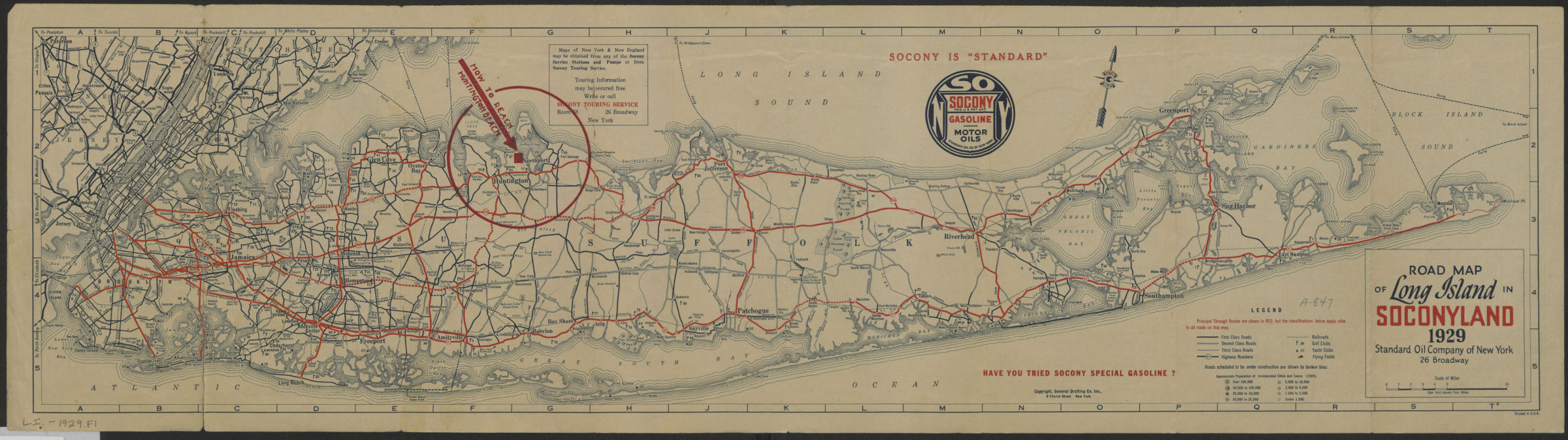

Road map of Long Island in Soconyland, 1929: copyright General Drafting Co., Inc [1929]
Map No. L.I.-1929.Fl
Shows roads, highways, railroads, golf clubs, yacht clubs, flying fields, and approximate city populations as of 1925. On verso: indexes, mileage tables, lists of yacht and golf clubs, and metropolitan ferry schedules and rates.
Map area shown
Relation
Full catalog recordSize
20 × 79 cmDownload
Low Resolution ImageCreator
General Drafting Company,Publisher
Brooklyn Historical SocietyCitation
Road map of Long Island in Soconyland, 1929: copyright General Drafting Co., Inc; [1929], Map Collection, L.I.-1929.Fl; Brooklyn Historical Society.Scale
Scale approximately 1:253Loading zoom image...