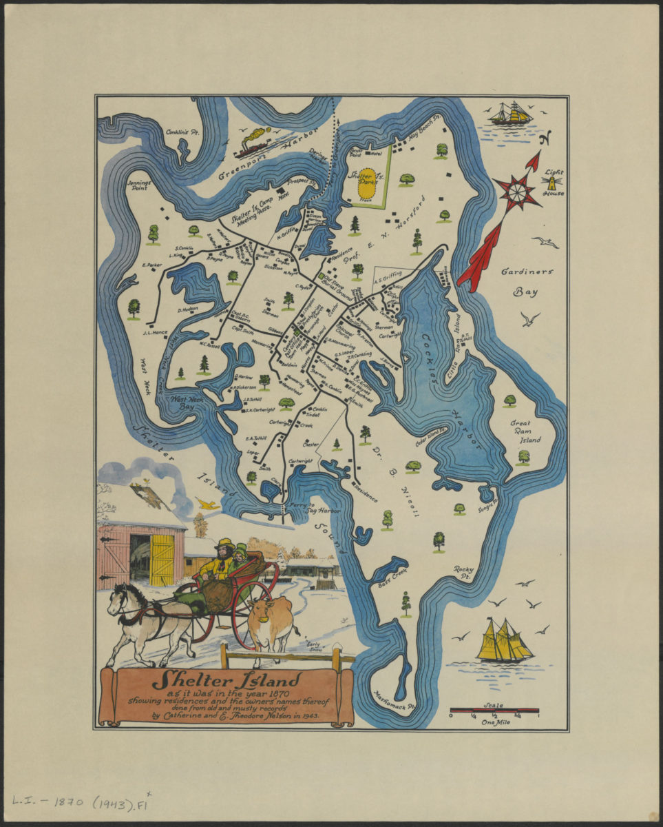
Shelter Island as it was in the year 1870: showing residents and the owners’ names thereof : done from old and musty records: by Catherine and E. Theodore Nelson in 1943 [1943]
Map No. L.I.-1870 (1943).Fl
Pictorial map also covering a portion of Greenport. Shows names of property owners, buildings, cemeteries, and parks. Oriented with north to the upper right. Includes ill.
Map area shown
Genre
Pictorial mapsRelation
Full catalog recordSize
34 × 26 cmDownload
Low Resolution Image
Creator
Nelson, Catherine,Publisher
Brooklyn Historical SocietyCitation
Shelter Island as it was in the year 1870: showing residents and the owners’ names thereof : done from old and musty records: by Catherine and E. Theodore Nelson in 1943; [1943], Map Collection, L.I.-1870 (1943).Fl; Brooklyn Historical Society.Scale
Scale [ca. 1:33,792]Loading zoom image...