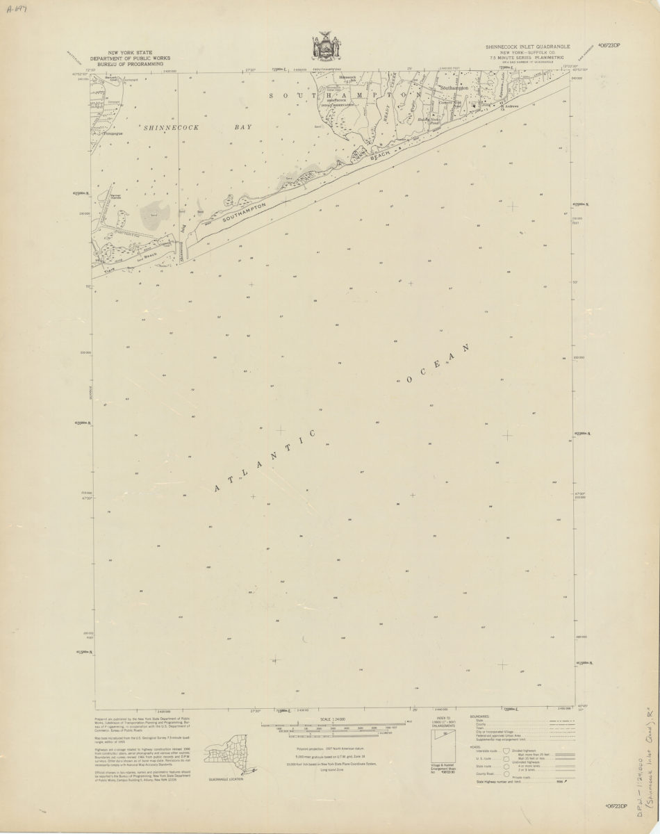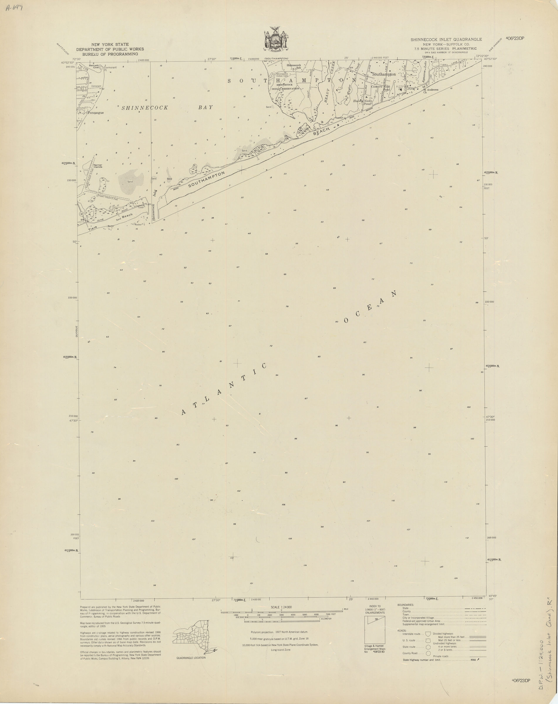
Shinnecock Inlet quadrangle, New York [1966]
Map No. D.P.W.-1:24,000 (Shinnecock Inlet Quad).R
Shows a portion of Suffolk County in New York. Relief shown by spots heights. Depths shown by soundings. Includes legend, quadrangle location map and index to 1:9600 enlargements series. “Map base reproduced from the U.S. Geological Survey 7.5-minute quadrangle, edition of 1955 … revised 1966 ….” “SW/4 Sag Harbor 15′ quadrangle.” “?06?23 DP.”
Map area shown
Relation
Full catalog recordSize
77 × 61 cmDownload
Low Resolution Image
Creator
New York (State); Department of Public Works.; Bureau of Programming,Publisher
Brooklyn Historical SocietyCitation
Shinnecock Inlet quadrangle, New York; [1966], Map Collection, D.P.W.-1:24,000 (Shinnecock Inlet Quad).R; Brooklyn Historical Society.Scale
Scale 1:24,000Loading zoom image...