Southampton, New York [1973]
Map No. L.I.-[1973?].Fl
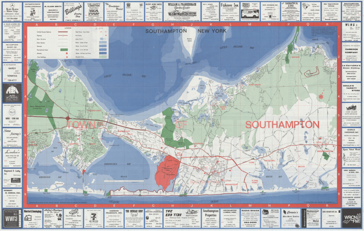
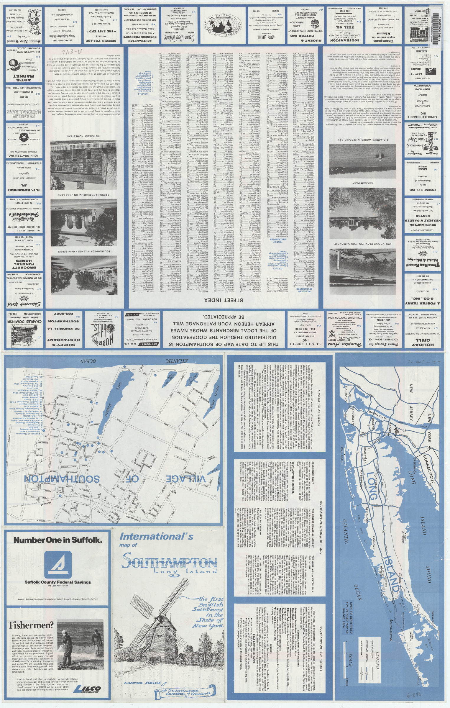
Covers Southampton from East Quouge east to Bridgehampton. Shows highways, streets, railroads, recreational areas, schools, buildings, docks, firehouses, lakes, rivers, and wooded areas. Depths shown by gradient tints. “Another service of the Southampton Chamber of Commerce”–Panel. Includes key and advertisements. On verso: Indexes, map of Long Island, indexed map of the village of Southampton, text, ill., and advertisements. BHS has 2 copies.
Map area shown
Genre
Road mapsRelation
Full catalog recordSize
62 × 97 cmDownload
Low Resolution Image
Creator
International Map Company, inc.,Publisher
Brooklyn Historical SocietyCitation
Southampton, New York; [1973], Map Collection, L.I.-[1973?].Fl; Brooklyn Historical Society.Scale
Scale [ca. 1:30,000]Loading zoom image...