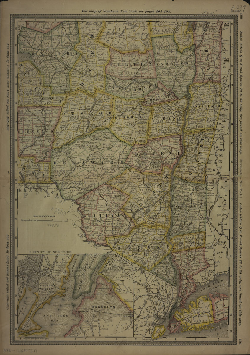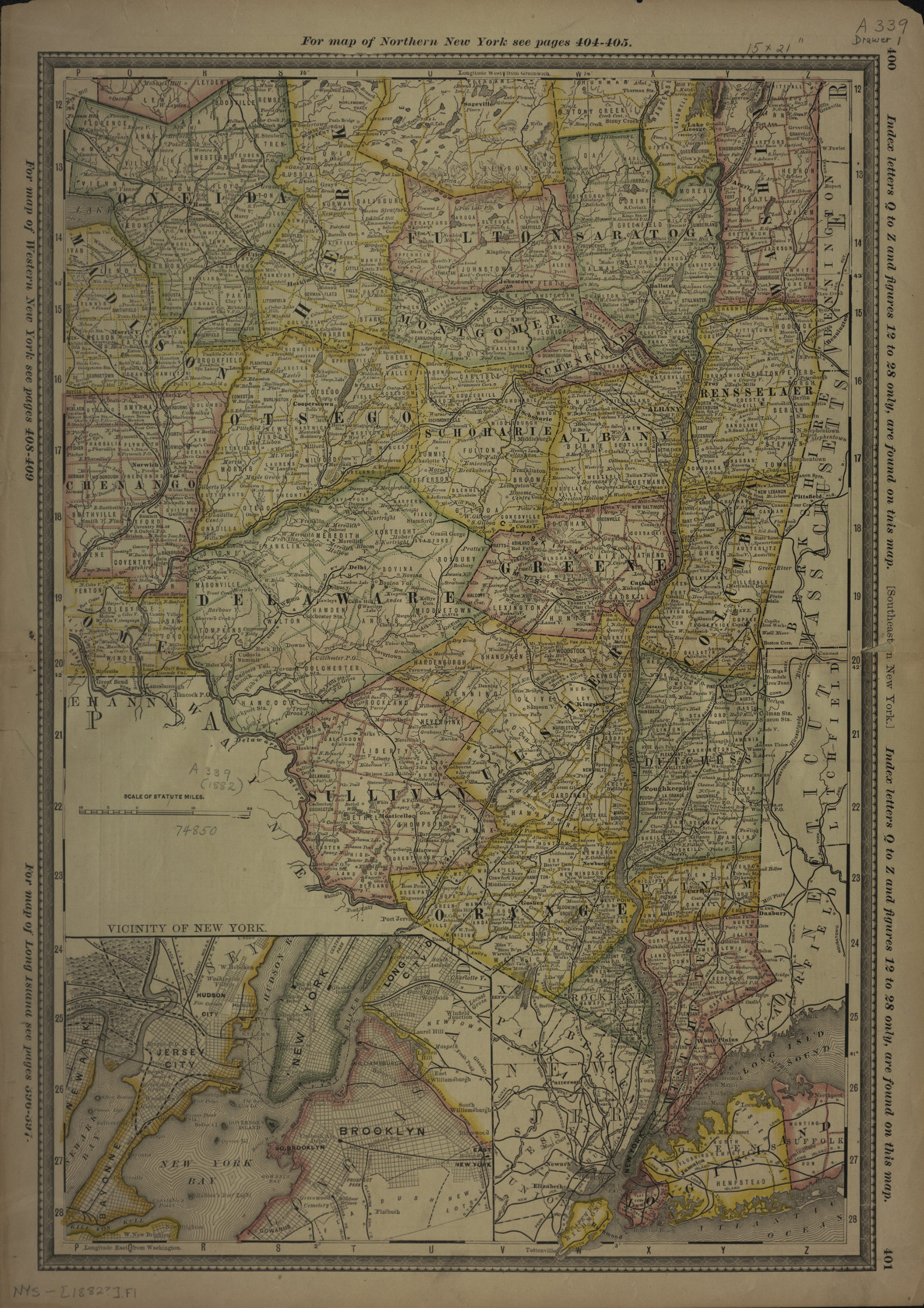
Southeastern New York [1882]
Covers area north from Staten Island to approximately Saratoga County and east from Chenango Couty to Suffolk County also covers portions of New Jersey, Pennsylvania, Connecticut, and Massachusetts. Shows counties, towns, and railroads. Relief shown by hachures. Likely extracted from: Rand, McNally & Co.’s indexed atlas of the world … accompanied by a new and original compilation forming a ready reference index. Chicago : Rand McNally & Co., 1882. Prime meridians: Washington and Greenwich. New York counties outlined in color. Includes text, inset, and decorative border. Inset: Vicinity of New York. On verso: Index. “400”–Upper right margin of recto. “401”–Lower right margin of recto. “399”–Upper left margin of verso. “402”–Lower left margin of verso.
Places
Map area shown
Genre
MapRelation
Full catalog recordSize
49 × 33 cmDownload
Low Resolution Image
Creator
Rand McNally and Company,Publisher
Brooklyn Historical SocietyCitation
Southeastern New York; [1882], Map Collection, NYS-[1882?].Fl; Brooklyn Historical Society.Scale
Scale [ca. 1:699,145]