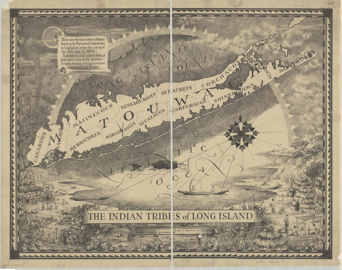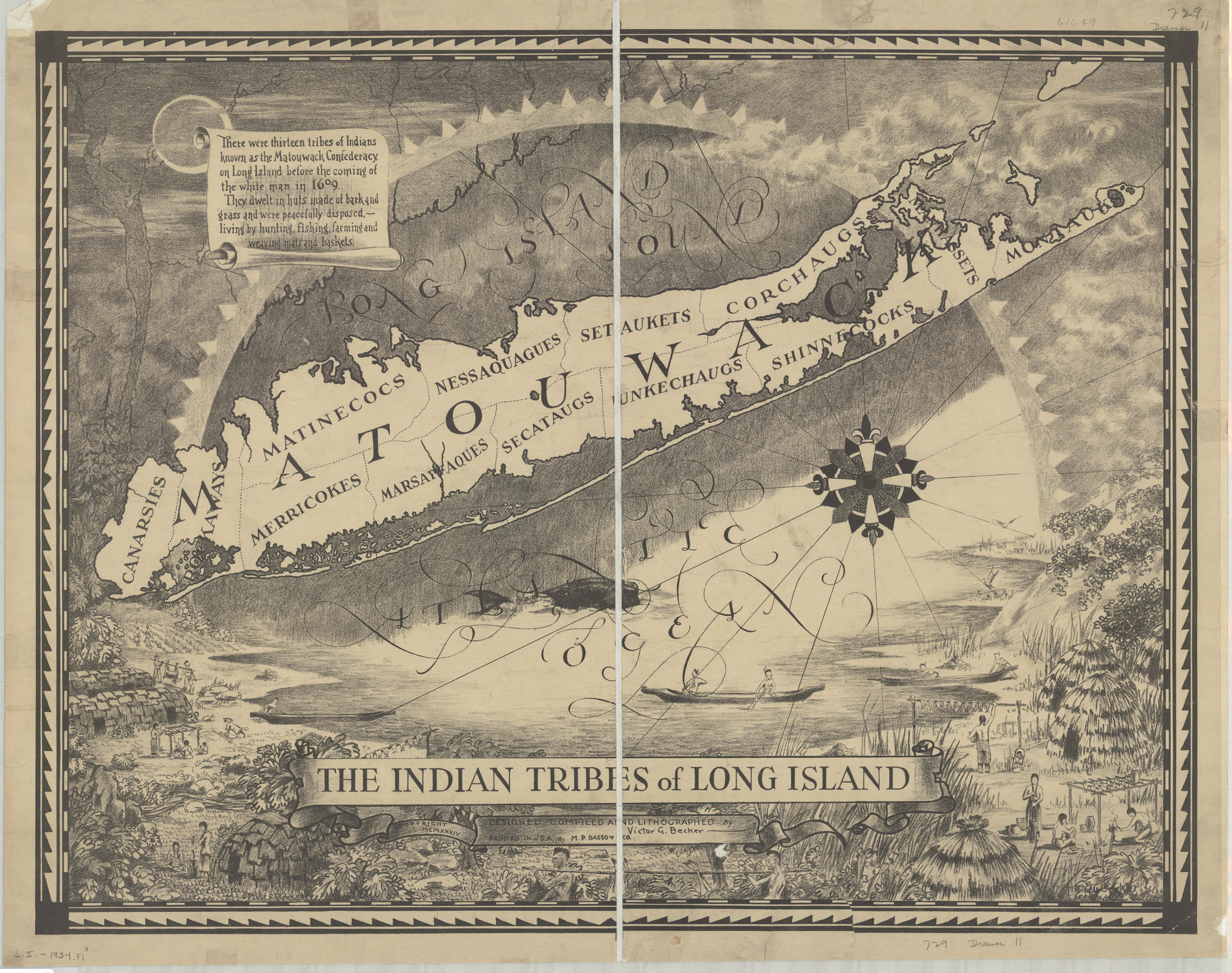
The Indian tribes of Long Island: designed, compiled and lithographed by Victor G. Becker [ca. 1934]
Map No. L.I.-1934.Fl
Shows areas of Long Island held by the various Indian tribes that made up the Matouwack Confederacy as of 1609. Includes ill. and text. BHS copy dissected and mounted on linen.
Map area shown
Genre
Thematic mapsRelation
Full catalog recordSize
63 × 77 cmDownload
Low Resolution Image
Creator
Becker, Victor G.,Publisher
Brooklyn Historical SocietyCitation
The Indian tribes of Long Island: designed, compiled and lithographed by Victor G. Becker; [ca. 1934], Map Collection, L.I.-1934.Fl; Brooklyn Historical Society.Scale
Scale not givenLoading zoom image...