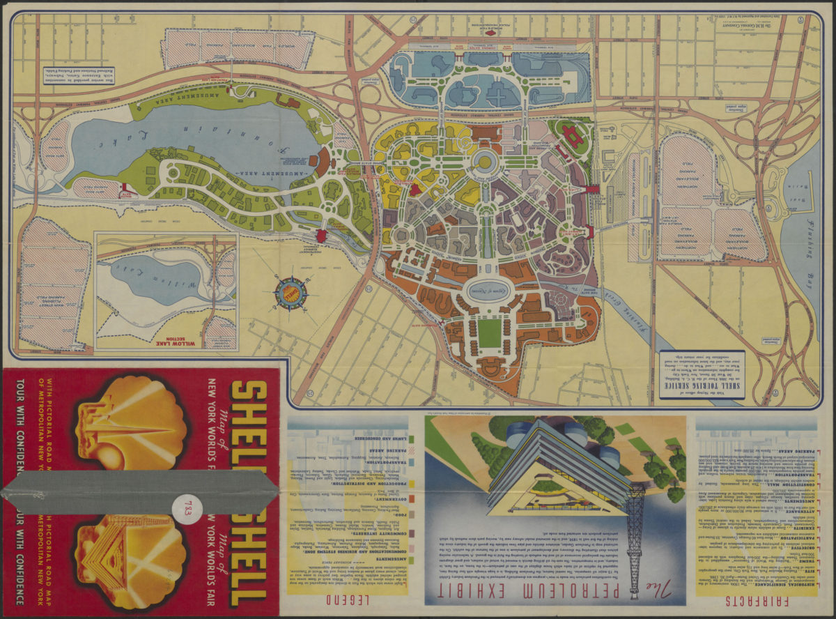
The locale of the New York World’s Fair: H.M. Gousha Company 1939
Map No. NYC-[1939].Fl
Road map shows New York City and portions of New Jersey along the Hudson River. Shows officially approved World’s Fair routes, places of interest, subway and rail lines. Places of interest shown pictorially. “Data furnished and approved by N.Y.W.F. 1939 Inc.” Indexed to points of interest. Inset: Pulaski Skyway and approaches to Holland and Lincoln Tunnels. “Detailed plan of the Fair Grounds”, “Fairfacts”, and col. illus. of the petroleum exhibit on verso.
Map area shown
Relation
Full catalog recordSize
65 × 48 cmDownload
Low Resolution Image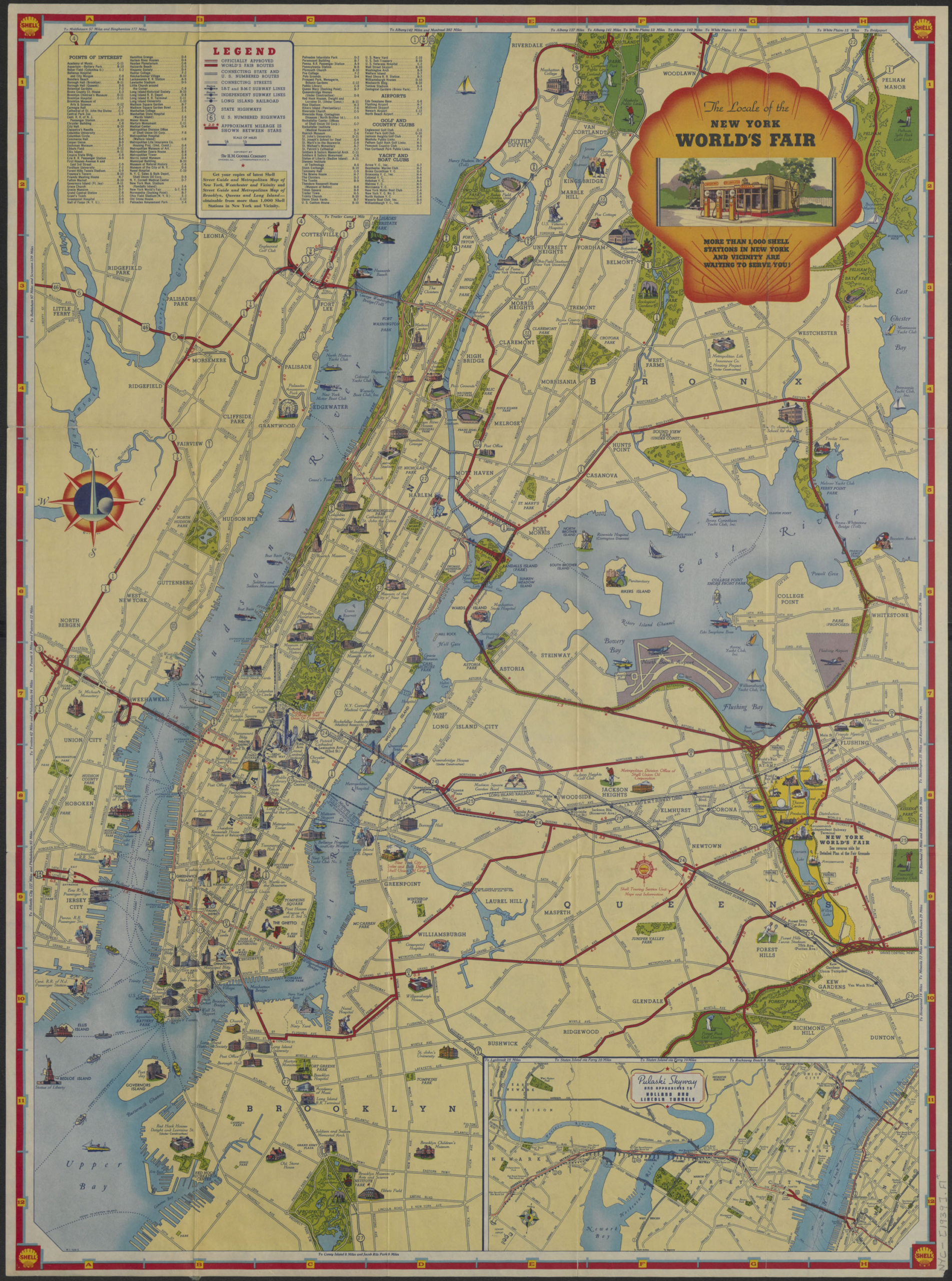
Creator
H.M. Gousha Company,Publisher
Brooklyn Historical SocietyCitation
The locale of the New York World’s Fair: H.M. Gousha Company; 1939, Map Collection, NYC-[1939].Fl; Brooklyn Historical Society.Scale
Scale [ca. 1:41,000]Loading zoom image...