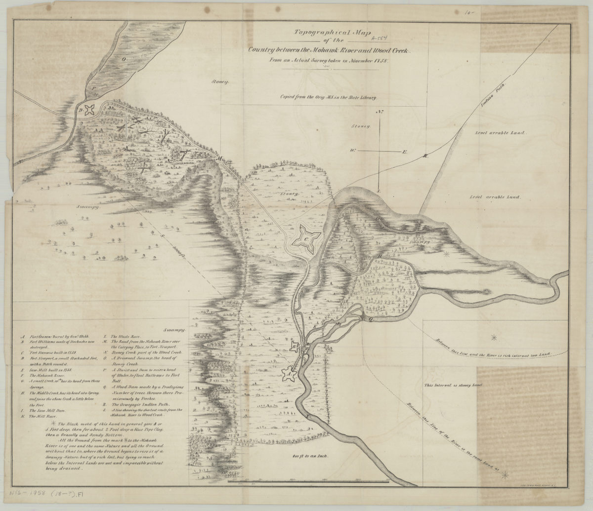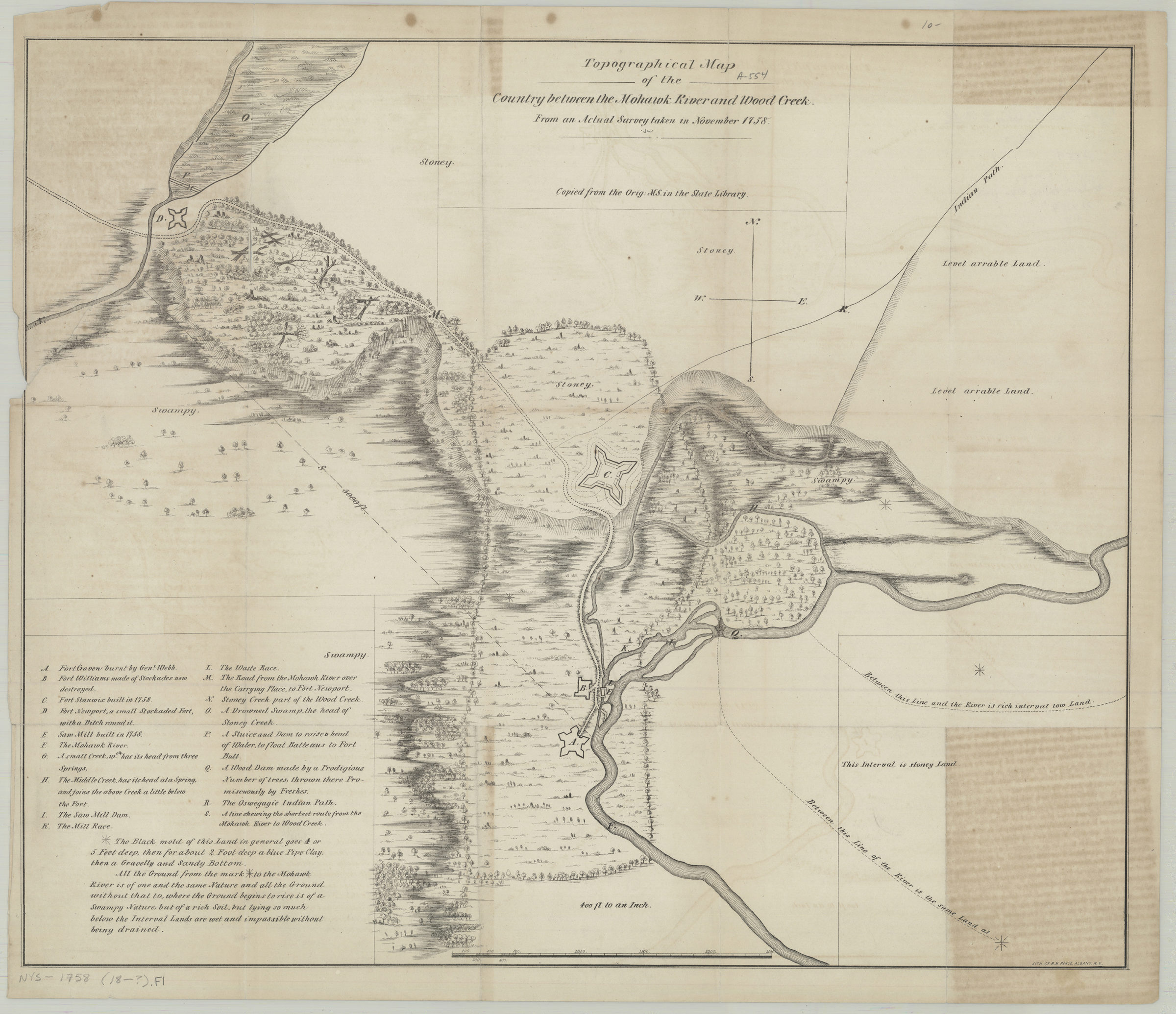
Topographical map of the country between the Mohawk River and Wood Creek: from an actual survey taken in November, 1758 [18??]
Map No. NYS-1758 (18--?).Fl
Facsimile of manuscript map. Covers area in Oneida County. Shows landscape details, dams, and forts. Vegetation represented pictorially. Relief shown by hachures. “Copied from the Orig. MS. in the State Library.” Includes index and note.
Map area shown
Genre
Topographic mapsRelation
Full catalog recordSize
43 × 52 cmDownload
Low Resolution Image
Creator
Pease, Richard H.,Publisher
Brooklyn Historical SocietyCitation
Topographical map of the country between the Mohawk River and Wood Creek: from an actual survey taken in November, 1758; [18??], Map Collection, NYS-1758 (18--?).Fl; Brooklyn Historical Society.Scale
Scale [1:4,800] 1 in to 4Loading zoom image...