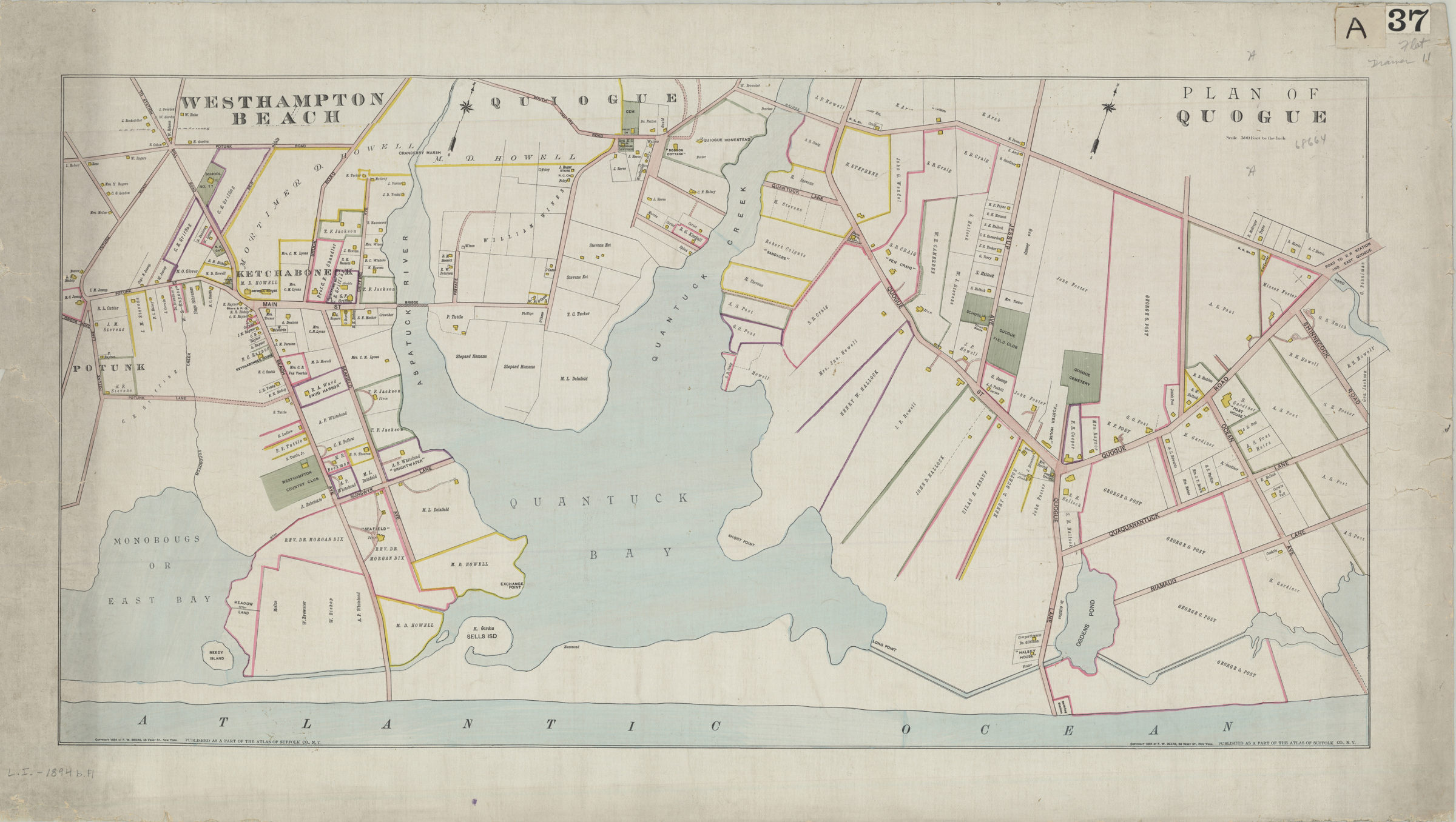
Westhampton Beach: plan of Quogue [ca. 1894]
Map No. L.I.-1894b.Fl
Covers area east from Potunk Rd. to Shinnecock Rd. and north to South Country Rd. Shows names of property owners, churches, schools, stables, and cemeteries. Oriented with north to the upper right. “Published as a part of the Atlas of Suffolk Co., N.Y.” “Copyright 1894 by F.W. Beers, 36 Vesey St., New York.” Item has 2 identical compass roses, scale statements, copyright statements, and publication statements however, the map is continuous with no breaks or interior neat lines to indicate that the item is 2 maps on 1 sheet.
Map area shown
Genre
Cadastral mapsRelation
Full catalog recordSize
48 × 85 cmDownload
Low Resolution Image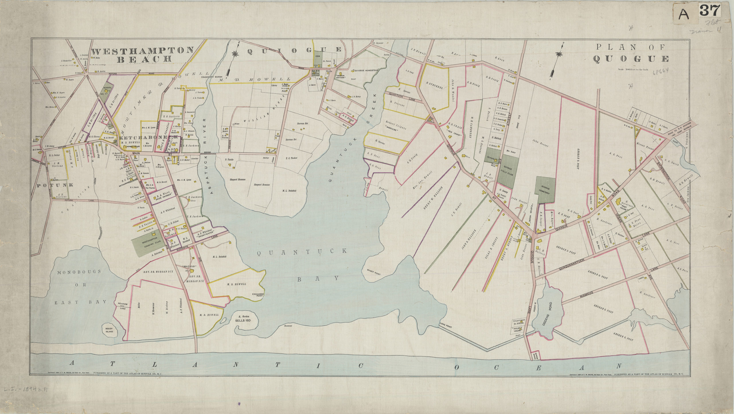
Creator
Beers, F. W.,Publisher
Brooklyn Historical SocietyCitation
Westhampton Beach: plan of Quogue; [ca. 1894], Map Collection, L.I.-1894b.Fl; Brooklyn Historical Society.Scale
Scale [1:6,000] 1 in to 5Loading zoom image... 