Center for Brooklyn History
Map Collections
Search
About
Othmer Library & Archives
Submit search query
Refine 11 records
Clear filters
3
Location
Connecticut
7
Hempstead (N.Y.)
13
Long Island (N.Y.)
197
New York Metropolitan Area
40
Suffolk County (N.Y.)
43
Subject
Election districts
36
Landowners
434
Real property
619
Trials
1
Date
19th Century
945
or enter range:
from
to
Genres
Map
191
Sort by:
Date (earliest)
Date (most recent)
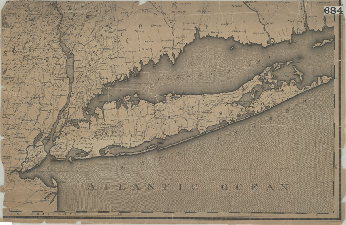
[Map of Long Island, the New York Metropolitan Area, and the southern coast of Connecticut]
[Map of Long Island, the New York Metropolitan Area, and the southern coast of Connecticut]
[18??]
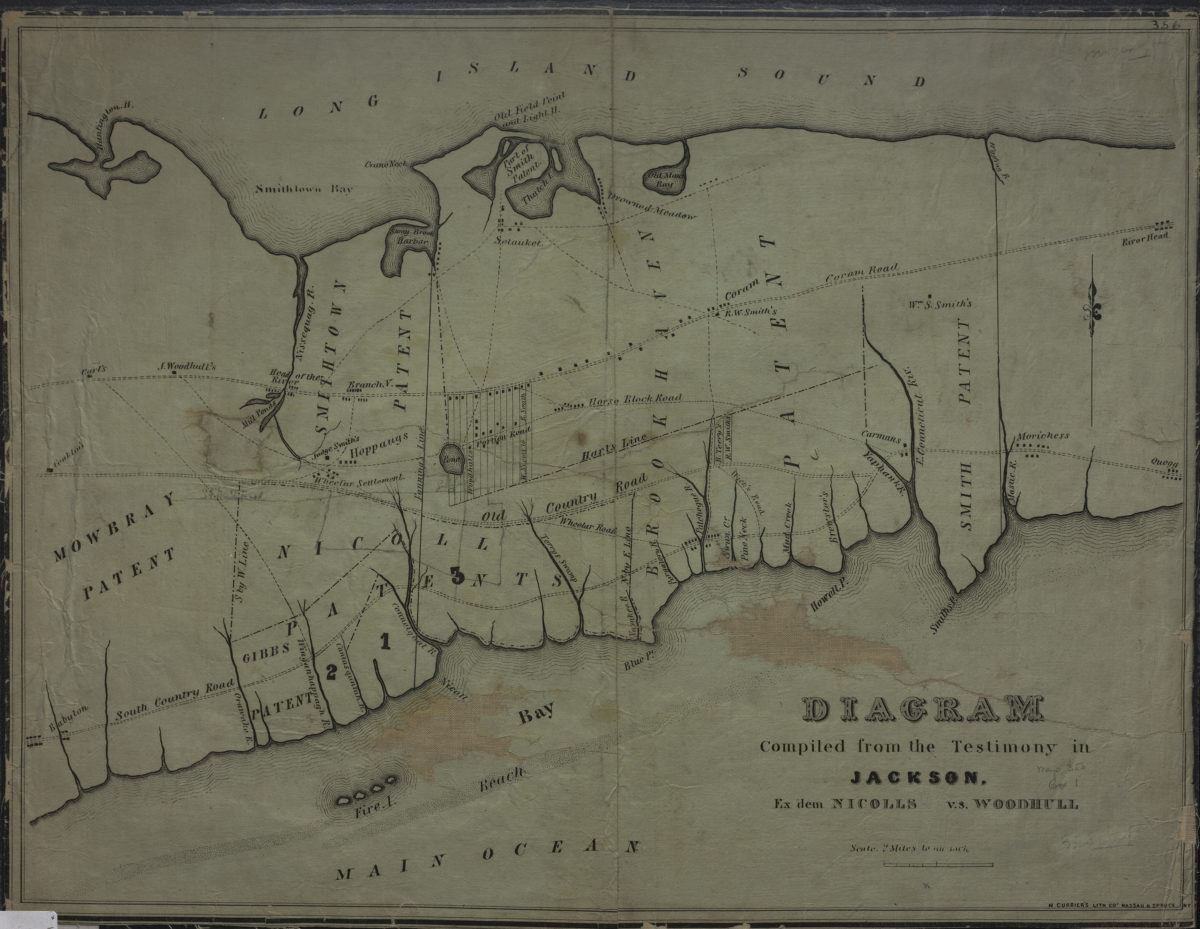
Diagram compiled from the testimony in Jackson, ex dem Nicolls vs. Woodhull
Diagram compiled from the testimony in Jackson, ex dem Nicolls vs. Woodhull
[18??]
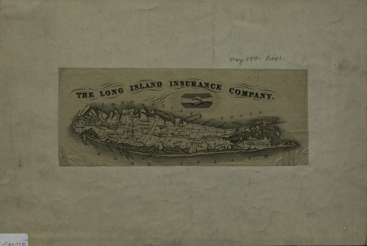
[Map of Long Island]
[Map of Long Island]
[184?]
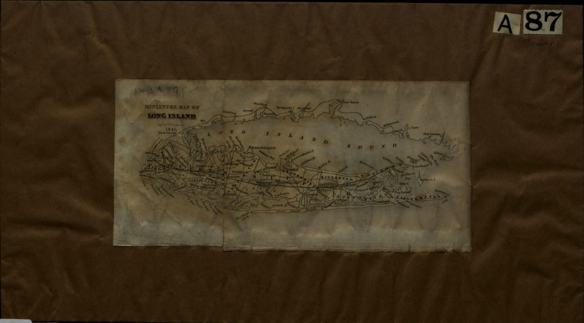
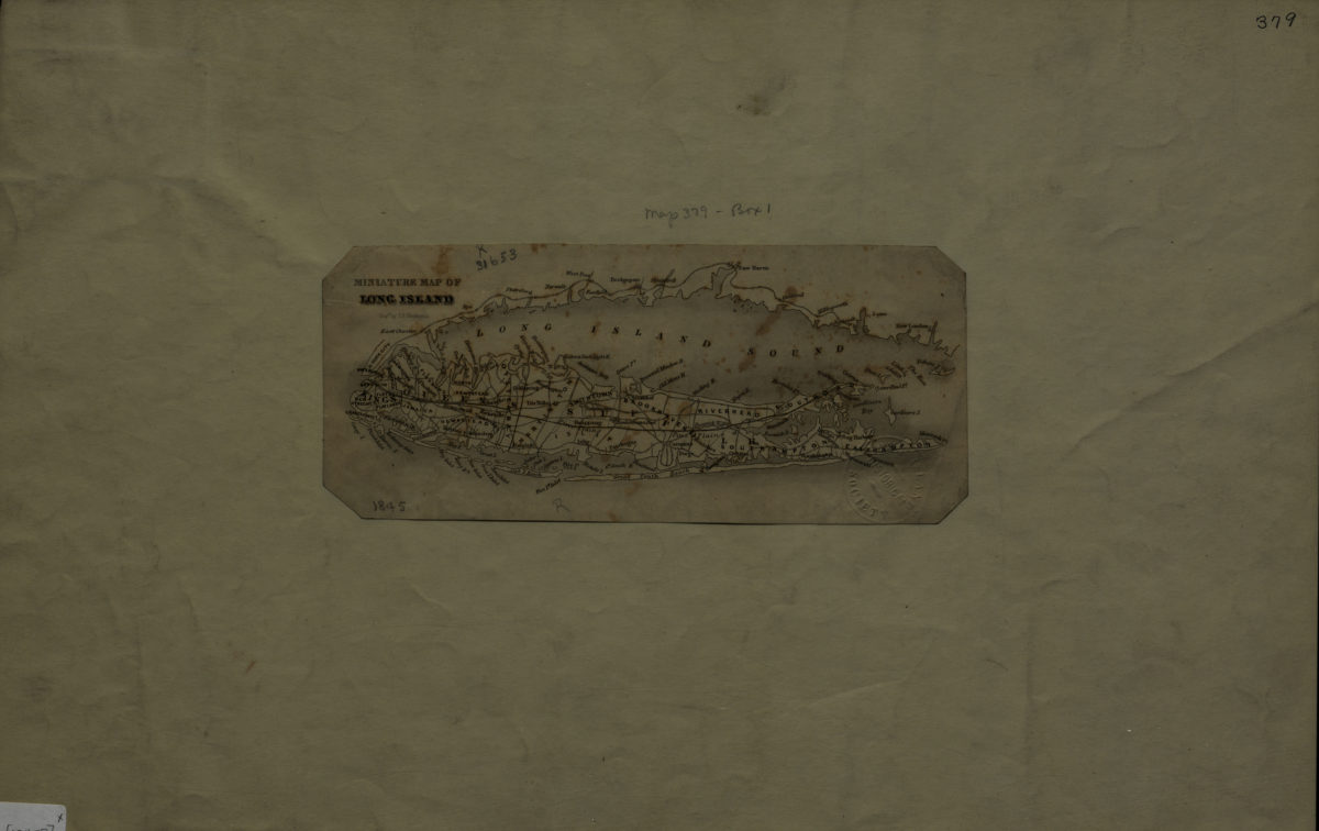
Miniature map of Long Island: engd. by T.S. Woodcock
Miniature map of Long Island: engd. by T.S. Woodcock
1845
Miniature map of Long Island: engd. by T.S. Woodcock
Miniature map of Long Island: engd. by T.S. Woodcock
[1845]
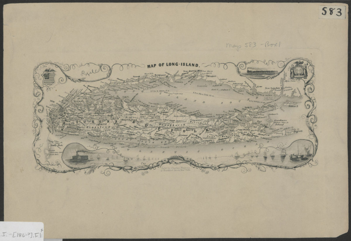
Map of Long Island
Map of Long Island
[186?]
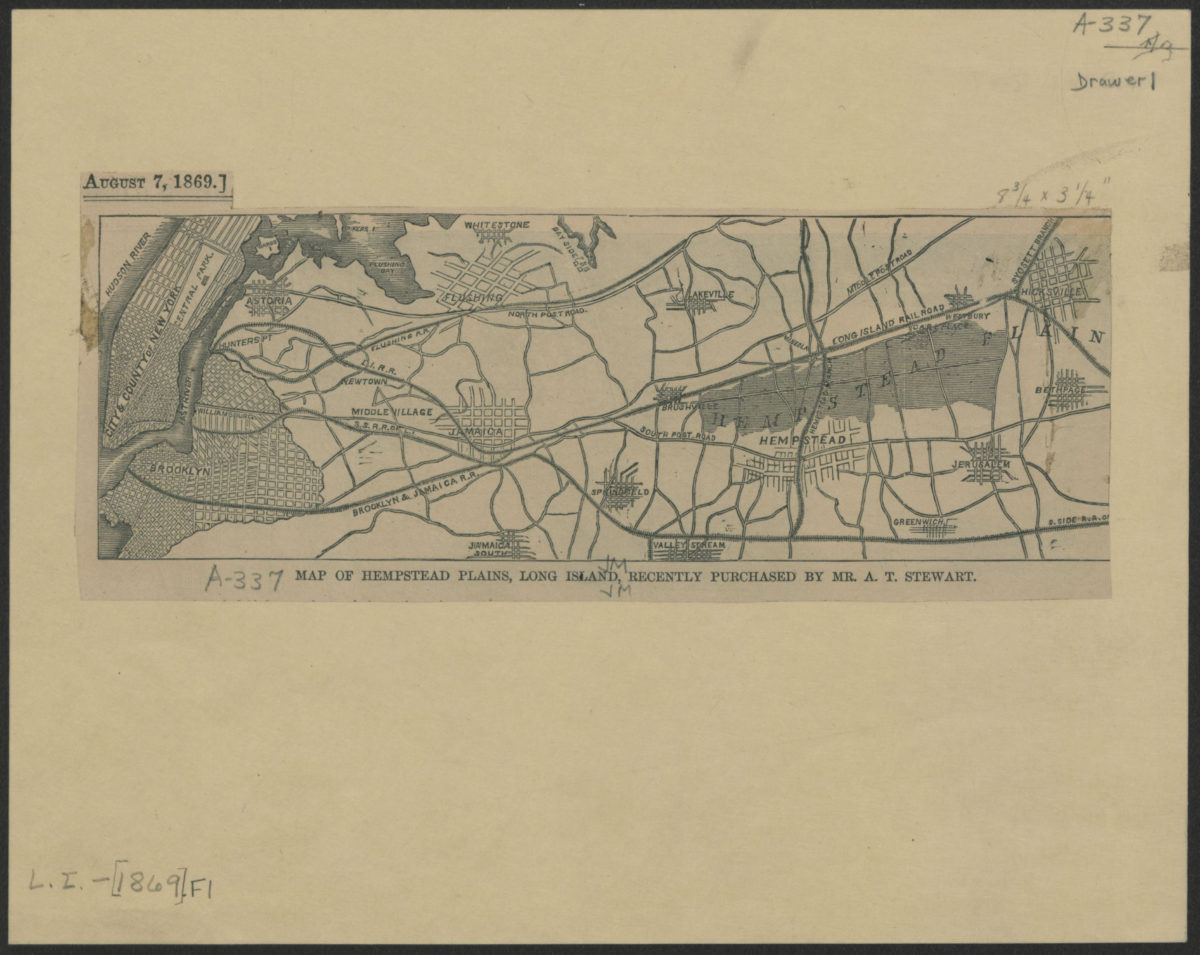
Map of Hempstead Plains, Long Island, recently purchased by Mr. A.T. Stewart
Map of Hempstead Plains, Long Island, recently purchased by Mr. A.T. Stewart
[1869]
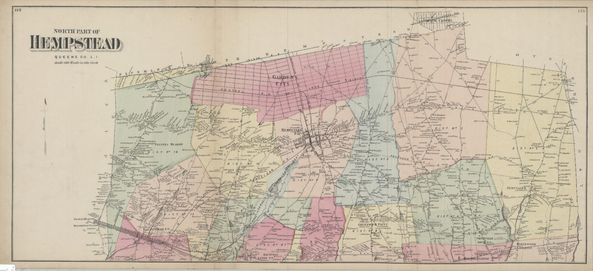
North part of Hempstead, Queens Co., L.I.
North part of Hempstead, Queens Co., L.I.
[1873]
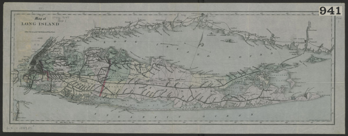
Map of Long Island
Map of Long Island
1889; [ca. 1882]
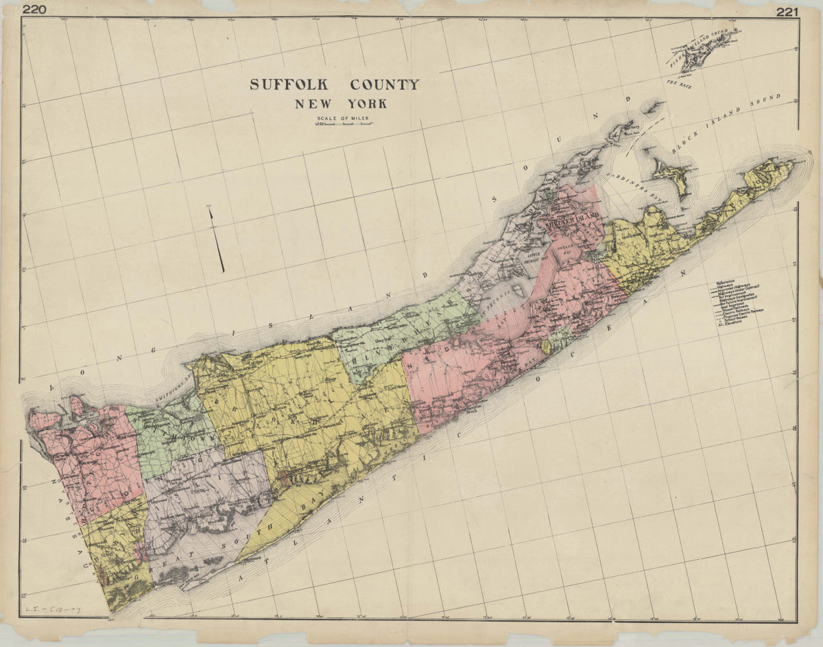
Suffolk County, New York
Suffolk County, New York
[189?]
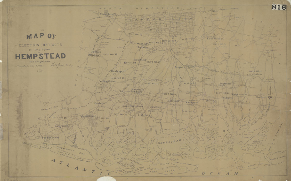
Map of election districts in the town of Hempstead: Thos. V. Smith, civ. eng., Hempstead, July 19, 1899
Map of election districts in the town of Hempstead: Thos. V. Smith, civ. eng., Hempstead, July 19, 1899
[1899]