Center for Brooklyn History
Map Collections
Search
About
Othmer Library & Archives
Submit search query
Refine 3 records
Clear filters
3
Location
Brooklyn (New York, N.Y.)
891
Brooklyn Heights (New York, N.Y.)
76
Subject
Land grants
12
Real property
619
Riparian rights
13
Submerged lands
17
Date
19th Century
945
or enter range:
from
to
Genres
Cadastral maps
597
Manuscript maps
365
Sort by:
Date (earliest)
Date (most recent)
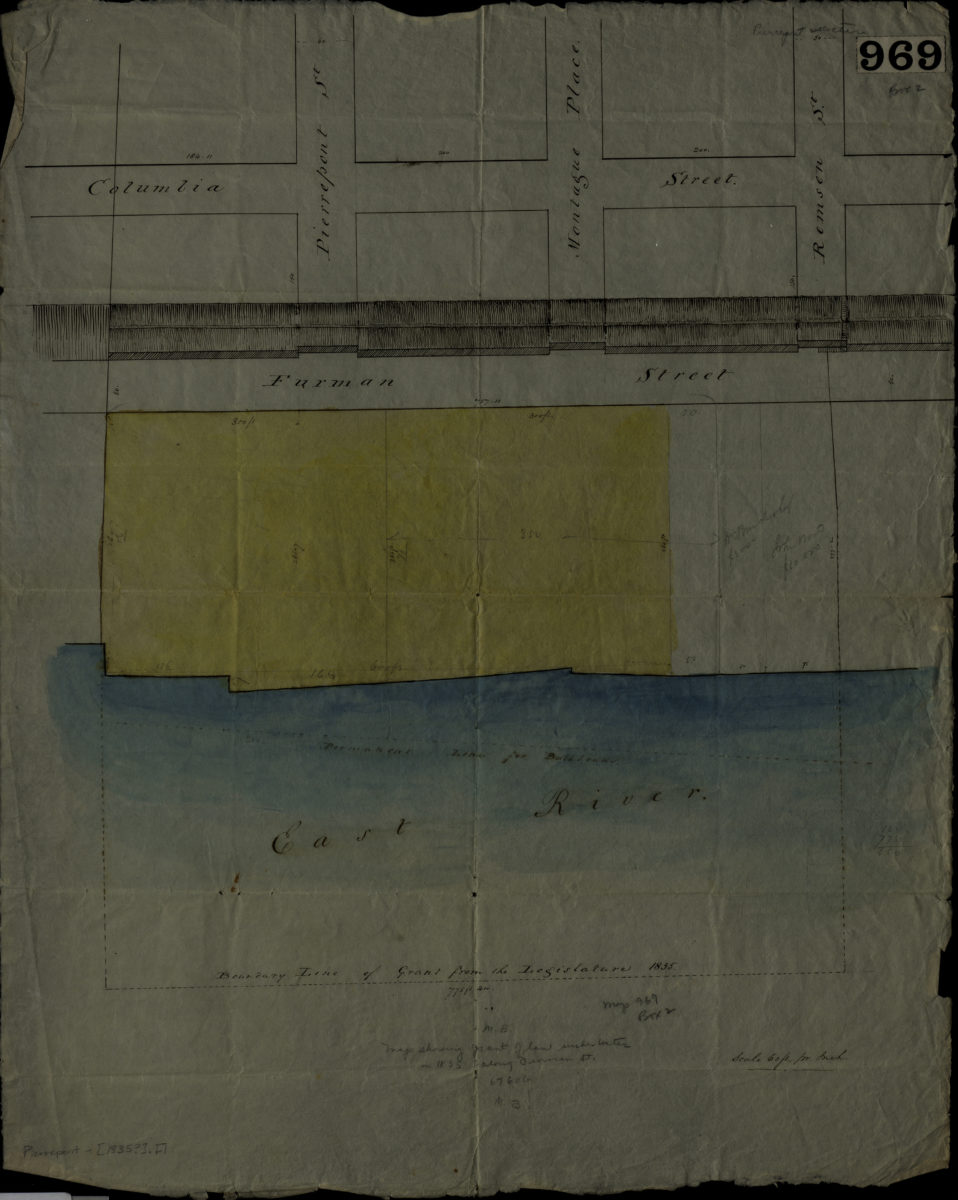
[Map showing grants of land under water in 1835 along Furman St.].
[Map showing grants of land under water in 1835 along Furman St.].
[1835]
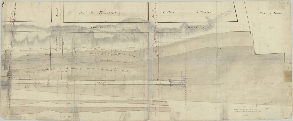
[Map showing grants of land under water in 1804, 1823, and 1835]
[Map showing grants of land under water in 1804, 1823, and 1835]
[1835]
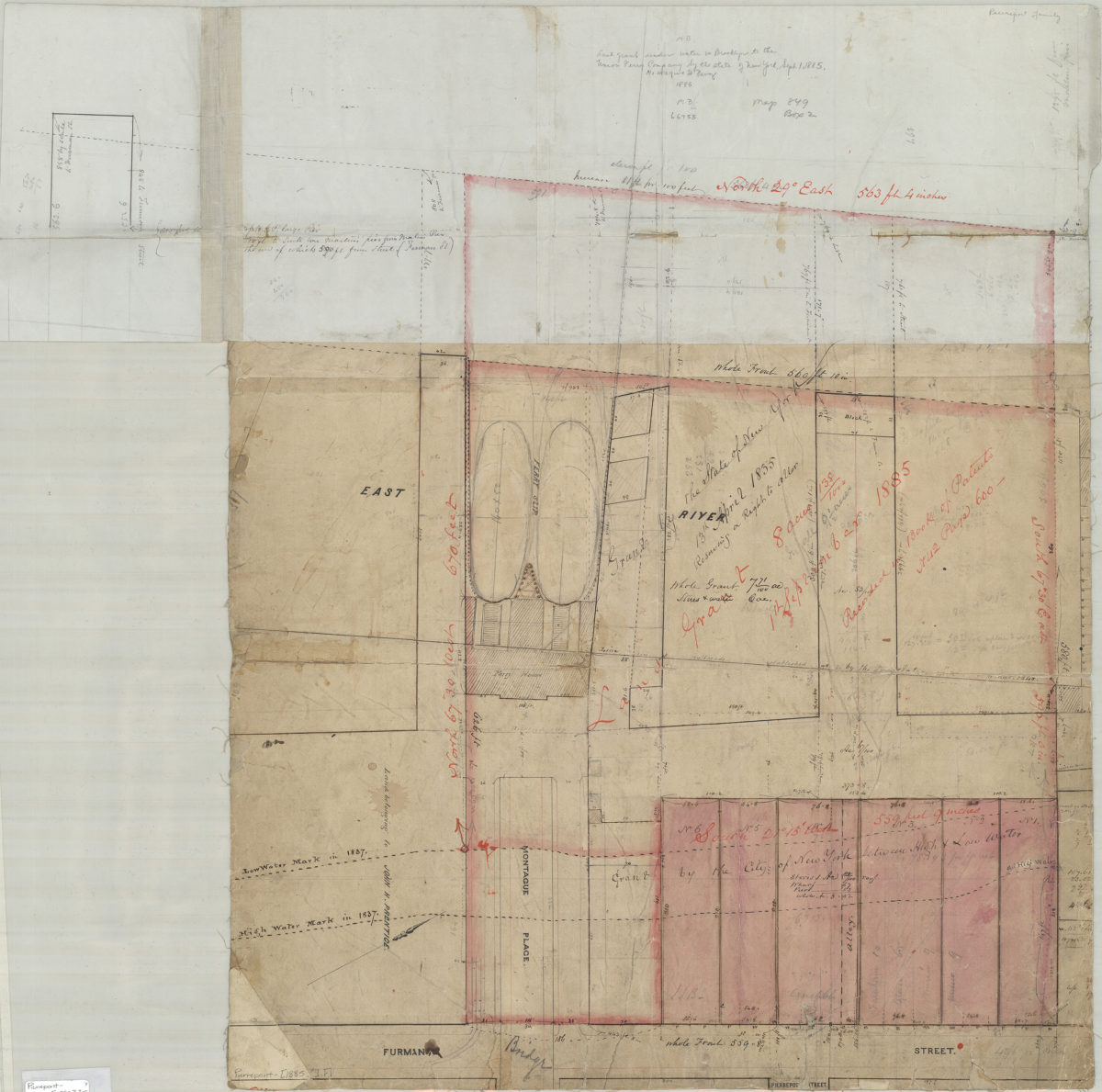
[Map showing grants of land under water near Montague Pl. and Furman St.].
[Map showing grants of land under water near Montague Pl. and Furman St.].
[1885]