Center for Brooklyn History
Map Collections
Search
About
Othmer Library & Archives
Submit search query
Refine 4 records
Clear filters
2
Location
Atlantic States
2
Caribbean Area
2
New France
1
North America
7
Subject
Date
19th Century
945
or enter range:
from
to
Genres
Early maps
35
Sort by:
Date (earliest)
Date (most recent)
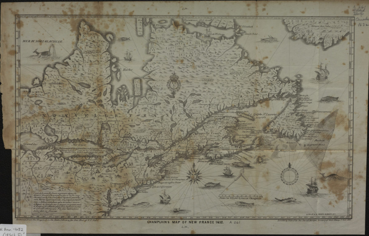
Champlain’s map of New France 1632
Champlain’s map of New France 1632
1850
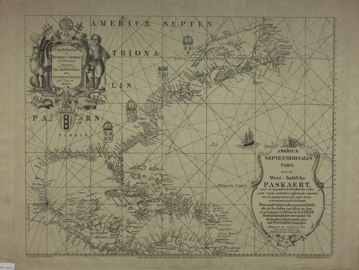
Americae septentrionalis pars.: from the West-Indische paskaert: beschreven door A. Iacobsz
Americae septentrionalis pars.: from the West-Indische paskaert: beschreven door A. Iacobsz
[1858]
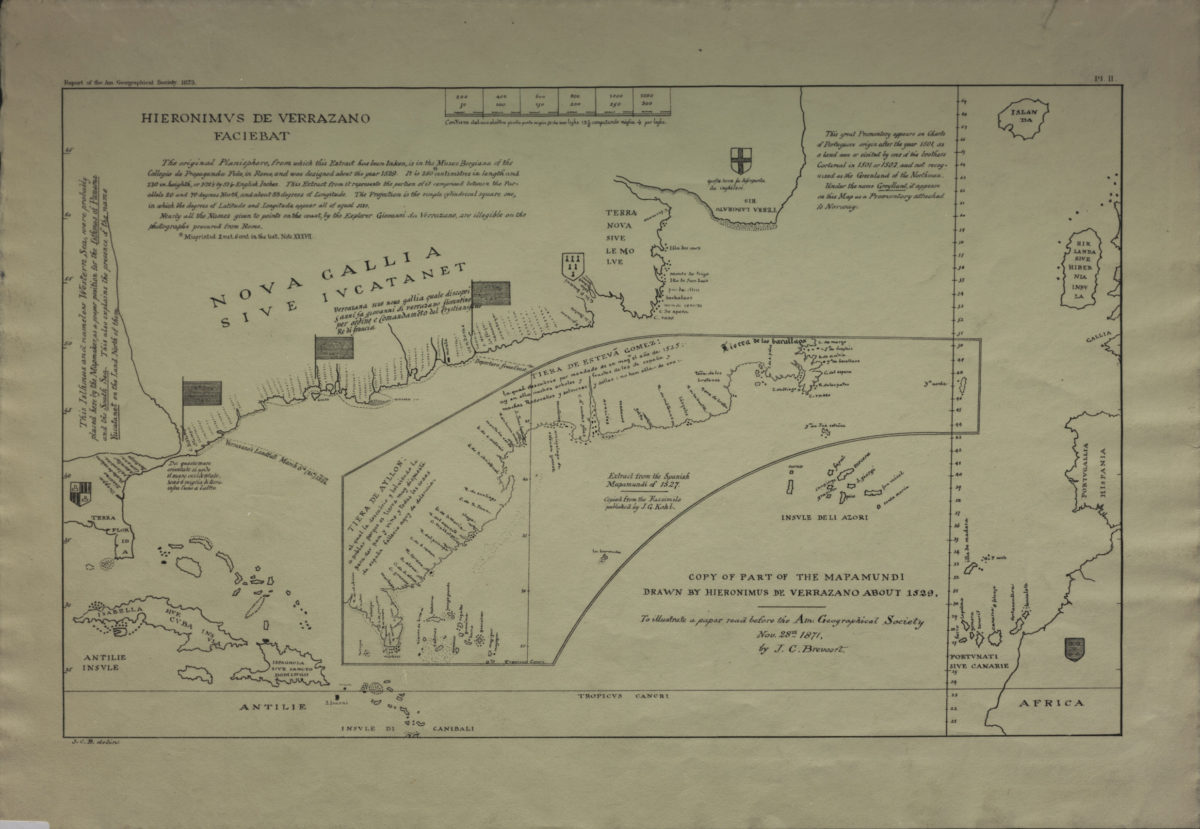
Copy of part of the Mapamundi drawn by Hieronimus de Verrazano about 1529: to illustrate a paper read before the Am. Geographical Society, Nov. 28th, 1871 by J.C. Breevort
Copy of part of the Mapamundi drawn by Hieronimus de Verrazano about 1529: to illustrate a paper read before the Am. Geographical Society, Nov. 28th, 1871 by J.C. Breevort
[1873]
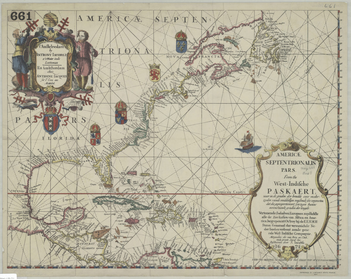
Americae septentrionalis pars.: from the West-Indische paskaert: beschreven door A. Iacobsz
Americae septentrionalis pars.: from the West-Indische paskaert: beschreven door A. Iacobsz
1877