Center for Brooklyn History
Map Collections
Search
About
Othmer Library & Archives
Submit search query
Refine 945 records
Clear filter
1
Location
Abingdon Square (New York, N.Y.)
1
Adirondack Mountains (N.Y.)
2
Adirondack Park (N.Y.)
1
Albany (N.Y.)
3
Albany County (N.Y.)
1
Albion (Oswego County : Town)
1
Annastown (N.Y.)
1
Astoria (New York, N.Y.)
4
Atlantic Basin (New York, N.Y.)
3
Atlantic Coast (North America)
6
Atlantic Ocean.
1
Atlantic States
2
Auburn (N.Y.)
1
Babylon (N.Y. : Town)
2
Bath Beach (New York, N.Y.)
8
Battery Park (New York, N.Y.)
3
Bay Ridge (New York, N.Y.)
108
Bay Ridge Park (New York, N.Y.)
1
Bedford-Stuyvesant (New York, N.Y.)
67
Bellerose (New York, N.Y.)
1
Bensonhurst (New York, N.Y.)
17
Bergen County (N.J.)
6
Block Island (R.I. : Island)
2
Blythebourne (New York, N.Y.)
1
Boerum Hill (New York, N.Y.)
6
Borough Park (New York, N.Y.)
23
Boylston (N.Y.)
1
Brandon (N.Y.)
1
Bridgehampton (N.Y.)
1
Brighton Beach (New York, N.Y.)
4
Brookhaven (N.Y. : Town)
3
Brookhaven (N.Y.)
2
Brooklyn (New York, N.Y.)
891
Brooklyn Heights (New York, N.Y.)
76
Brownsville (New York, N.Y.)
10
Buffalo (N.Y.)
3
Bushwick (New York, N.Y.)
20
Bushwick Park (New York, N.Y.)
1
Buttermilk Channel (New York, N.Y.)
1
Canarsie (New York, N.Y.)
18
Caribbean Area
2
Carroll Gardens (New York, N.Y.)
21
Carroll Park (New York, N.Y.)
1
Cemetery of the Evergreens (New York, N.Y.)
1
Central Park (New York, N.Y.)
3
Champlain Canal (N.Y.)
1
City Hall Park (New York, N.Y.)
1
Clermont (N.Y. : Town)
1
Clinton County (N.Y.)
1
Clinton Hill (New York, N.Y.)
10
Cobble Hill (New York, N.Y.)
7
College Point (New York, N.Y.)
2
Columbus Park (New York, N.Y.)
1
Commodore Barry Park (New York, N.Y.)
1
Coney Island (New York, N.Y.)
22
Connecticut
7
Connecticut River
1
Constable (N.Y.)
1
Corona (New York, N.Y.)
2
Cortelyou Farm (New York, N.Y.)
1
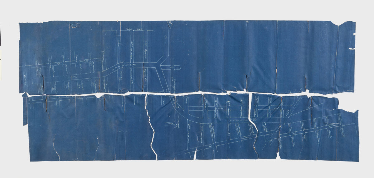
Cowenhoven Homestead (Brooklyn, New York, N.Y.)
1
Croton Aqueduct (N.Y.)
3
Croton River Watershed (N.Y.)
2
Crown Heights (New York, N.Y.)
25
Cypress Hills (New York, N.Y.)
8
David Johnson Farm (New York, N.Y.)
1
Delaware River Valley (N.Y.-Del. and N.J.)
1
Denmark (N.Y.)
1
Dickinson (N.Y.)
2
Ditmas Park (New York, N.Y.)
1
Douglaston (New York, N.Y.)
1
Downtown Brooklyn (New York, N.Y.)
29
Duane Street Park (New York, N.Y.)
1
DUMBO Historic District (New York, N.Y.)
7
Dunkirk (N.Y.)
1
Dutchess County (N.Y.)
2
Dyker Heights (New York, N.Y.)
23
East Elmhurst (New York, N.Y.)
2
East Flatbush (New York, N.Y.)
23
East Harlem (New York, N.Y.)
1
East Midwood (New York, N.Y.)
1
East New York (New York, N.Y.)
16
East Patchogue (N.Y.)
1
East River (N.Y.)
3
Erasmus (New York, N.Y.)
1
Erie Basin (New York, N.Y.)
2
Erie Canal (N.Y.)
3
Erie County (N.Y.)
1
Essex County (N.J.)
4
Fairfield County (Conn.)
5
Far Rockaway (New York, N.Y.)
2
Farragut (New York, N.Y.)
1
Flatbush (New York, N.Y.)
35
Flatlands (New York, N.Y.)
19
Flushing (New York, N.Y.)
13
Fort Brooklyn (New York, N.Y.)
1
Fort Covington (N.Y.)
1
Fort Greene (New York, N.Y.)
22
Fort Hamilton (New York, N.Y.)
31
Fort Stanwix (Rome, N.Y.)
1
Fort Washington (New York, N.Y.)
2
Franklin County (N.Y.)
2
Freeport (N.Y.)
1
Fulton Ferry Historic District (New York, N.Y.)
5
Futurama (New York, N.Y.)
2
Genesee County (N.Y.)
2
Genesee River (Pa. and N.Y.)
1
Germantown (N.Y. : Town)
1
Glen Cove (N.Y.)
1
Gowanus (New York, N.Y.)
12
Gowanus Bay (New York, N.Y.)
1
Gowanus Canal (New York, N.Y.)
5
Gramercy Park (New York, N.Y.)
1
Gravesend (New York, N.Y.)
25
Great Neck (N.Y.)
3
Green-Wood Cemetery (New York, N.Y.)
2
Greenboro (N.Y.)
1
Greenpoint (New York, N.Y.)
38
Greenport (N.Y.)
1
Greenwood (New York, N.Y.)
1
Harrisburgh (N.Y.)
1
Hempstead (N.Y.)
13
Herbert Von King Park (New York, N.Y.)
1
Hicksville (N.Y.)
1
Hinsdale (New York, N.Y.)
1
Hoboken (N.J.)
1
Hudson County (N.J.)
3
Hudson River (N.Y. and N.J.)
7
Hunters Point (New York, N.Y.)
2
Huntington (N.Y.)
7
Islip (N.Y.)
5
Jamaica (New York, N.Y.)
8
Jamaica Bay (N.Y.)
5
Jefferson County (N.Y.)
1
Jersey City (N.J.)
4
Kensington (New York, N.Y.)
11
Kings County (New York, N.Y.)
8
Kingslandville (New York, N.Y.)
1
Lakeland (N.Y.)
1
Lawrence Beach (N.Y.)
1
Lefferts Park (New York, N.Y.)
1
Lewis County (N.Y.)
2
Livingston (N.Y. : Town)
1
Livingston County (N.Y.)
1
Long Island (N.Y.)
197
Long Island City (New York, N.Y.)
8
Long Island Sound (N.Y. and Conn.)
12
Long Island, Battle of, New York, N.Y., 1776
4
Lorraine (N.Y.)
1
Madison Square Park (New York, N.Y.)
1
Manhattan (New York, N.Y.)
120
Marine Park (New York, N.Y.)
5
Maritime Provinces
1
Martense Farm (New York, N.Y.)
1
Martinsburg (N.Y.)
1
Marway Farm (New York, N.Y.)
1
Maspeth (New York, N.Y.)
2
Mattituck (N.Y.)
1
Middle Atlantic States
2
Middlesex County (N.J.)
4
Midwood (New York, N.Y.)
9
Miller Place (N.Y.)
1
Mineola (N.Y.)
1
Mohawk River Valley (N.Y.)
3
Monmouth County (N.J.)
3
Monsignor Mcgolrick Park (New York, N.Y.)
1
Montauk (N.Y.)
4
Morningside Heights (New York, N.Y.)
1
Morris County (N.J.)
3
Napeague Bay (N.Y.)
1
Nassau County (N.Y.)
24
New England
8
New France
1
New Jersey
27
New Lots (New York, N.Y.)
1
New Netherland
2
New Utrecht (New York, N.Y.)
9
New York (N.Y.)
164
New York (State)
95
New York Harbor (N.Y. and N.J.)
16
New York Metropolitan Area
40
New York Region
5
Newport County (R.I.)
1
Newtown (New York, N.Y.)
1
Newtown (Queens County, N.Y.)
4
North America
7
North Hempstead (N.Y. : Town)
4
Northport Bay (N.Y. : Bay)
1
Nottingham (New York, N.Y.)
2
Old Bethpage (N.Y.)
1
Oneida County (N.Y.)
2
Orwell (N.Y.)
2
Osceola (N.Y.)
2
Oswego (N.Y.)
1
Oswego County (N.Y.)
4
Oyster Bay (N.Y.)
9
Park Slope (New York, N.Y.)
16
Parkville (New York, N.Y.)
2
Passaic County (N.J.)
5
Patchogue (N.Y.)
2
Pearsalls (N.Y.)
1
Pennsylvania
4
Pierrepont (N.Y.)
1
Pierrepont Homestead (New York, N.Y.)
6
Port Jefferson (N.Y.)
1
Prospect Heights (New York, N.Y.)
16
Prospect Lefferts Gardens (Brooklyn, New York, N.Y.)
16
Prospect Park (New York, N.Y.)
25
Prospect Park South (New York, N.Y.)
8
Putnam County (N.Y.)
1
Queens (New York, N.Y.)
83
Quiogue (N.Y.)
1
Raritan Bay (N.J. and N.Y.)
1
Ravenswood (New York, N.Y.)
4
Red Hook (New York, N.Y.)
19
Rensselaer County (N.Y.)
2
Rhode Island
2
Richmond (N.Y.)
1
Richmond Hill (New York, N.Y.)
2
Ridgewood (New York, N.Y.)
2
Riverhead (N.Y.)
3
Rockaway (New York, N.Y.)
1
Rockaway Beach (New York, N.Y.)
1
Rockland County (N.Y.)
5
Rockville Centre (N.Y.)
2
Rodman (N.Y.)
1
Rosevale (N.Y.)
2
Roslyn (N.Y.)
3
Roslyn Harbor (N.Y.)
1
Roslyn Highlands (N.Y.)
1
Rye (N.Y.)
1
Sag Harbor (N.Y.)
2
Saint Lawrence River
2
Sand Creek (N.Y.)
1
Saratoga Springs (N.Y.)
1
Sayville (N.Y.)
1
Schoharie County (N.Y.)
1
Schoharie Creek Valley (N.Y.)
1
Sea Cliff (N.Y.)
1
Sea Gate (New York, N.Y.)
7
Sewerage
1
Sheepshead Bay (New York, N.Y.)
13
Shelter Island (N.Y.)
2
Smithtown (N.Y. : Town)
4
Somerset County (N.J.)
3
South Brooklyn Temperance Village (Brooklyn, New York, N.Y.)
1
South Greenfield (New York, N.Y.)
1
Southampton (N.Y.)
5
Southold (N.Y.)
4
Stony Brook (N.Y.)
1
Stuyvesant Heights (New York, N.Y.)
1
Stuyvesant Square (New York, N.Y.)
1
Suffolk (N.Y.)
1
Suffolk County (N.Y.)
43
Sunnyside (New York, N.Y.)
1
Sunset Park (New York, N.Y.)
53
Susquehanna River Valley
1
Syracuse (N.Y.)
1
Tompkins Square (New York, N.Y.)
1
Union County (N.J.)
1
Union Square (New York, N.Y.)
1
United States
10
Upper Bay (N.Y. and N.J.)
4
Upper West Side (New York, N.Y.)
2
Van Pelt Manor House (Brooklyn, New York, N.Y.)
1
Vinegar Hill Historic District (New York, N.Y.)
4
Wallabout Bay (New York, N.Y.)
6
Washington Heights (New York, N.Y.)
2
Washington Square (New York, N.Y.)
1
Weeksville (New York, N.Y.)
7
West Turin (N.Y.)
1
Westchester County (N.Y.)
11
Western Hemisphere
1
Westhampton Beach (N.Y.)
1
Westville (Franklin County, N.Y.)
1
Whitestone (New York, N.Y.)
3
Williamsburg (New York, N.Y.)
36
Windsor Terrace (New York, N.Y.)
10
Woodhaven (New York, N.Y.)
1
Woodside (New York, N.Y.)
3
Wyoming County (N.Y.)
1
Yaphank (N.Y.)
1
Show 262 more
Subject
Apartment houses
1
Aqueducts
3
Auctions
32
Bays
5
Bicycle trails
17
Botanical gardens
2
Brooklyn (New York, N.Y.)
1
Buildings
12
Cables, Submarine
1
Canals
15
Cemeteries
17
Church property
1
Coasts
4
Decedents' estates
1
docks
2
Drainage
1
Election districts
36
Farms
2
ferries
32
Fills (Earthwork)
4
Fire alarms
4
Fire protection districts
2
Fires
1
Fortification
7
Gardens
1
Geology
2
Grading (Earthwork)
1
Harbors
11
Harlem Heights, Battle of, N.Y.
1
Ice sheets
1
Indians of North America
6
Iron mines and mining
1
Land grants
12
Land tenure
1
Land titles
1
Landforms
15
Landowners
434
Lighthouses
1
Local transit
63
Long Island, Battle of, New York, N.Y. , 1776
7
Manuscript Maps
2
Marshes
1
Mines and mineral resources
1
Monorail railroads
1
Nautical charts
14
Parishes
1
Parks
35
Pavements
3
Piers
25
Plank roads
1
Planned communities
2
Ponds
6
Post roads
1
Prisons
1
Public lands
1
Railroads
72
Railroads, Elevated
24
Real estate development
1
Real property
619
Reservoirs
2
Resorts
3
Riparian rights
13
Rivers
16
Roads
117
Salt marshes
2
Salt mines and mining
1
School districts
4
Schools
1
Sewerage
7
Shorelines
3
Steam-navigation
1
Steamboats
1
Storm sewers
2
Street railroads
8
Streets
46
Submerged lands
17
Swamps
2
Telecommunication
1
Telegraph
1
Tenement houses
1
Tide-waters
2
Transatlantic cables
1
Trials
1
Water-supply
3
Waterfronts
5
Watersheds
5
Waterways
2
Waterworks
5
Wetlands
6
Wharves
1
Show 70 more
Date
19th Century
945
or enter range:
from
to
Genres
Advertisements
30
Aerial views
15
Bathymetric maps
94
Blueprints (reprographic copies)
1
Broadsides
33
Cadastral maps
597
Early maps
35
Early works
3
Facsimiles
1
Historical maps
53
History
2
Intaglio prints
2
Lithographs
1
Manuscript maps
365
Map
191
Maps
6
Military maps
23
Nautical charts
30
Nautical maps
1
Physical maps
4
Pictorial maps
38
Pictorial works
1
Public utility maps
15
Publishers' cloth bindings (Binding)
1
Road maps
83
Statistical maps
8
Thematic maps
60
Topographic maps
70
Tourist maps
55
Transportation maps
120
Zoning maps
55
Show 11 more
Sort by:
Date (earliest)
Date (most recent)
[Map of area bounded by 31st Street, 8th Avenue, 40th Street and 2nd Avenue]
[Map of area bounded by 31st Street, 8th Avenue, 40th Street and 2nd Avenue]
[18??]
[Map of area bounded by 46th Street, 8th Avenue, 48th Street and 7th Avenue]
[Map of area bounded by 46th Street, 8th Avenue, 48th Street and 7th Avenue]
[18??]
Schermerhorn & Pope adjoining Greenwood Cemetery
Schermerhorn & Pope adjoining Greenwood Cemetery
[18??]
[Map of area bounded by 71st Street, 2nd Avenue, 74th Street, and 1st Avenue]
[Map of area bounded by 71st Street, 2nd Avenue, 74th Street, and 1st Avenue]
[18??]
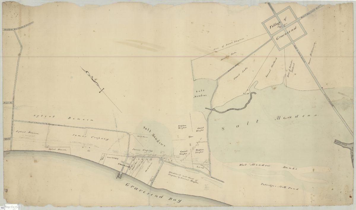
Map of territory near the Bay from the Village of New Utrecht to Gravesend & Coney Island
Map of territory near the Bay from the Village of New Utrecht to Gravesend & Coney Island
[18??]
Map of Bay Ridge
Map of Bay Ridge
[18??]
[Map of Dyker Meadows in the town of New Utrecht]
[Map of Dyker Meadows in the town of New Utrecht]
[18??]
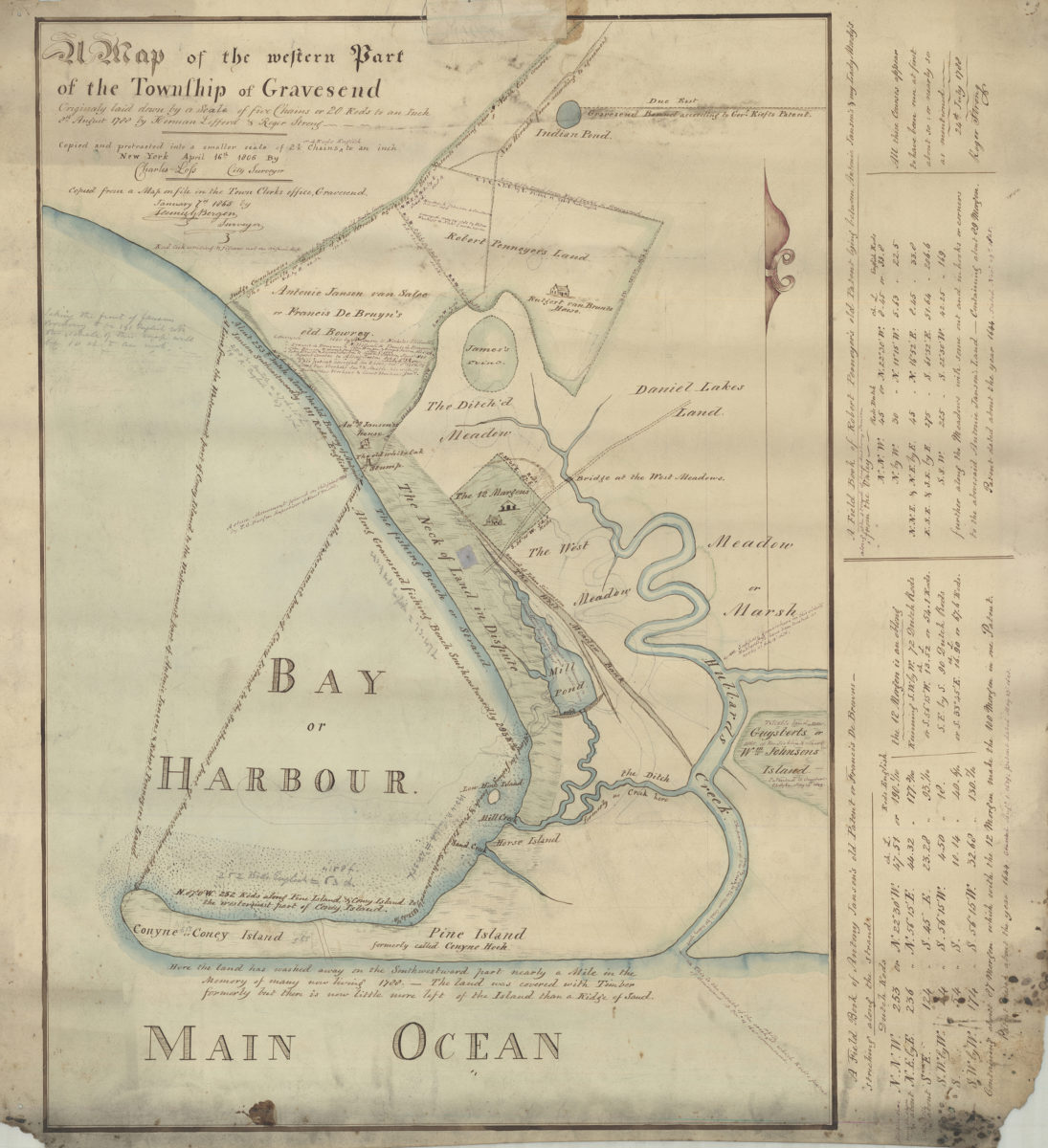
Map of the western part of the Township of Gravesend originally laid down by a scale of five chains or 20 rods to an inch, 8th August 1788 by Herman Lefford & Roger Strong:New York City, April 16th 1806
Map of the western part of the Township of Gravesend originally laid down by a scale of five chains or 20 rods to an inch, 8th August 1788 by Herman Lefford & Roger Strong:New York City, April 16th 1806
[18??]
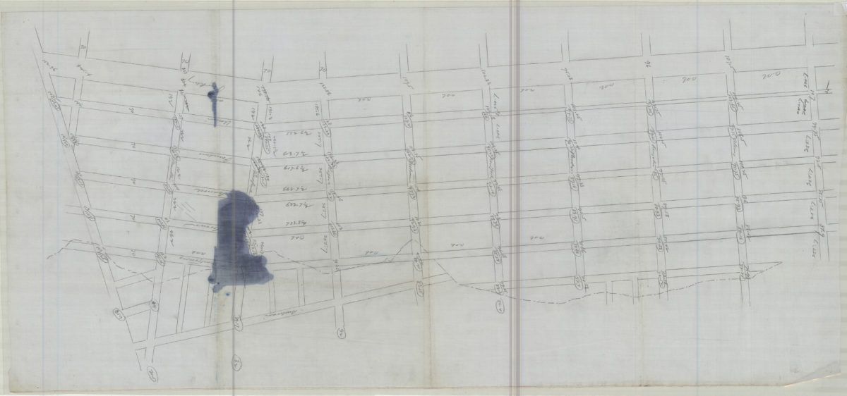
[Map of land near Avenue E, East 52nd Street, Avenue D and East 54th Street in the Town of Flatlands]
[Map of land near Avenue E, East 52nd Street, Avenue D and East 54th Street in the Town of Flatlands]
[18??]
Sketch of New Utrecht from Dripps map
Sketch of New Utrecht from Dripps map
[18??]
[Map of area around Gowanus Creek]: surveyed 6th April 1750 by Fran Maerschalck, copied by T. G. Bergen from the original in the possession of John Martense
[Map of area around Gowanus Creek]: surveyed 6th April 1750 by Fran Maerschalck, copied by T. G. Bergen from the original in the possession of John Martense
[18??]
Draft of extension of Ovington Ave
Draft of extension of Ovington Ave
[18??]
[Land of John Lott at Flatbush Avenue and Montgomery Street]
[Land of John Lott at Flatbush Avenue and Montgomery Street]
[18??]
[Survey maps of Kings County Penitentiary Grounds and Vanderveer encroachment onto Clarendon property]
[Survey maps of Kings County Penitentiary Grounds and Vanderveer encroachment onto Clarendon property]
[18??]
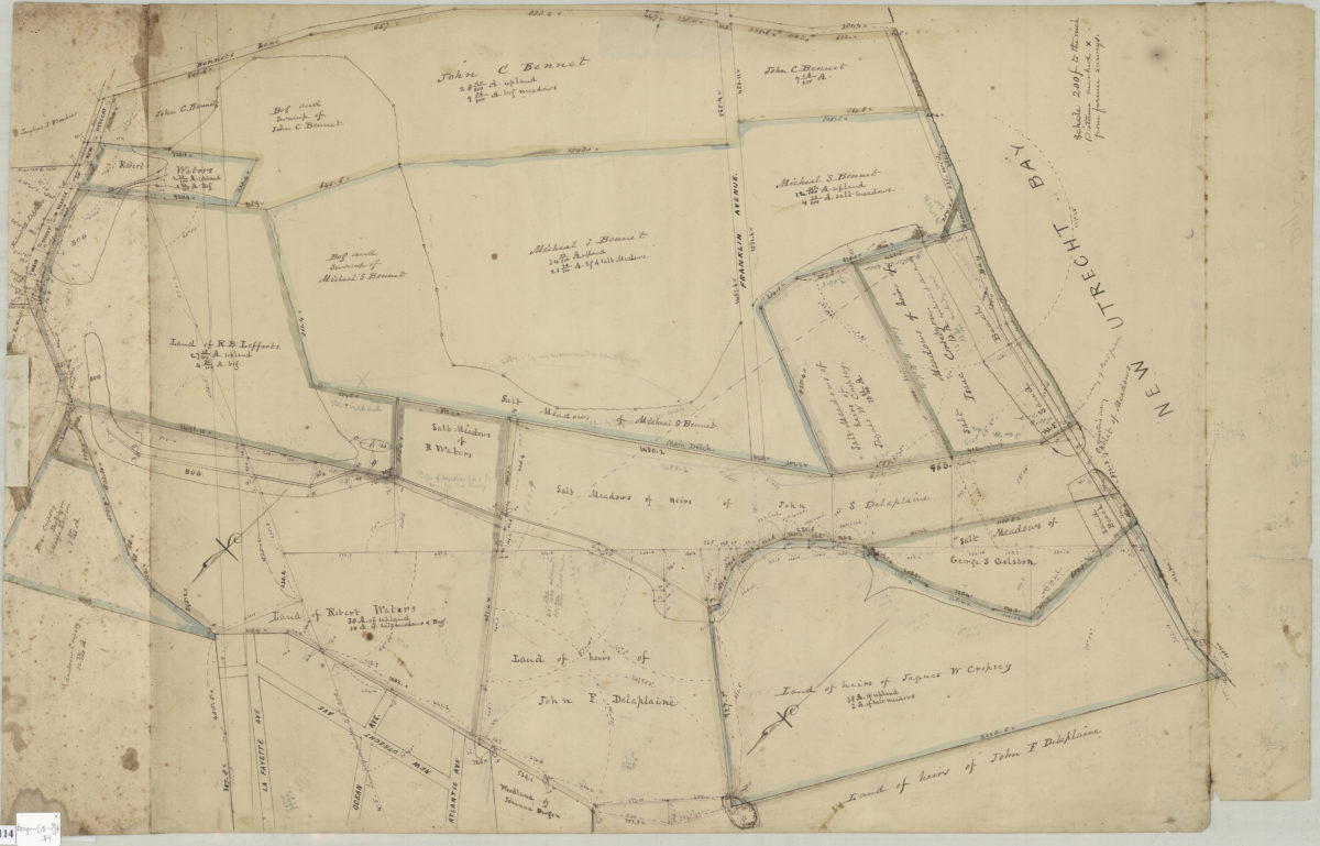
Land of G. Van Brunt, Sieger, Delaplaine, A. Cropsey & c
Land of G. Van Brunt, Sieger, Delaplaine, A. Cropsey & c
[18??]
Grades on street in Richards tract, Bay Ridge
Grades on street in Richards tract, Bay Ridge
[18??]
Opening map and tracing of 22nd Ave
Opening map and tracing of 22nd Ave
[18??]
92nd St
92nd St
[18??]
[Grade maps for Richard R. Bennet]
[Grade maps for Richard R. Bennet]
[18??]
[Map showing the intersection of Gowanus Creek with Gowanus Canal, Brooklyn, N.Y.]
[Map showing the intersection of Gowanus Creek with Gowanus Canal, Brooklyn, N.Y.]
[18??]
[Map showing street grid, existing buildings, and the course of Wykoff Creek in Greenpoint, Brooklyn]
[Map showing street grid, existing buildings, and the course of Wykoff Creek in Greenpoint, Brooklyn]
[18??]
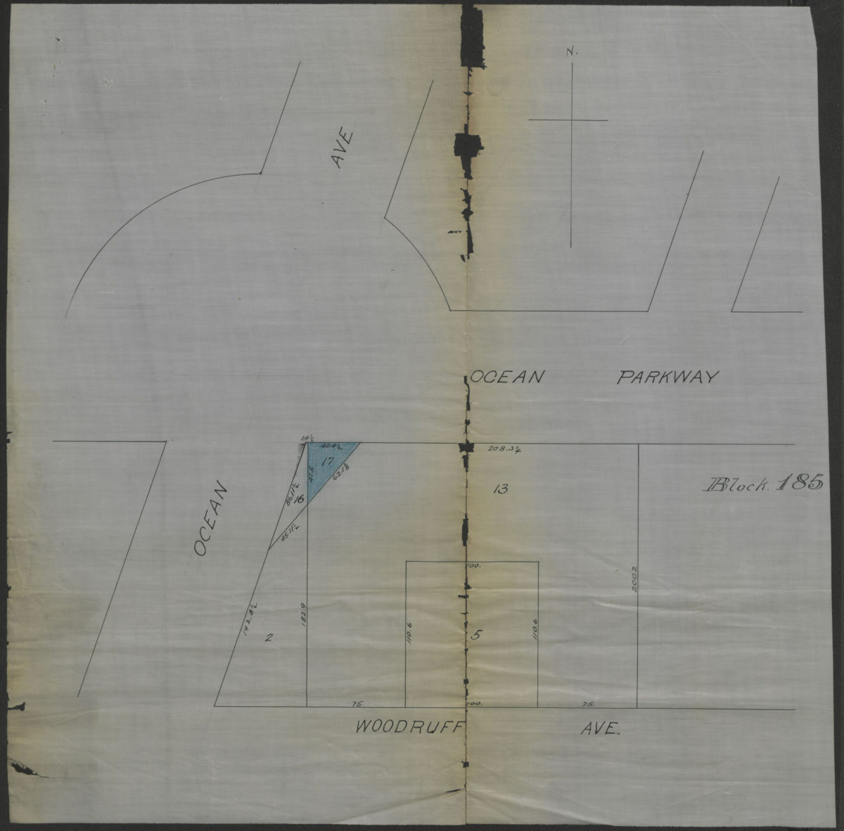
[Map showing property at intersection of Ocean Avenue and Ocean Parkway in Brooklyn, N.Y.]
[Map showing property at intersection of Ocean Avenue and Ocean Parkway in Brooklyn, N.Y.]
[18??]
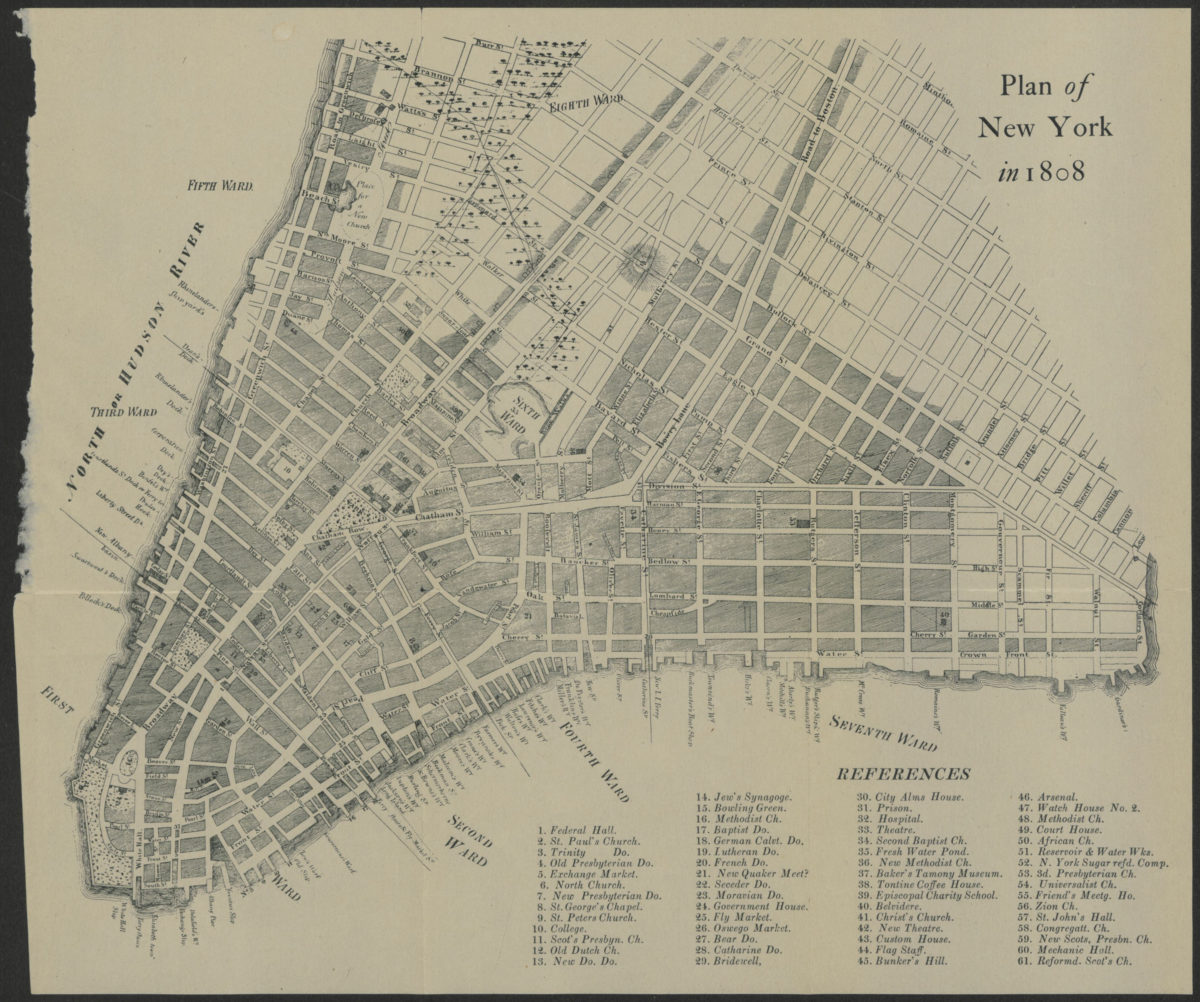
Plan of New York in 1808
Plan of New York in 1808
[18??]
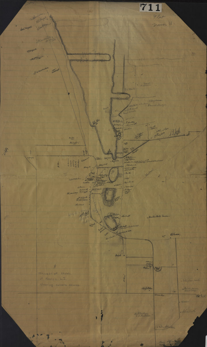
Manuscript sketch of Roslyn L.I. showing owners names
Manuscript sketch of Roslyn L.I. showing owners names
[18??]
Map of the western part of the Township of Gravesend originally laid down by a scale of five chains or 20 rods to an inch, 8th August 1788 by Herman Lefford & Roger Strong: April 16th 1806
Map of the western part of the Township of Gravesend originally laid down by a scale of five chains or 20 rods to an inch, 8th August 1788 by Herman Lefford & Roger Strong: April 16th 1806
[18??]
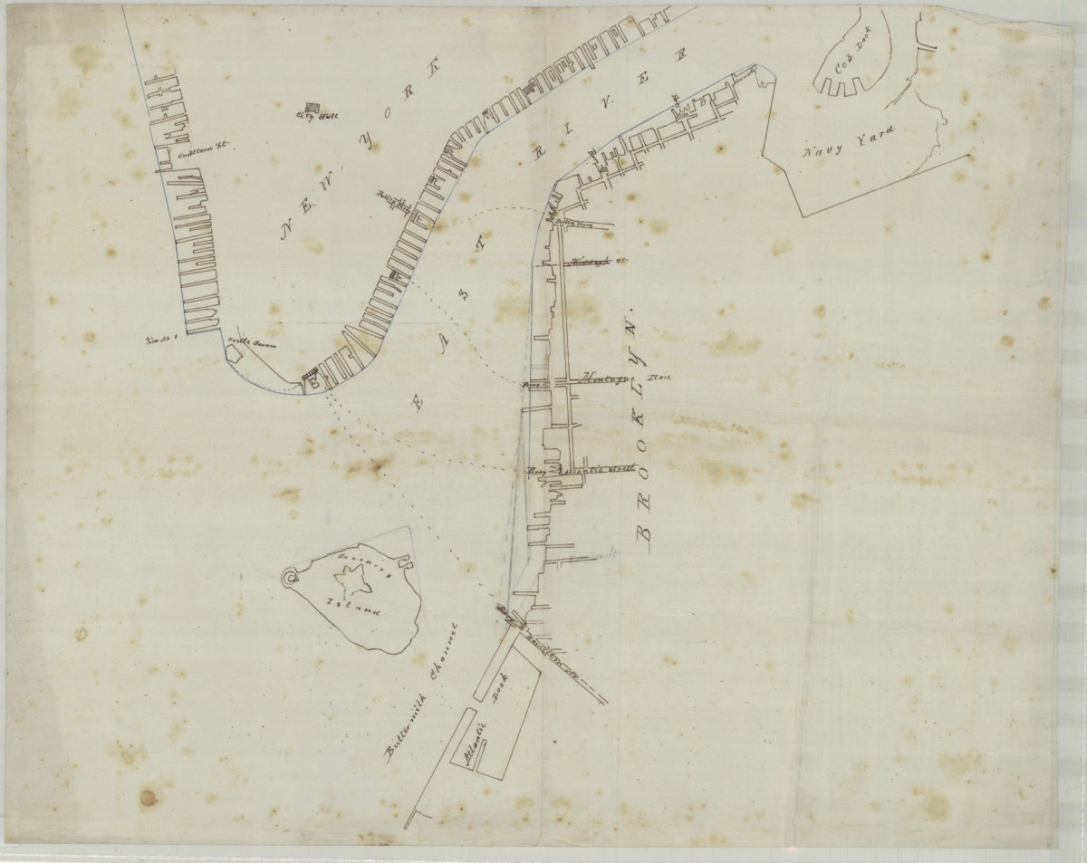
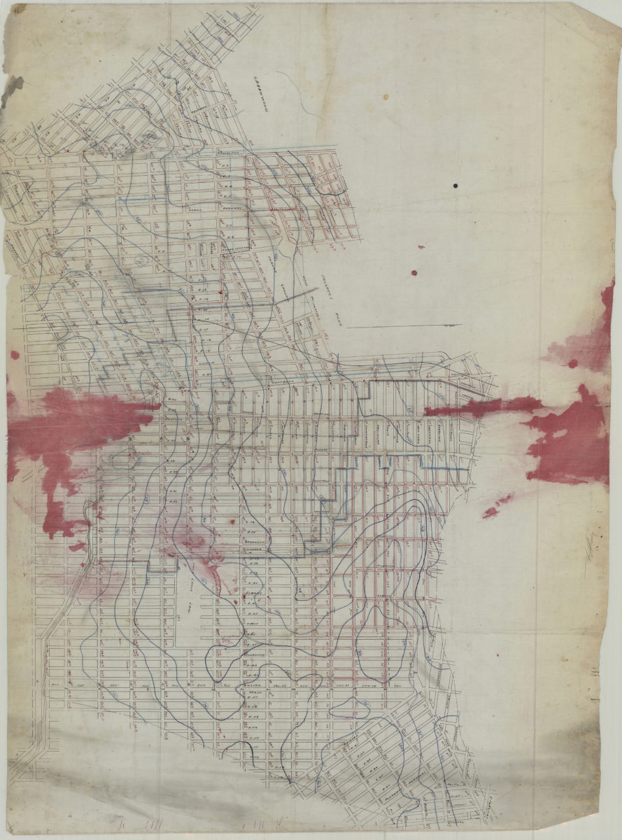
[Map of northwest Brooklyn and Lower Manhattan]
[Map of northwest Brooklyn and Lower Manhattan]
[18??]
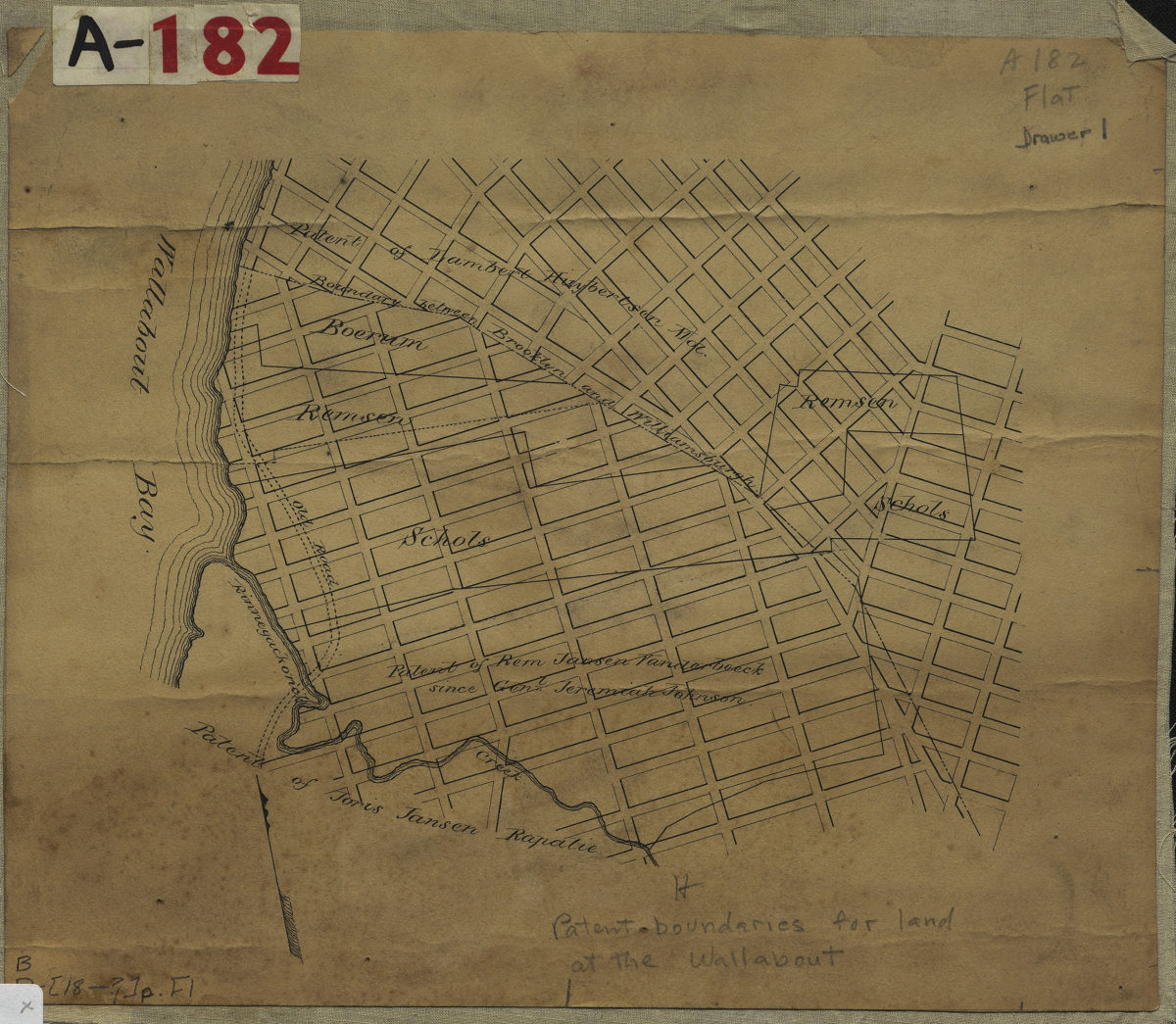
[Map showing land patents near Wallabout Bay]
[Map showing land patents near Wallabout Bay]
[18??]
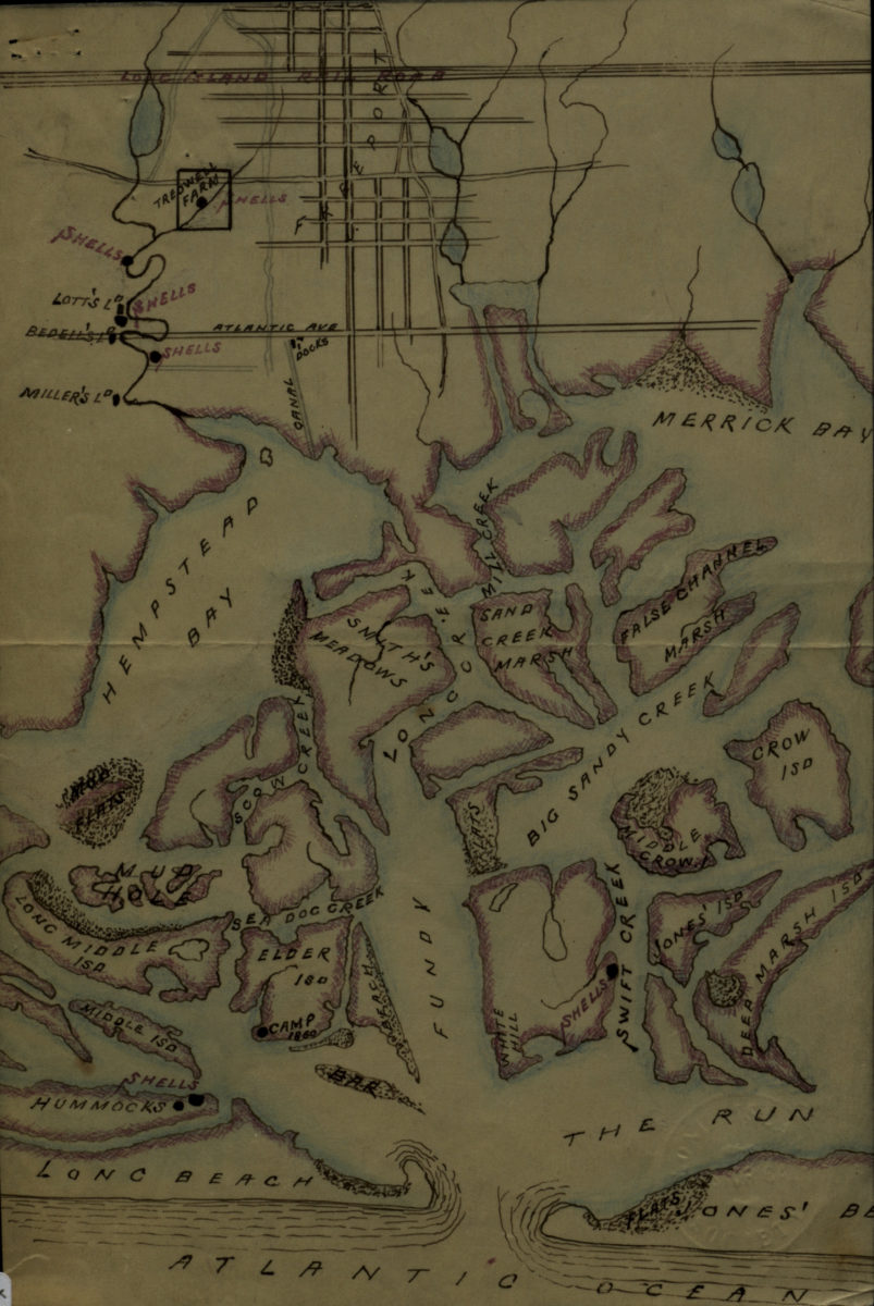
[Map of Hempstead Bay]
[Map of Hempstead Bay]
[18??]
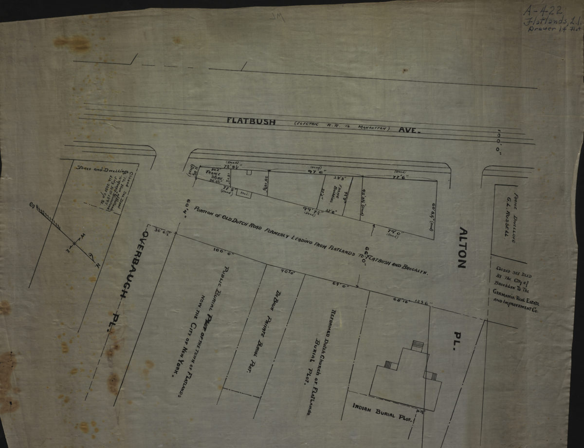
[Map of Flatbush Ave. at Alton Pl. and Overbaugh Pl.].
[Map of Flatbush Ave. at Alton Pl. and Overbaugh Pl.].
[18??]
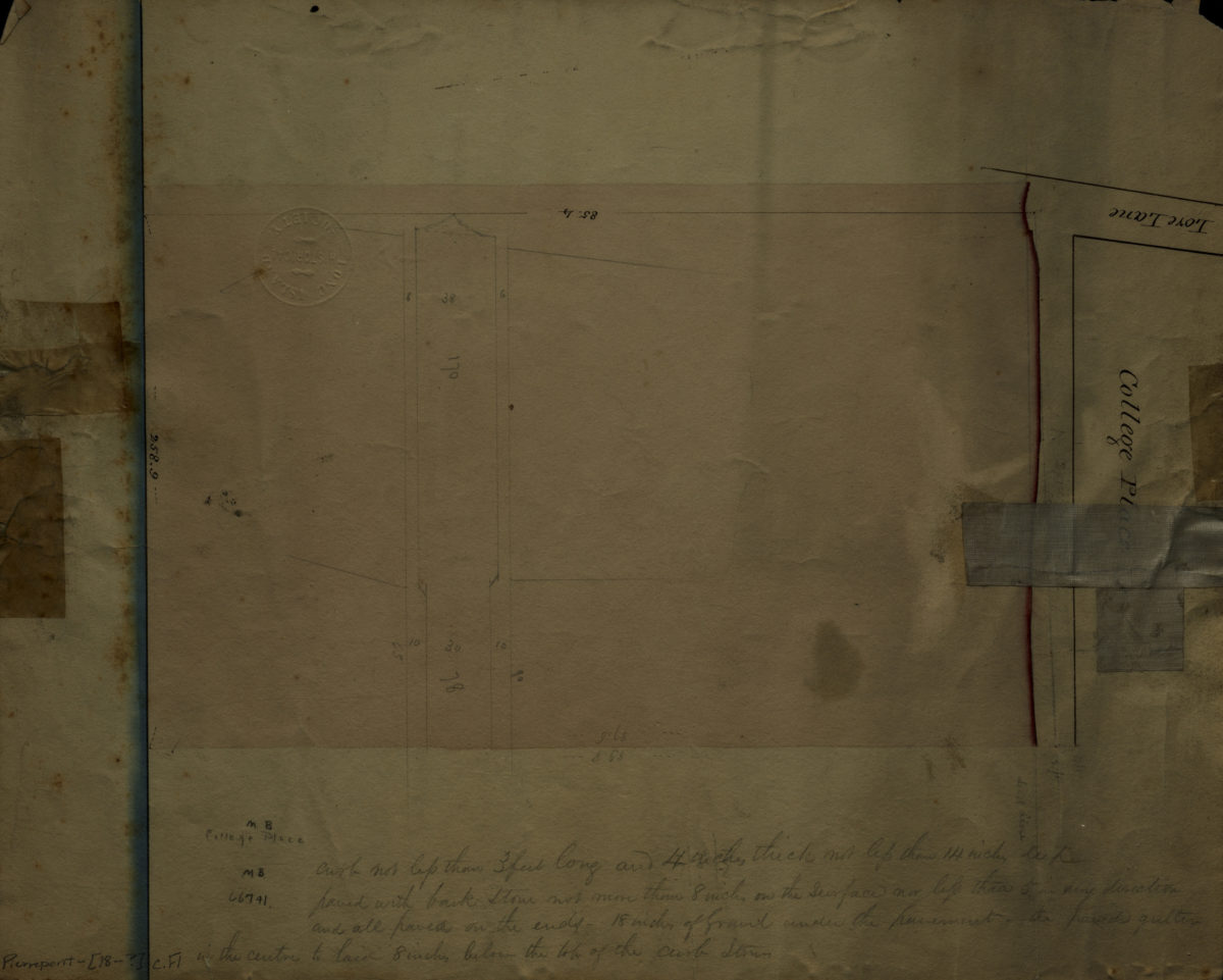
College Place
College Place
[18??]
A map of the Manor Renselaerwick: surveyed and laid down by a scale of 100 chains to an inch: by Jno. R. Bleeker, surveyor ; from the original in possession of Genl. Stephen Van Renselaer [sic] ; copied from the original by D. Vaughan
A map of the Manor Renselaerwick: surveyed and laid down by a scale of 100 chains to an inch: by Jno. R. Bleeker, surveyor ; from the original in possession of Genl. Stephen Van Renselaer [sic] ; copied from the original by D. Vaughan
[18??]
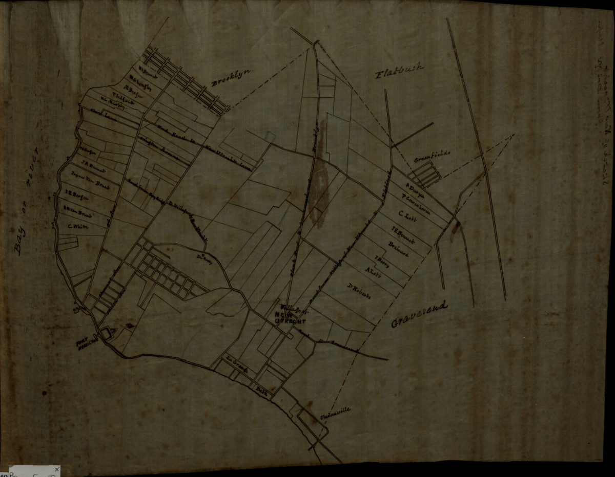
[Map of New Utrecht]
[Map of New Utrecht]
[18??]
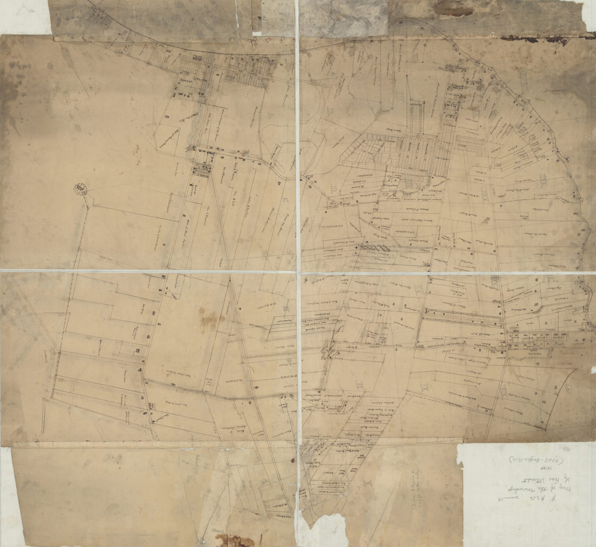
[Map of roads from Gravesend to Flatbush to Flatlands, New Utrecht and Flatbush]
[Map of roads from Gravesend to Flatbush to Flatlands, New Utrecht and Flatbush]
[18??]
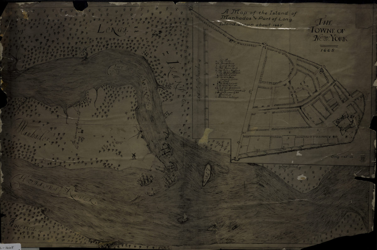
A map of the island of Manhados and part of Long Island, drawn about 1665
A map of the island of Manhados and part of Long Island, drawn about 1665
[18??]
Map of Brooklyn City Railroad in New Utrecht
Map of Brooklyn City Railroad in New Utrecht
[18??]
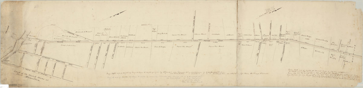
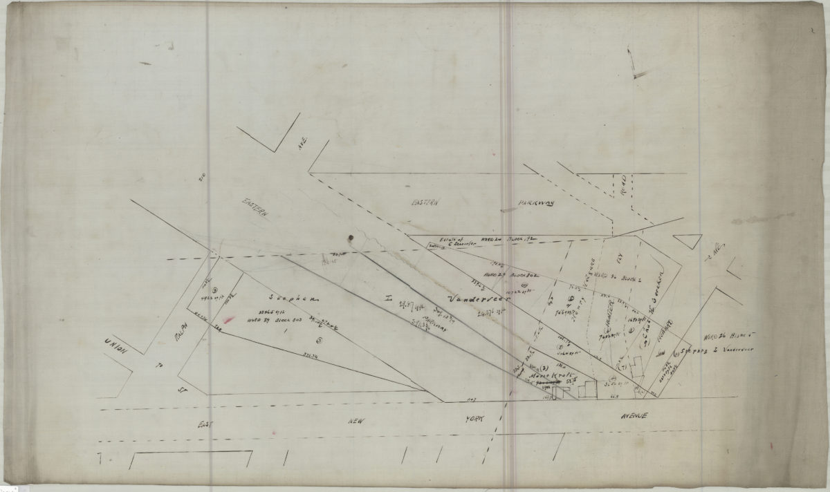
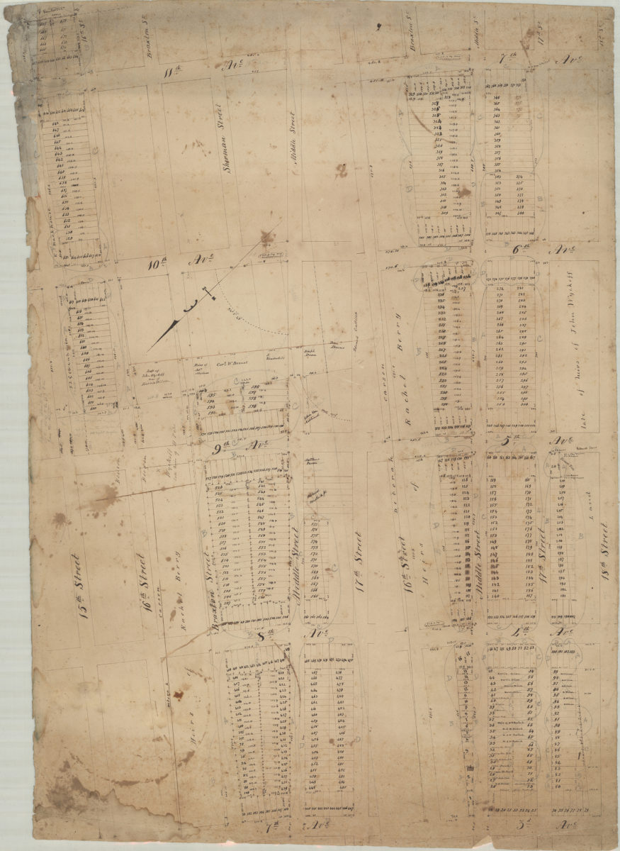
[Map of area bounded by Ralph Ave., East New York Ave., Howard Ave., and Eastern Pkwy]
[Map of area bounded by Ralph Ave., East New York Ave., Howard Ave., and Eastern Pkwy]
[18??]
Heirs of Peter Wyckoff, original draft
Heirs of Peter Wyckoff, original draft
[18??]
Plan of the Battle of Long Island and of the Brooklyn defences, August 27th, 1776: compiled by Henry P. Johnston ; F. von Egloffstein, del
Plan of the Battle of Long Island and of the Brooklyn defences, August 27th, 1776: compiled by Henry P. Johnston ; F. von Egloffstein, del
[18??]
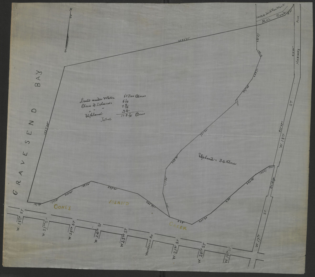
[Survey map of Coney Island and Gravesend]
[Survey map of Coney Island and Gravesend]
[18??]
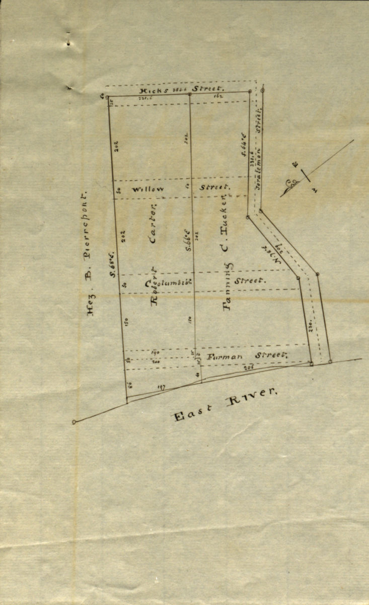
[Map showing land of Robert Carter, Fanning C. Tucker, and Hez. B. Pierrepont]
[Map showing land of Robert Carter, Fanning C. Tucker, and Hez. B. Pierrepont]
[18??]
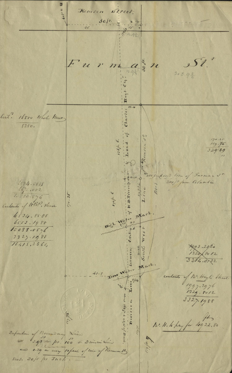
[Map of Remsen St. and Furman St.].
[Map of Remsen St. and Furman St.].
[18??]
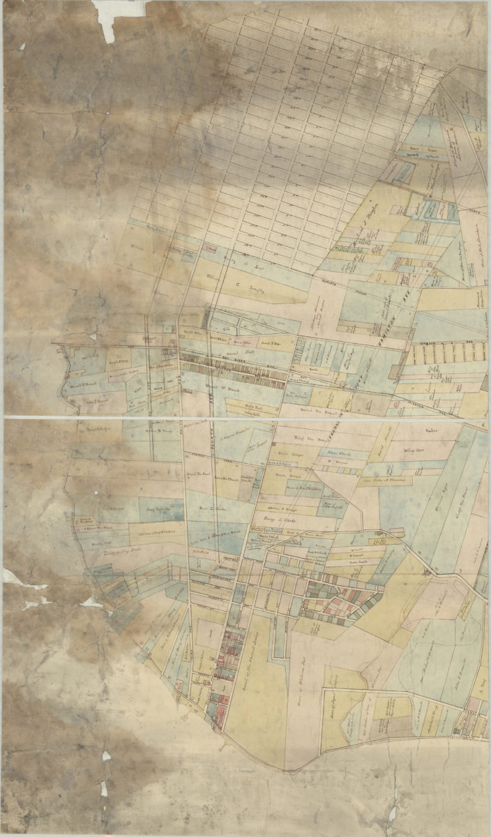
[Map of area bounded by Franklin Ave., Sullivan Pl., Albany Ave., and Eastern Pkwy]
[Map of area bounded by Franklin Ave., Sullivan Pl., Albany Ave., and Eastern Pkwy]
[18??]
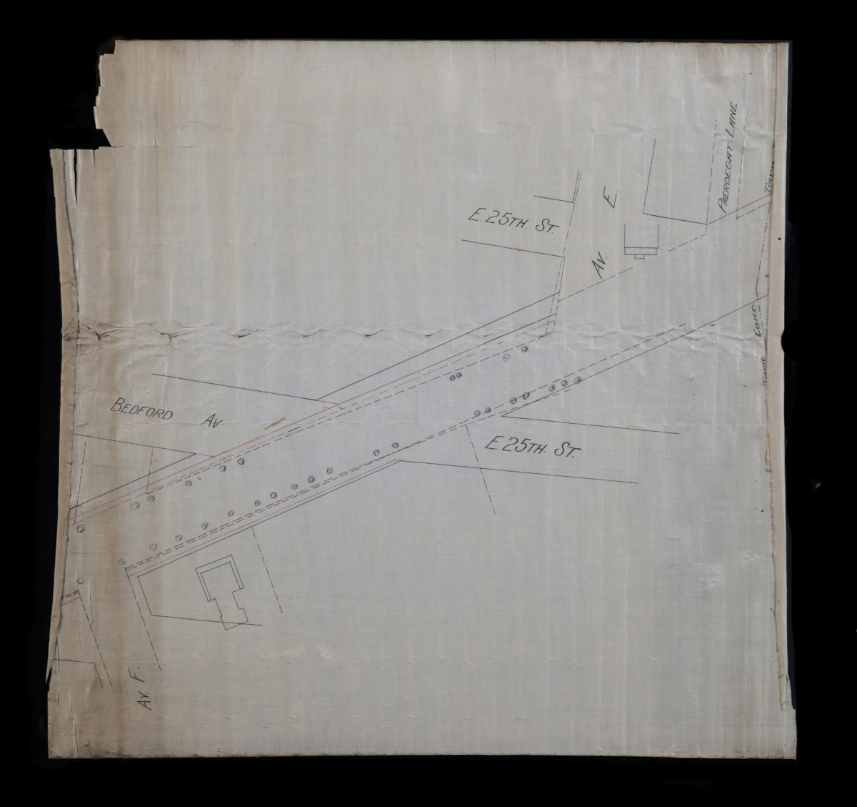
[Map of E. 25th St. and Bedford Ave. between Ave. F and Paerdegat Ln]
[Map of E. 25th St. and Bedford Ave. between Ave. F and Paerdegat Ln]
[18??]
[Map covering area east from Greenwood Cemetery to Howard Ave. and north from Ave G. to Eastern Pkwy]
[Map covering area east from Greenwood Cemetery to Howard Ave. and north from Ave G. to Eastern Pkwy]
[18??]
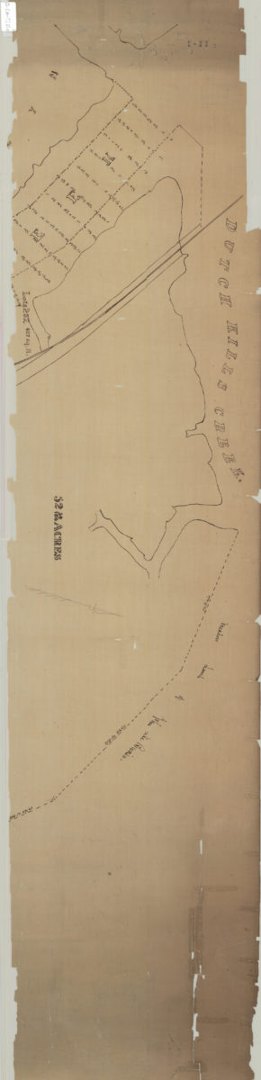
[Map of land near Dutch Kills Creek]
[Map of land near Dutch Kills Creek]
[18??]
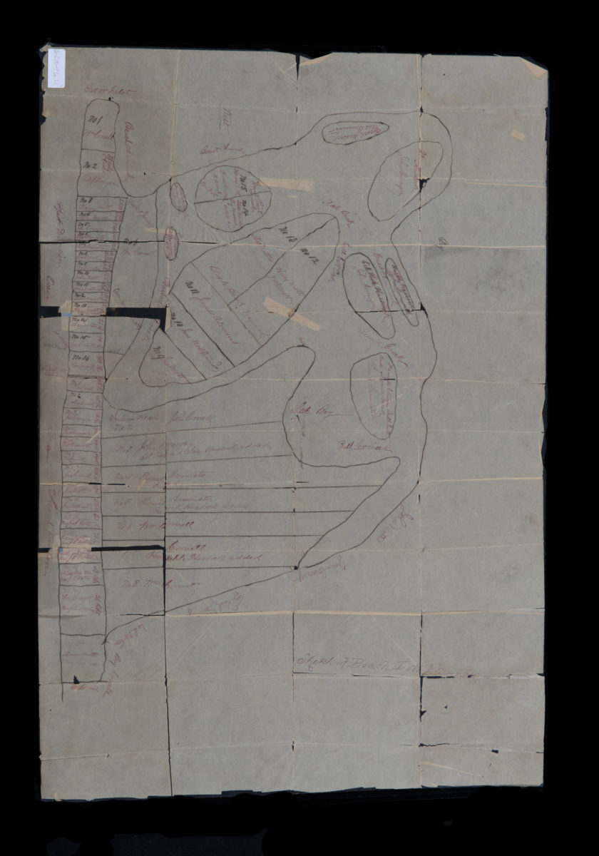
Sketch of beach lots & marsh
Sketch of beach lots & marsh
[18??]
[Map of Long Island Ciy]: P.G. Van-Alst, city surveyor, Brooklyn, E.D.
[Map of Long Island Ciy]: P.G. Van-Alst, city surveyor, Brooklyn, E.D.
[18??]
[Map covering area north from E. 93rd St. to Douglass St. and east from East New York Ave. to Flatlands Ave.].
[Map covering area north from E. 93rd St. to Douglass St. and east from East New York Ave. to Flatlands Ave.].
[18??]
[Map of East New York Ave.].
[Map of East New York Ave.].
[18??]
[Map of Church Ave. between E. 18th St. and Nostrand Ave.].
[Map of Church Ave. between E. 18th St. and Nostrand Ave.].
[18??]
1
2
3
4
5
6
7
8
9
10
11
12
13
14
15
16
17
18
19
Next