
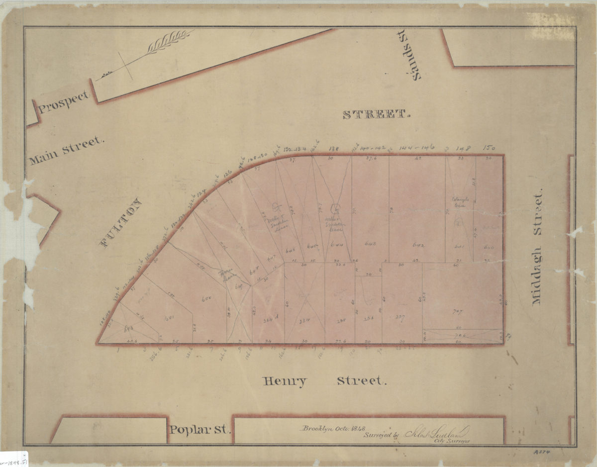
[Map of area bounded by Fulton St., Henry St., and Middagh St.]: surveyed by Silas Ludlam, city surveyor
October 1848
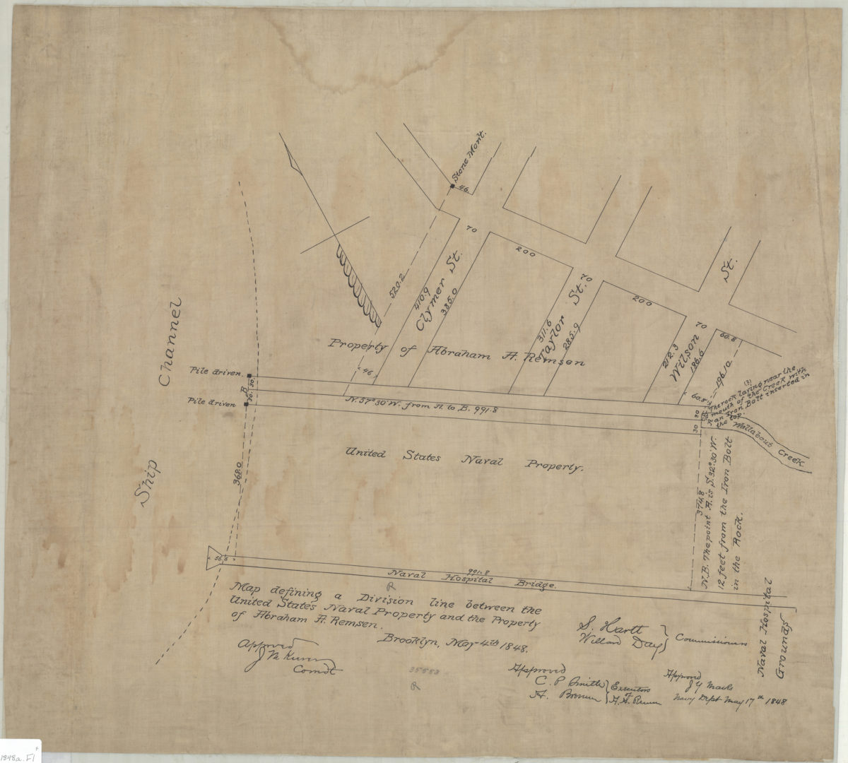
Map defining a division line between the United States Naval Property and the property of Abraham A. Remsen
May 4, 1848

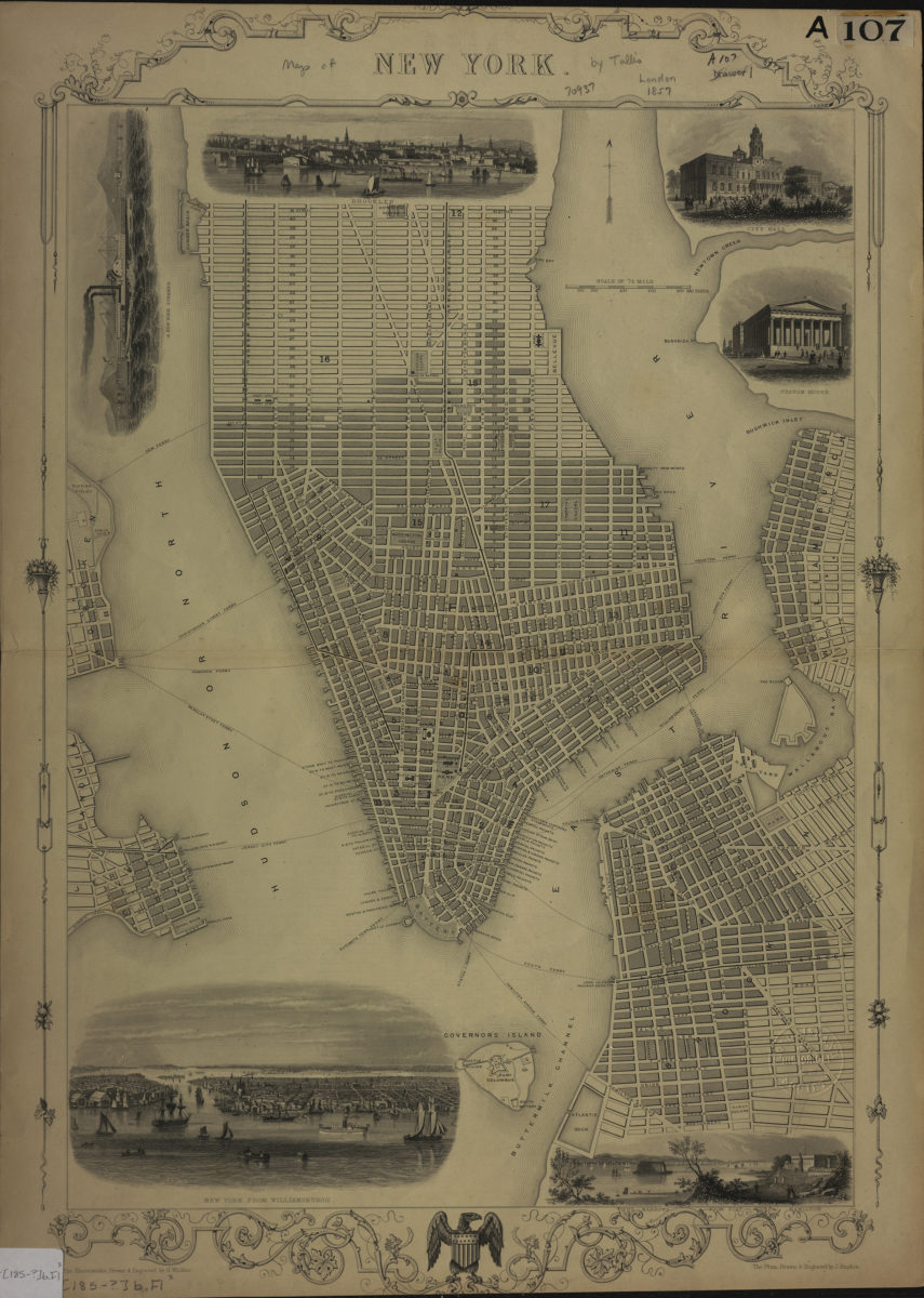
New York: the plan drawn & engraved by J. Rapkin ; the illustrations drawn & engraved by H. Winkles
[185?]