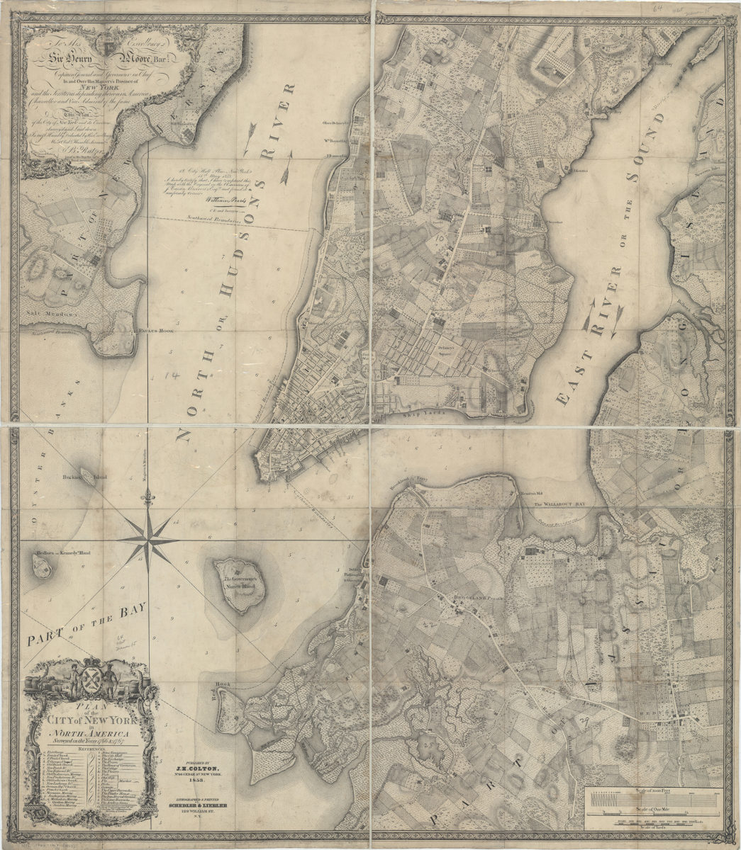
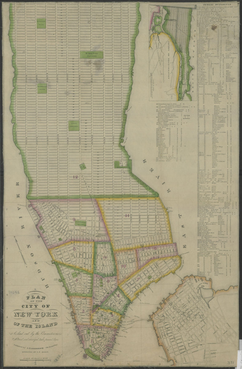
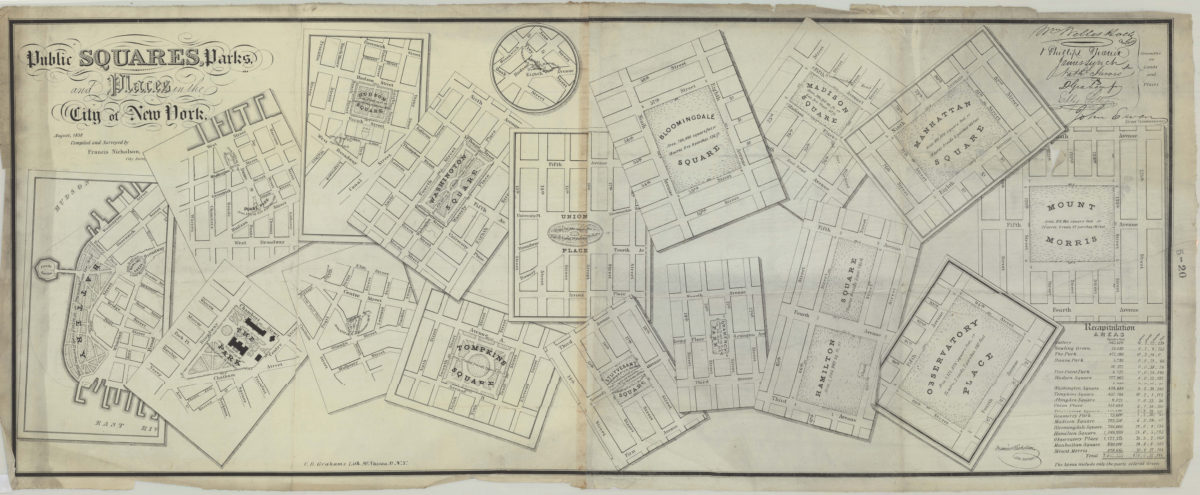
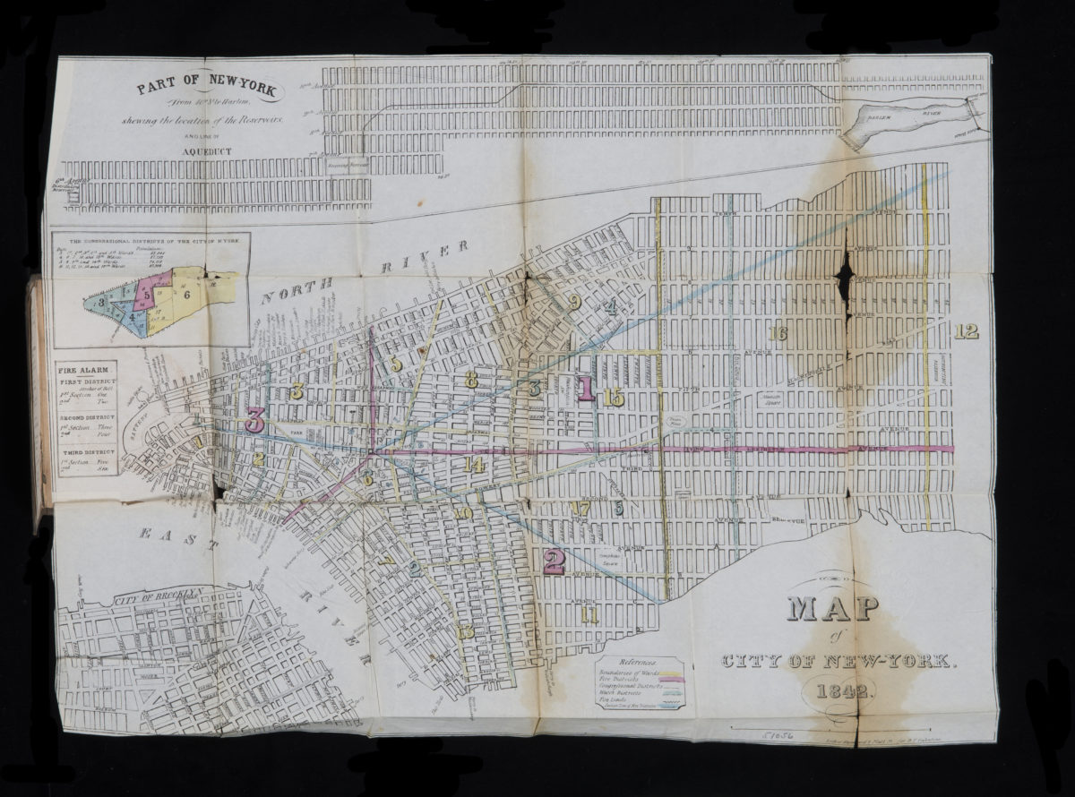
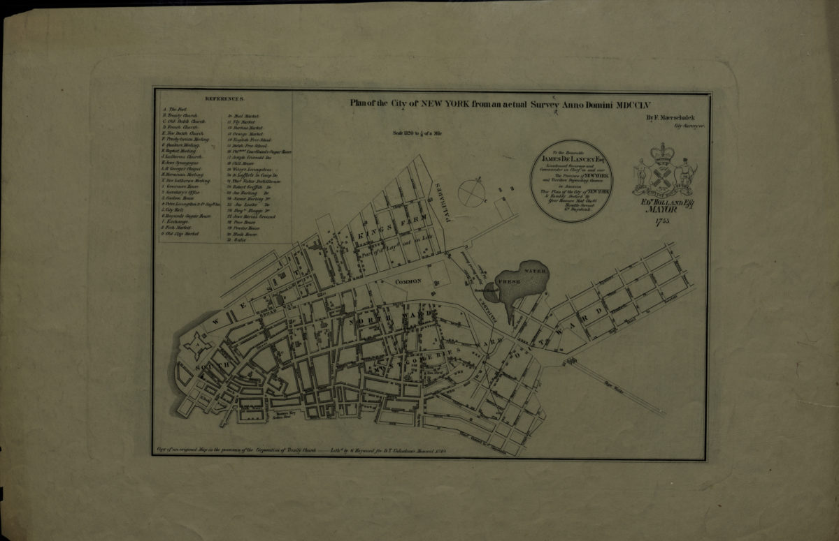
Public squares, parks, and places in the city of New York: compiled and surveyed by Francis Nicholson
August 1838
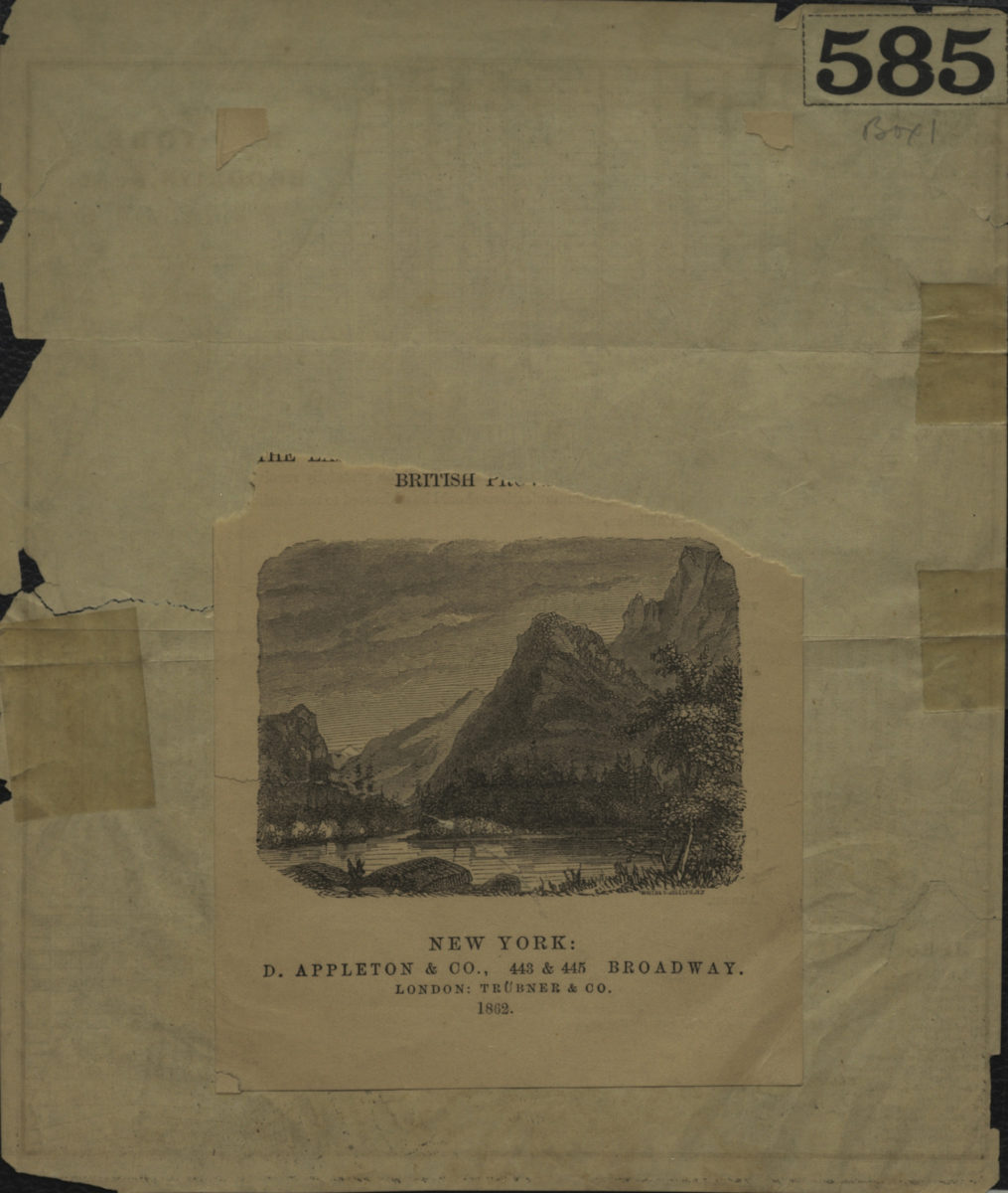
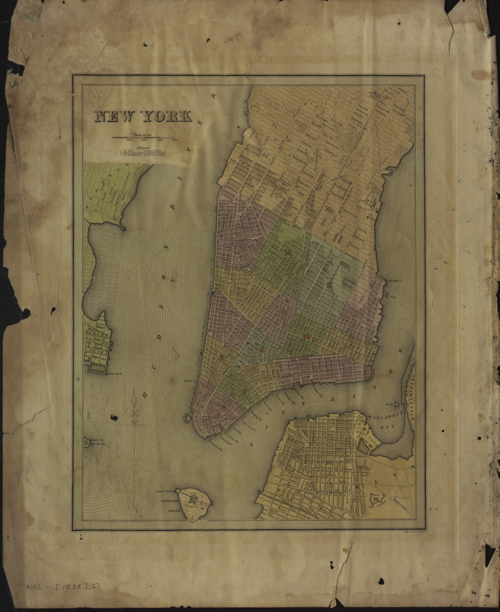
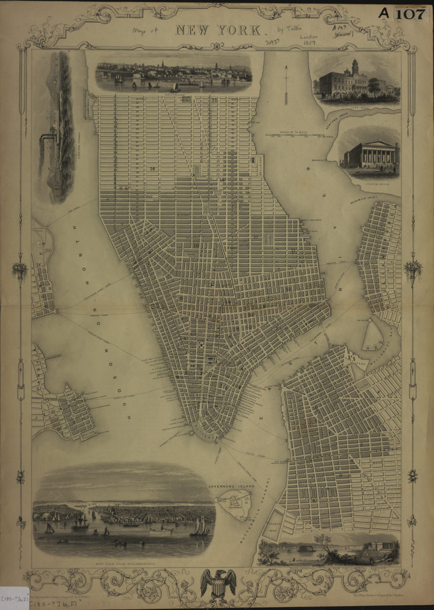
New York: the plan drawn & engraved by J. Rapkin ; the illustrations drawn & engraved by H. Winkles
[185?]
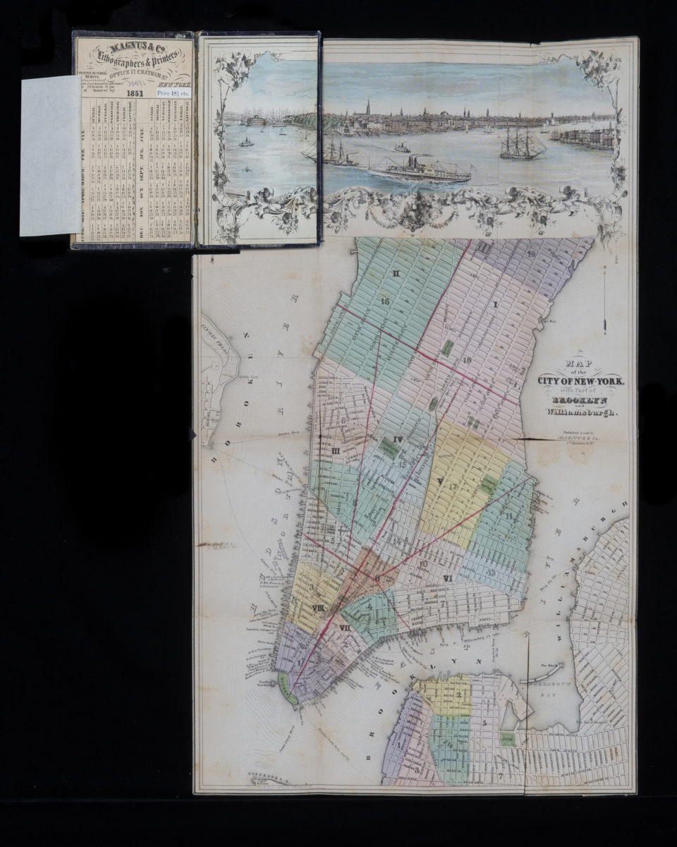
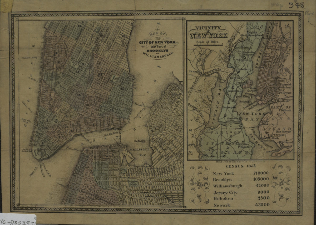
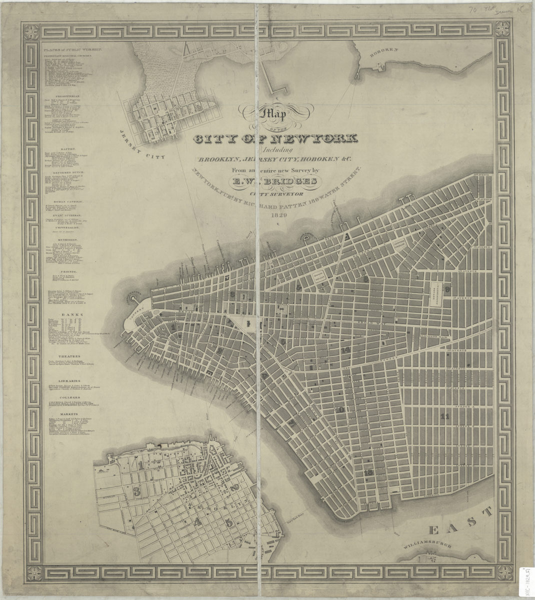
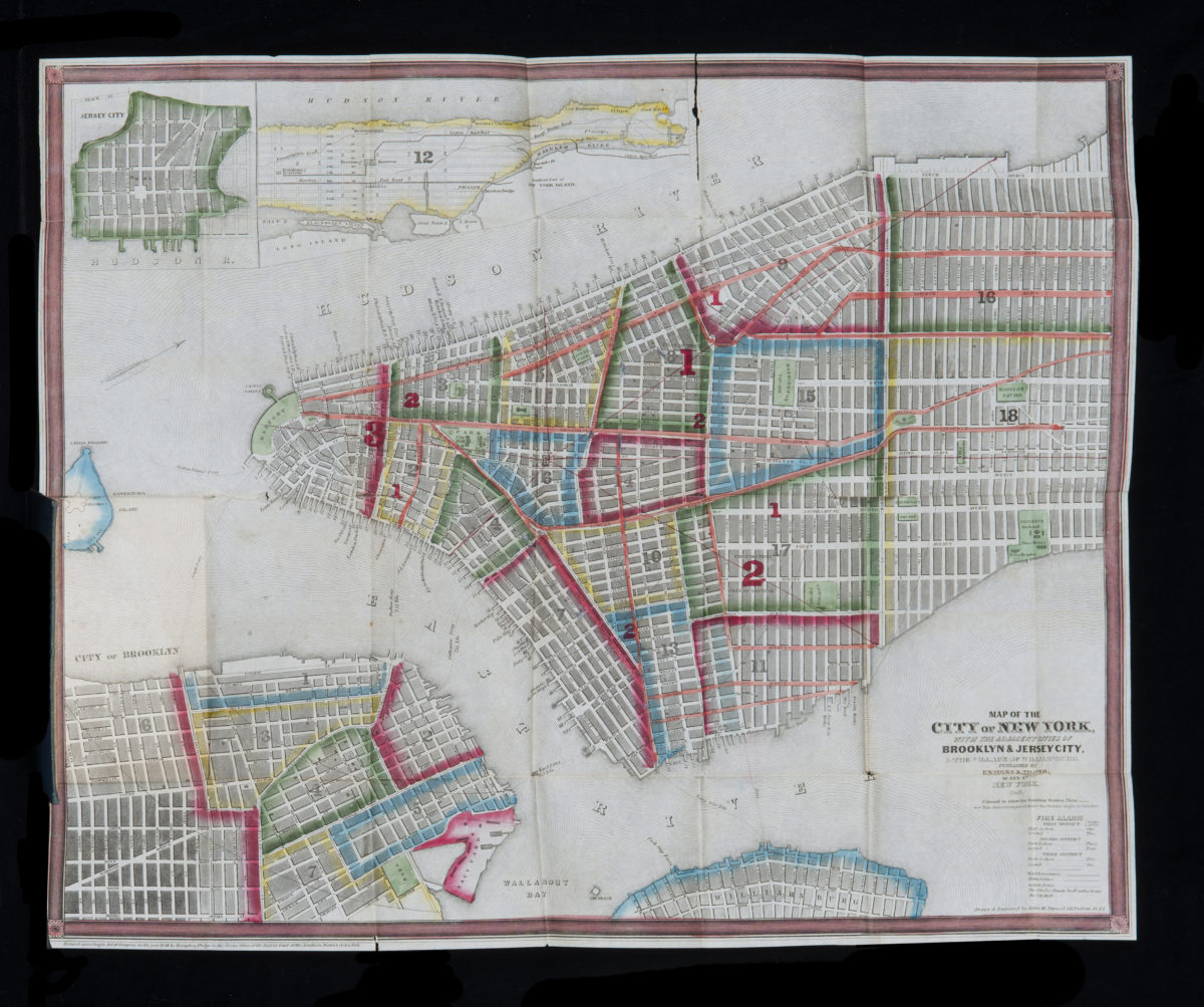
Map of the city of New York, with the adjacent cities of Brooklyn & Jersey City, & the village of Williamsburg: drawn & engraved by John M. Atwood
1851; [ca. 1844]
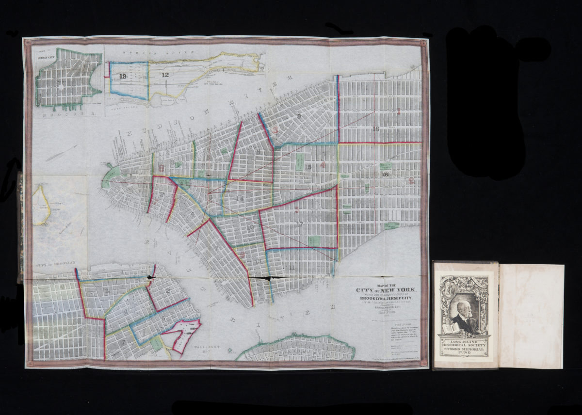
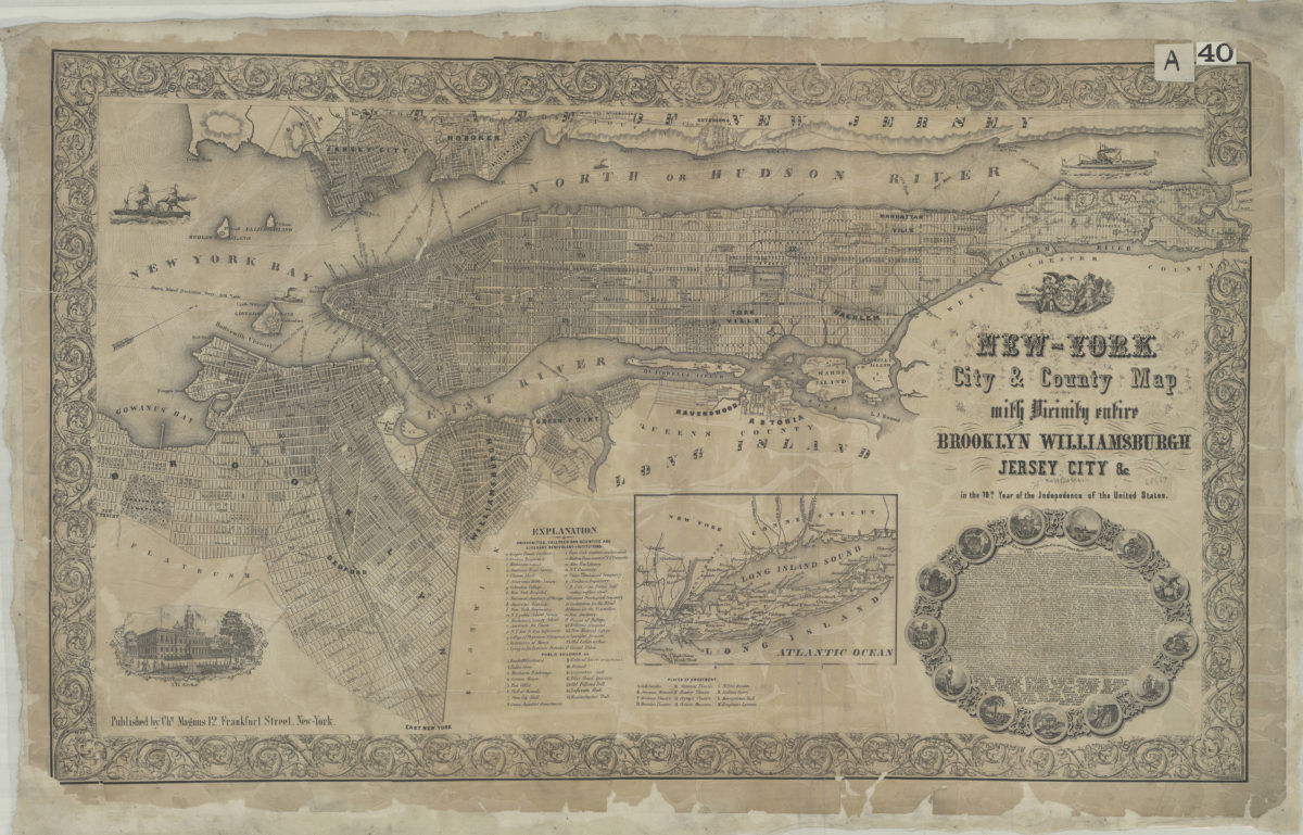
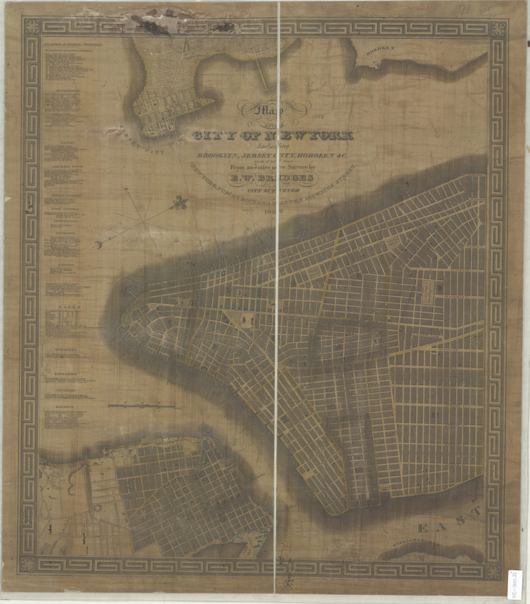
City & County map of New-York, Brooklyn, Williamsburgh, Jersey City and the adjacent waters: by J.H. Colton
1852; [ca. 1845]