Center for Brooklyn History
Map Collections
Search
About
Othmer Library & Archives
Submit search query
Refine 553 records
Clear filters
2
Location
Albany County (N.Y.)
1
Albion (Oswego County : Town)
1
Annastown (N.Y.)
1
Astoria (New York, N.Y.)
4
Atlantic Basin (New York, N.Y.)
3
Babylon (N.Y. : Town)
2
Bath Beach (New York, N.Y.)
8
Battery Park (New York, N.Y.)
3
Bay Ridge (New York, N.Y.)
108
Bay Ridge Park (New York, N.Y.)
1
Bedford-Stuyvesant (New York, N.Y.)
67
Bellerose (New York, N.Y.)
1
Bensonhurst (New York, N.Y.)
17
Blythebourne (New York, N.Y.)
1
Boerum Hill (New York, N.Y.)
6
Borough Park (New York, N.Y.)
23
Boylston (N.Y.)
1
Brandon (N.Y.)
1
Bridgehampton (N.Y.)
1
Brighton Beach (New York, N.Y.)
4
Brookhaven (N.Y. : Town)
3
Brookhaven (N.Y.)
2
Brooklyn (New York, N.Y.)
891
Brooklyn Heights (New York, N.Y.)
76
Brownsville (New York, N.Y.)
10
Bushwick (New York, N.Y.)
20
Canarsie (New York, N.Y.)
18
Carroll Gardens (New York, N.Y.)
21
Clinton County (N.Y.)
1
Clinton Hill (New York, N.Y.)
10
Cobble Hill (New York, N.Y.)
7
College Point (New York, N.Y.)
2
Coney Island (New York, N.Y.)
22
Constable (N.Y.)
1
Corona (New York, N.Y.)
2
Cortelyou Farm (New York, N.Y.)
1
Cowenhoven Homestead (Brooklyn, New York, N.Y.)
1
Crown Heights (New York, N.Y.)
25
Cypress Hills (New York, N.Y.)
8
David Johnson Farm (New York, N.Y.)
1
Delaware River Valley (N.Y.-Del. and N.J.)
1
Denmark (N.Y.)
1
Dickinson (N.Y.)
2
Ditmas Park (New York, N.Y.)
1
Douglaston (New York, N.Y.)
1
Downtown Brooklyn (New York, N.Y.)
29
DUMBO Historic District (New York, N.Y.)
7
Dunkirk (N.Y.)
1
Dyker Heights (New York, N.Y.)
23
East Elmhurst (New York, N.Y.)
2
East Flatbush (New York, N.Y.)
23
East Harlem (New York, N.Y.)
1
East Midwood (New York, N.Y.)
1
East New York (New York, N.Y.)
16
East Patchogue (N.Y.)
1
Erasmus (New York, N.Y.)
1
Erie Basin (New York, N.Y.)
2
Essex County (N.J.)
4
Far Rockaway (New York, N.Y.)
2
Farragut (New York, N.Y.)
1
Flatbush (New York, N.Y.)
35
Flatlands (New York, N.Y.)
19
Flushing (New York, N.Y.)
13
Fort Covington (N.Y.)
1
Fort Greene (New York, N.Y.)
22
Fort Hamilton (New York, N.Y.)
31
Franklin County (N.Y.)
2
Freeport (N.Y.)
1
Fulton Ferry Historic District (New York, N.Y.)
5
Futurama (New York, N.Y.)
2
Glen Cove (N.Y.)
1
Gowanus (New York, N.Y.)
12
Gowanus Canal (New York, N.Y.)
5
Gravesend (New York, N.Y.)
25
Great Neck (N.Y.)
3
Green-Wood Cemetery (New York, N.Y.)
2
Greenboro (N.Y.)
1
Greenpoint (New York, N.Y.)
38
Greenport (N.Y.)
1
Harrisburgh (N.Y.)
1
Hempstead (N.Y.)
13
Hicksville (N.Y.)
1
Hinsdale (New York, N.Y.)
1
Hudson County (N.J.)
3
Hunters Point (New York, N.Y.)
2
Huntington (N.Y.)
7
Islip (N.Y.)
5
Jamaica (New York, N.Y.)
8
Jefferson County (N.Y.)
1
Kensington (New York, N.Y.)
11
Kings County (New York, N.Y.)
8
Kingslandville (New York, N.Y.)
1
Lakeland (N.Y.)
1
Lefferts Park (New York, N.Y.)
1
Lewis County (N.Y.)
2
Long Island (N.Y.)
197
Long Island City (New York, N.Y.)
8
Lorraine (N.Y.)
1
Manhattan (New York, N.Y.)
120
Marine Park (New York, N.Y.)
5
Martense Farm (New York, N.Y.)
1
Martinsburg (N.Y.)
1
Marway Farm (New York, N.Y.)
1
Maspeth (New York, N.Y.)
2
Mattituck (N.Y.)
1
Middlesex County (N.J.)
4
Midwood (New York, N.Y.)
9
Miller Place (N.Y.)
1
Mineola (N.Y.)
1
Mohawk River Valley (N.Y.)
3
Montauk (N.Y.)
4
New Jersey
27
New Lots (New York, N.Y.)
1
New Utrecht (New York, N.Y.)
9
New York (N.Y.)
164
New York (State)
95
New York Metropolitan Area
40
Newport County (R.I.)
1
Newtown (Queens County, N.Y.)
4
North Hempstead (N.Y. : Town)
4
Northport Bay (N.Y. : Bay)
1
Nottingham (New York, N.Y.)
2
Old Bethpage (N.Y.)
1
Oneida County (N.Y.)
2
Orwell (N.Y.)
2
Osceola (N.Y.)
2
Oswego County (N.Y.)
4
Oyster Bay (N.Y.)
9
Park Slope (New York, N.Y.)
16
Parkville (New York, N.Y.)
2
Patchogue (N.Y.)
2
Pearsalls (N.Y.)
1
Pierrepont (N.Y.)
1
Pierrepont Homestead (New York, N.Y.)
6
Port Jefferson (N.Y.)
1
Prospect Heights (New York, N.Y.)
16
Prospect Lefferts Gardens (Brooklyn, New York, N.Y.)
16
Prospect Park (New York, N.Y.)
25
Prospect Park South (New York, N.Y.)
8
Queens (New York, N.Y.)
83
Quiogue (N.Y.)
1
Ravenswood (New York, N.Y.)
4
Red Hook (New York, N.Y.)
19
Rensselaer County (N.Y.)
2
Richmond (N.Y.)
1
Richmond Hill (New York, N.Y.)
2
Ridgewood (New York, N.Y.)
2
Riverhead (N.Y.)
3
Rockaway Beach (New York, N.Y.)
1
Rockville Centre (N.Y.)
2
Rodman (N.Y.)
1
Rosevale (N.Y.)
2
Roslyn (N.Y.)
3
Roslyn Harbor (N.Y.)
1
Roslyn Highlands (N.Y.)
1
Rye (N.Y.)
1
Sag Harbor (N.Y.)
2
Sand Creek (N.Y.)
1
Sayville (N.Y.)
1
Schoharie County (N.Y.)
1
Schoharie Creek Valley (N.Y.)
1
Sea Cliff (N.Y.)
1
Sea Gate (New York, N.Y.)
7
Sheepshead Bay (New York, N.Y.)
13
Shelter Island (N.Y.)
2
Smithtown (N.Y. : Town)
4
South Brooklyn Temperance Village (Brooklyn, New York, N.Y.)
1
South Greenfield (New York, N.Y.)
1
Southampton (N.Y.)
5
Southold (N.Y.)
4
Stony Brook (N.Y.)
1
Stuyvesant Heights (New York, N.Y.)
1
Suffolk (N.Y.)
1
Suffolk County (N.Y.)
43
Sunnyside (New York, N.Y.)
1
Sunset Park (New York, N.Y.)
53
Susquehanna River Valley
1
Union County (N.J.)
1
United States
10
Upper West Side (New York, N.Y.)
2
Van Pelt Manor House (Brooklyn, New York, N.Y.)
1
Vinegar Hill Historic District (New York, N.Y.)
4
Wallabout Bay (New York, N.Y.)
6
Weeksville (New York, N.Y.)
7
West Turin (N.Y.)
1
Westchester County (N.Y.)
11
Westhampton Beach (N.Y.)
1
Westville (Franklin County, N.Y.)
1
Whitestone (New York, N.Y.)
3
Williamsburg (New York, N.Y.)
36
Windsor Terrace (New York, N.Y.)
10
Woodhaven (New York, N.Y.)
1
Woodside (New York, N.Y.)
3
Yaphank (N.Y.)
1
Show 174 more
Subject
Aqueducts
3
Auctions
32
Buildings
12
Canals
15
Cemeteries
17
Decedents' estates
1
docks
2
Farms
2
ferries
32
Fills (Earthwork)
4
Gardens
1
Grading (Earthwork)
1
Land grants
12
Land titles
1
Landforms
15
Landowners
434
Parks
35
Piers
25
Plank roads
1
Planned communities
2
Ponds
6
Prisons
1
Railroads
72
Real estate development
1
Real property
619
Riparian rights
13
Rivers
16
Roads
117
Salt marshes
2
Sewerage
7
Streets
46
Submerged lands
17
Tide-waters
2
Watersheds
5
Waterways
2
Wetlands
6
Show 16 more
Date
19th Century
945
or enter range:
from
to
Genres
Advertisements
30
Bathymetric maps
94
Broadsides
33
Cadastral maps
597
Early maps
35
Historical maps
53
Manuscript maps
365
Pictorial maps
38
Public utility maps
15
Thematic maps
60
Topographic maps
70
Transportation maps
120
Zoning maps
55
Sort by:
Date (earliest)
Date (most recent)
Draft of extension of Ovington Ave
Draft of extension of Ovington Ave
[18??]
Land of G. Van Brunt, Sieger, Delaplaine, A. Cropsey & c
Land of G. Van Brunt, Sieger, Delaplaine, A. Cropsey & c
[18??]
[Survey maps of Kings County Penitentiary Grounds and Vanderveer encroachment onto Clarendon property]
[Survey maps of Kings County Penitentiary Grounds and Vanderveer encroachment onto Clarendon property]
[18??]
Opening map and tracing of 22nd Ave
Opening map and tracing of 22nd Ave
[18??]
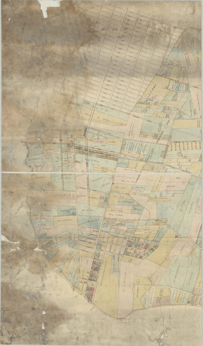
[Map showing street grid, existing buildings, and the course of Wykoff Creek in Greenpoint, Brooklyn]
[Map showing street grid, existing buildings, and the course of Wykoff Creek in Greenpoint, Brooklyn]
[18??]
[Map showing property at intersection of Ocean Avenue and Ocean Parkway in Brooklyn, N.Y.]
[Map showing property at intersection of Ocean Avenue and Ocean Parkway in Brooklyn, N.Y.]
[18??]
[Land of John Lott at Flatbush Avenue and Montgomery Street]
[Land of John Lott at Flatbush Avenue and Montgomery Street]
[18??]
[Map of area around Gowanus Creek]: surveyed 6th April 1750 by Fran Maerschalck, copied by T. G. Bergen from the original in the possession of John Martense
[Map of area around Gowanus Creek]: surveyed 6th April 1750 by Fran Maerschalck, copied by T. G. Bergen from the original in the possession of John Martense
[18??]
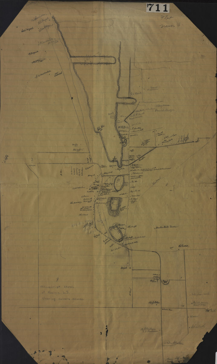
Manuscript sketch of Roslyn L.I. showing owners names
Manuscript sketch of Roslyn L.I. showing owners names
[18??]
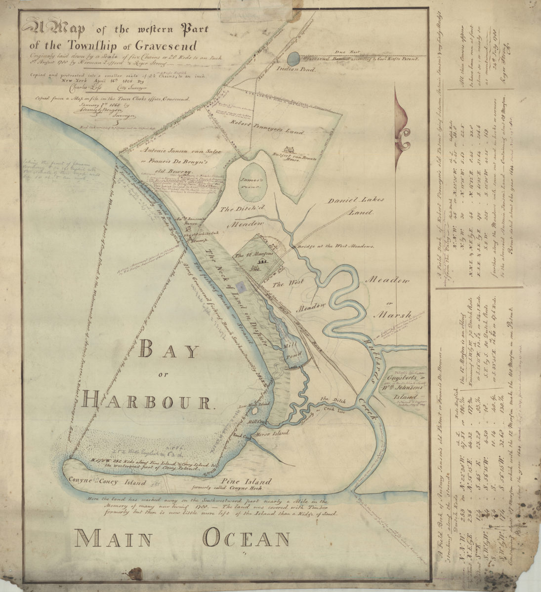
Map of the western part of the Township of Gravesend originally laid down by a scale of five chains or 20 rods to an inch, 8th August 1788 by Herman Lefford & Roger Strong: April 16th 1806
Map of the western part of the Township of Gravesend originally laid down by a scale of five chains or 20 rods to an inch, 8th August 1788 by Herman Lefford & Roger Strong: April 16th 1806
[18??]
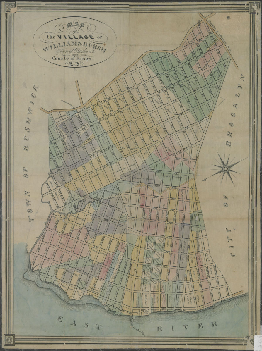
Map of the village of Williamsburgh, town of Bushwick, and county of Kings, L.I.
Map of the village of Williamsburgh, town of Bushwick, and county of Kings, L.I.
[18??]
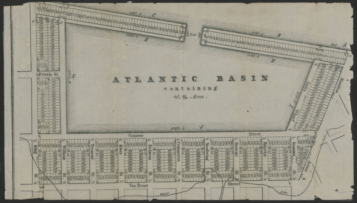
Atlantic Basin containing 40” 86/100 acres
Atlantic Basin containing 40” 86/100 acres
[18??]
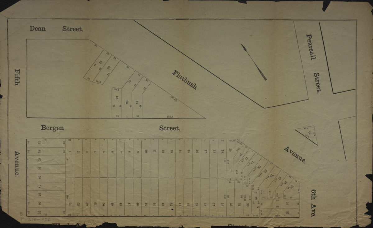
[Map of area bounded by 5th Ave., Dean St., Pearsall St., and Wyckoff St.].
[Map of area bounded by 5th Ave., Dean St., Pearsall St., and Wyckoff St.].
[18??]
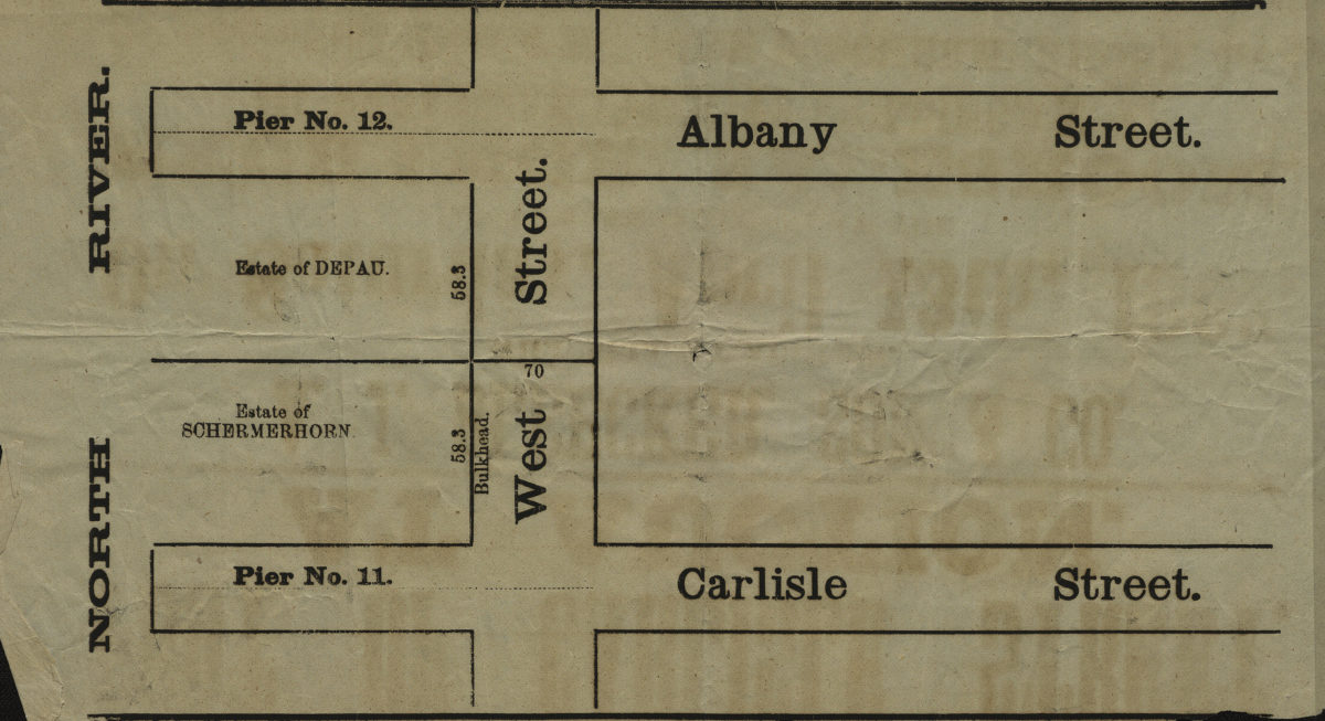
[Map showing area north from Carlisle St. to Albany St. and east from the North River to approximately West St.].
[Map showing area north from Carlisle St. to Albany St. and east from the North River to approximately West St.].
[18??]
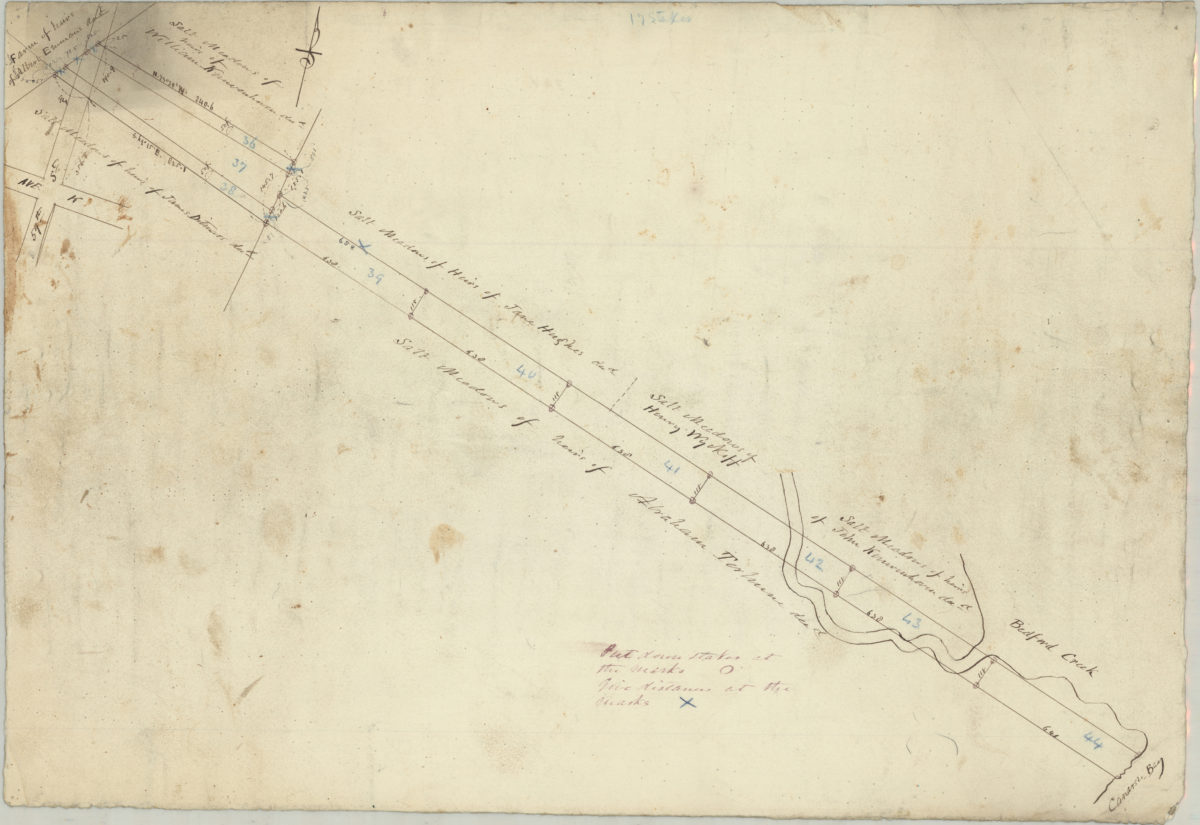
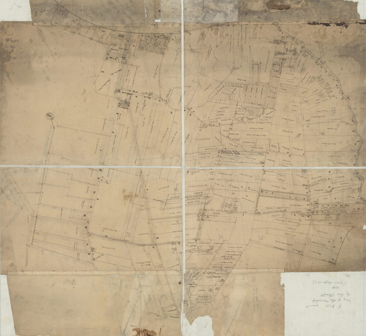
[Survey maps of Flatlands]
[Survey maps of Flatlands]
[18??]
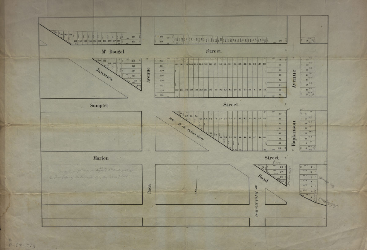
[Map of area bounded by McDougal Street, Hopkinson Avenue, and Jamaica Road]
[Map of area bounded by McDougal Street, Hopkinson Avenue, and Jamaica Road]
[18??]
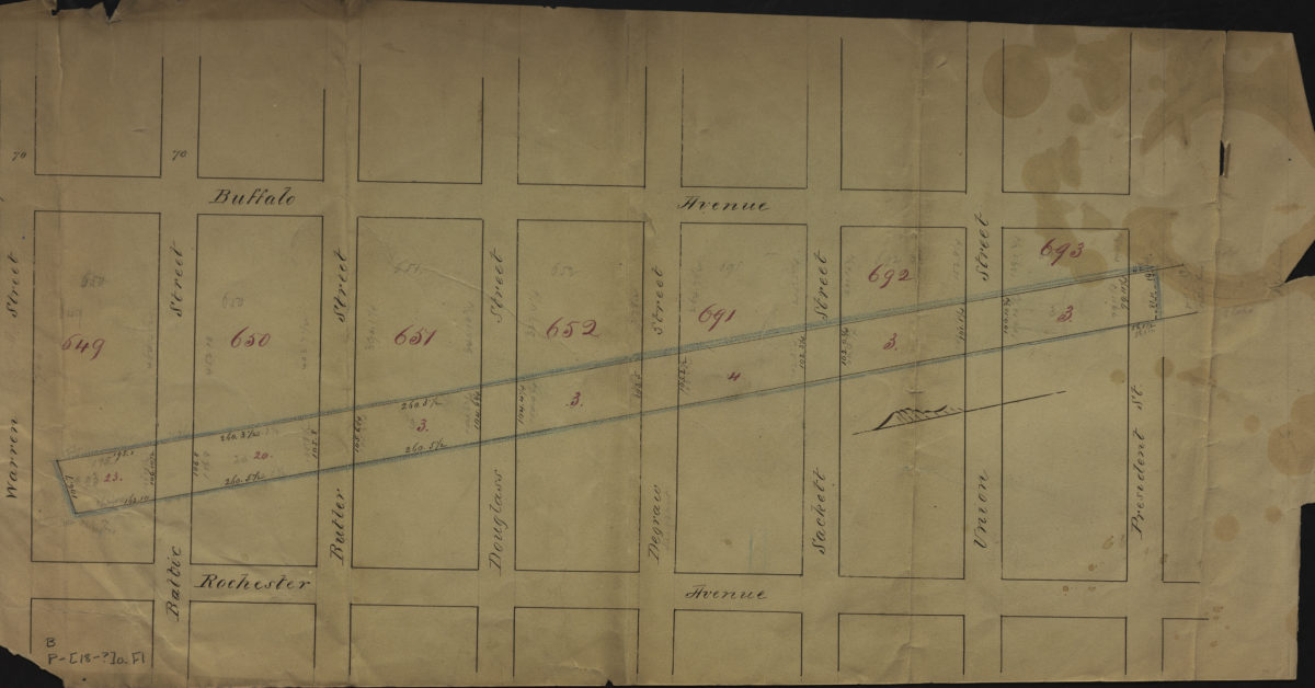
[Map of area bounded by Buffalo Ave., Warren St., Rochester Ave., and President St.].
[Map of area bounded by Buffalo Ave., Warren St., Rochester Ave., and President St.].
[18??]
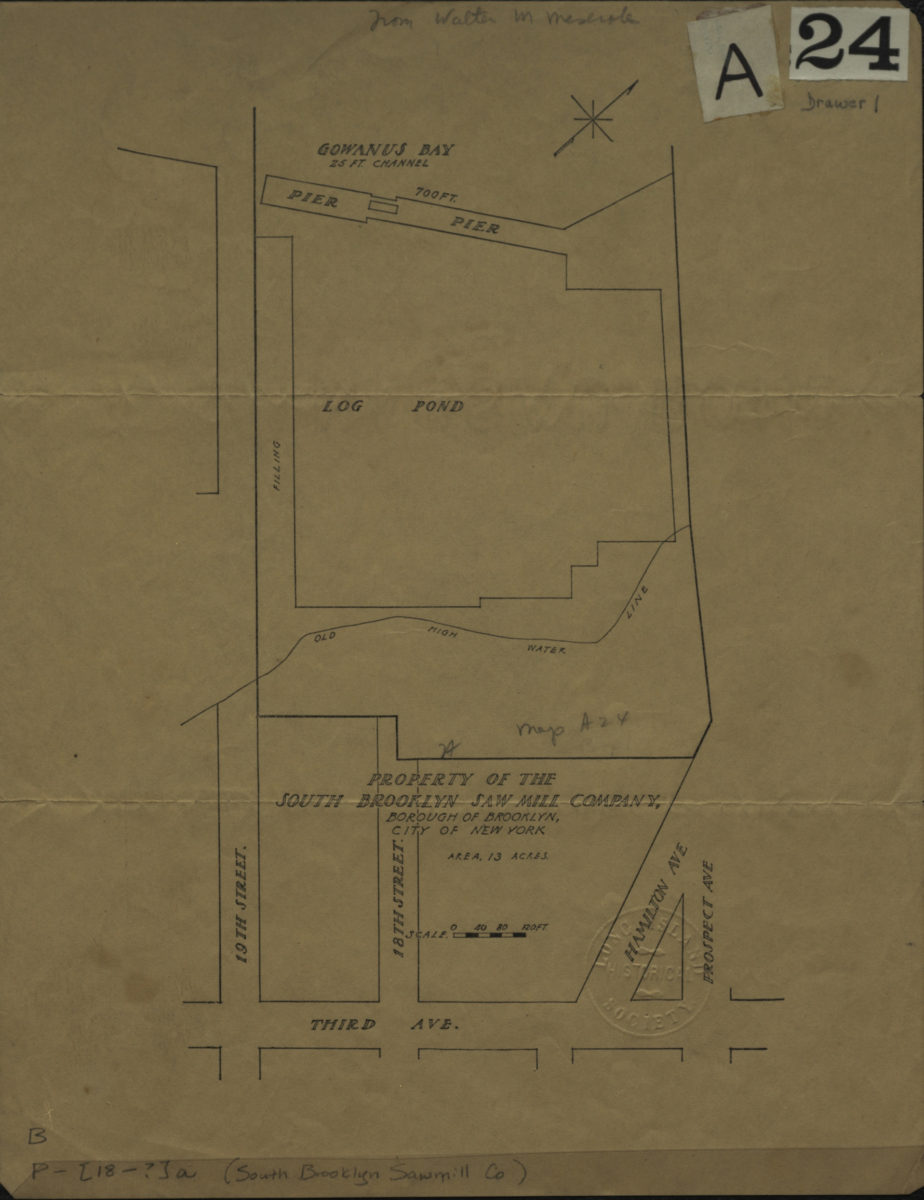
Property of the South Brooklyn Saw Mill Company, borough of Brooklyn, city of New York
Property of the South Brooklyn Saw Mill Company, borough of Brooklyn, city of New York
[18??]
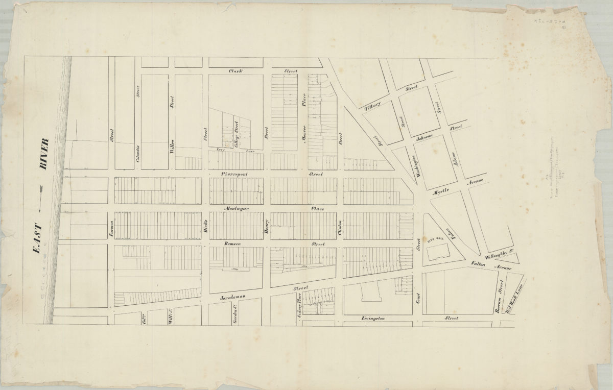
[Map of area bounded by Clark St., Adams St., Livingston St., and the East River]
[Map of area bounded by Clark St., Adams St., Livingston St., and the East River]
[18??]
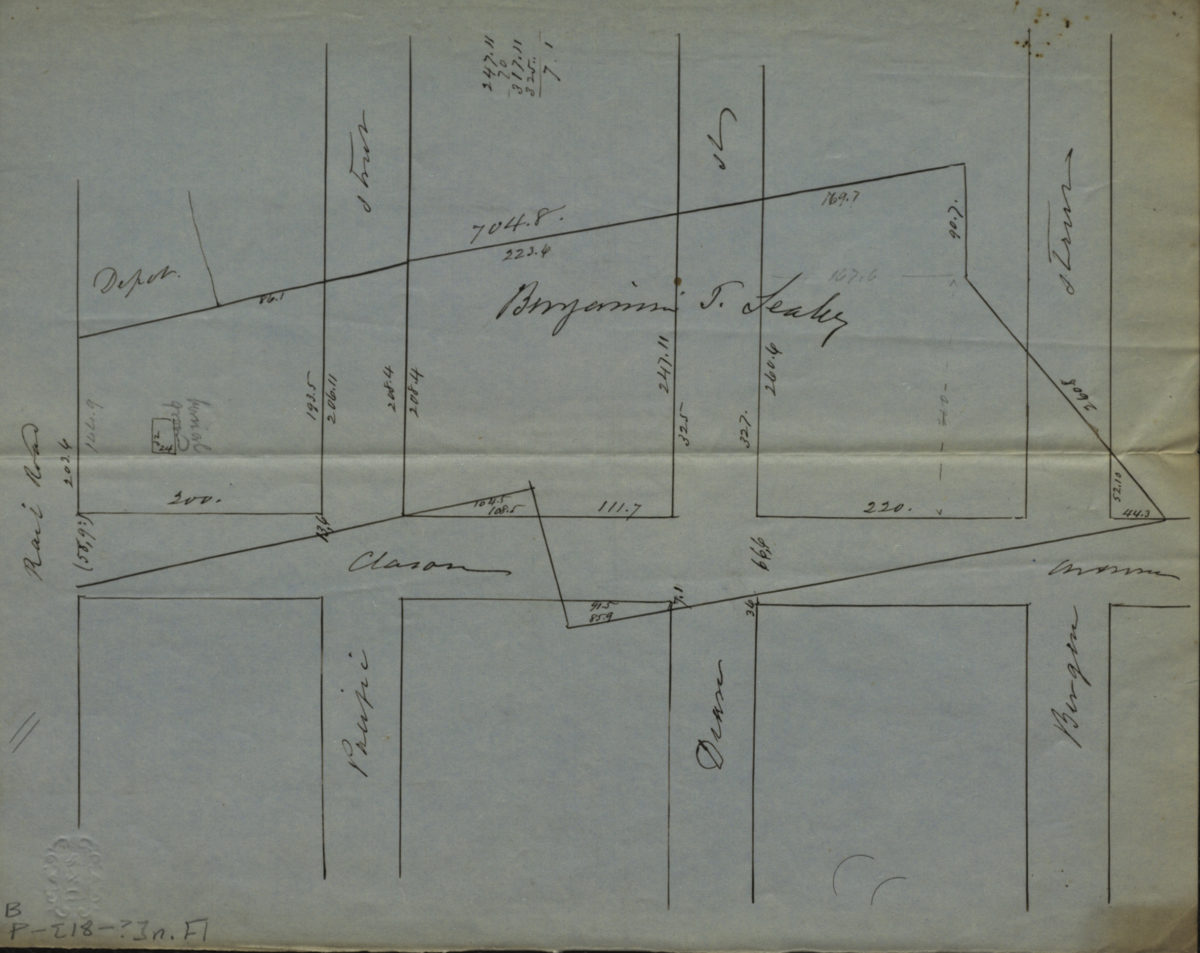
[Map of Atlantic Ave., Pacific St., Dean St., and Bergen St. at Classon Ave.].
[Map of Atlantic Ave., Pacific St., Dean St., and Bergen St. at Classon Ave.].
[18??]
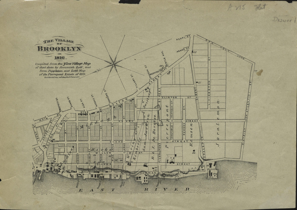
The village of Brooklyn in 1816: compiled from the First village map of that date by Jeremiah Lott and from Poppleton and Lott’s map of the Pierrepont Estate of 1819
The village of Brooklyn in 1816: compiled from the First village map of that date by Jeremiah Lott and from Poppleton and Lott’s map of the Pierrepont Estate of 1819
[18??]
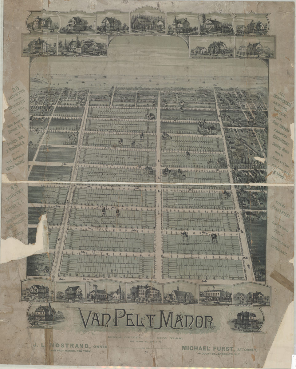
Van Pelt Manor, Kings County, New York
Van Pelt Manor, Kings County, New York
[18??]
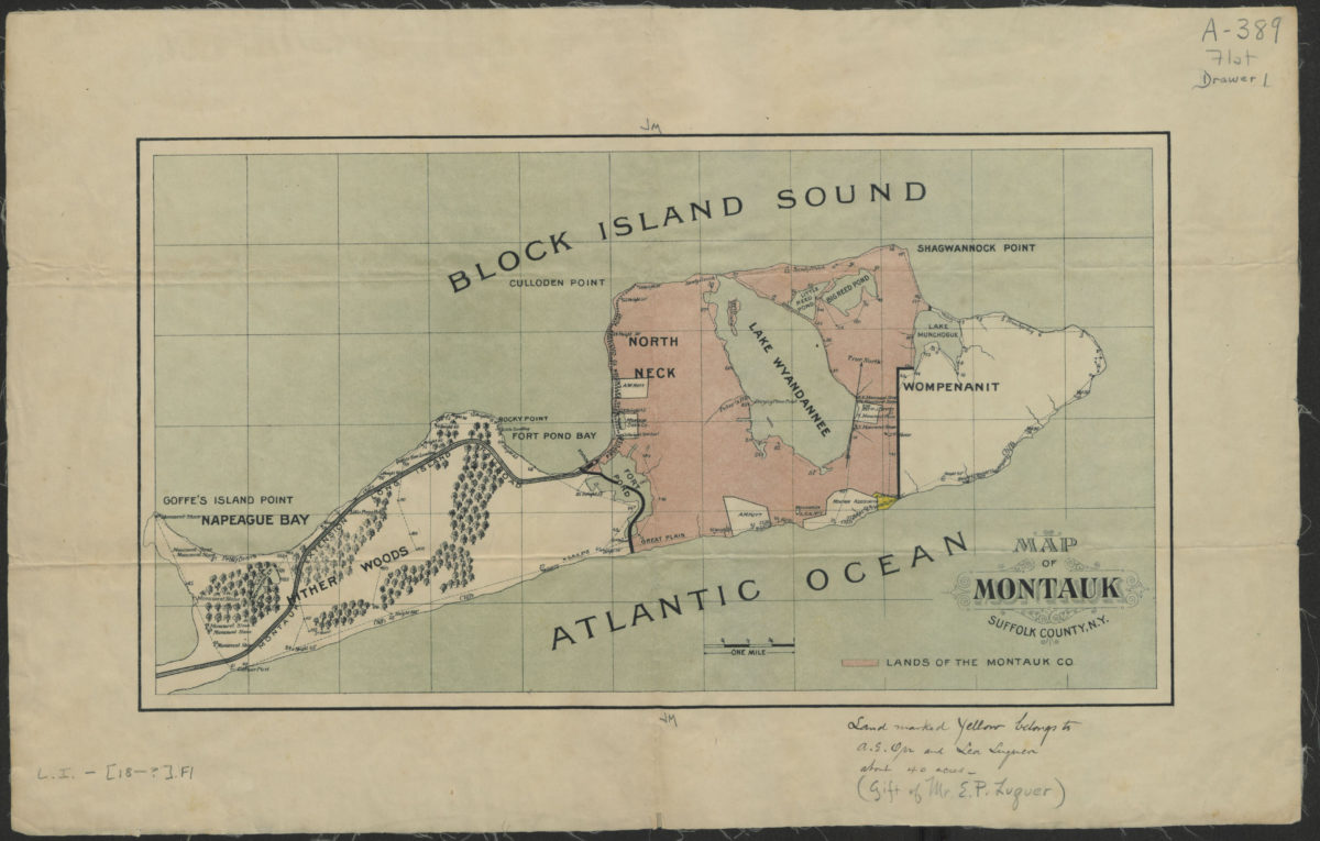
Map of Montauk, Suffolk County, N.Y.
Map of Montauk, Suffolk County, N.Y.
[18??]
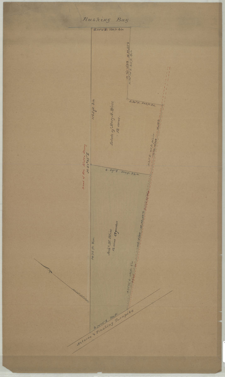
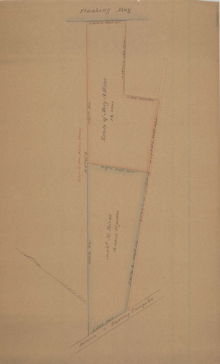
[Map of property between Astoria & Flushing Turnpike and Flushing Bay]
[Map of property between Astoria & Flushing Turnpike and Flushing Bay]
[18??]
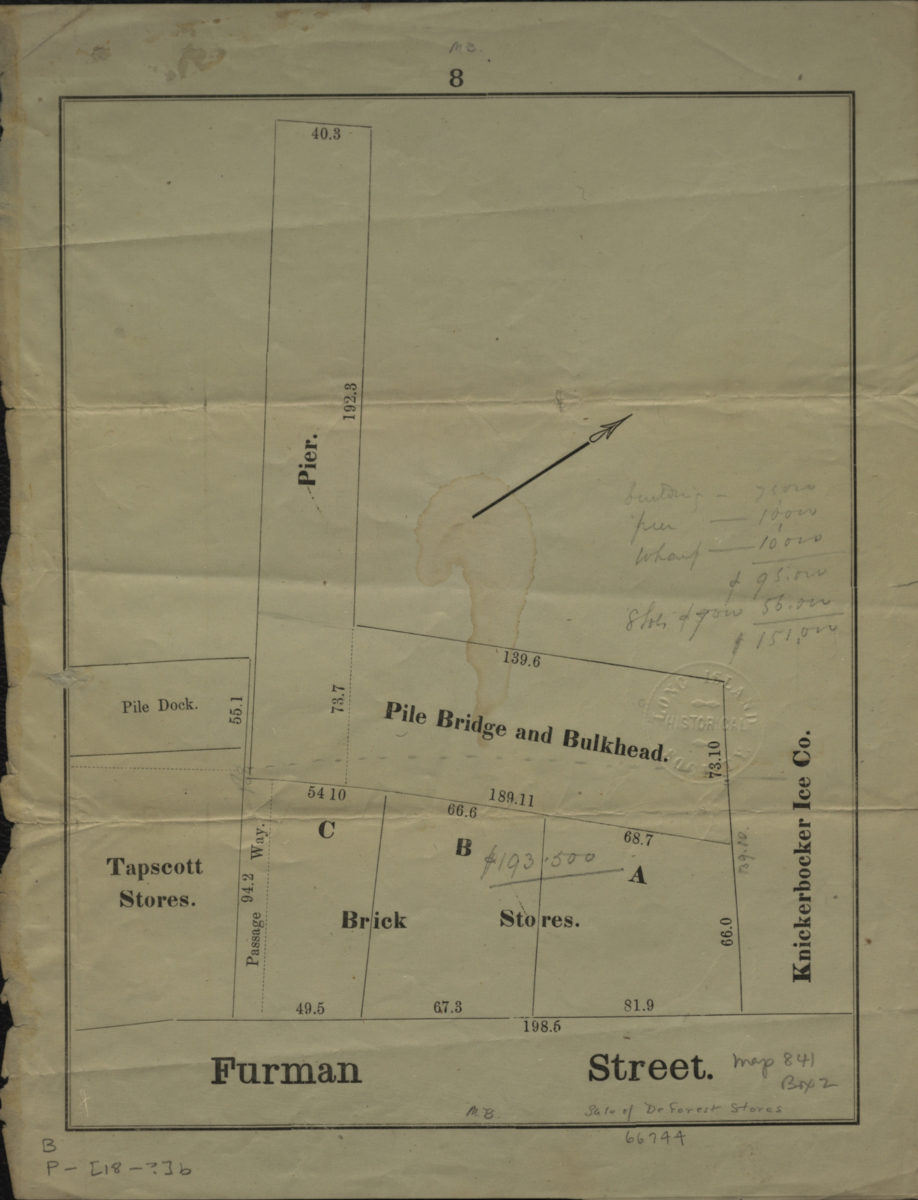
[Map of Brooklyn dock properties]
[Map of Brooklyn dock properties]
[18??]
[Map of property between Astoria & Flushing Turnpike and Flushing Bay]
[Map of property between Astoria & Flushing Turnpike and Flushing Bay]
[18??]
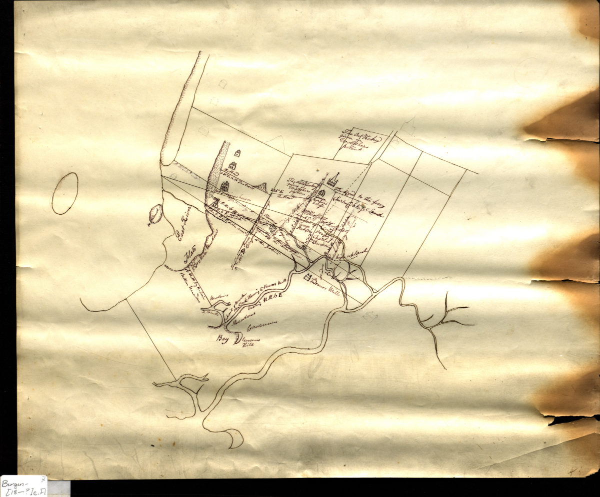
[Map of 17th century Brooklyn]
[Map of 17th century Brooklyn]
[18??]
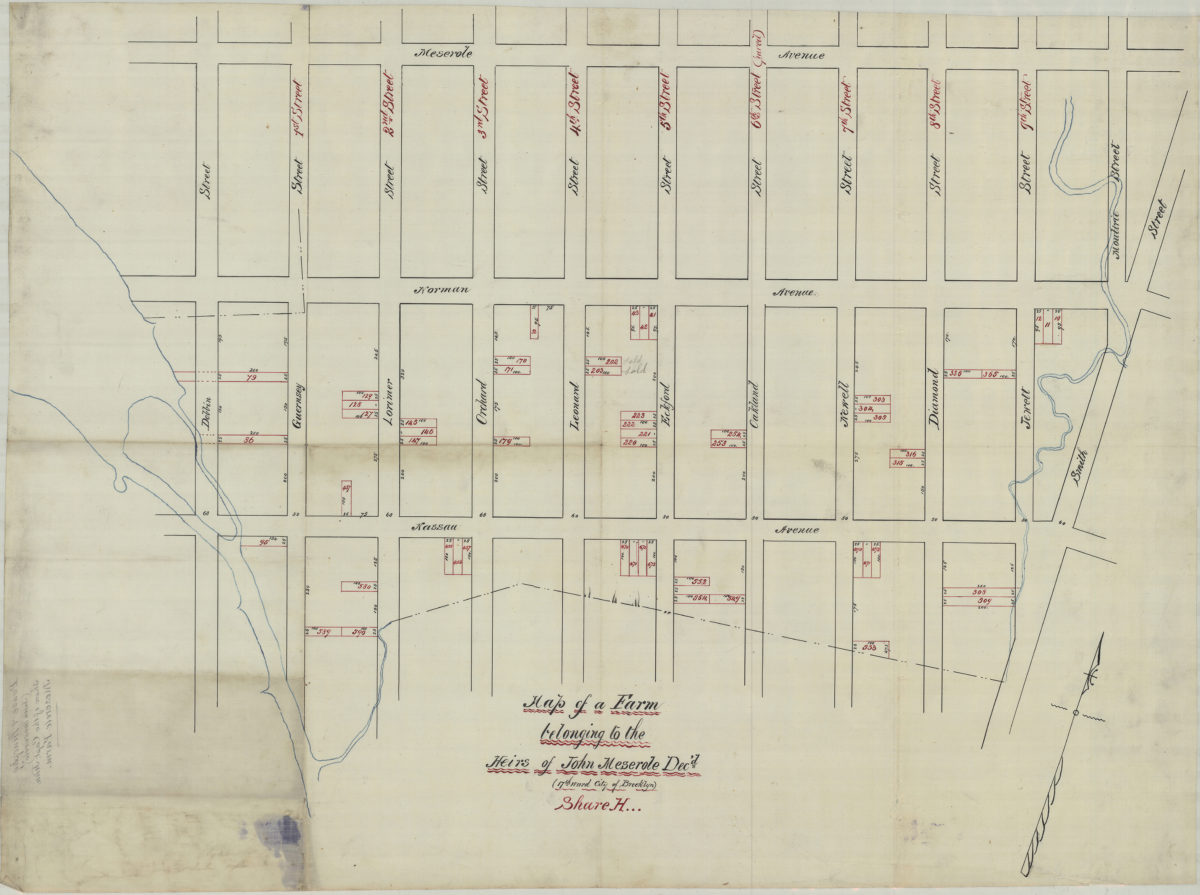
Map of a farm belonging to the heirs of John Meserole, dec’d. (17th Ward, city of Brooklyn), Share H
Map of a farm belonging to the heirs of John Meserole, dec’d. (17th Ward, city of Brooklyn), Share H
[18??]
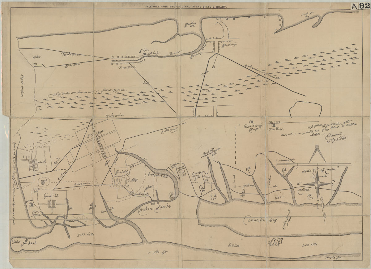
A plott of ye situations of the towns & places on ye wester end of Long Island to Hempstead: laid down by … [text illegible] Hubbard, July 3rd, 1666
A plott of ye situations of the towns & places on ye wester end of Long Island to Hempstead: laid down by … [text illegible] Hubbard, July 3rd, 1666
[18??]
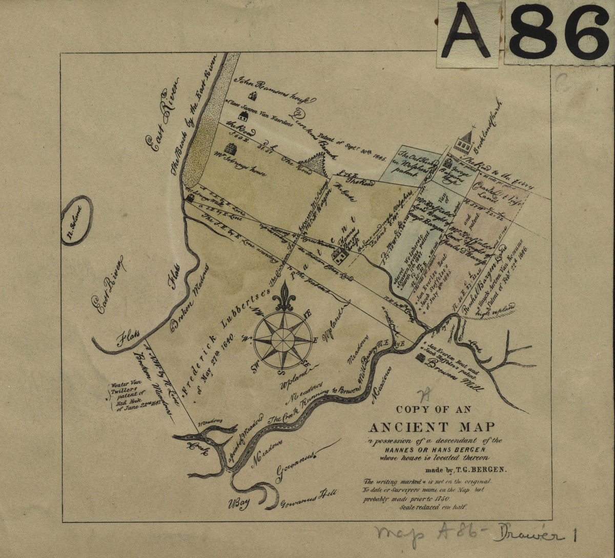
Copy of an ancient map in possession of a descendant of the Hannes or Han Bergen: whose house is located thereon: made by T. G. Bergen
Copy of an ancient map in possession of a descendant of the Hannes or Han Bergen: whose house is located thereon: made by T. G. Bergen
[18??]
Map of Cortelyou Farm lots, Garret Vanderveer, Flatbush
Map of Cortelyou Farm lots, Garret Vanderveer, Flatbush
[18??]
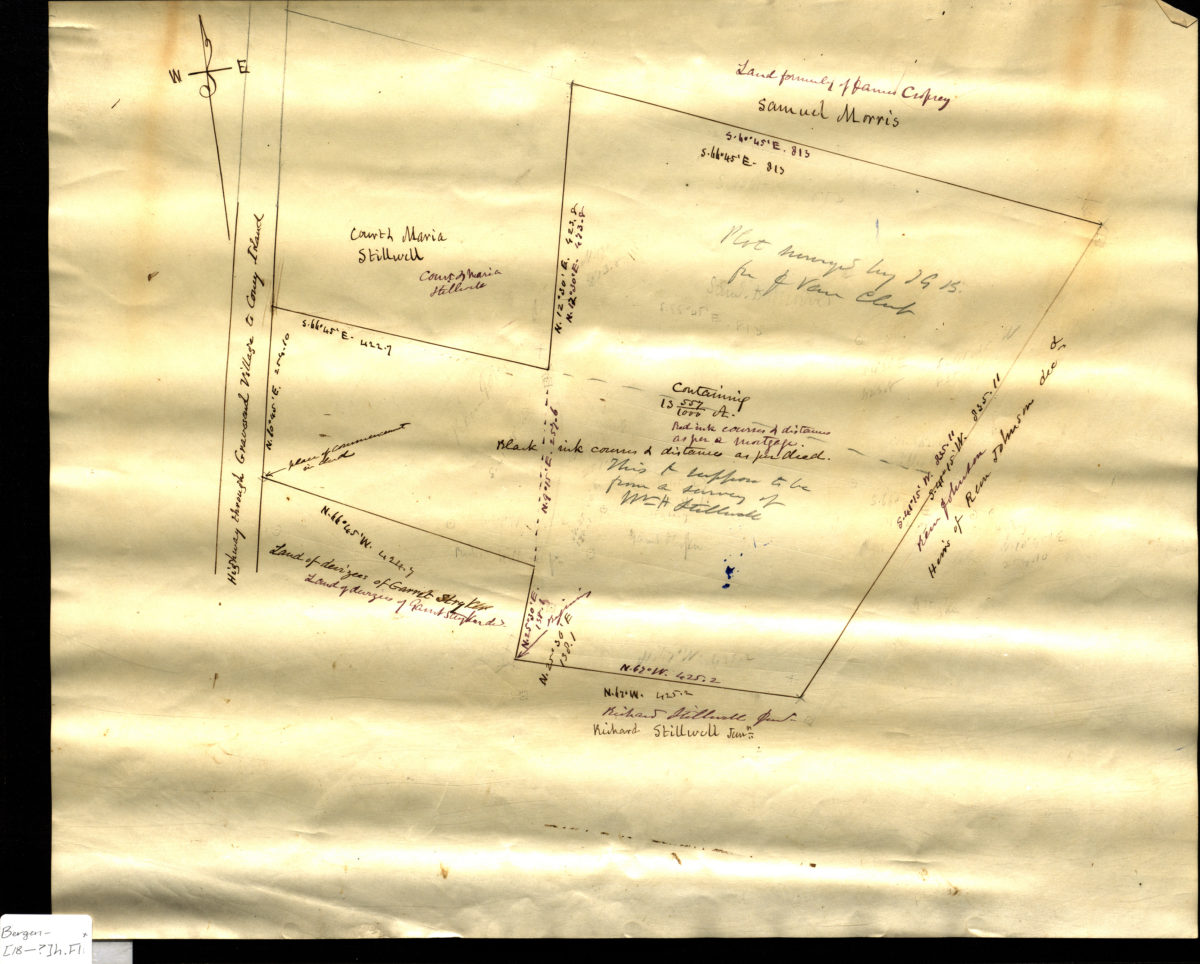
[Map of land east of the Highway through Gravesend Village to Coney Island]
[Map of land east of the Highway through Gravesend Village to Coney Island]
[18??]
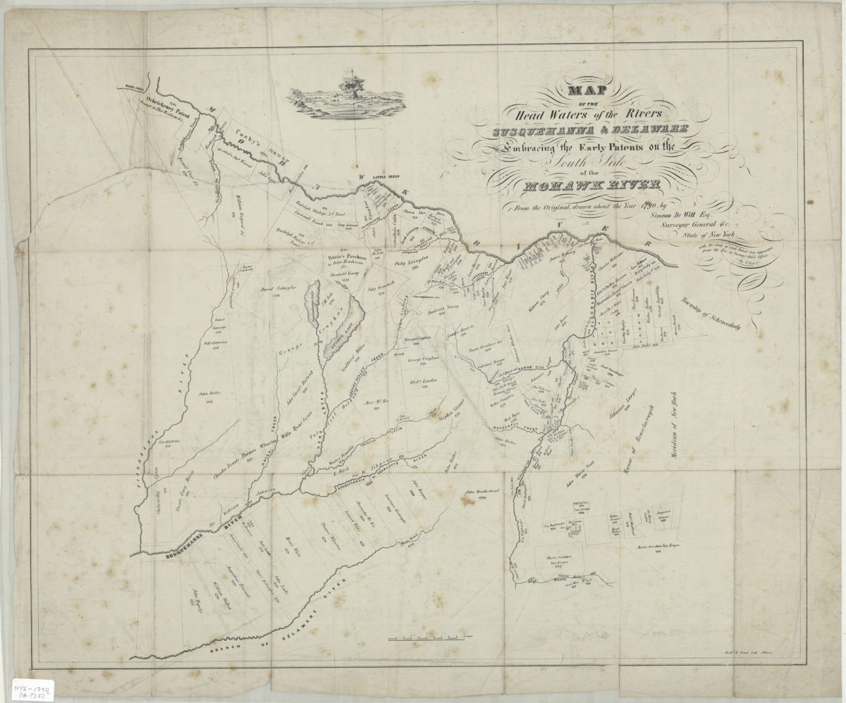
Map of the head waters of the rivers Susquehanna & Delaware: embracing the early patents on the south side of the Mohawk River : from the original, drawn about the year 1790: by Simeon DeWitt, Esq. … ;
Map of the head waters of the rivers Susquehanna & Delaware: embracing the early patents on the south side of the Mohawk River : from the original, drawn about the year 1790: by Simeon DeWitt, Esq. … ;
[18??]
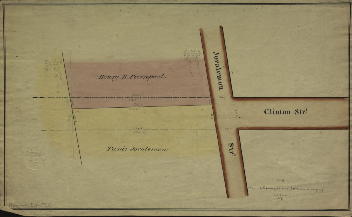
[Map of Pierrepont and Joralemon property at the intersection of Joralemon St. and Clinton St.].
[Map of Pierrepont and Joralemon property at the intersection of Joralemon St. and Clinton St.].
[18??]
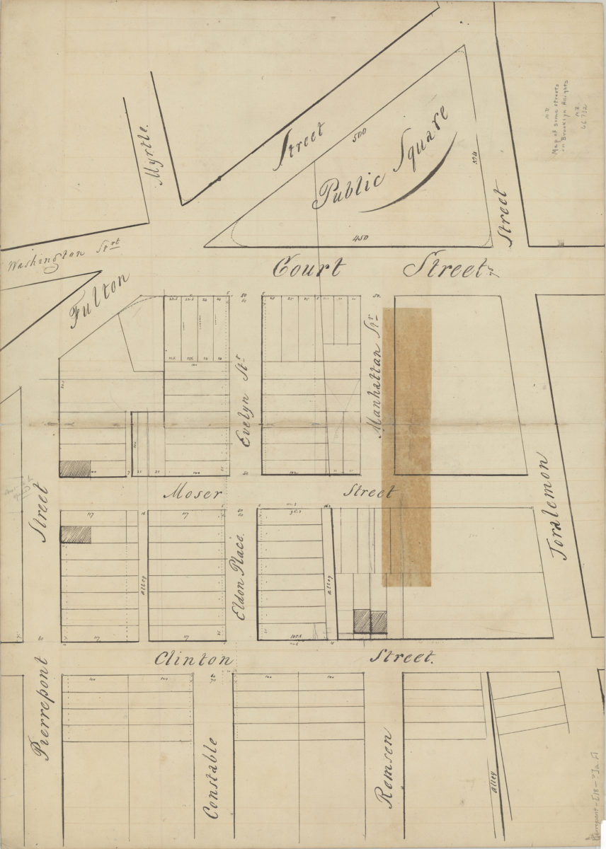
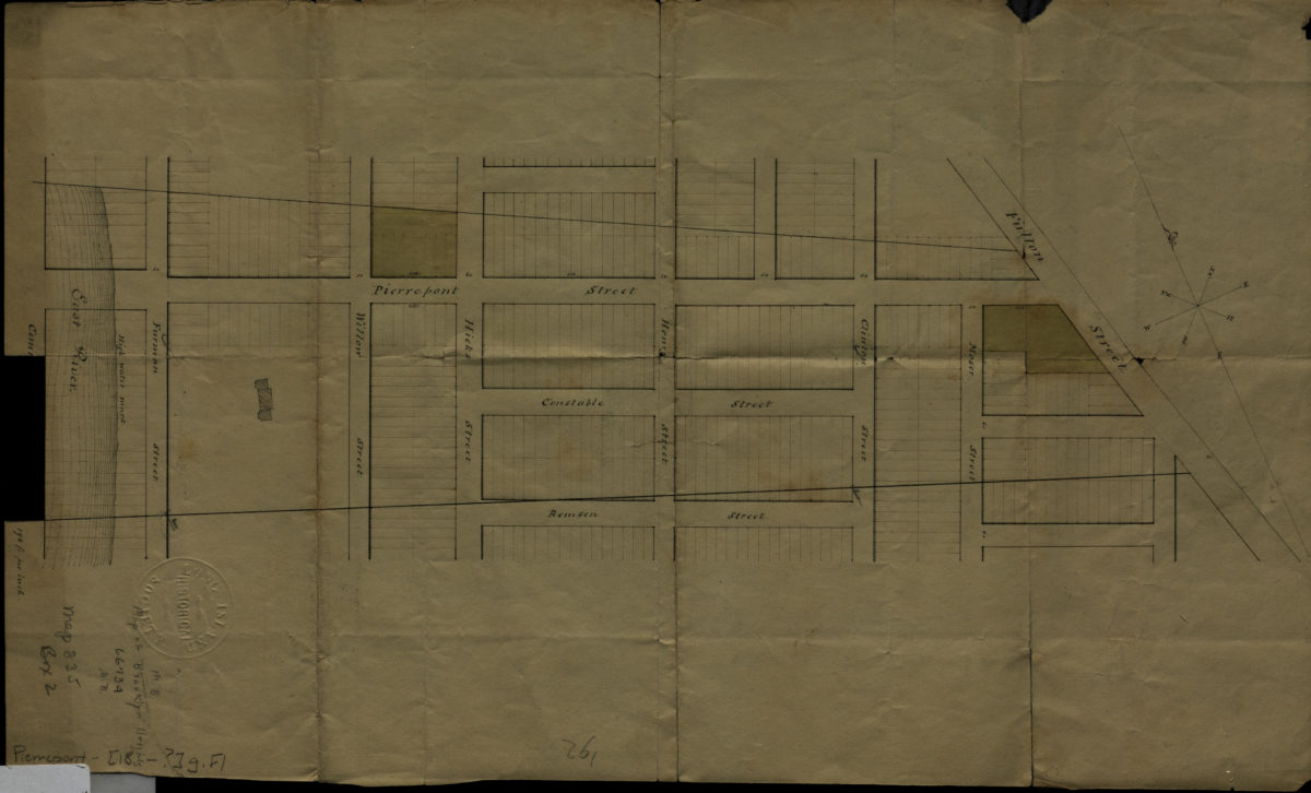
[Map of area roughly bounded by Fulton Street, Joralemon St., Clinton St. and Pierrepont St.].
[Map of area roughly bounded by Fulton Street, Joralemon St., Clinton St. and Pierrepont St.].
[18??]
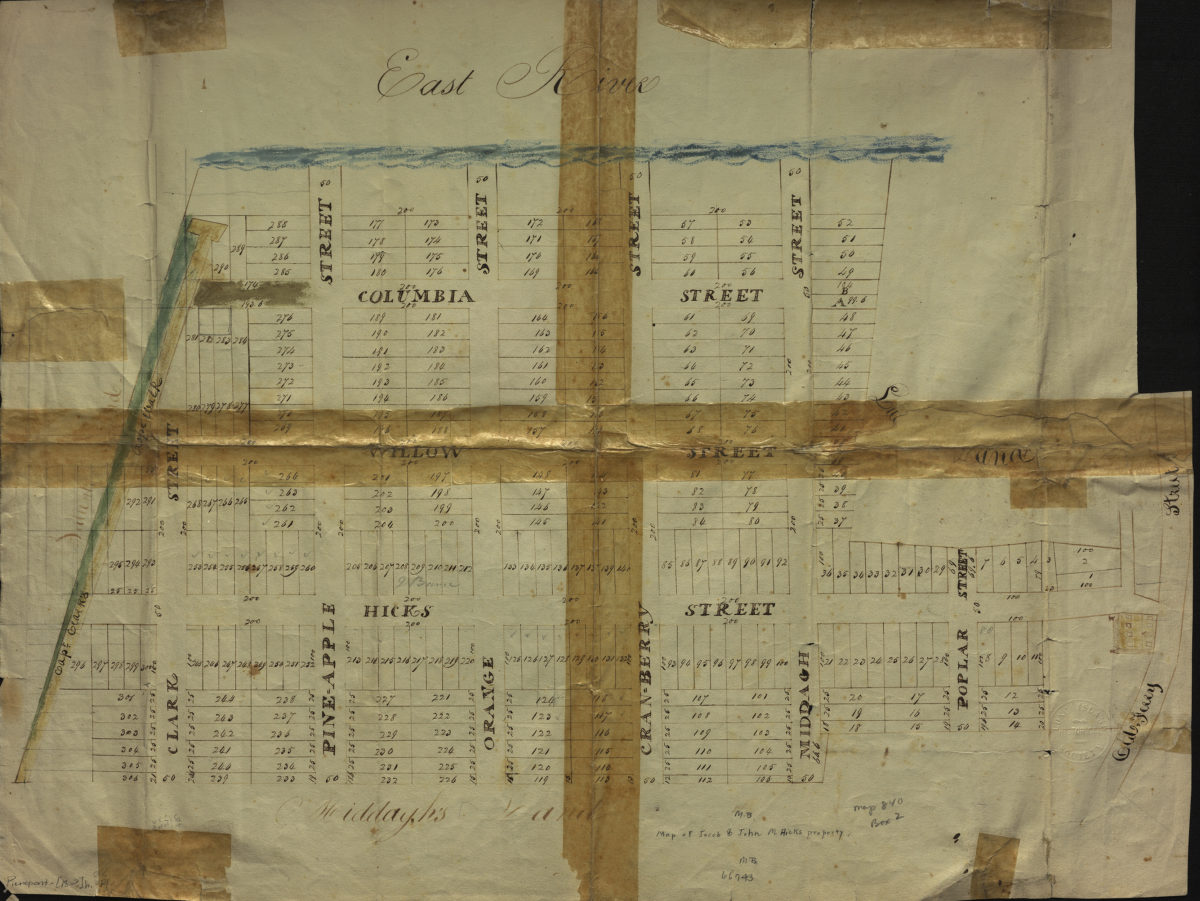
Map of Jacob & John M. Hicks property
Map of Jacob & John M. Hicks property
[18??]
[Map of area bounded by Remsen St., Fulton St., Pierrepont St. and Commerce St.].
[Map of area bounded by Remsen St., Fulton St., Pierrepont St. and Commerce St.].
[18??]
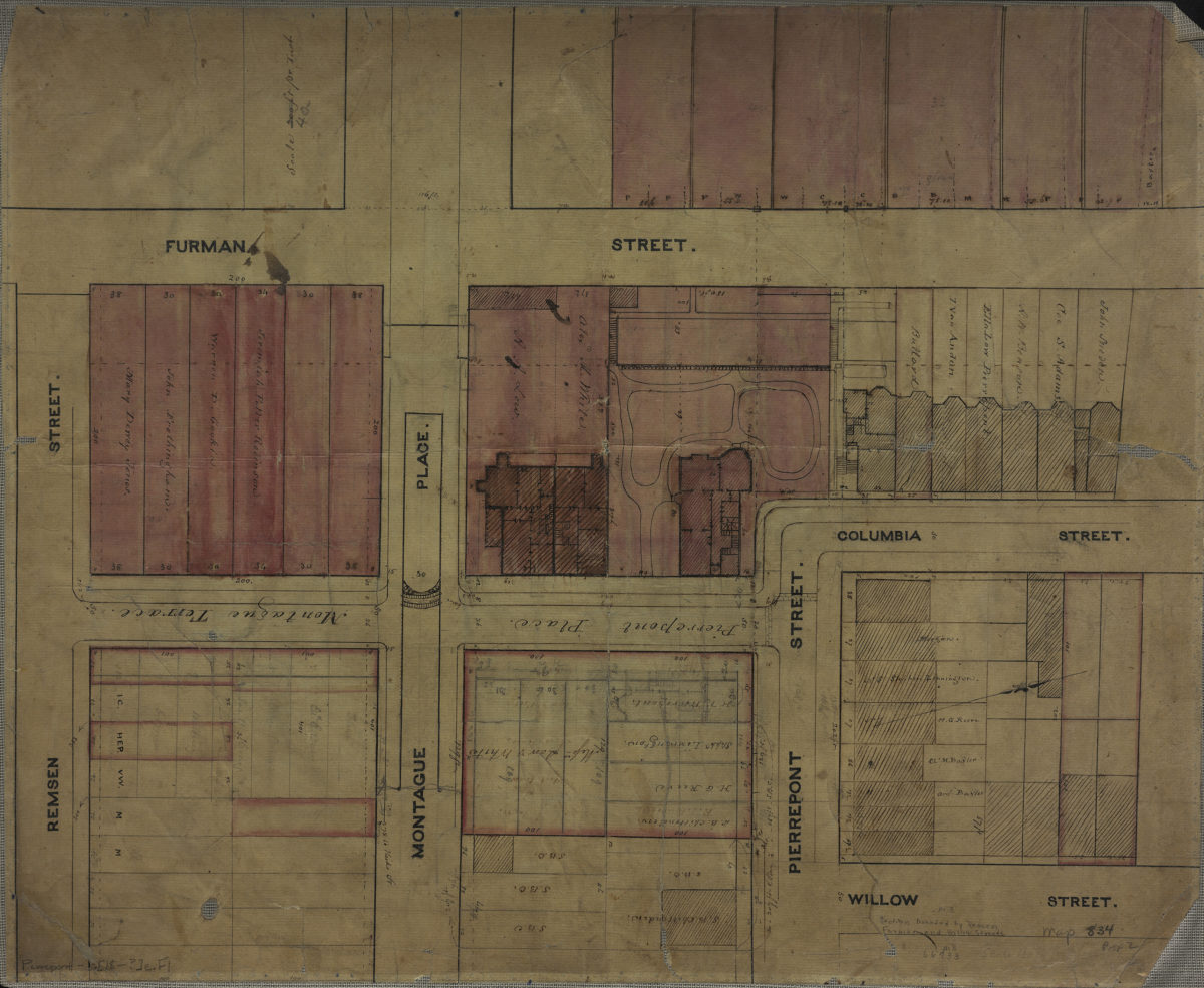
[Map of area bounded by Furman St., Remsen St., and Willow St.].
[Map of area bounded by Furman St., Remsen St., and Willow St.].
[18??]
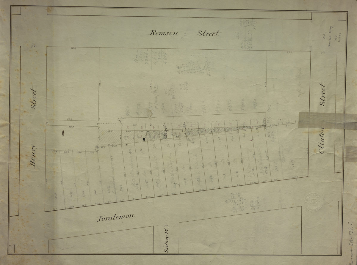
Remsen Alley
Remsen Alley
[18??]
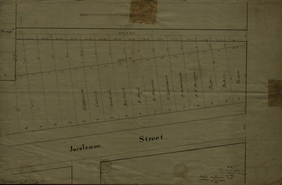
[Survey of lots on Joralemon St.].
[Survey of lots on Joralemon St.].
[18??]
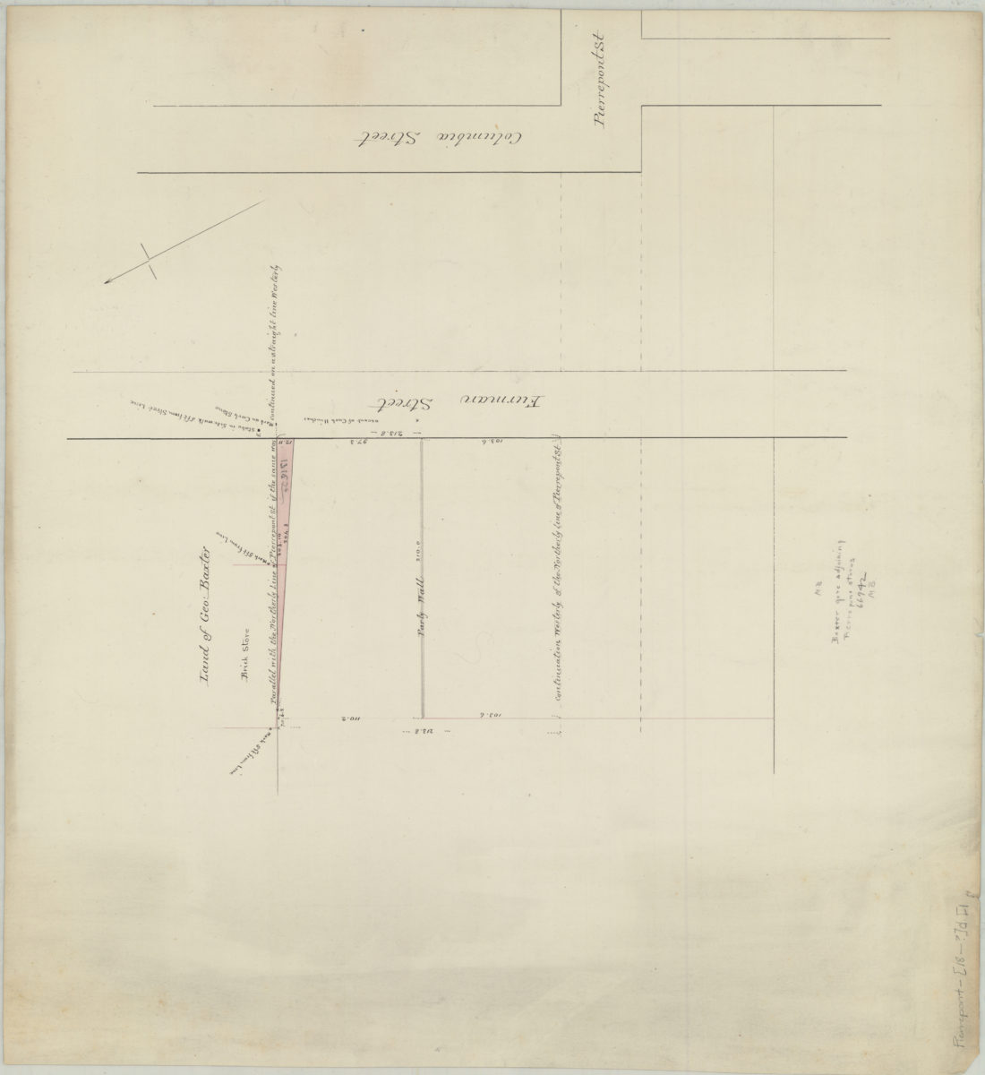
Baxter gore adjoining stores
Baxter gore adjoining stores
[18??]
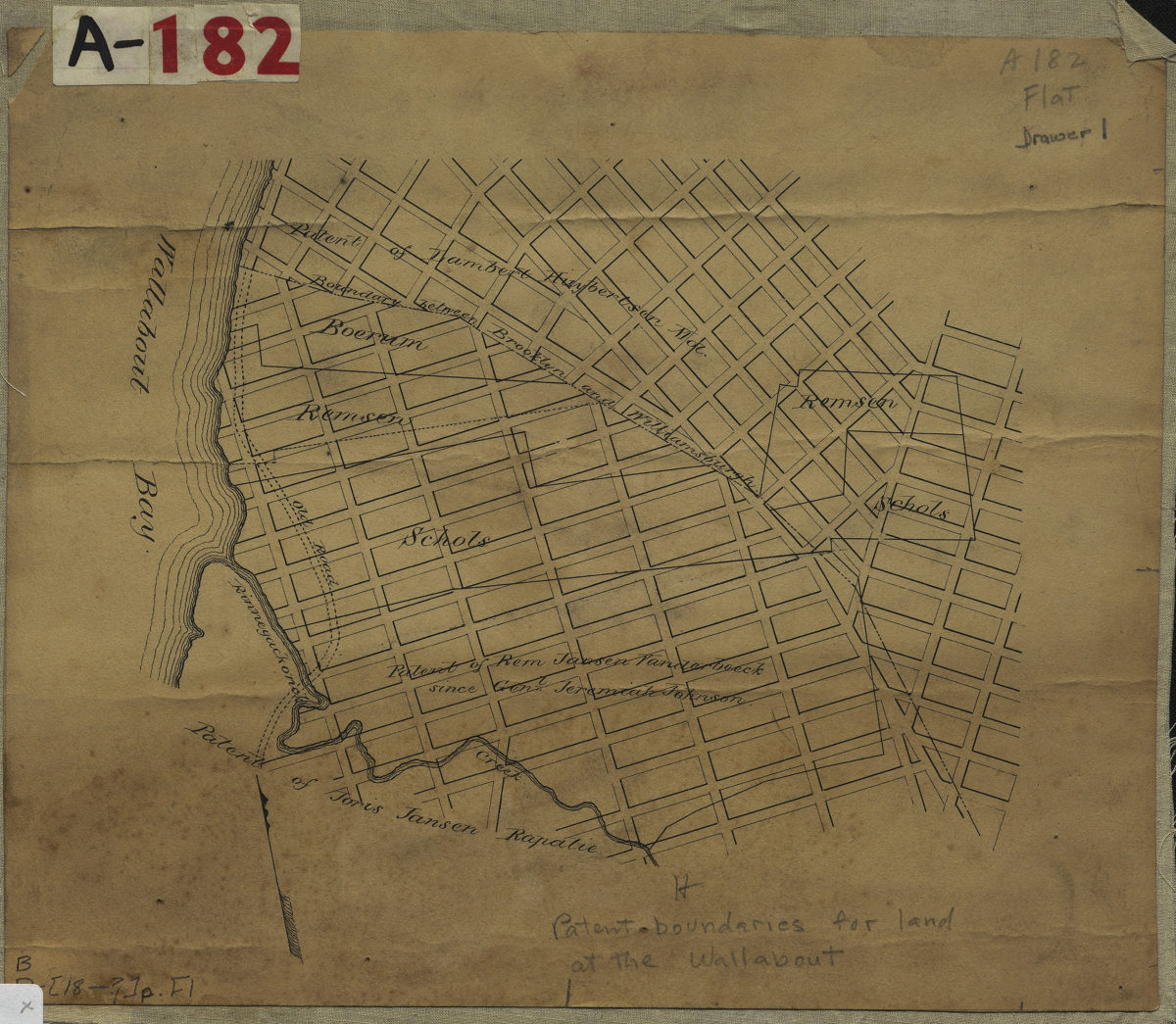
[Map showing land patents near Wallabout Bay]
[Map showing land patents near Wallabout Bay]
[18??]
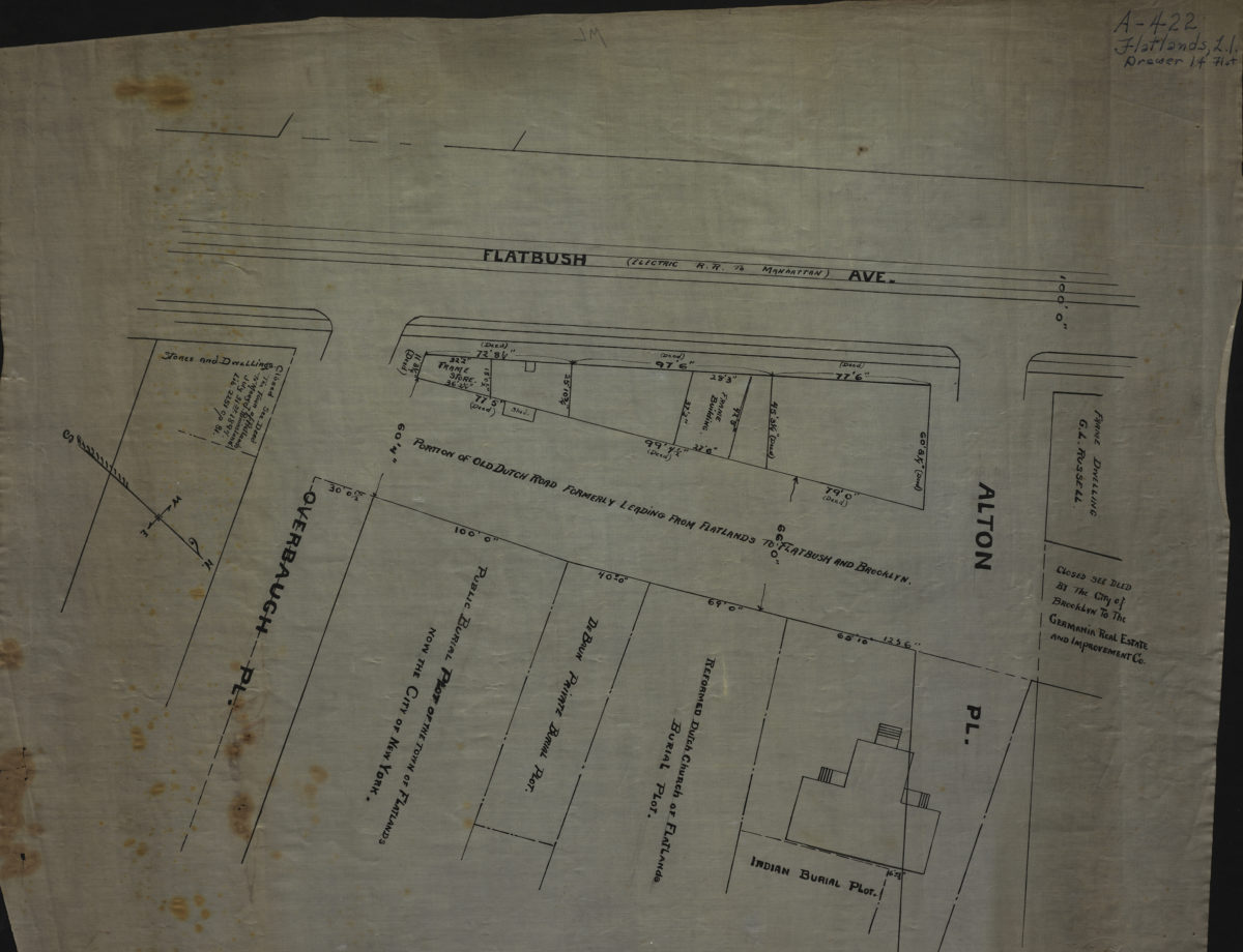
[Map of Flatbush Ave. at Alton Pl. and Overbaugh Pl.].
[Map of Flatbush Ave. at Alton Pl. and Overbaugh Pl.].
[18??]
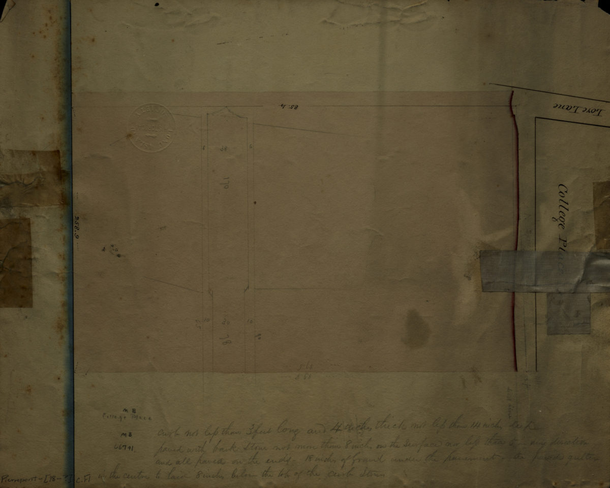
College Place
College Place
[18??]
A map of the Manor Renselaerwick: surveyed and laid down by a scale of 100 chains to an inch: by Jno. R. Bleeker, surveyor ; from the original in possession of Genl. Stephen Van Renselaer [sic] ; copied from the original by D. Vaughan
A map of the Manor Renselaerwick: surveyed and laid down by a scale of 100 chains to an inch: by Jno. R. Bleeker, surveyor ; from the original in possession of Genl. Stephen Van Renselaer [sic] ; copied from the original by D. Vaughan
[18??]
[Map of New Utrecht]
[Map of New Utrecht]
[18??]
[Map of roads from Gravesend to Flatbush to Flatlands, New Utrecht and Flatbush]
[Map of roads from Gravesend to Flatbush to Flatlands, New Utrecht and Flatbush]
[18??]
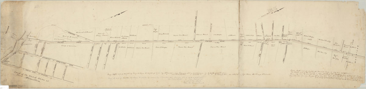
Map of Brooklyn City Railroad in New Utrecht
Map of Brooklyn City Railroad in New Utrecht
[18??]
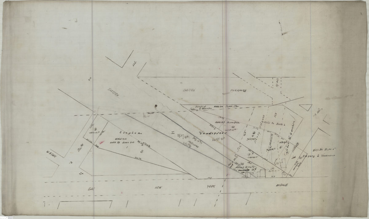
[Map of area bounded by Ralph Ave., East New York Ave., Howard Ave., and Eastern Pkwy]
[Map of area bounded by Ralph Ave., East New York Ave., Howard Ave., and Eastern Pkwy]
[18??]
Heirs of Peter Wyckoff, original draft
Heirs of Peter Wyckoff, original draft
[18??]
1
2
3
4
5
6
7
8
9
10
11
12
Next