Center for Brooklyn History
Map Collections
Search
About
Othmer Library & Archives
Submit search query
Refine 3 records
Clear filters
3
Location
Brooklyn (New York, N.Y.)
891
Jersey City (N.J.)
4
Manhattan (New York, N.Y.)
120
New York (N.Y.)
164
Queens (New York, N.Y.)
83
Williamsburg (New York, N.Y.)
36
Subject
Buildings
12
Canals
15
ferries
32
Fills (Earthwork)
4
Landowners
434
Parks
35
Piers
25
Ponds
6
Railroads
72
Real property
619
Rivers
16
Streets
46
Wetlands
6
Date
19th Century
945
or enter range:
from
to
Genres
Cadastral maps
597
Map
191
Sort by:
Date (earliest)
Date (most recent)
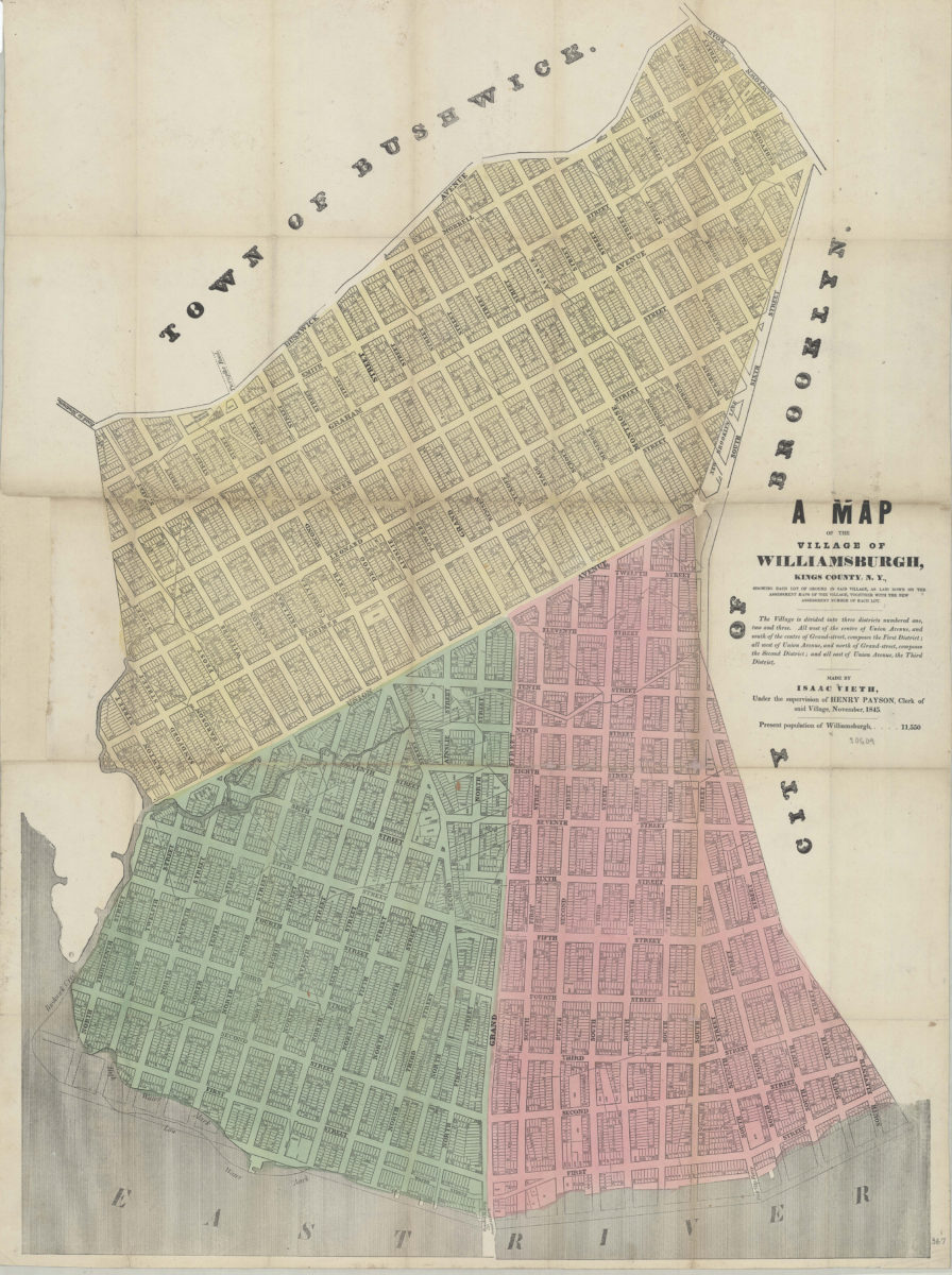
A map of the village of Williamsburgh, Kings County, N.Y.: showing each lot of ground in said village, as laid down on the assessment maps of the village, together with the new assessment number of each lot: made by Isaac Vieth,
A map of the village of Williamsburgh, Kings County, N.Y.: showing each lot of ground in said village, as laid down on the assessment maps of the village, together with the new assessment number of each lot: made by Isaac Vieth,
November 1845
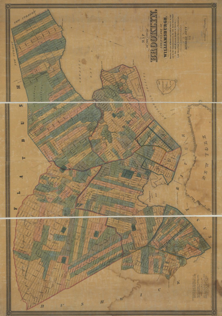
Map of the city of Brooklyn and village of Williamsburgh: showing the size of blocks and width of streets as laid out by the commissioners, the old farm lines, water line, and all recent changes in streets
Map of the city of Brooklyn and village of Williamsburgh: showing the size of blocks and width of streets as laid out by the commissioners, the old farm lines, water line, and all recent changes in streets
1846
City & County map of New-York, Brooklyn, Williamsburgh, Jersey City and the adjacent waters: by J.H. Colton
City & County map of New-York, Brooklyn, Williamsburgh, Jersey City and the adjacent waters: by J.H. Colton
1852; [ca. 1845]