Center for Brooklyn History
Map Collections
Search
About
Othmer Library & Archives
Submit search query
Refine 3 records
Clear filters
4
Location
Brooklyn (New York, N.Y.)
891
Manhattan (New York, N.Y.)
120
Queens (New York, N.Y.)
83
Subject
Electric railroads
5
Local transit
63
Postal codes
4
Railroads, Elevated
24
Roads
117
Street addresses
11
Street railroads
8
Streets
46
Subways
55
Date
20th Century
469
or enter range:
from
to
Genres
Road maps
83
Transportation maps
120
Sort by:
Date (earliest)
Date (most recent)
Map showing Brooklyn automobile routes and car lines approved by the Borough President, July 1919
Map showing Brooklyn automobile routes and car lines approved by the Borough President, July 1919
[1919]
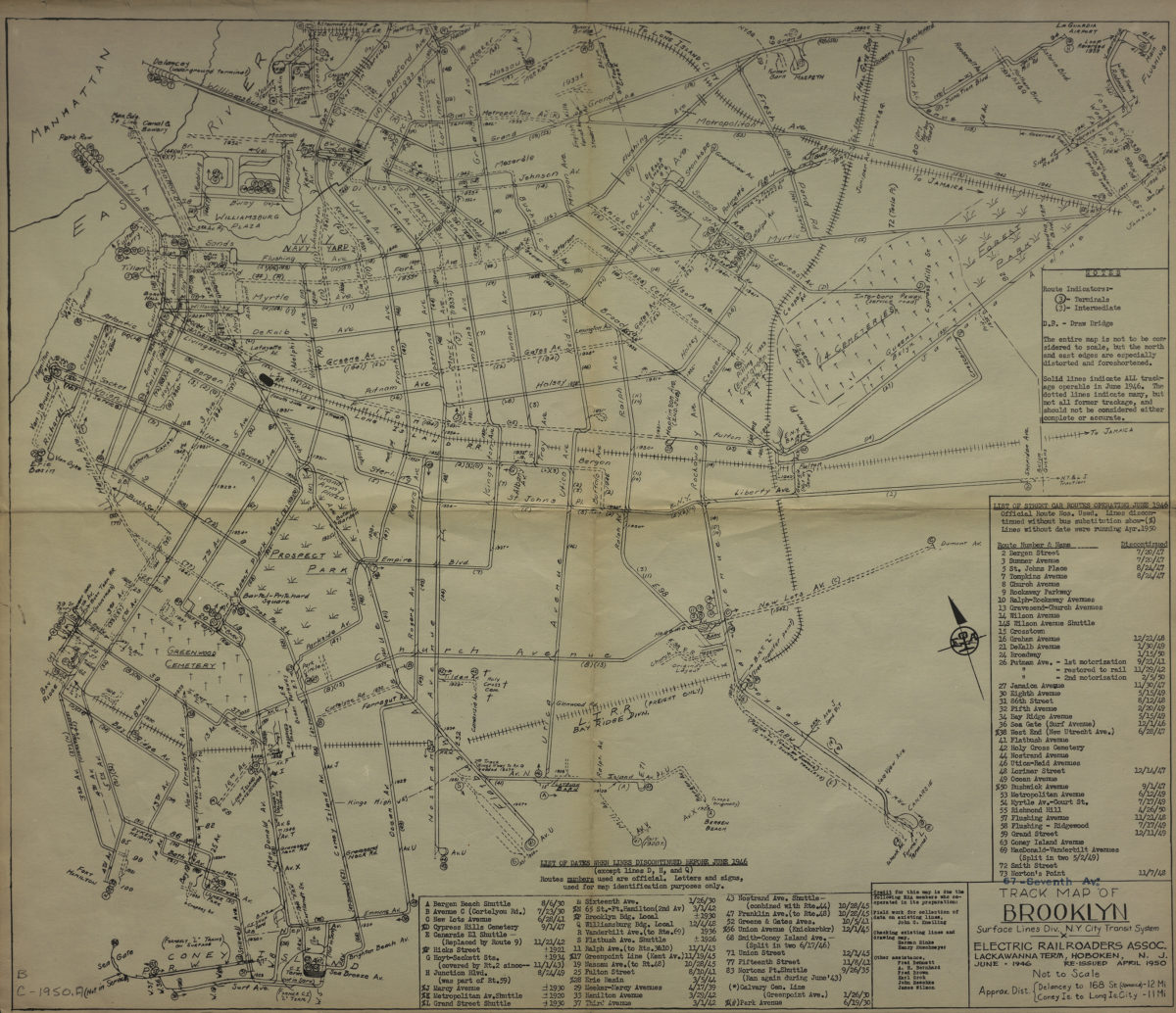
Track map of Brooklyn, Surface Lines Division, N.Y. City Transit System: Electric Railroaders Association
Track map of Brooklyn, Surface Lines Division, N.Y. City Transit System: Electric Railroaders Association
1950
Hagstrom’s map of Brooklyn, New York City: house number and transit guide: compiled, printed, and published by Hagstrom Company Incorporated
Hagstrom’s map of Brooklyn, New York City: house number and transit guide: compiled, printed, and published by Hagstrom Company Incorporated
[1950; 1947]