Center for Brooklyn History
Map Collections
Search
About
Othmer Library & Archives
Submit search query
Refine 7 records
Clear filters
2
Location
Lower Bay (N.Y. and N.J.)
1
New York (N.Y.)
164
New York Harbor (N.Y. and N.J.)
16
New York Metropolitan Area
40
New York Region
5
Upper Bay (N.Y. and N.J.)
4
Subject
Bays
5
Ferry routes
3
Harbors
11
Nautical charts
14
Piers
25
Railroad terminals
2
Railroads
72
Roads
117
Steamboat lines
4
Waterfronts
5
Date
20th Century
469
or enter range:
from
to
Genres
Aerial views
15
Bathymetric maps
94
Early maps
35
Nautical charts
30
Transportation maps
120
Sort by:
Date (earliest)
Date (most recent)
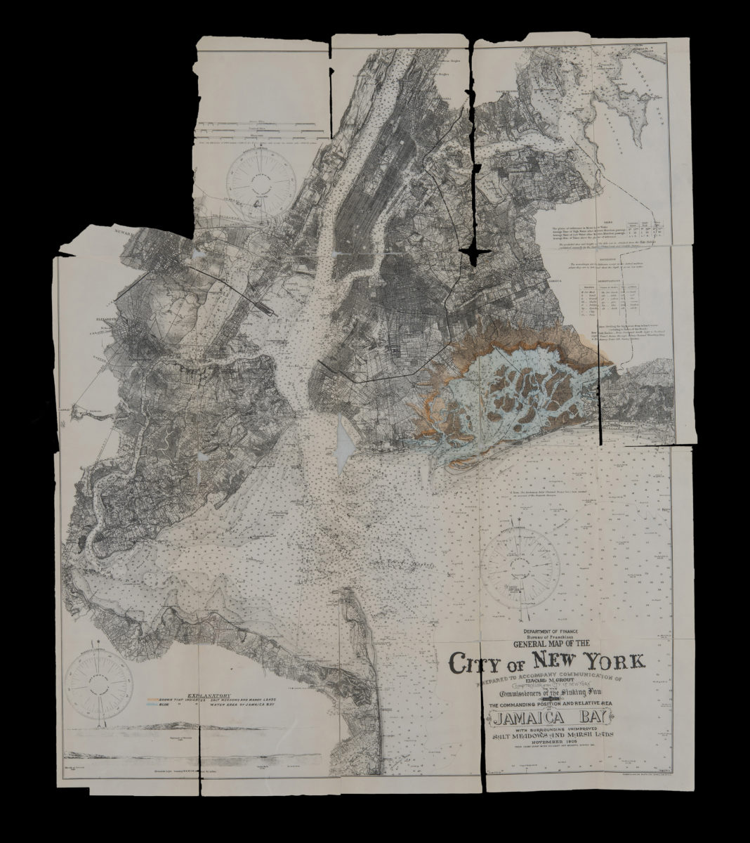
General map of the City of New York: prepared to accompany communication of Edward M. Grout, Comptroller of the City of New York, to the Commissioners of the Sinking Fund showing the commanding position and relative area of Jamaica Bay November 1905
General map of the City of New York: prepared to accompany communication of Edward M. Grout, Comptroller of the City of New York, to the Commissioners of the Sinking Fund showing the commanding position and relative area of Jamaica Bay November 1905
1905
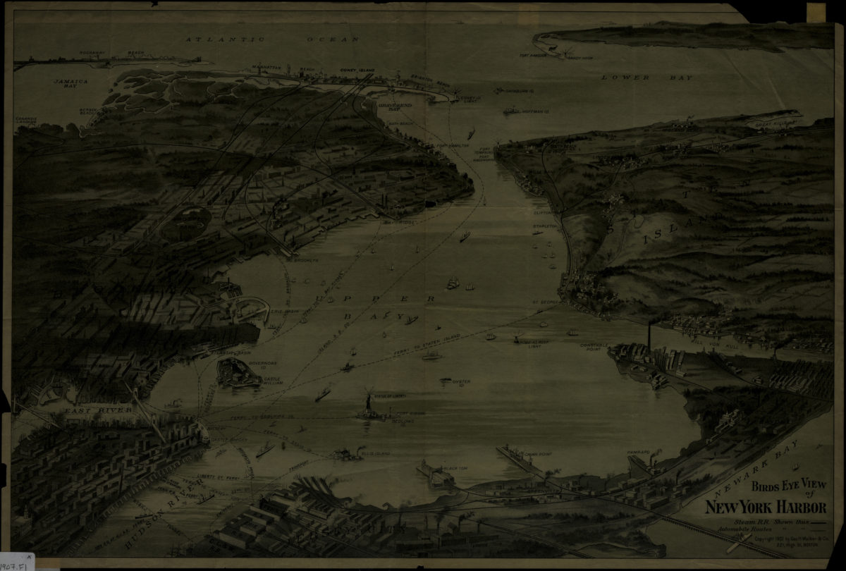
Birds eye view of New York Harbor
Birds eye view of New York Harbor
[1907]
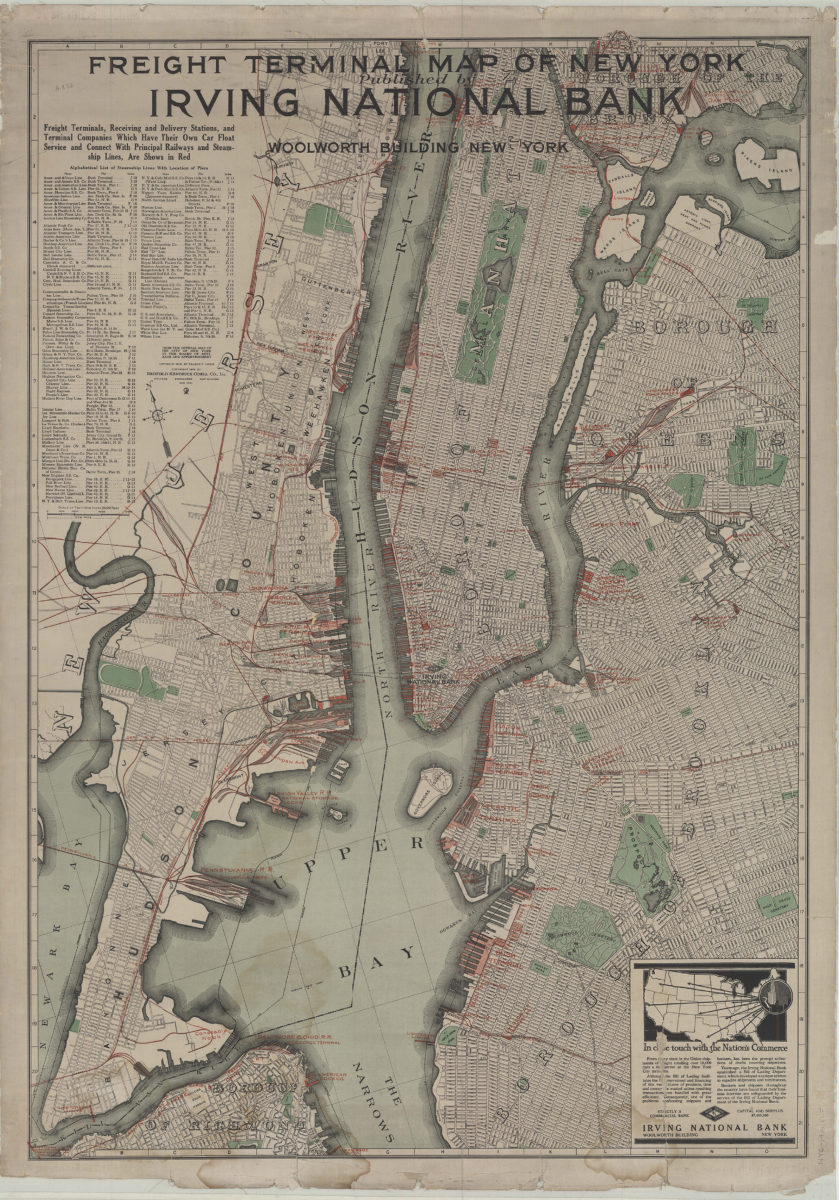
Freight terminal map of New York: published by Irving National Bank
Freight terminal map of New York: published by Irving National Bank
1916
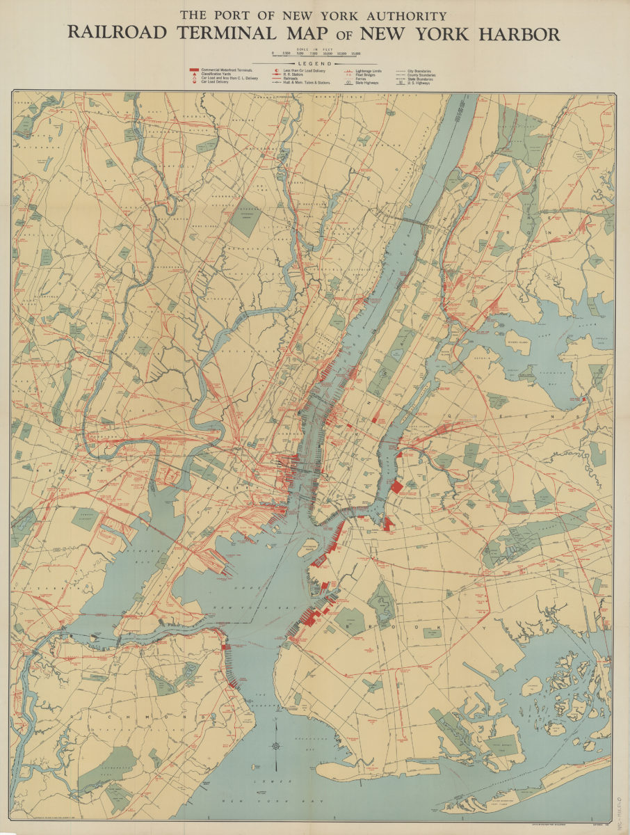
Railroad terminal map of New York Harbor
Railroad terminal map of New York Harbor
[ca. 1933]
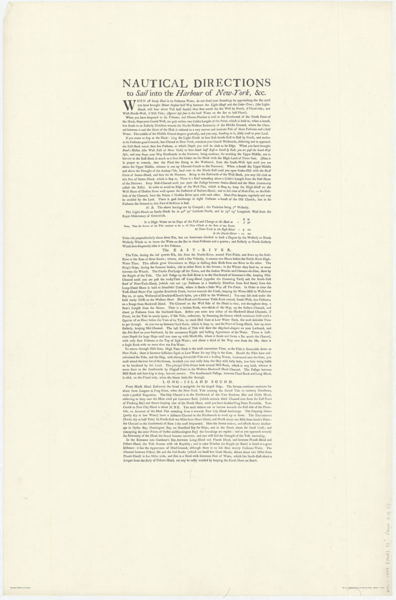
A chart of New York Harbour: with the soundings, views of land marks, and nautical directions for the use of pilotage: composed from surveys and observations of Lieutenants John Knight, John Hunter of the Navy, & others
A chart of New York Harbour: with the soundings, views of land marks, and nautical directions for the use of pilotage: composed from surveys and observations of Lieutenants John Knight, John Hunter of the Navy, & others
[ca. 1968]
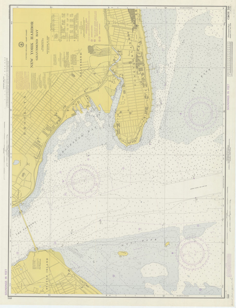
United States – East coast, New York Harbor, Gravesend Bay: National Ocean Survey
United States – East coast, New York Harbor, Gravesend Bay: National Ocean Survey
1974
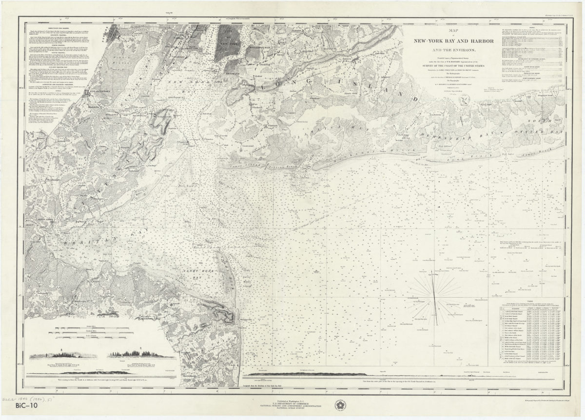
Map of New-York Bay and Harbor and the environs: founded upon a trigonometrical survey under the direction of F.R. Hassler, superintendent of the Survey of the Coast of the United States
Map of New-York Bay and Harbor and the environs: founded upon a trigonometrical survey under the direction of F.R. Hassler, superintendent of the Survey of the Coast of the United States
[1976]