Center for Brooklyn History
Map Collections
Search
About
Othmer Library & Archives
Submit search query
Refine 6 records
Clear filters
3
Location
Long Island (N.Y.)
197
New York (N.Y.)
164
New York (State)
95
New York Harbor (N.Y. and N.J.)
16
Subject
Bridges
13
Canals
15
ferries
32
Local transit
63
Railroad terminals
2
Railroads
72
Roads
117
Street addresses
11
Subways
55
Tunnels
16
Date
20th Century
469
or enter range:
from
to
Genres
Road maps
83
Transportation maps
120
Sort by:
Date (earliest)
Date (most recent)
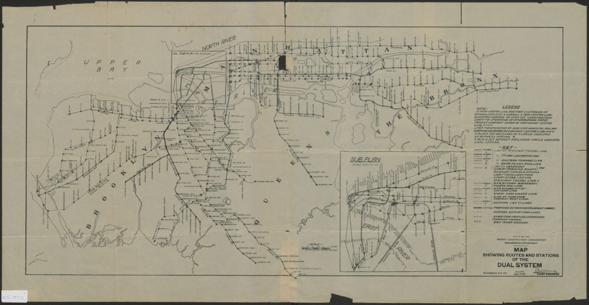
Map showing routes and stations of the dual systems
Map showing routes and stations of the dual systems
1919
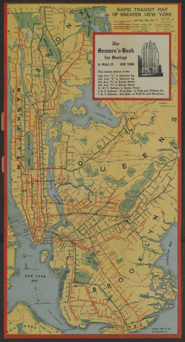
Rapid transit map of greater New York: shows house numbers at each station
Rapid transit map of greater New York: shows house numbers at each station
[1929]
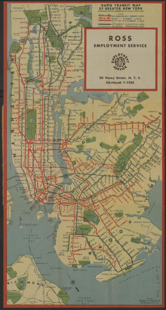
Rapid transit map of greater New York: showing house numbers at each station
Rapid transit map of greater New York: showing house numbers at each station
[193?]
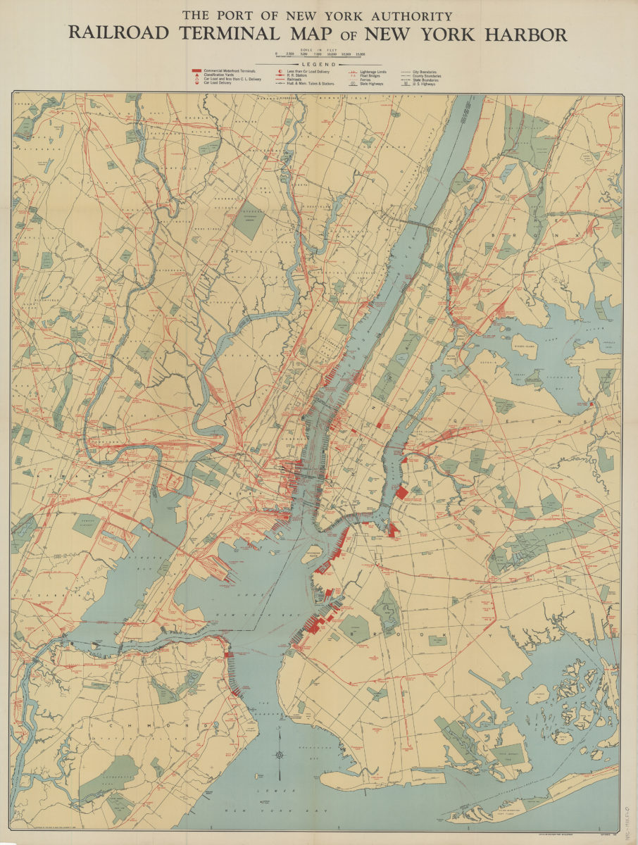
Railroad terminal map of New York Harbor
Railroad terminal map of New York Harbor
[ca. 1933]
Canal and railroad map of the State of New York: to accompany the Legislative Manual
Canal and railroad map of the State of New York: to accompany the Legislative Manual
1943
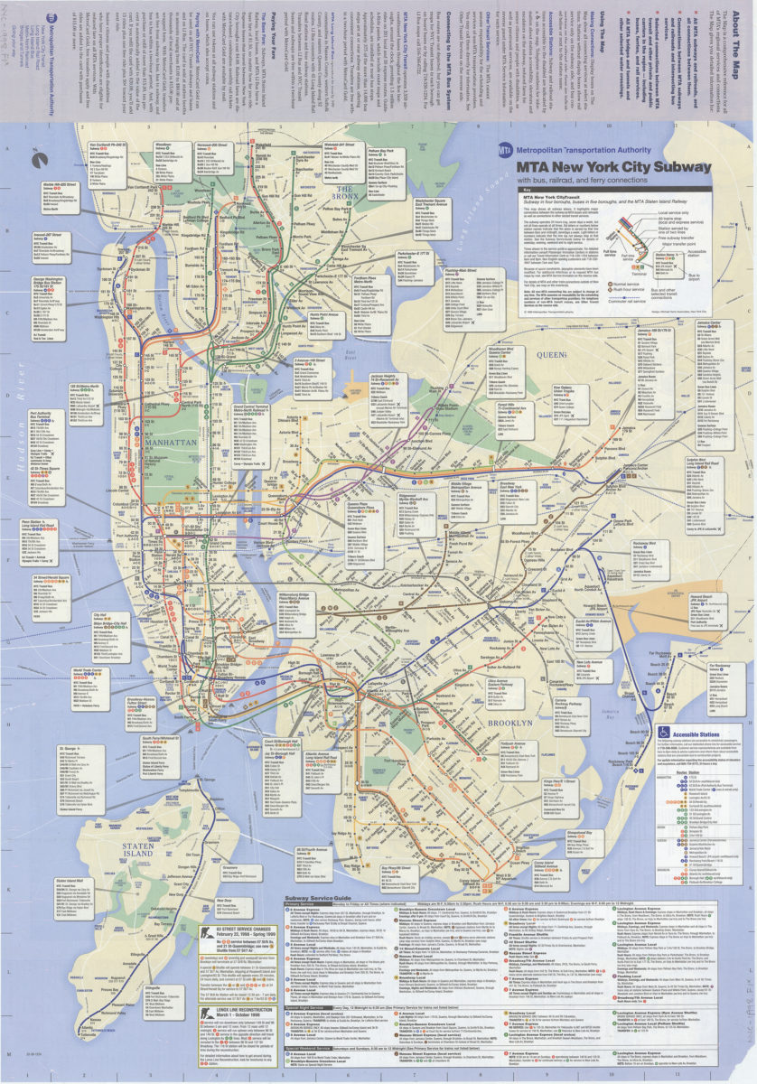
The map, MTA subways and railroads and their interconnections: connections between MTA subway, rail, and bus services, selected connections to other regional transit services: MTA Metropolitan Transportation Authority
The map, MTA subways and railroads and their interconnections: connections between MTA subway, rail, and bus services, selected connections to other regional transit services: MTA Metropolitan Transportation Authority
[ca. 1998]