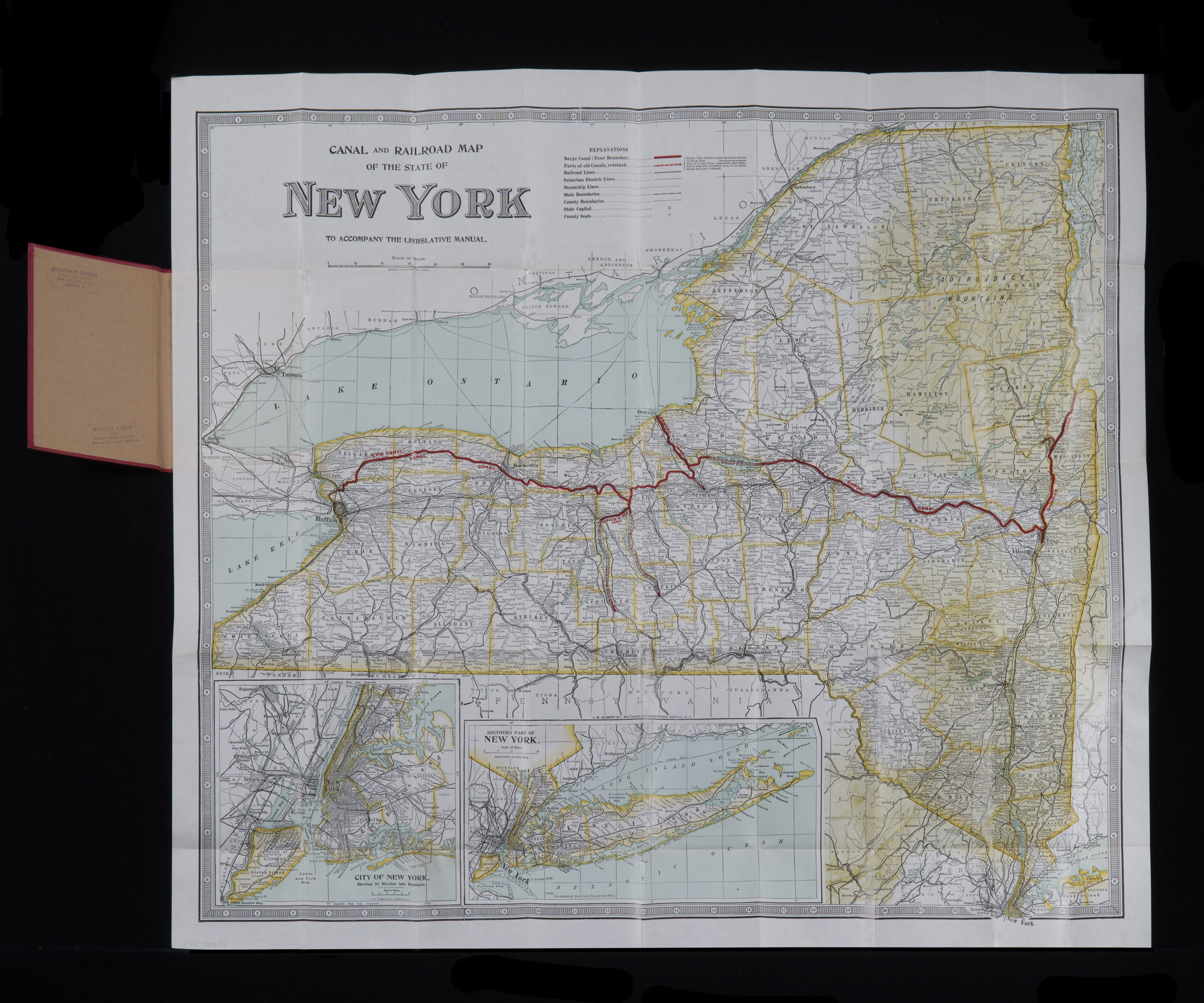
Canal and railroad map of the State of New York: to accompany the Legislative Manual 1943
Map No. NYS-1943.Folded
Shows canals, railroads, major auto routes, steamship lines, and county lines. Includes 2 insets: Southern part of New York and New York, showing division into Boroughs.
Map area shown
Relation
Full catalog recordSize
65 × 72 cmDownload
Low Resolution Image
Creator
Publisher
Brooklyn Historical SocietyCitation
Canal and railroad map of the State of New York: to accompany the Legislative Manual; 1943, Map Collection, NYS-1943.Folded; Brooklyn Historical Society.Scale
Scale approximately 1:760Loading zoom image...