Center for Brooklyn History
Map Collections
Search
About
Othmer Library & Archives
Submit search query
Refine 3 records
Clear filters
2
Location
Atlantic States
2
Queens (New York, N.Y.)
83
United States
10
Subject
Housing
4
Market surveys
4
Railroads
72
Rent
4
Date
20th Century
469
or enter range:
from
to
Genres
Historical maps
53
Maps
6
Population maps
6
Sort by:
Date (earliest)
Date (most recent)
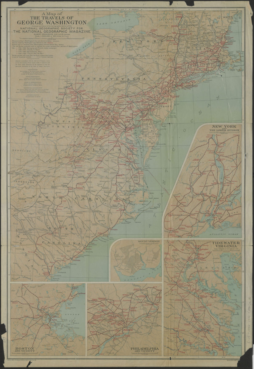
A map of the travels of George Washington: compiled and drawn in the Cartographic Section of the National Geographic Society for the National Geographic Magazine
A map of the travels of George Washington: compiled and drawn in the Cartographic Section of the National Geographic Society for the National Geographic Magazine
[ca. 1931]
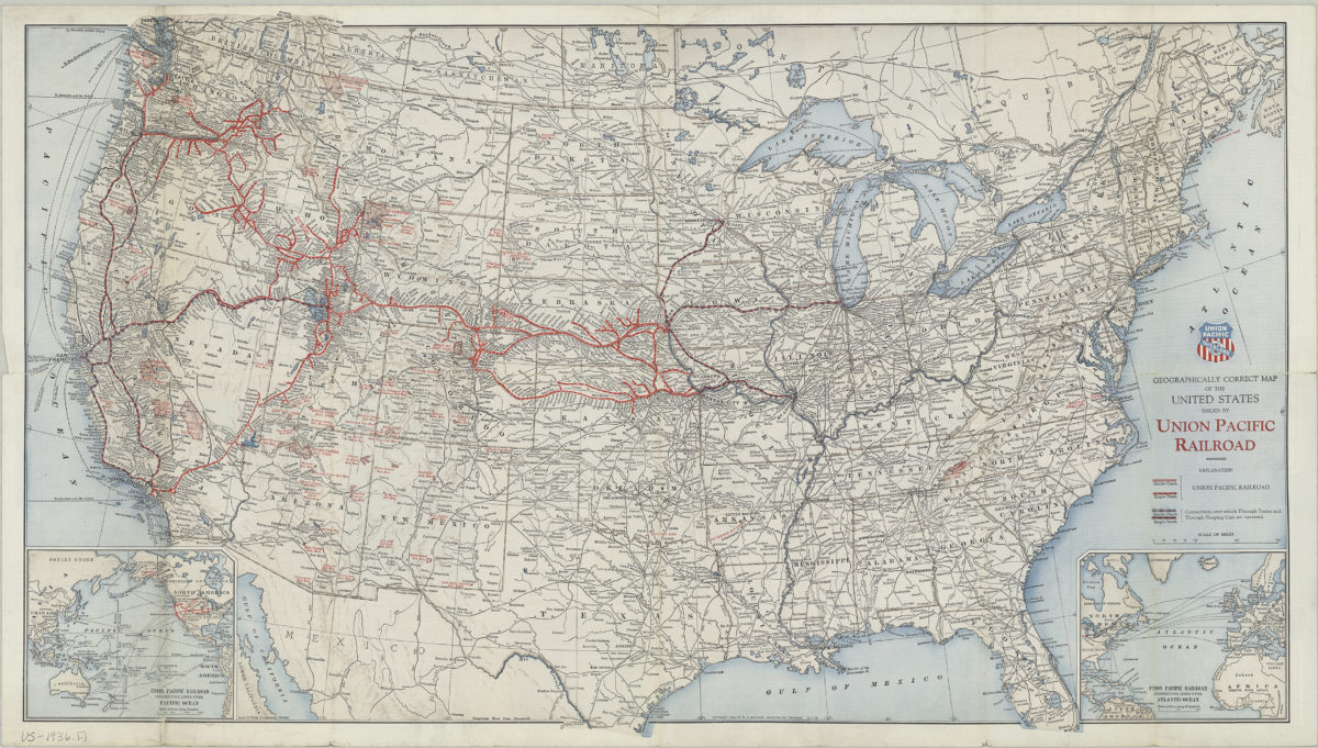
Geographically correct map of the United States: issued by Union Pacific Railroad
Geographically correct map of the United States: issued by Union Pacific Railroad
[ca. 1936]
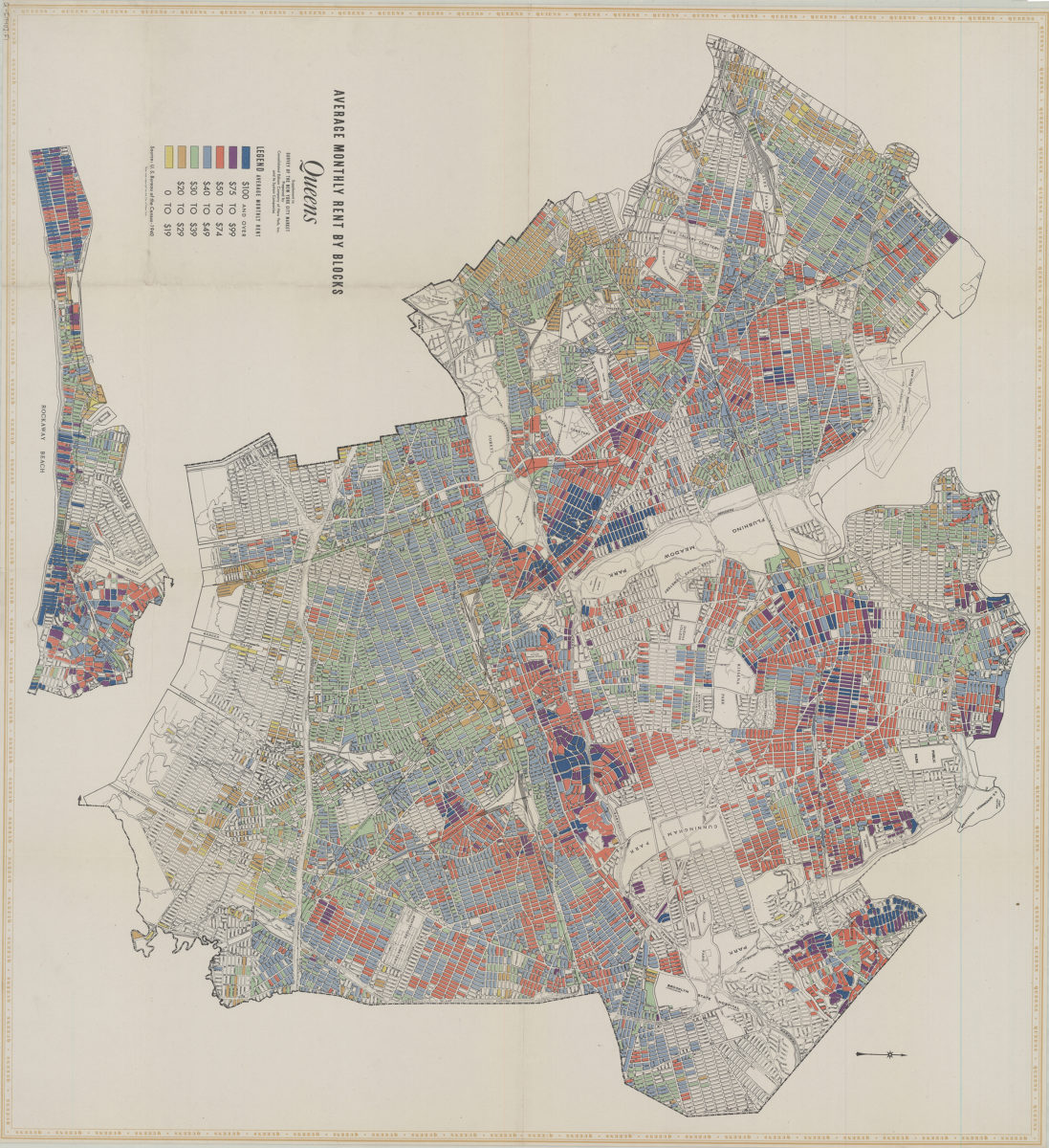
Average monthly rent by blocks, Queens: supplement to Survey of the New York City market: prepared by Consolidated Edison Company of New York, Inc. and its system companies
Average monthly rent by blocks, Queens: supplement to Survey of the New York City market: prepared by Consolidated Edison Company of New York, Inc. and its system companies
[1940]