Center for Brooklyn History
Map Collections
Search
About
Othmer Library & Archives
Submit search query
Refine 2 records
Clear filters
3
Location
Bay Ridge (New York, N.Y.)
108
Brooklyn (New York, N.Y.)
891
Manhattan (New York, N.Y.)
120
Subject
Buildings
12
Fills (Earthwork)
4
Fortification
7
Landforms
15
Landowners
434
Ponds
6
Real property
619
Rivers
16
Roads
117
Wetlands
6
Date
20th Century
469
or enter range:
from
to
Genres
Cadastral maps
597
Historical maps
53
Manuscript maps
365
Sort by:
Date (earliest)
Date (most recent)
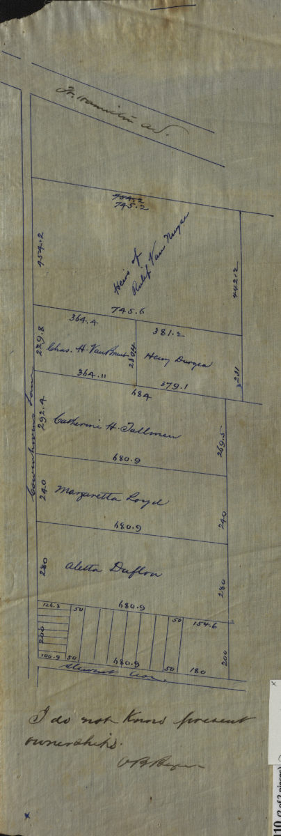
[Maps of Cowenhoven Lane and profile map of the grade of 2nd Avenue]
[Maps of Cowenhoven Lane and profile map of the grade of 2nd Avenue]
[ca. 1903]
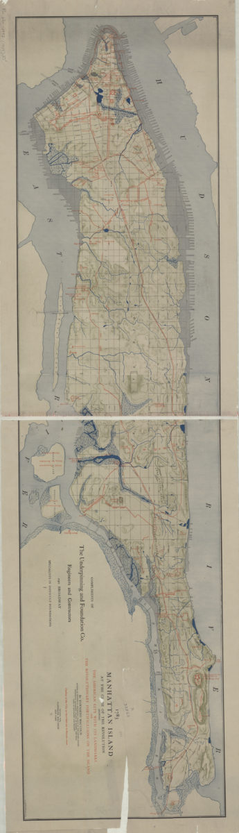
1783 Manhattan Island at the close of the Revolution: showing the American city with its landmarks and the Revolutionary fortifictions on the island: by Townsend Mac Coun
1783 Manhattan Island at the close of the Revolution: showing the American city with its landmarks and the Revolutionary fortifictions on the island: by Townsend Mac Coun
[ca. 1909]