Center for Brooklyn History
Map Collections
Search
About
Othmer Library & Archives
Submit search query
Refine 5 records
Clear filters
3
Location
Brooklyn (New York, N.Y.)
891
New York (N.Y.)
164
Subject
Bridges
13
Electric railroads
5
ferries
32
Local transit
63
Railroads
72
Railroads, Elevated
24
Street addresses
11
Streets
46
Subways
55
Tunnels
16
Date
20th Century
469
or enter range:
from
to
Genres
Road maps
83
Transportation maps
120
Sort by:
Date (earliest)
Date (most recent)
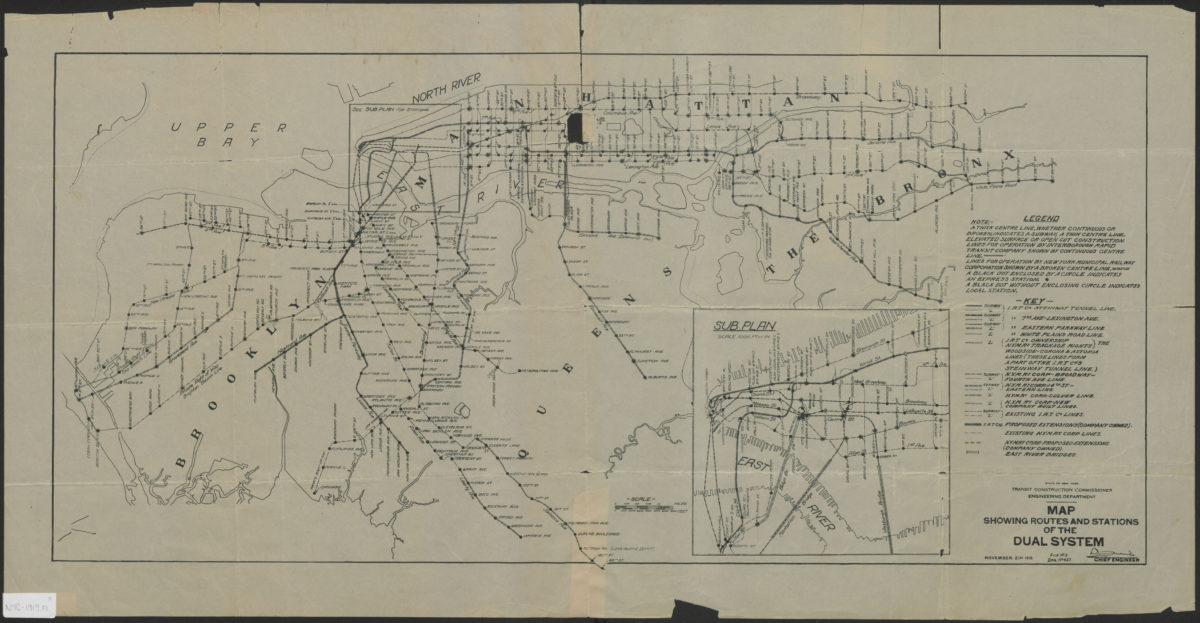
Map showing routes and stations of the dual systems
Map showing routes and stations of the dual systems
1919
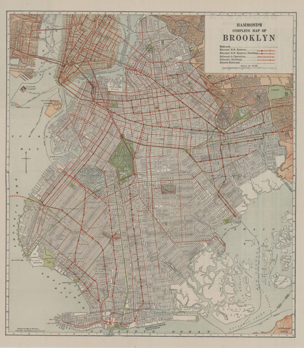
Hammond’s complete map of Brooklyn: copyright by C.S. Hammond Co
Hammond’s complete map of Brooklyn: copyright by C.S. Hammond Co
[192?]
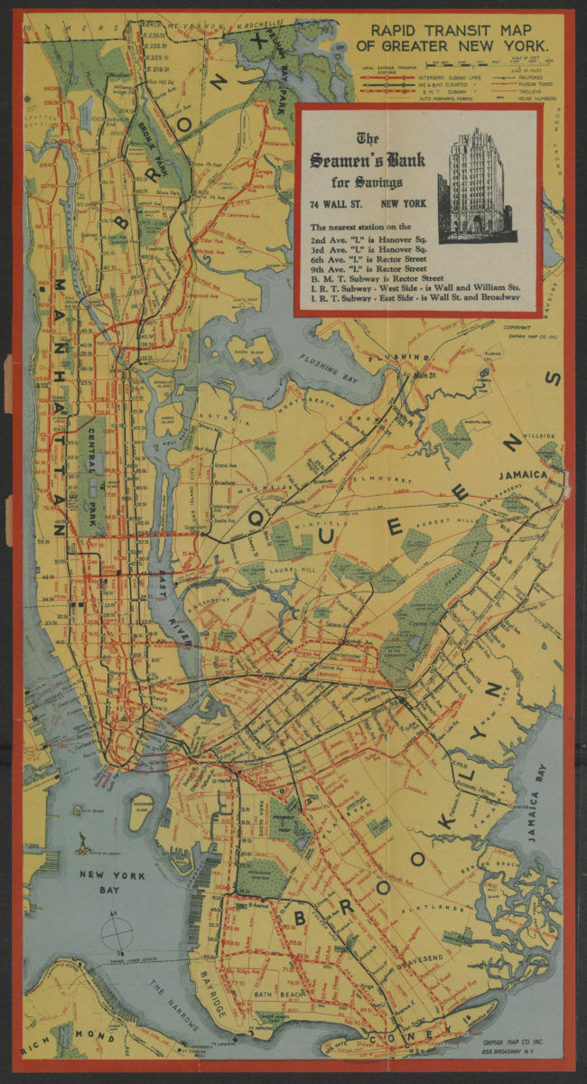
Rapid transit map of greater New York: shows house numbers at each station
Rapid transit map of greater New York: shows house numbers at each station
[1929]
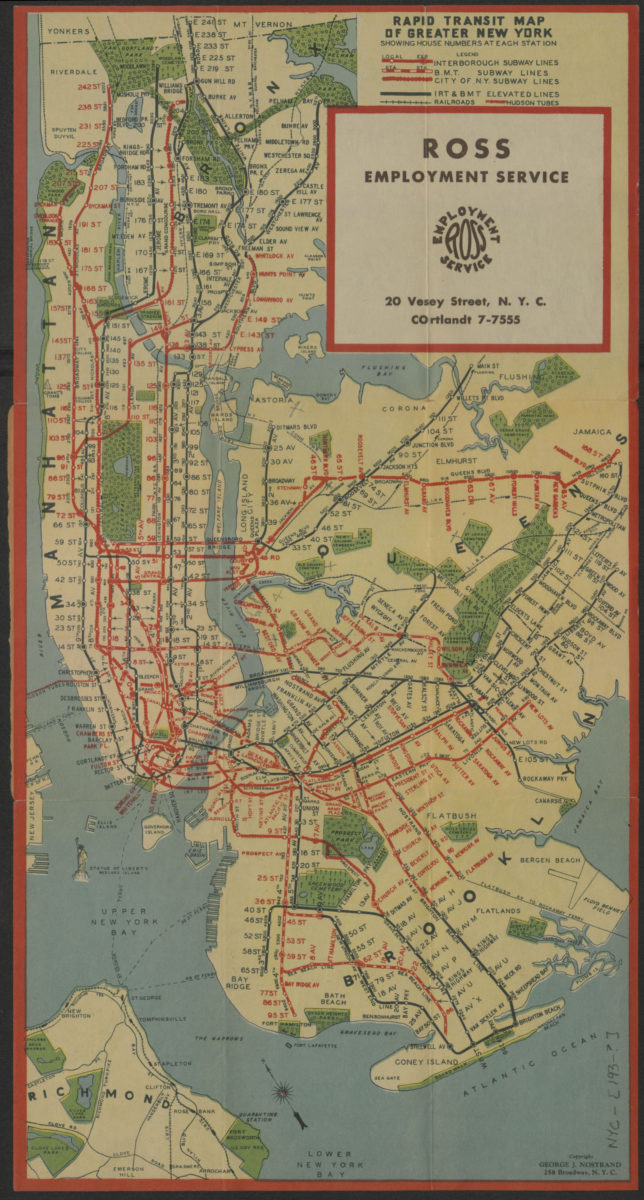
Rapid transit map of greater New York: showing house numbers at each station
Rapid transit map of greater New York: showing house numbers at each station
[193?]
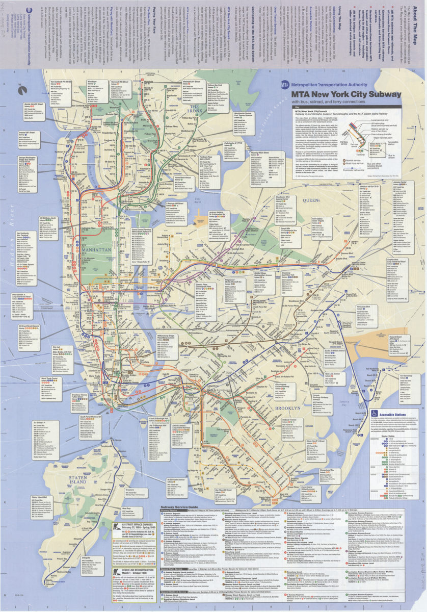
The map, MTA subways and railroads and their interconnections: connections between MTA subway, rail, and bus services, selected connections to other regional transit services: MTA Metropolitan Transportation Authority
The map, MTA subways and railroads and their interconnections: connections between MTA subway, rail, and bus services, selected connections to other regional transit services: MTA Metropolitan Transportation Authority
[ca. 1998]