Center for Brooklyn History
Map Collections
Search
About
Othmer Library & Archives
Submit search query
Refine 5 records
Clear filters
2
Location
Brooklyn (New York, N.Y.)
891
New England
8
New Jersey
27
New York (N.Y.)
164
New York (State)
95
Subject
Long Island, Battle of, New York, N.Y. , 1776
7
Date
19th Century
945
20th Century
469
or enter range:
from
to
Genres
Early maps
35
Historical maps
53
Military maps
23
Sort by:
Date (earliest)
Date (most recent)
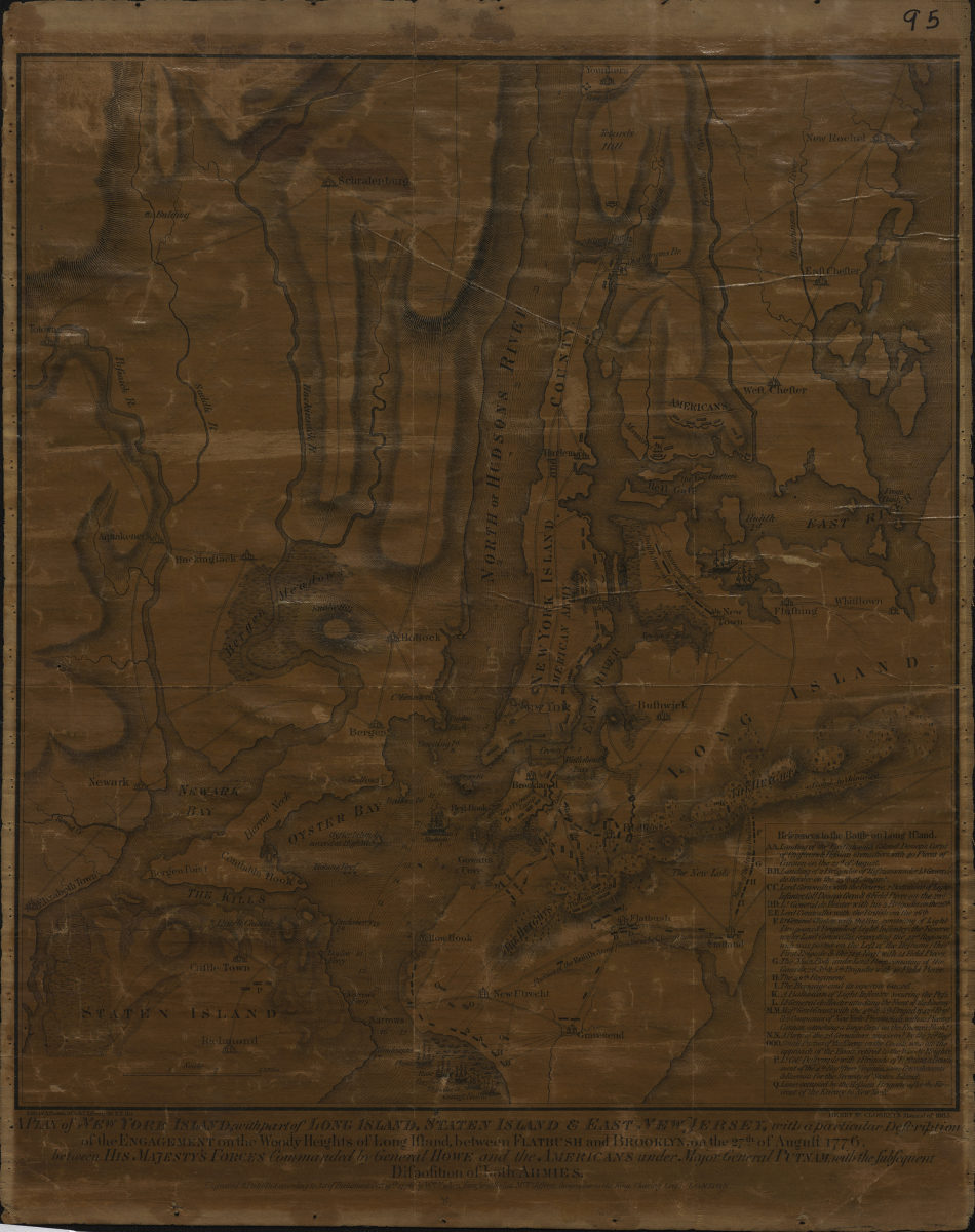
A plan of New York Island, with part of Long Island, Staten Island & East New Jersey: with a particular description of the Engagement on the Woody Heights of Long Island, between Flatbush and Brooklyn, on the 27th of August 1776
A plan of New York Island, with part of Long Island, Staten Island & East New Jersey: with a particular description of the Engagement on the Woody Heights of Long Island, between Flatbush and Brooklyn, on the 27th of August 1776
[1865]
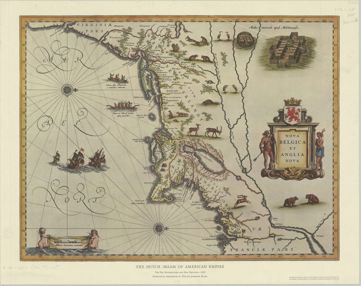
The Dutch dream of American empire: the New Netherlands and New England, 1635: engraved in Amsterdam by Willem Janszoon Blaeu
The Dutch dream of American empire: the New Netherlands and New England, 1635: engraved in Amsterdam by Willem Janszoon Blaeu
[195?]
Washington’s retreat across New Jersey in Nov. & Dec. 1776
Washington’s retreat across New Jersey in Nov. & Dec. 1776
[1964]
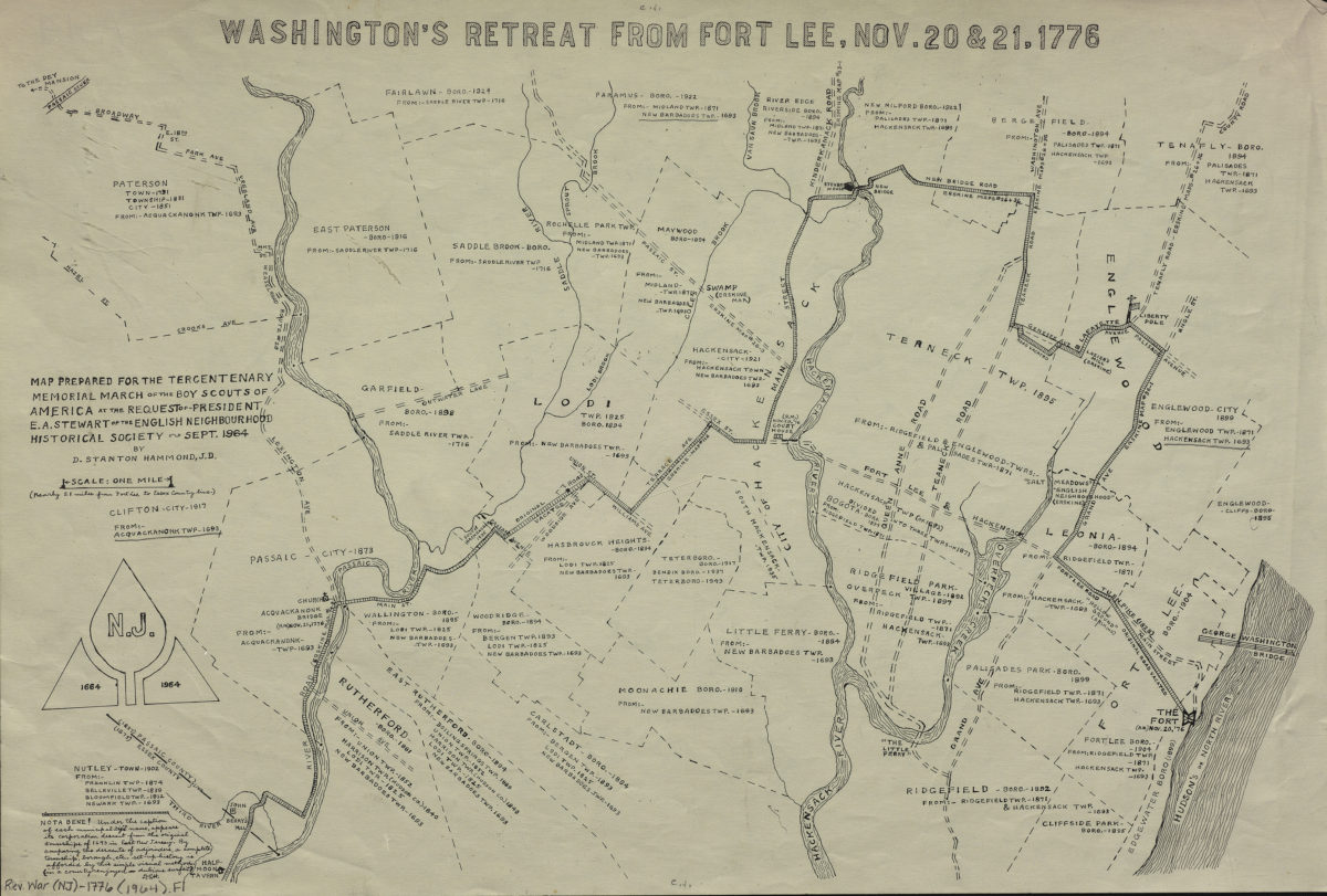
Washington’s retreat from Fort Lee, Nov. 20 & 21, 1776
Washington’s retreat from Fort Lee, Nov. 20 & 21, 1776
[1964]
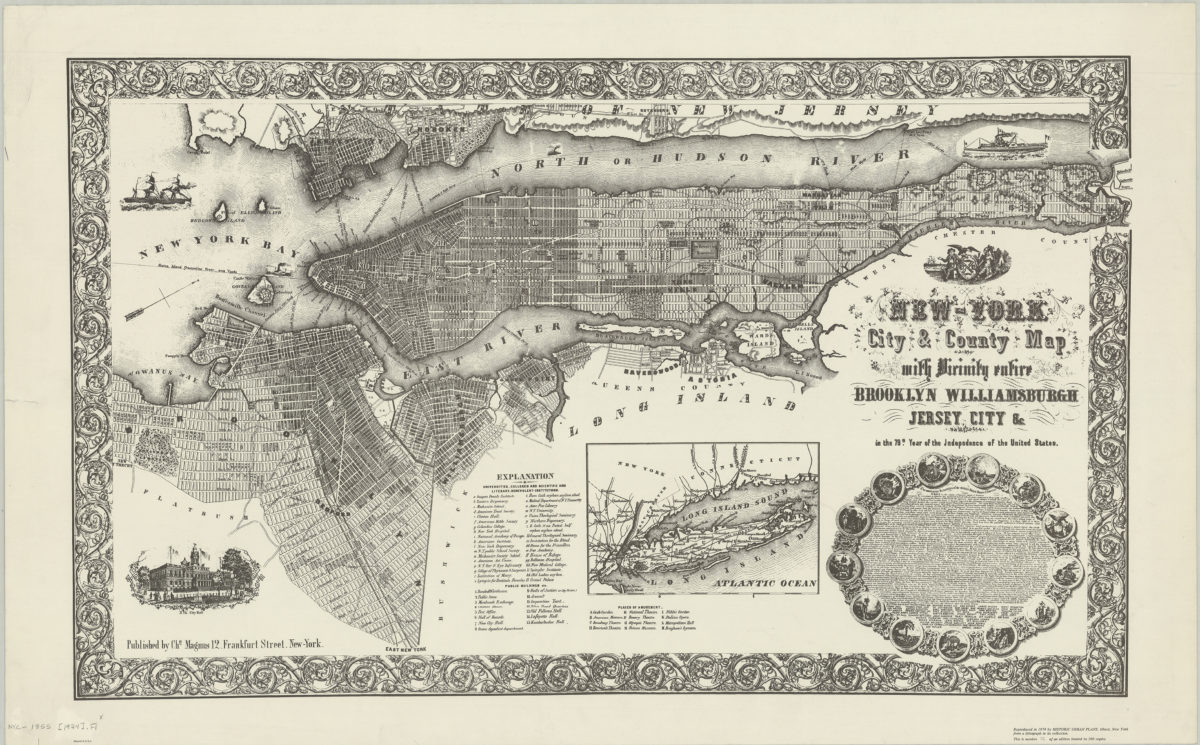
New-York City & County map with vicinity entire: Brooklyn, Williamsburgh, Jersey City &c. in the 79th year of the independence of the United States
New-York City & County map with vicinity entire: Brooklyn, Williamsburgh, Jersey City &c. in the 79th year of the independence of the United States
1974