Center for Brooklyn History
Map Collections
Search
About
Othmer Library & Archives
Submit search query
Refine 4 records
Clear filters
2
Location
Brooklyn (New York, N.Y.)
891
Fulton Ferry Historic District (New York, N.Y.)
5
Great Neck (N.Y.)
3
Lawrence (Mercer County, N.J. : Township)
1
Long Island (N.Y.)
197
Maidenhead (N.J.)
1
Subject
Land titles
1
Landowners
434
Real property
619
Date
19th Century
945
20th Century
469
or enter range:
from
to
Genres
Cadastral maps
597
Historical maps
53
Manuscript maps
365
Sort by:
Date (earliest)
Date (most recent)
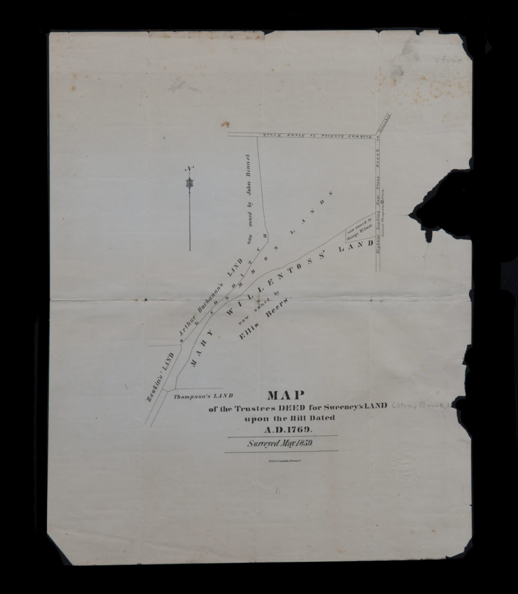
Map of the trustees deed for Sweeney’s land upon the hill dated A.D. 1769
Map of the trustees deed for Sweeney’s land upon the hill dated A.D. 1769
[1859]
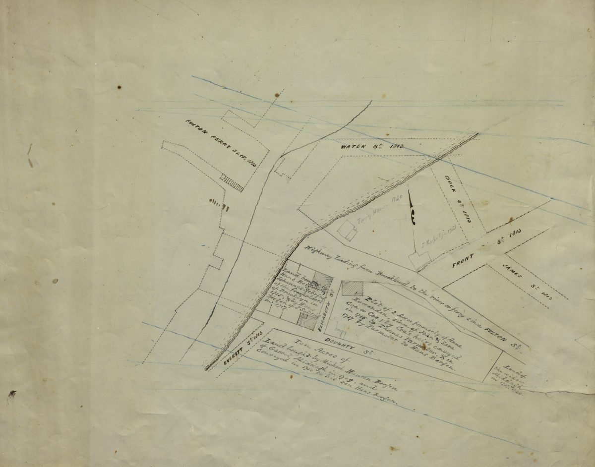
[Map of Hans Bergen’s land at Brooklyn Ferry]
[Map of Hans Bergen’s land at Brooklyn Ferry]
[ca. 1876]
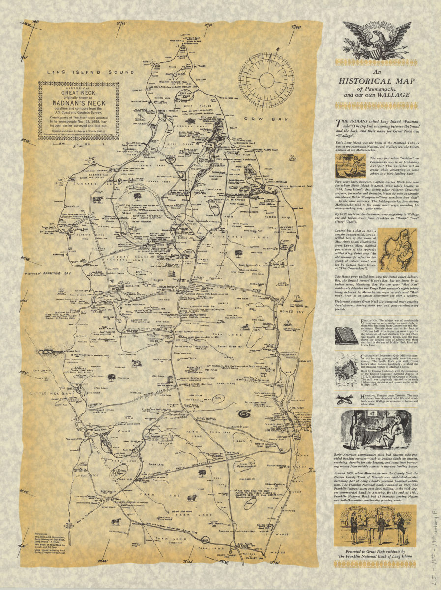
An historical map of Paumanacke and our own Wallage: compiled and drawn by George L. Whittle
An historical map of Paumanacke and our own Wallage: compiled and drawn by George L. Whittle
[ca. 1940, 1961]
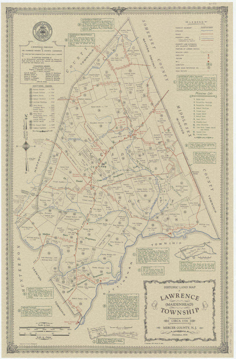
Historic land map of Lawrence (Maidenhead) Township, circa 1776, Mercer County, N.J.: December 1976: this map has been prepared from primary source material by D. Stanton Hammond, III as his Bi-centennial contribution
Historic land map of Lawrence (Maidenhead) Township, circa 1776, Mercer County, N.J.: December 1976: this map has been prepared from primary source material by D. Stanton Hammond, III as his Bi-centennial contribution
[ca. 1977]