Center for Brooklyn History
Map Collections
Search
About
Othmer Library & Archives
Submit search query
Refine 5 records
Clear filters
2
Location
Bedford-Stuyvesant (New York, N.Y.)
67
Brooklyn (New York, N.Y.)
891
Crown Heights (New York, N.Y.)
25
Subject
Landowners
434
Real property
619
Streets
46
Date
19th Century
945
or enter range:
from
to
Genres
Cadastral maps
597
Manuscript maps
365
Sort by:
Date (earliest)
Date (most recent)
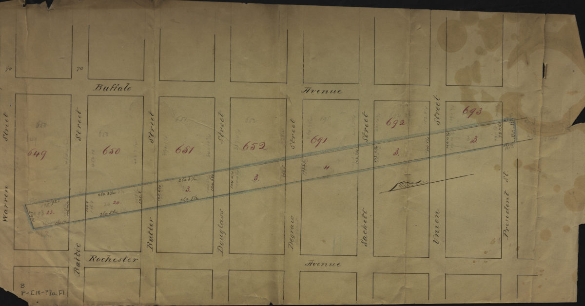
[Map of area bounded by Buffalo Ave., Warren St., Rochester Ave., and President St.].
[Map of area bounded by Buffalo Ave., Warren St., Rochester Ave., and President St.].
[18??]
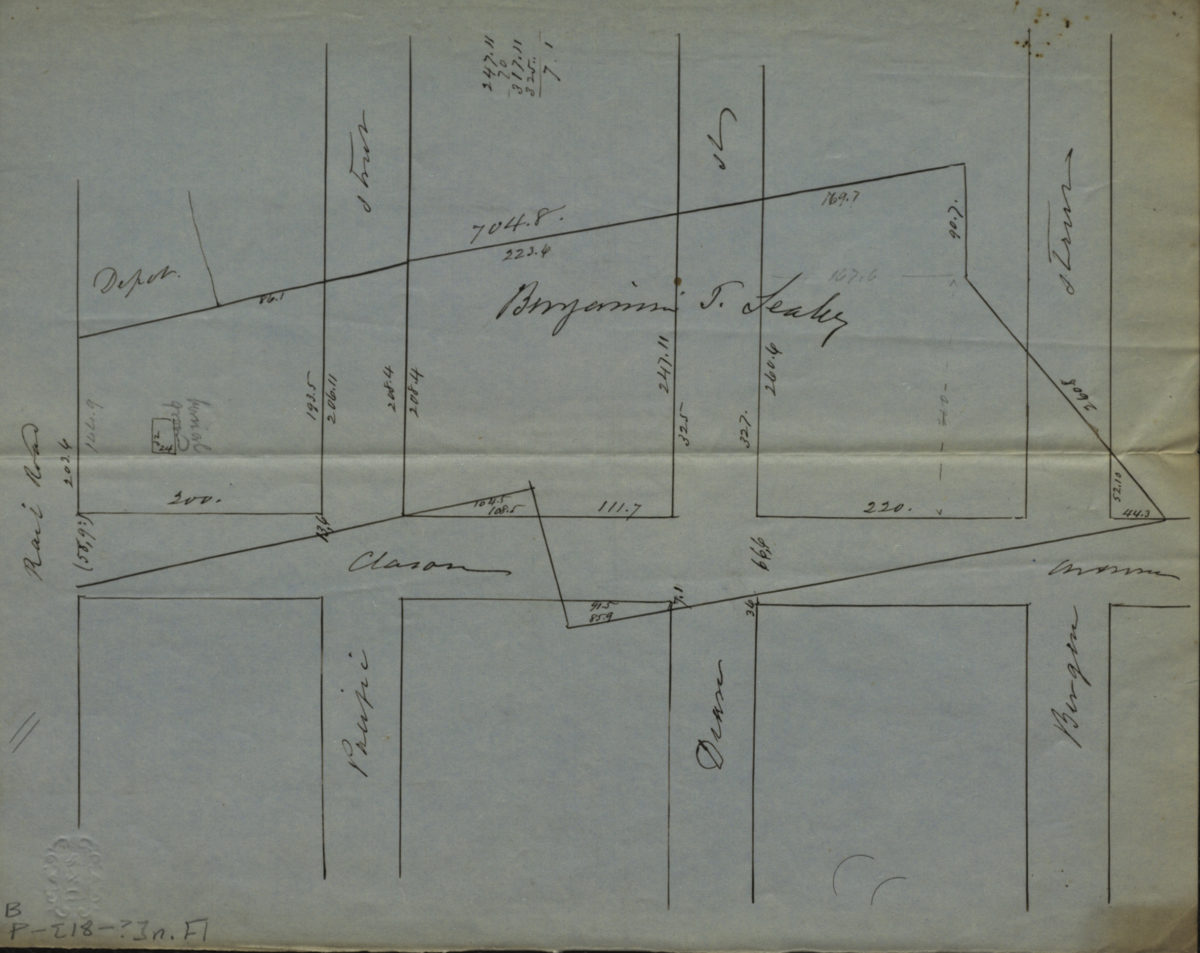
[Map of Atlantic Ave., Pacific St., Dean St., and Bergen St. at Classon Ave.].
[Map of Atlantic Ave., Pacific St., Dean St., and Bergen St. at Classon Ave.].
[18??]
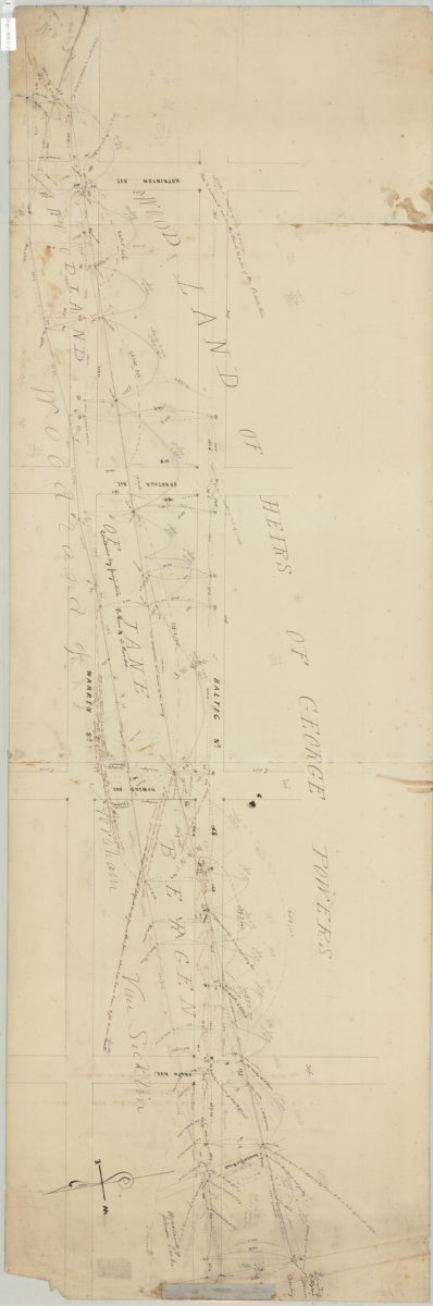
Woodlot of Jane Bergen, 9th Ward, Brooklyn
Woodlot of Jane Bergen, 9th Ward, Brooklyn
1853
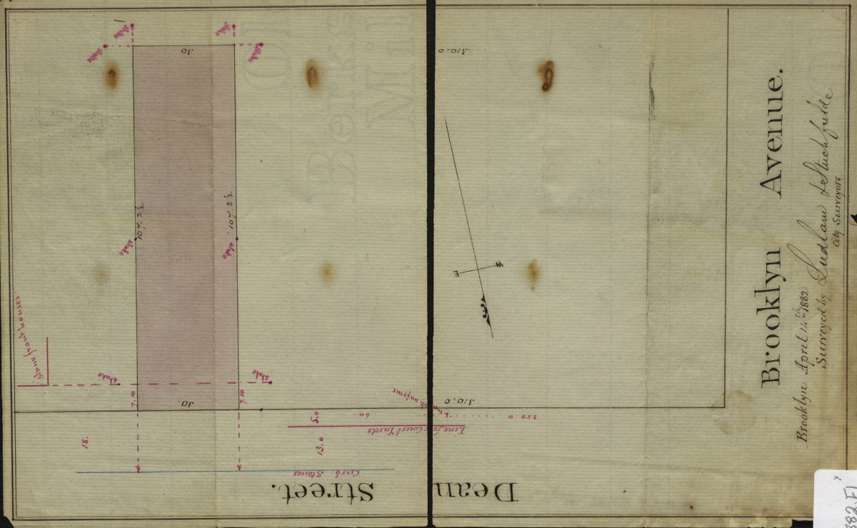
[Map of Dean St. and Brookyln Ave.]: surveyed by Ludlam & Stuchfielde [sic], city surveyors
[Map of Dean St. and Brookyln Ave.]: surveyed by Ludlam & Stuchfielde [sic], city surveyors
April 14, 1882
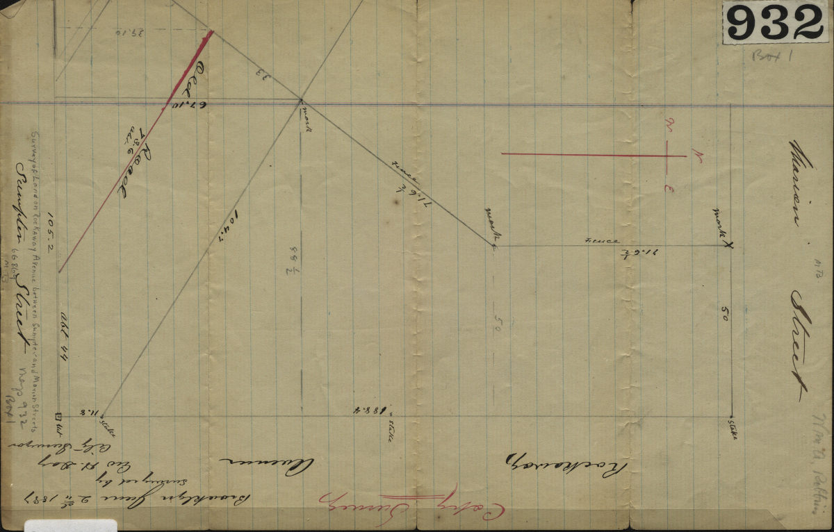
[Map covering the interesections of Rockaway Ave. with Martion St. and Sumpter St.]: surveyed by Geo. H. Day, city surveyor, Brooklyn, June 2, 1887
[Map covering the interesections of Rockaway Ave. with Martion St. and Sumpter St.]: surveyed by Geo. H. Day, city surveyor, Brooklyn, June 2, 1887
1887