Center for Brooklyn History
Map Collections
Search
About
Othmer Library & Archives
Submit search query
Refine 4 records
Clear filters
4
Location
Brooklyn (New York, N.Y.)
891
Crown Heights (New York, N.Y.)
25
East Flatbush (New York, N.Y.)
23
Erasmus (New York, N.Y.)
1
Farragut (New York, N.Y.)
1
Flatbush (New York, N.Y.)
35
Kensington (New York, N.Y.)
11
Prospect Lefferts Gardens (Brooklyn, New York, N.Y.)
16
Prospect Park South (New York, N.Y.)
8
Windsor Terrace (New York, N.Y.)
10
Subject
Landforms
15
Landowners
434
Real property
619
Streets
46
Date
19th Century
945
or enter range:
from
to
Genres
Cadastral maps
597
Manuscript maps
365
Sort by:
Date (earliest)
Date (most recent)
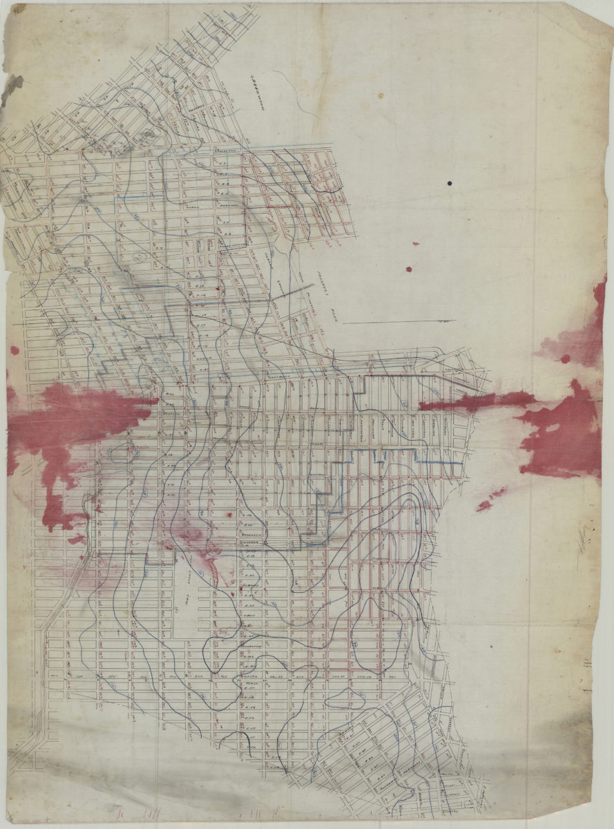
[Map covering area east from Greenwood Cemetery to Howard Ave. and north from Ave G. to Eastern Pkwy]
[Map covering area east from Greenwood Cemetery to Howard Ave. and north from Ave G. to Eastern Pkwy]
[18??]
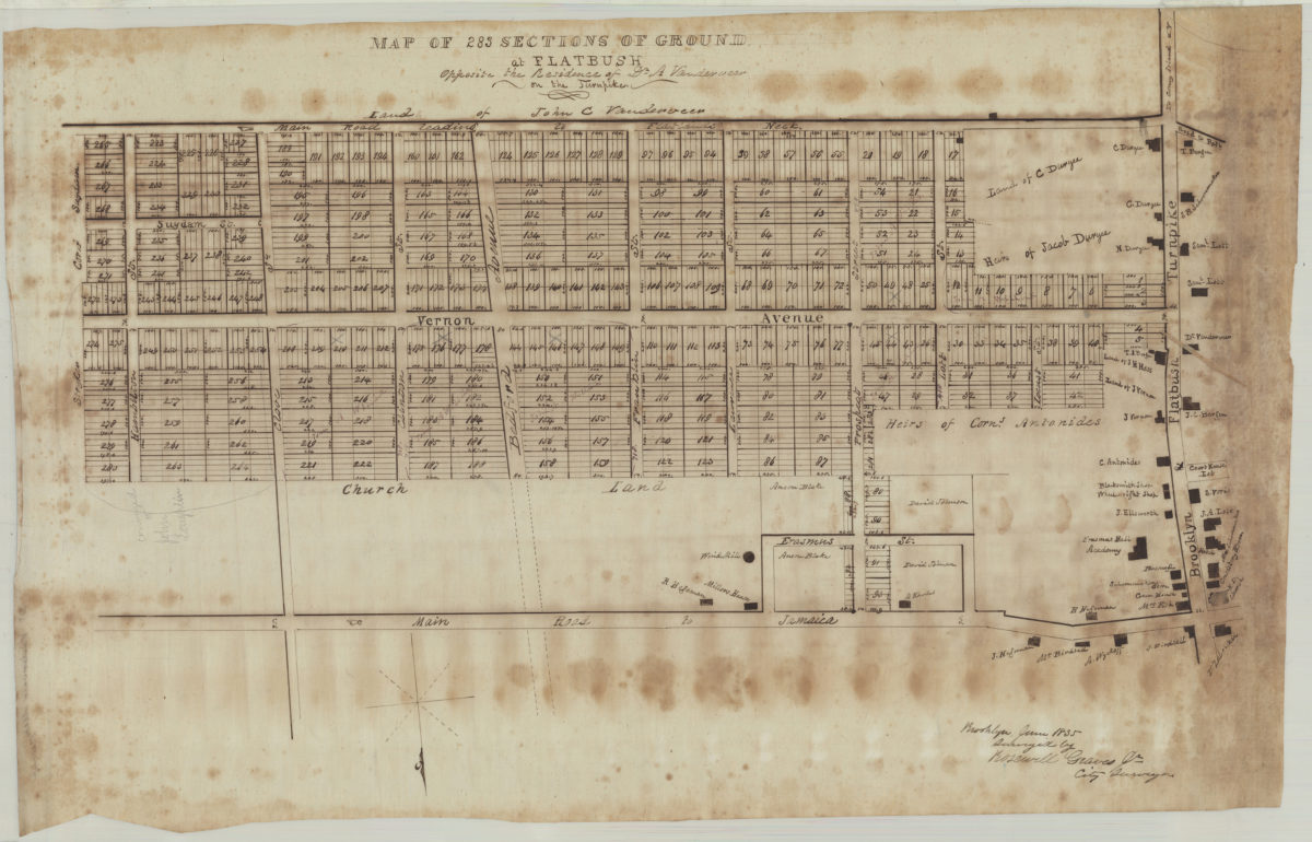
Map of 283 sections of ground at Flatbush opposite the residence of Dr. A. Vanderveer on the Turnpike: surveyed by Rosewell Graves Jr., city surveyor
Map of 283 sections of ground at Flatbush opposite the residence of Dr. A. Vanderveer on the Turnpike: surveyed by Rosewell Graves Jr., city surveyor
June 1835
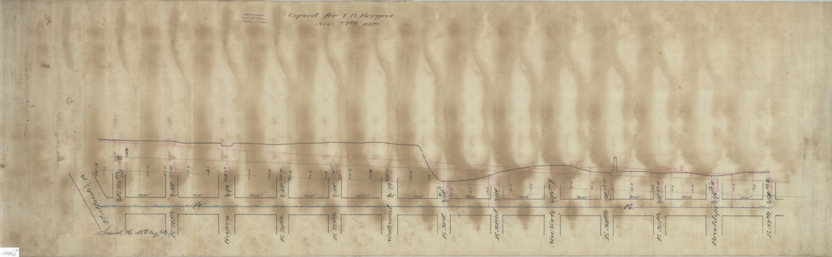
[Plan and profile of Avenue E from Flatbush Avenue to East 37th Street]: Samuel H. McElroy, C.E.
[Plan and profile of Avenue E from Flatbush Avenue to East 37th Street]: Samuel H. McElroy, C.E.
1889
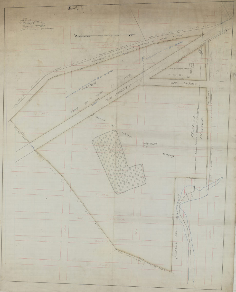
[Map of area bounded by E. 25th St., Ave. G, E. 35th St., and Ave. E.]: Charles Crooke, engineer & surveyor
[Map of area bounded by E. 25th St., Ave. G, E. 35th St., and Ave. E.]: Charles Crooke, engineer & surveyor
January 1891