Center for Brooklyn History
Map Collections
Search
About
Othmer Library & Archives
Submit search query
Refine 2 records
Clear filters
3
Location
Manhattan (New York, N.Y.)
120
New York (N.Y.)
164
New York Metropolitan Area
40
Subject
Local transit
63
Postal codes
4
Railroads, Elevated
24
Roads
117
Street addresses
11
Subways
55
Date
19th Century
945
20th Century
469
or enter range:
from
to
Genres
Road maps
83
Transportation maps
120
Sort by:
Date (earliest)
Date (most recent)
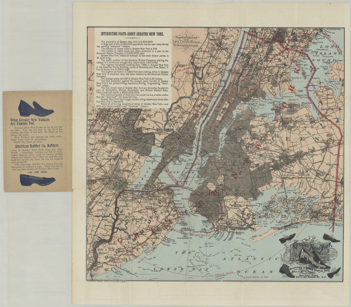
Pocket map of greater New York: showing the good roads in and about greater New York, together with a map of New York City proper
Pocket map of greater New York: showing the good roads in and about greater New York, together with a map of New York City proper
[ca. 1896]
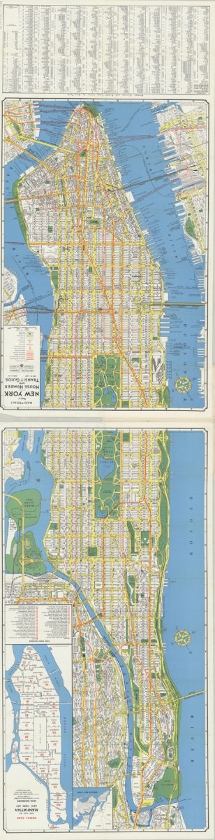
Hagstrom’s map of New York, house number and transit guide: compiled, printed and published by Hagstrom Company Incorporated
Hagstrom’s map of New York, house number and transit guide: compiled, printed and published by Hagstrom Company Incorporated
[1963]