Center for Brooklyn History
Map Collections
Search
About
Othmer Library & Archives
Submit search query
Refine 5 records
Clear filters
2
Location
Brooklyn (New York, N.Y.)
891
Long Island (N.Y.)
197
Subject
ferries
32
Golf courses
2
Indians of North America
6
Railroads
72
Roads
117
Waterworks
5
Yacht clubs
1
Date
19th Century
945
20th Century
469
or enter range:
from
to
Genres
Public utility maps
15
Statistical maps
8
Thematic maps
60
Zoning maps
55
Sort by:
Date (earliest)
Date (most recent)
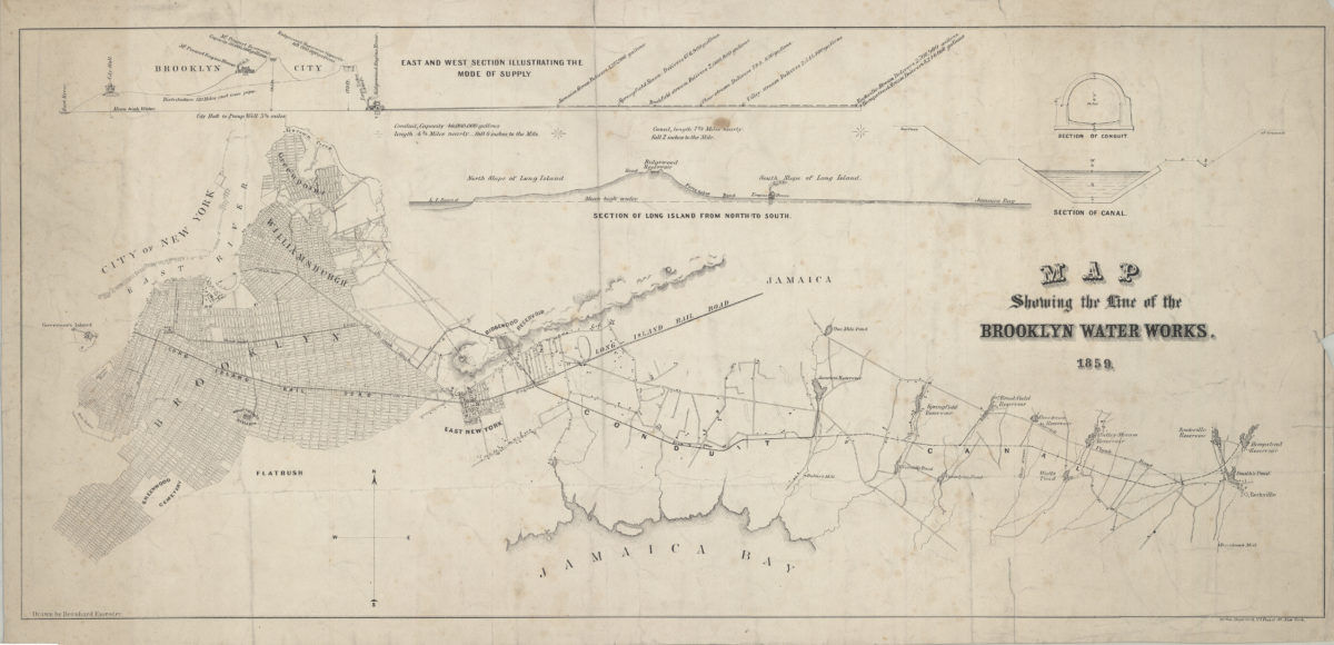
Map showing the line of the Brooklyn Water Works: drawn by Bernhard Essroger
Map showing the line of the Brooklyn Water Works: drawn by Bernhard Essroger
1859
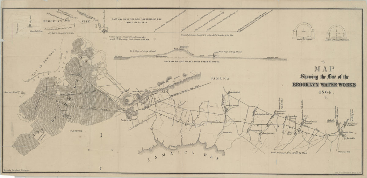
Map showing the line of the Brooklyn Water Works: drawn by Bernhard Essroger
Map showing the line of the Brooklyn Water Works: drawn by Bernhard Essroger
1864
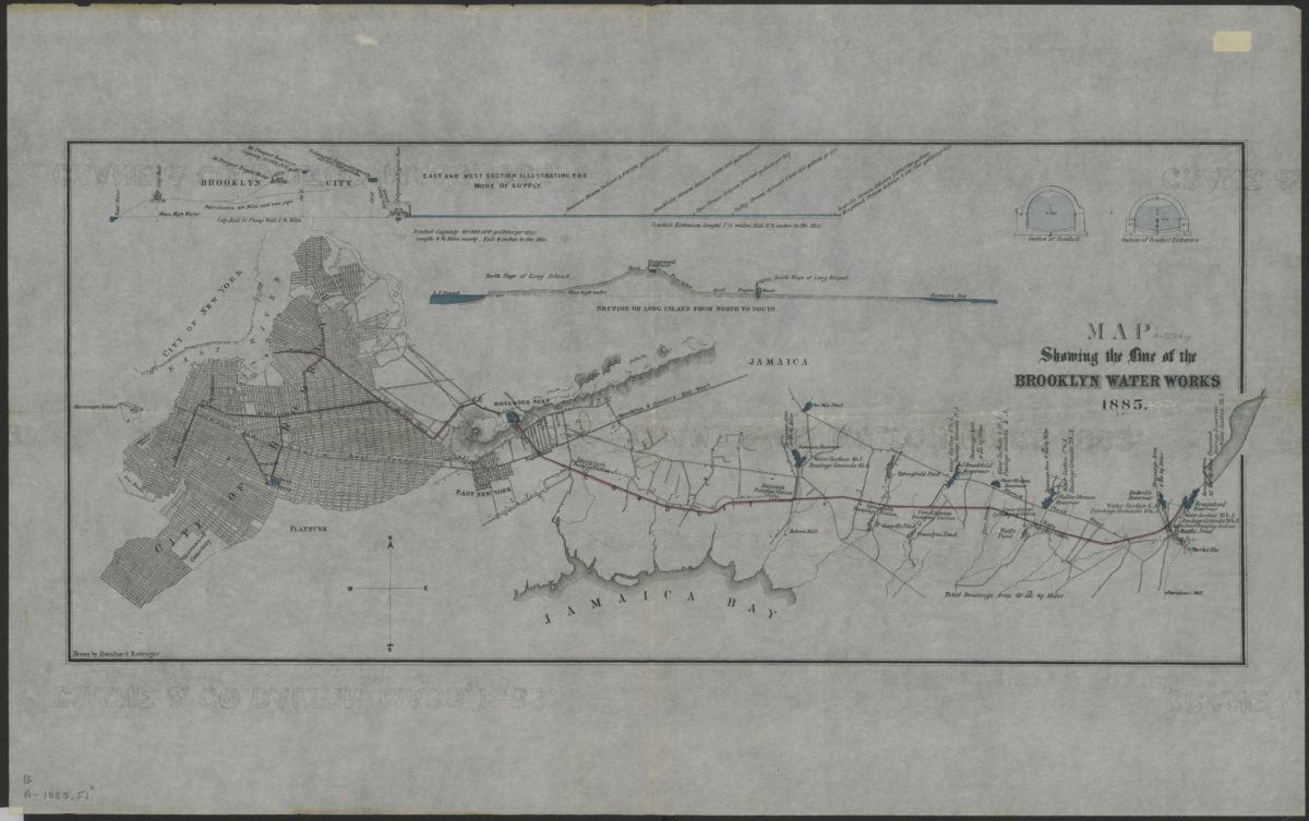
Map showing the line of the Brooklyn Water Works: drawn by Bernhard Essroger
Map showing the line of the Brooklyn Water Works: drawn by Bernhard Essroger
1885
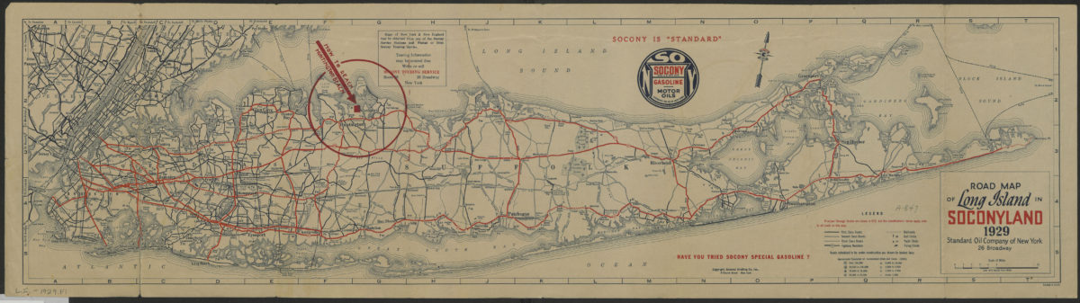
Road map of Long Island in Soconyland, 1929: copyright General Drafting Co., Inc
Road map of Long Island in Soconyland, 1929: copyright General Drafting Co., Inc
[1929]
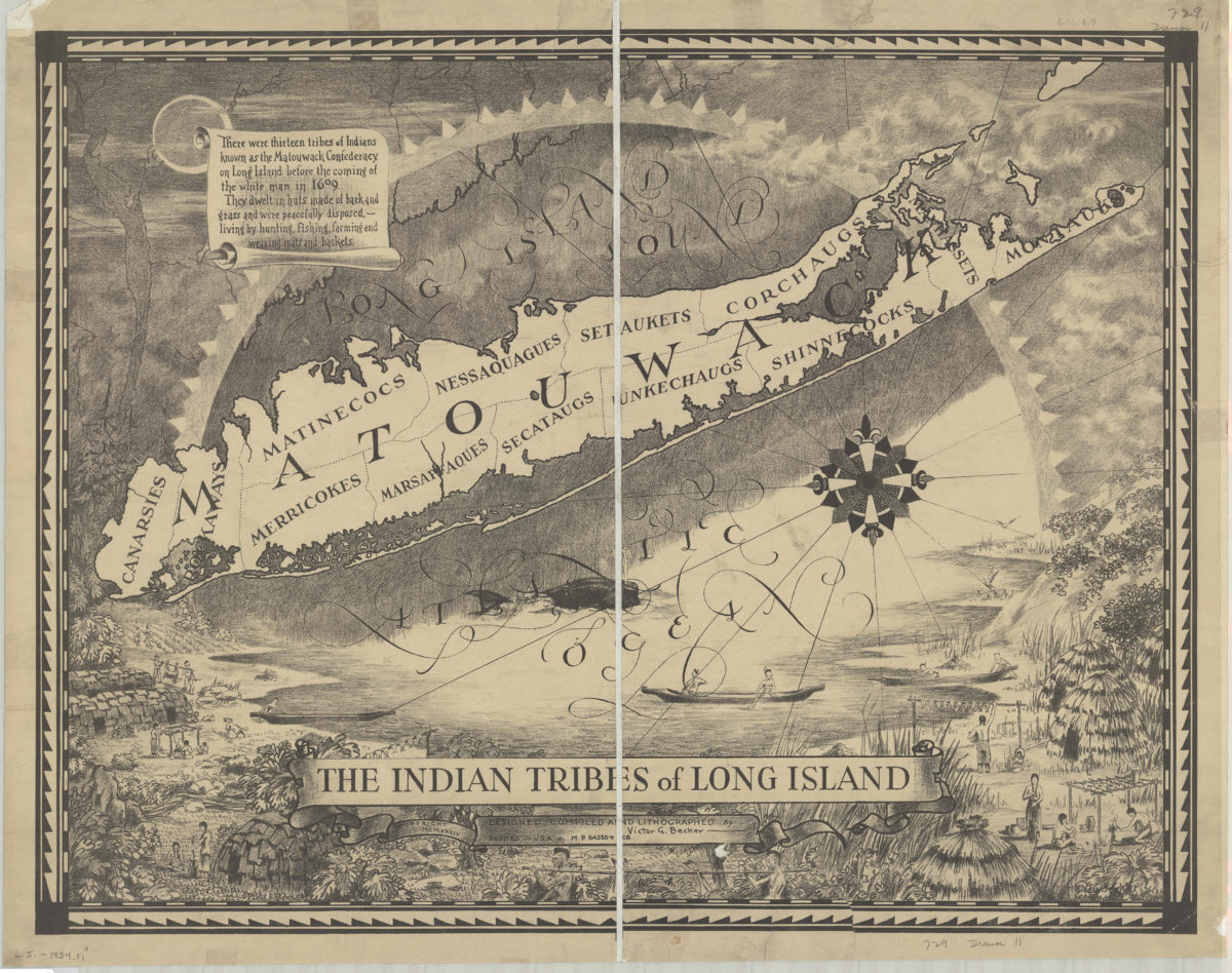
The Indian tribes of Long Island: designed, compiled and lithographed by Victor G. Becker
The Indian tribes of Long Island: designed, compiled and lithographed by Victor G. Becker
[ca. 1934]