Center for Brooklyn History
Map Collections
Search
About
Othmer Library & Archives
Submit search query
Refine 4 records
Clear filters
3
Location
Brooklyn (New York, N.Y.)
891
Brooklyn Heights (New York, N.Y.)
76
Buffalo (N.Y.)
3
East River (N.Y.)
3
Manhattan (New York, N.Y.)
120
Queens (New York, N.Y.)
83
Subject
Ferry routes
3
Local transit
63
Roads
117
Street railroads
8
Subways
55
Date
19th Century
945
20th Century
469
21th Century
66
or enter range:
from
to
Genres
Tourist maps
55
Transportation maps
120
Zoning maps
55
Sort by:
Date (earliest)
Date (most recent)
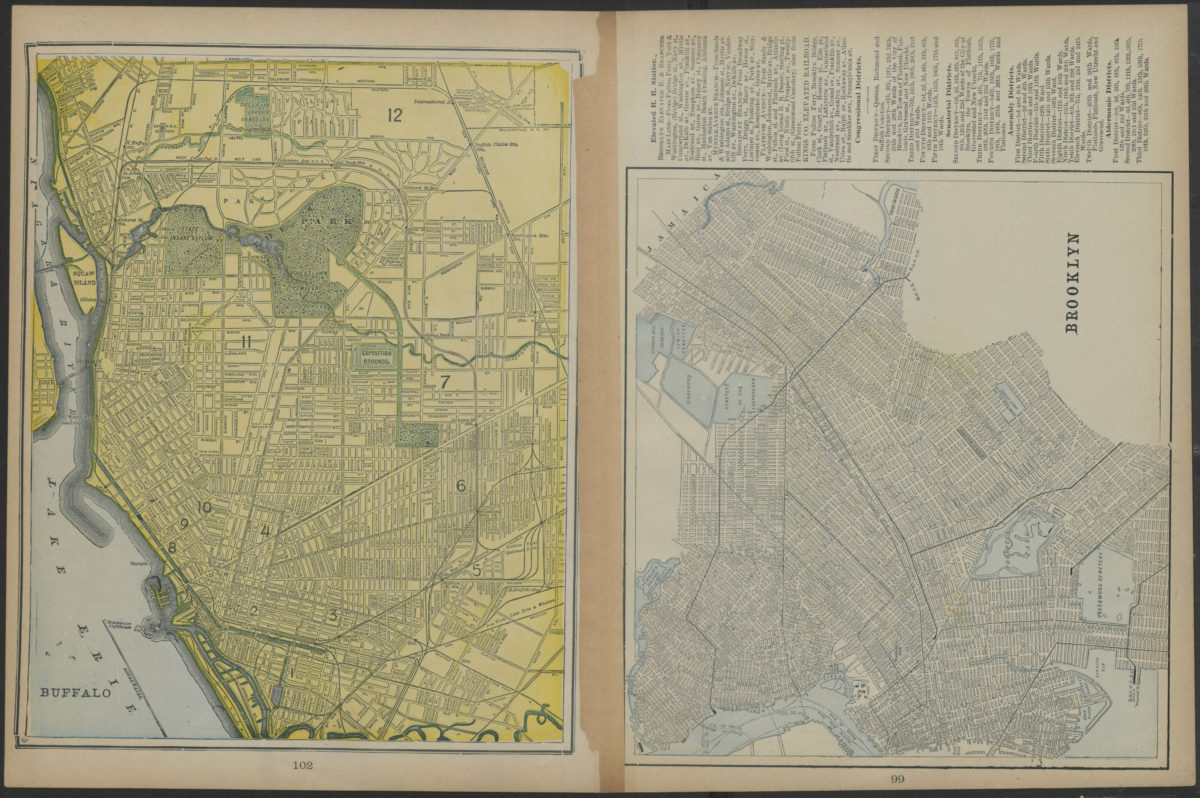
Map of New York and vicinity
Map of New York and vicinity
[1886-1894]
Map showing Brooklyn automobile routes and car lines approved by the Borough President, July 1919
Map showing Brooklyn automobile routes and car lines approved by the Borough President, July 1919
[1919]
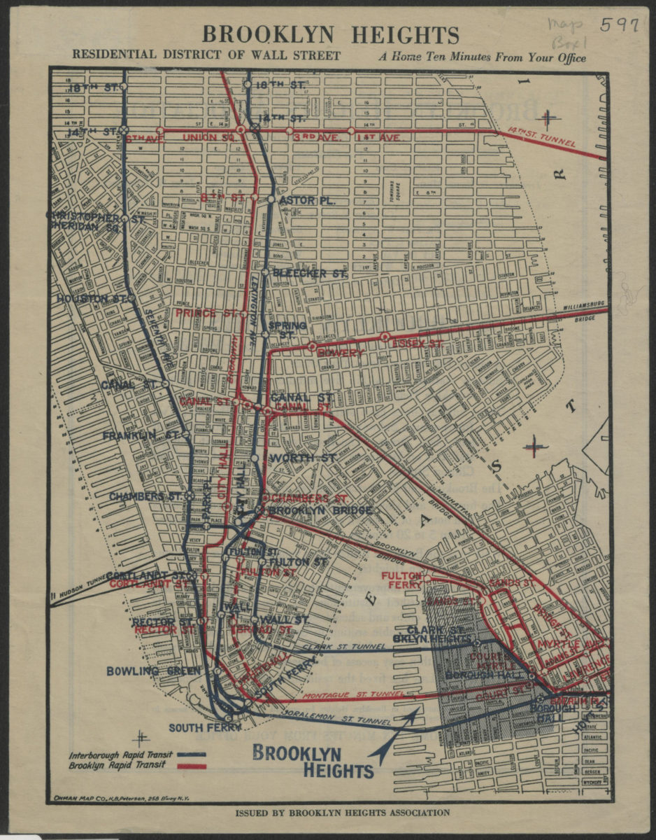
Brooklyn Heights, residential district of Wall Street: a home ten minutes from your office
Brooklyn Heights, residential district of Wall Street: a home ten minutes from your office
[1921]
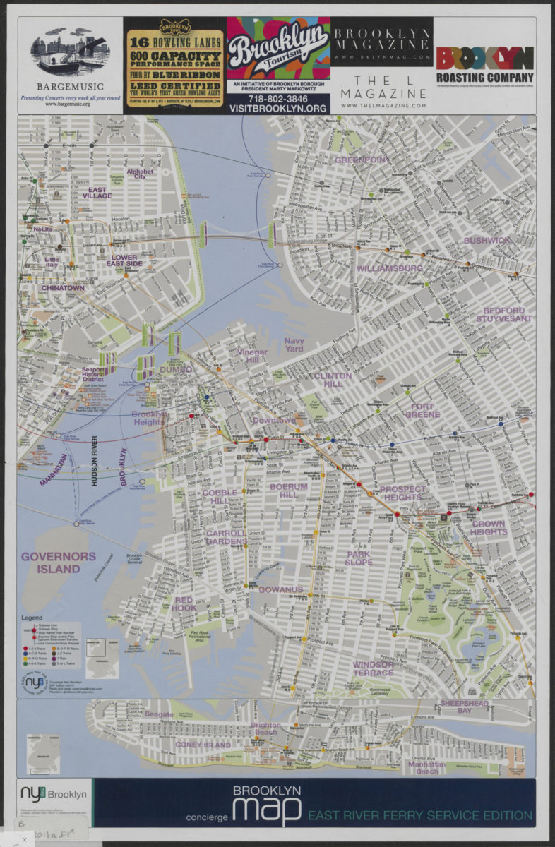
Concierge Brooklyn map: East River Ferry service edition
Concierge Brooklyn map: East River Ferry service edition
[2011; 2011]