Center for Brooklyn History
Map Collections
Search
About
Othmer Library & Archives
Submit search query
Refine 3 records
Clear filters
3
Location
Manhattan (New York, N.Y.)
120
New York (N.Y.)
164
Subject
Exhibitions
5
Local transit
63
Railroads, Elevated
24
Remote sensing
1
Roads
117
Subways
55
Date
20th Century
469
or enter range:
from
to
Genres
Aerial views
15
Remote-sensing maps
1
Tourist maps
55
Transportation maps
120
Sort by:
Date (earliest)
Date (most recent)
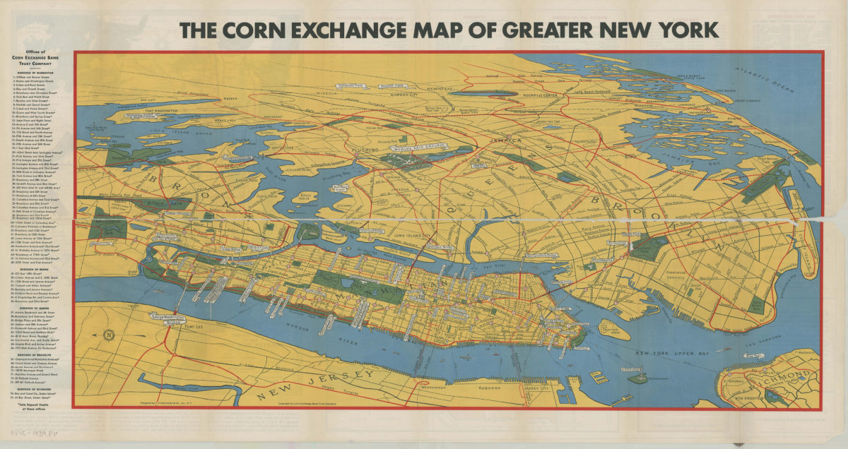
Map of greater New York: New York World’s Fair, 1939: prepared by C.S. Hammond & Co., inc ; copyright by Corn Exchange Bank Trust Company
Map of greater New York: New York World’s Fair, 1939: prepared by C.S. Hammond & Co., inc ; copyright by Corn Exchange Bank Trust Company
[1939]
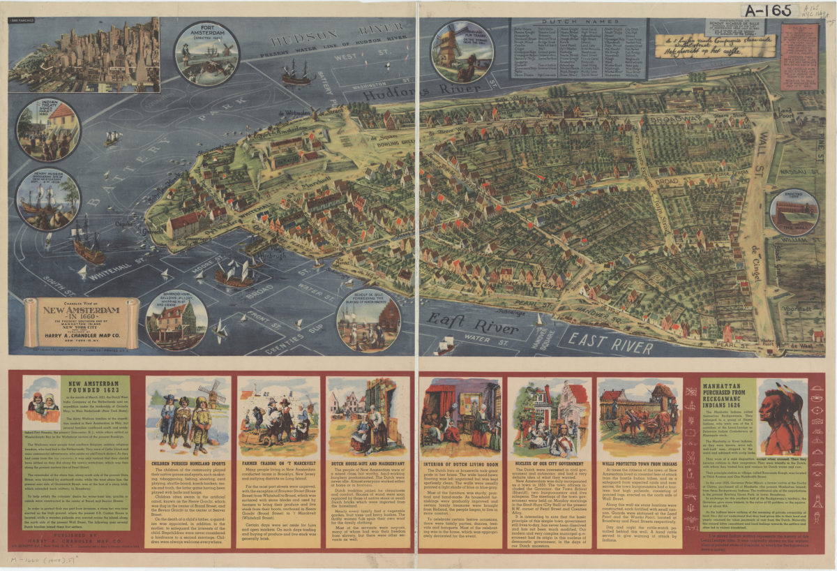
Chandler view of New Amsterdam in 1660: the present southern end of Manhattan Island, New York City
Chandler view of New Amsterdam in 1660: the present southern end of Manhattan Island, New York City
[ca. 1947]
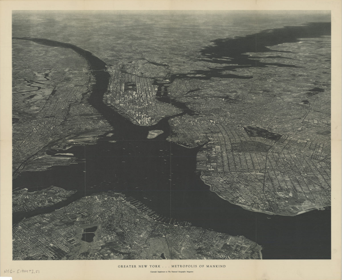
Greater New York, metropolis of mankind
Greater New York, metropolis of mankind
[1954]