Center for Brooklyn History
Map Collections
Search
About
Othmer Library & Archives
Submit search query
Refine 4 records
Clear filters
2
Location
New York (N.Y.)
164
New York (State)
95
New York Harbor (N.Y. and N.J.)
16
Raritan Bay (N.J. and N.Y.)
1
Subject
Bays
5
Railroad terminals
2
Railroads
72
Waterfronts
5
Date
18th Century
12
19th Century
945
20th Century
469
or enter range:
from
to
Genres
Bathymetric maps
94
Cadastral maps
597
Early maps
35
Early works
3
Nautical charts
30
Transportation maps
120
Sort by:
Date (earliest)
Date (most recent)
A plan of the city of New-York & its environs: to Greenwich, on the North or Hudsons River, and to Crown Point, on the East or Sound River, shewing the several streets, publick buildings, docks, fort & battery,
A plan of the city of New-York & its environs: to Greenwich, on the North or Hudsons River, and to Crown Point, on the East or Sound River, shewing the several streets, publick buildings, docks, fort & battery,
1775
New York
New York
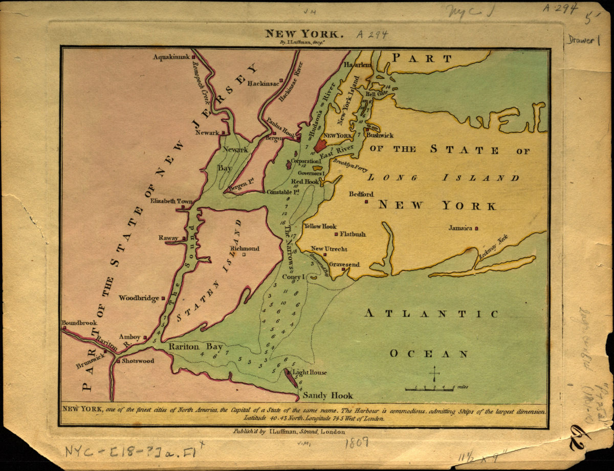
[1809]
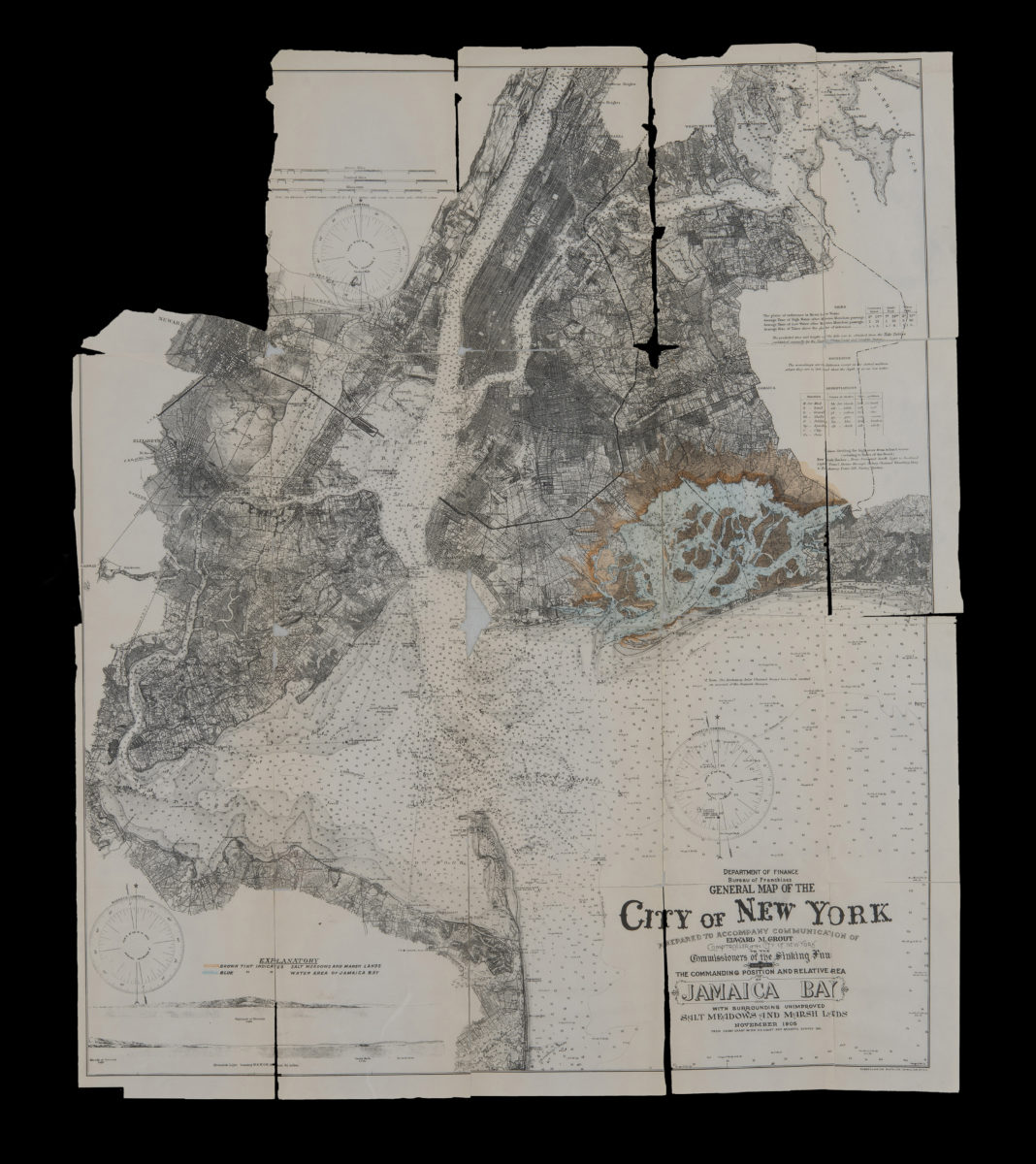
General map of the City of New York: prepared to accompany communication of Edward M. Grout, Comptroller of the City of New York, to the Commissioners of the Sinking Fund showing the commanding position and relative area of Jamaica Bay November 1905
General map of the City of New York: prepared to accompany communication of Edward M. Grout, Comptroller of the City of New York, to the Commissioners of the Sinking Fund showing the commanding position and relative area of Jamaica Bay November 1905
1905
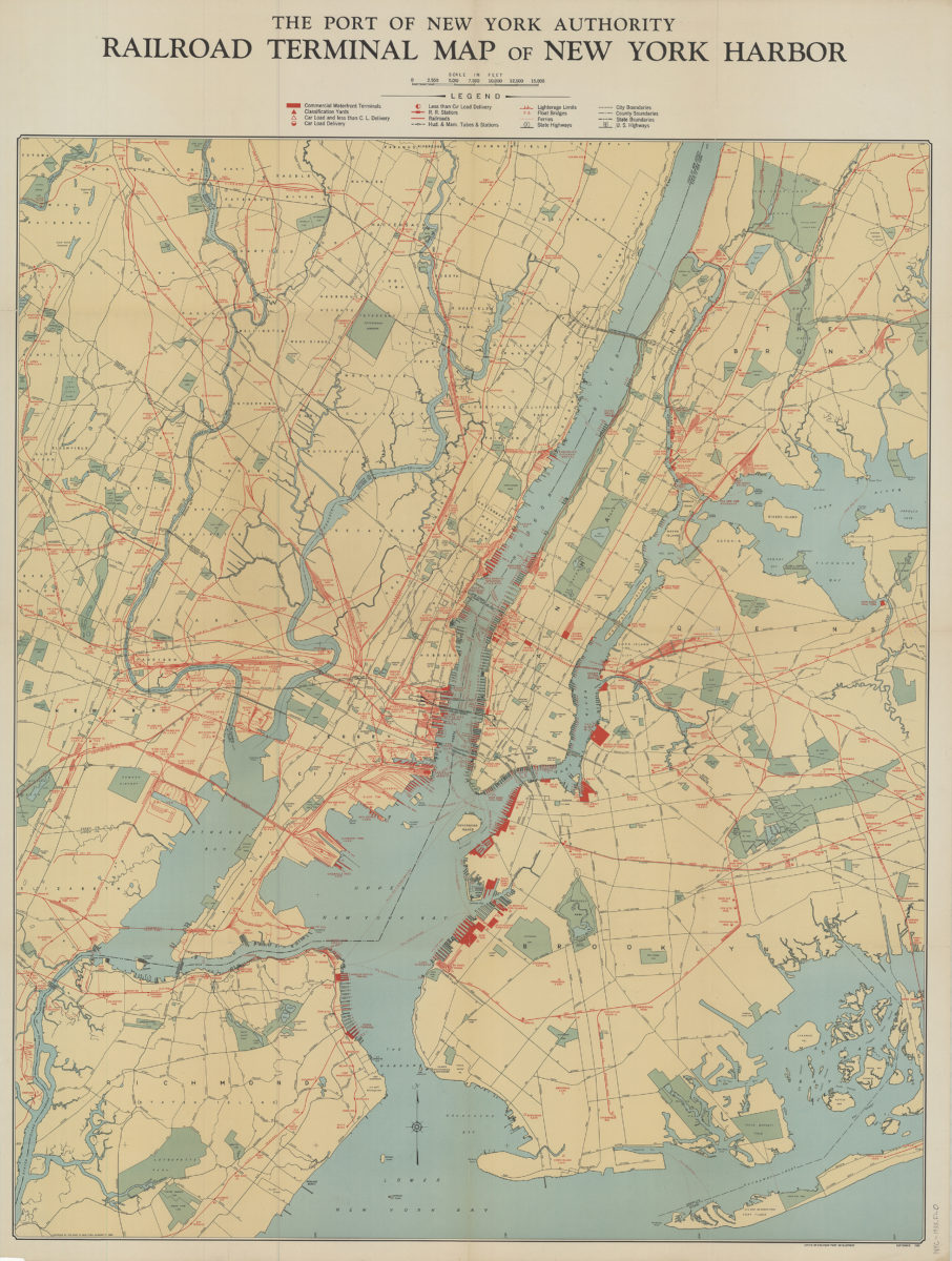
Railroad terminal map of New York Harbor
Railroad terminal map of New York Harbor
[ca. 1933]