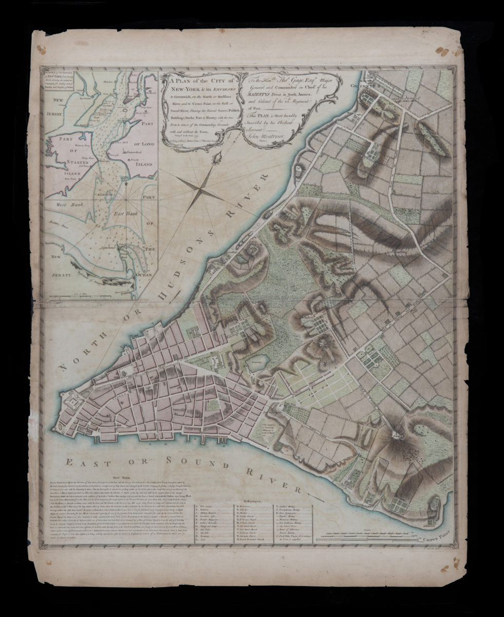
A plan of the city of New-York & its environs: to Greenwich, on the North or Hudsons River, and to Crown Point, on the East or Sound River, shewing the several streets, publick buildings, docks, fort & battery, 1775
Map No. M-1775.Fl.RA
Cadastral map. Covers Manhattan, New York (N.Y.) south of the later Houston Street. Shows existing streets, some buildings, farms, docks, and names of property owners and natural landmarks. Relief shown by hachures. Depths shown by form lines. Dedicated to Major Gen. Thos. Gage. Includes descriptive note, “References,” and inset “A chart of the entrance to New York from Sandy Hook, shewing the properest channel for sailing, with ye banks and depths of water” ca. 1:128,000. N-YHS copy: “Engraved from the original map by John Montrésor for D. T. Valentines manual for 1855 by G. Hayward 120 Water St. N.Y.”
Map area shown
Relation
Full catalog recordSize
65 × 53 cmDownload
Low Resolution Image
Creator
Montrésor, John,Publisher
Brooklyn Historical SocietyCitation
A plan of the city of New-York & its environs: to Greenwich, on the North or Hudsons River, and to Crown Point, on the East or Sound River, shewing the several streets, publick buildings, docks, fort & battery,; 1775, Map Collection, M-1775.Fl.RA; Brooklyn Historical Society.Scale
Scale [ca. 1:6,300]Loading zoom image...