Center for Brooklyn History
Map Collections
Search
About
Othmer Library & Archives
Submit search query
Refine 5 records
Clear filter
1
Location
Brooklyn (New York, N.Y.)
891
Brooklyn Heights (New York, N.Y.)
76
Downtown Brooklyn (New York, N.Y.)
29
Long Island (N.Y.)
197
New York (State)
95
Subject
Bicycle trails
17
Camp sites, facilities, etc
1
Country clubs
1
Golf resorts
1
Greenbelts
1
Parks
35
Pedestrian areas
1
Recreation
5
Roads
117
Waterfronts
5
Date
20th Century
469
21th Century
66
or enter range:
from
to
Genres
Pictorial maps
38
Road maps
83
Tourist maps
55
Sort by:
Date (earliest)
Date (most recent)
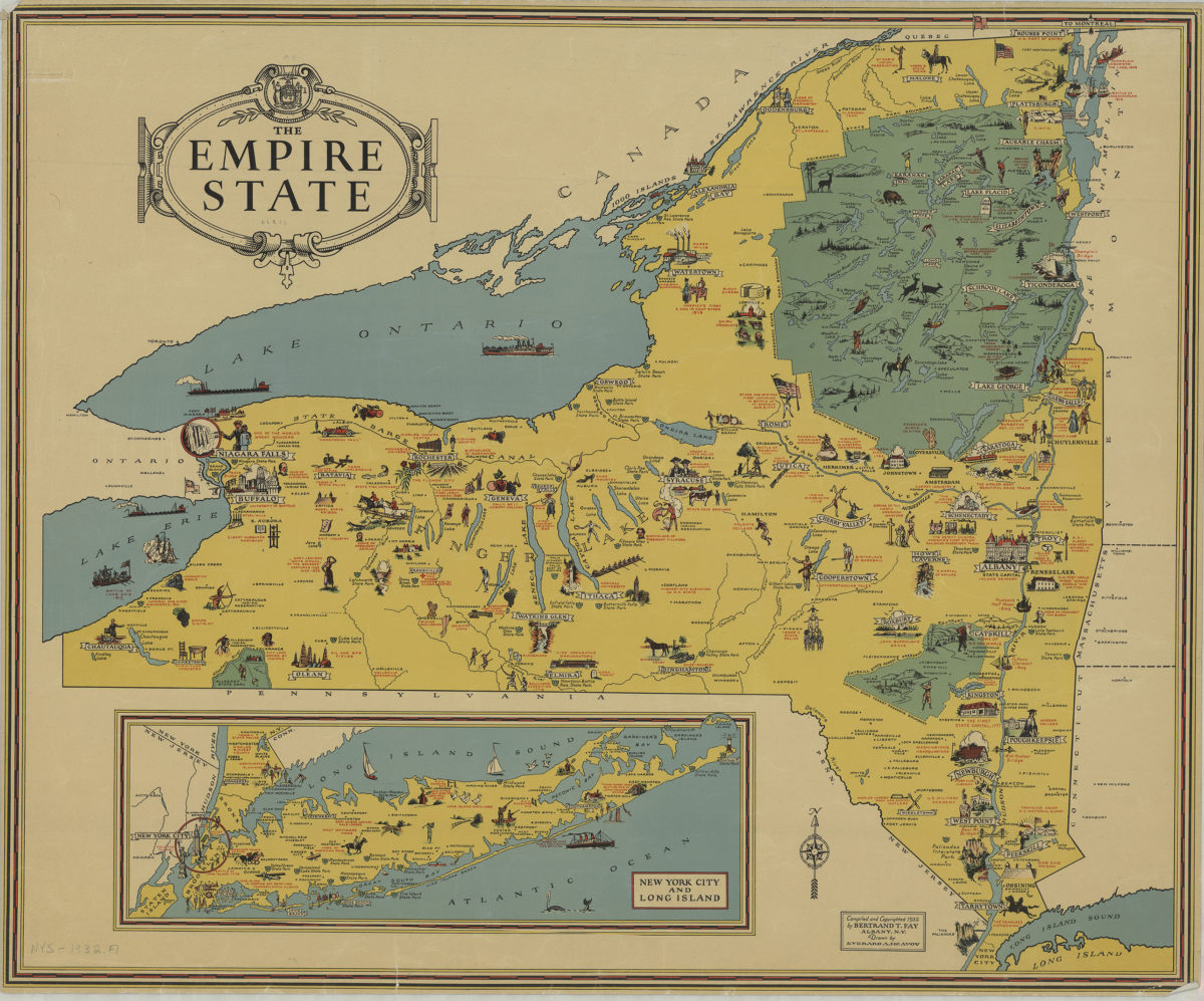
The Empire State: compiled and copyrighted 1932 by Bertrand T. Fay ; drawn by Everard A. McAvoy
The Empire State: compiled and copyrighted 1932 by Bertrand T. Fay ; drawn by Everard A. McAvoy
[1932;1932]
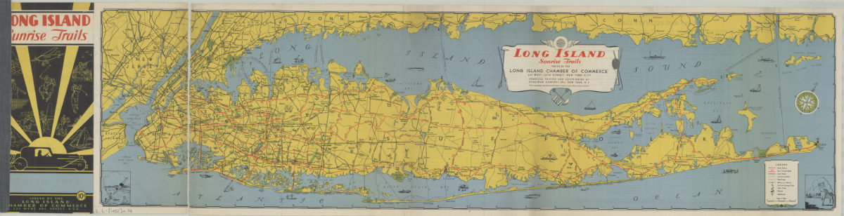
Long Island sunrise trails: issued by the Long Island Chamber of commerce, compiled … by Hagstrom Map Company
Long Island sunrise trails: issued by the Long Island Chamber of commerce, compiled … by Hagstrom Map Company
[1932]
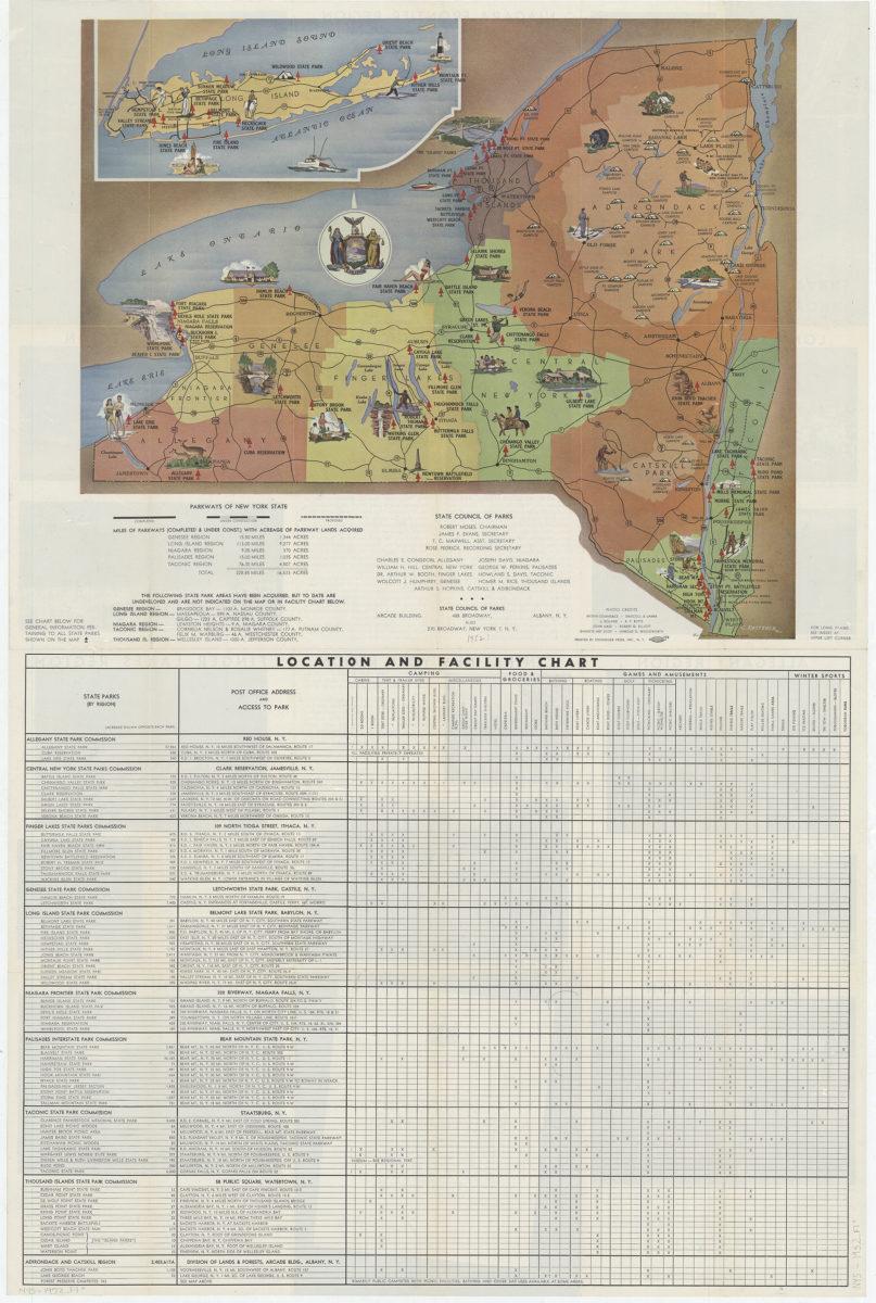
New York state parks: C. Koetzner
New York state parks: C. Koetzner
[195?]
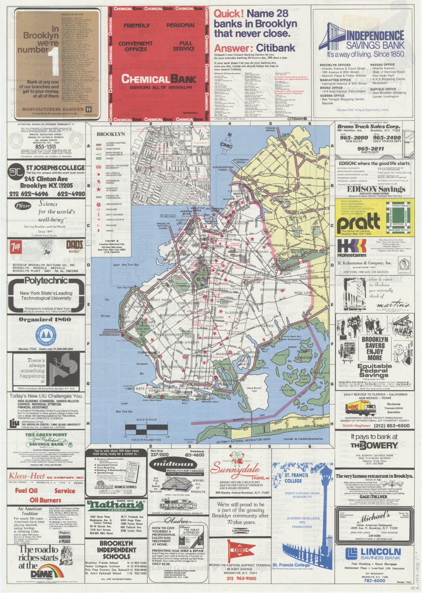
Brooklyn
Brooklyn
1977
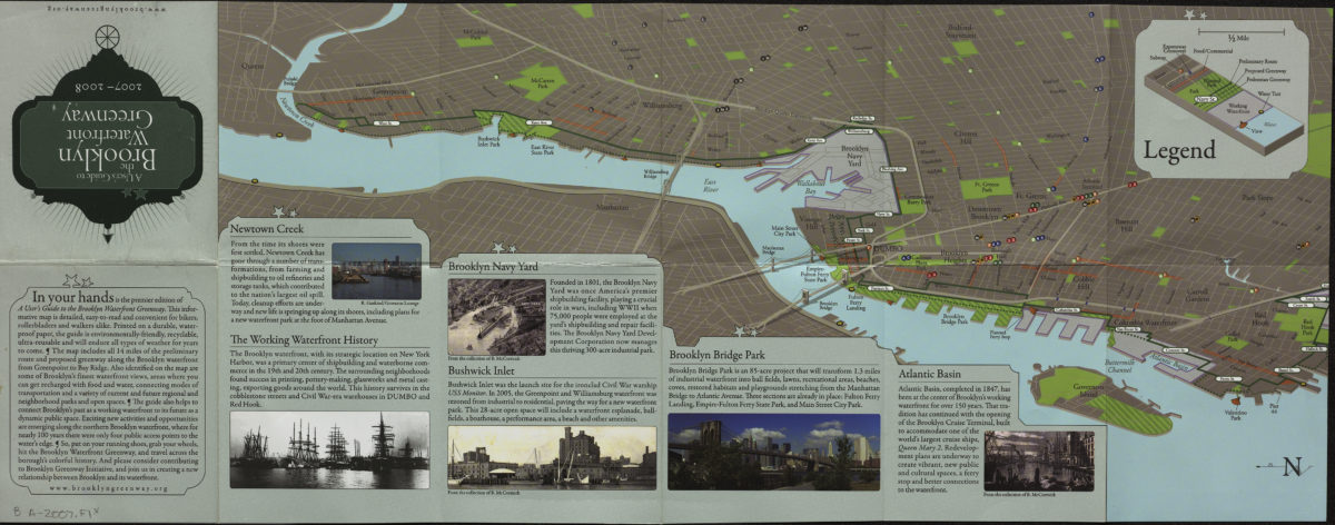
A user’s guide to the Brooklyn waterfront greenway: 2007-2008
A user’s guide to the Brooklyn waterfront greenway: 2007-2008
[2007; 2007]