Center for Brooklyn History
Map Collections
Search
About
Othmer Library & Archives
Submit search query
Refine 4 records
Clear filters
2
Location
Brooklyn (New York, N.Y.)
891
Brownsville (New York, N.Y.)
10
East Flatbush (New York, N.Y.)
23
Flatlands (New York, N.Y.)
19
Flushing (New York, N.Y.)
13
Gravesend (New York, N.Y.)
25
Kings Highway (New York, N.Y.)
1
Long Island (N.Y.)
197
Midwood (New York, N.Y.)
9
Nassau County (N.Y.)
24
Queens (New York, N.Y.)
83
Sheepshead Bay (New York, N.Y.)
13
Subject
Aqueducts
3
Exhibitions
5
ferries
32
Golf courses
2
Highway planning
2
Local transit
63
Ponds
6
Railroads
72
Reservoirs
2
Rivers
16
Roads
117
Subways
55
Transportation
3
Yacht clubs
1
Date
19th Century
945
20th Century
469
or enter range:
from
to
Genres
Aerial views
15
Road maps
83
Statistical maps
8
Thematic maps
60
Tourist maps
55
Sort by:
Date (earliest)
Date (most recent)
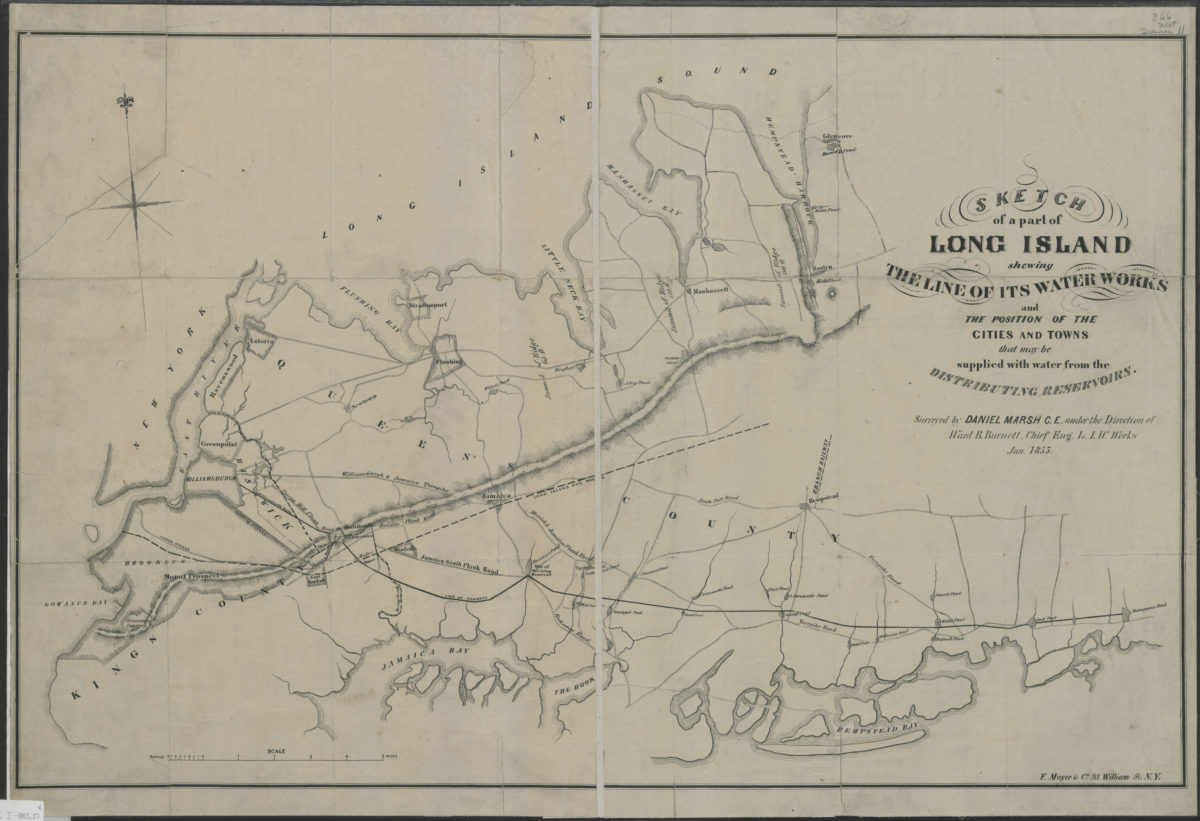
Sketch of a part of Long Island shewing the line of its water works and the position of the cities and towns that may be supplied with water from the distributing reservoirs: surveyed by Daniel Marsh … under the direction of Ward B. Burnett
Sketch of a part of Long Island shewing the line of its water works and the position of the cities and towns that may be supplied with water from the distributing reservoirs: surveyed by Daniel Marsh … under the direction of Ward B. Burnett
January 1853
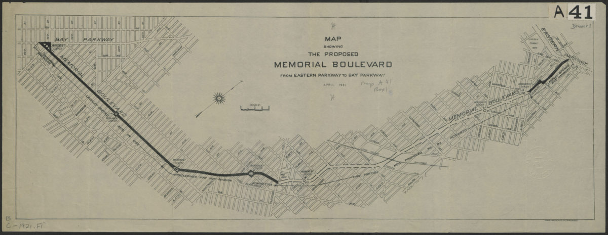
Map showing the proposed Memorial Boulevard from Eastern Parkway to Bay Parkway, April 1921
Map showing the proposed Memorial Boulevard from Eastern Parkway to Bay Parkway, April 1921
[1921]
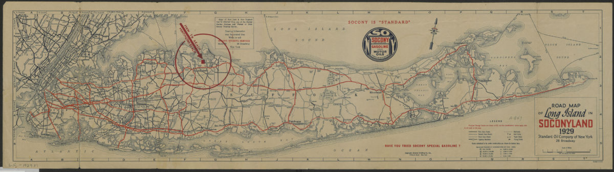
Road map of Long Island in Soconyland, 1929: copyright General Drafting Co., Inc
Road map of Long Island in Soconyland, 1929: copyright General Drafting Co., Inc
[1929]
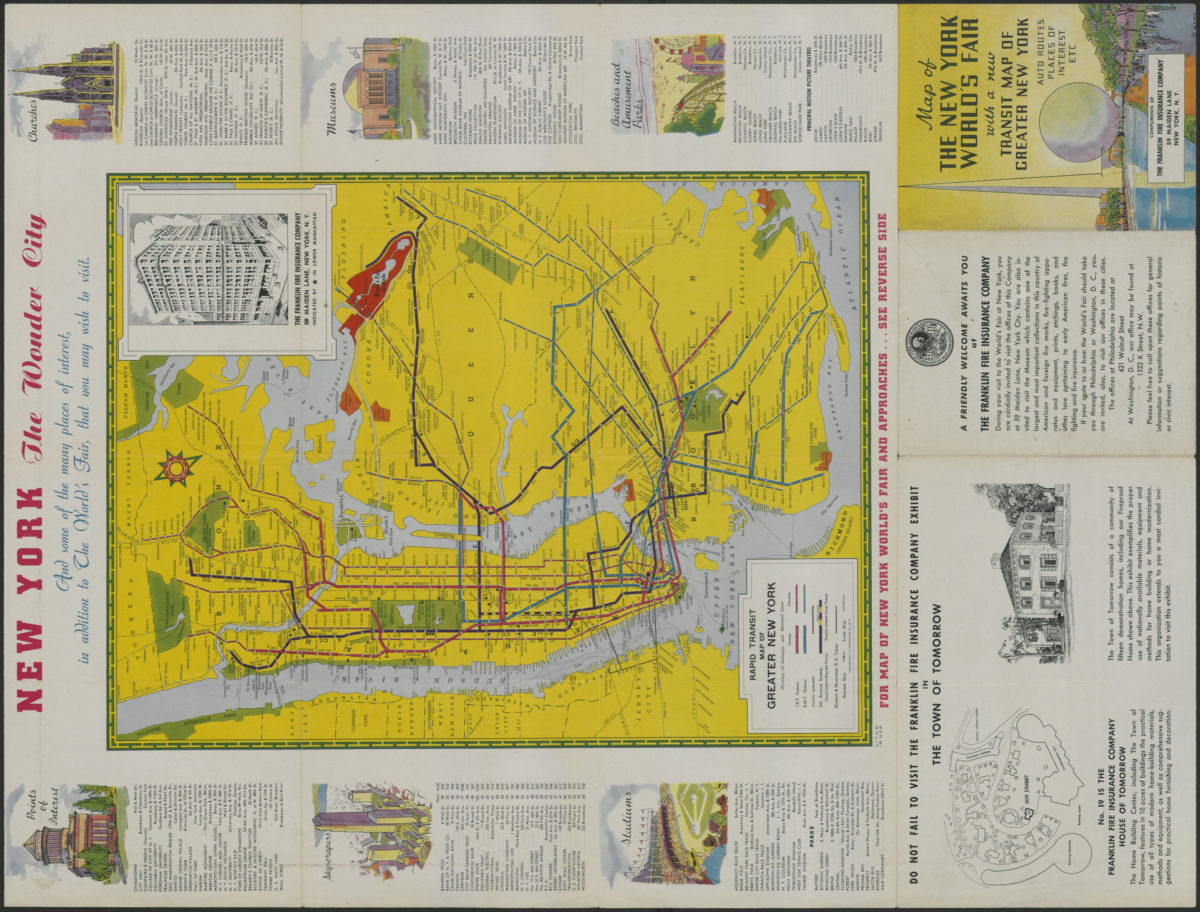
Map of the New York World’s Fair with a new transit map of Greater New York: auto routes, places of interest
Map of the New York World’s Fair with a new transit map of Greater New York: auto routes, places of interest
[1939]