Center for Brooklyn History
Map Collections
Search
About
Othmer Library & Archives
Submit search query
Refine 5 records
Clear filter
1
Location
Brooklyn (New York, N.Y.)
891
Long Island (N.Y.)
197
Subject
Waterworks
5
Wells
2
Date
19th Century
945
20th Century
469
or enter range:
from
to
Genres
Map
191
Public utility maps
15
Thematic maps
60
Zoning maps
55
Sort by:
Date (earliest)
Date (most recent)
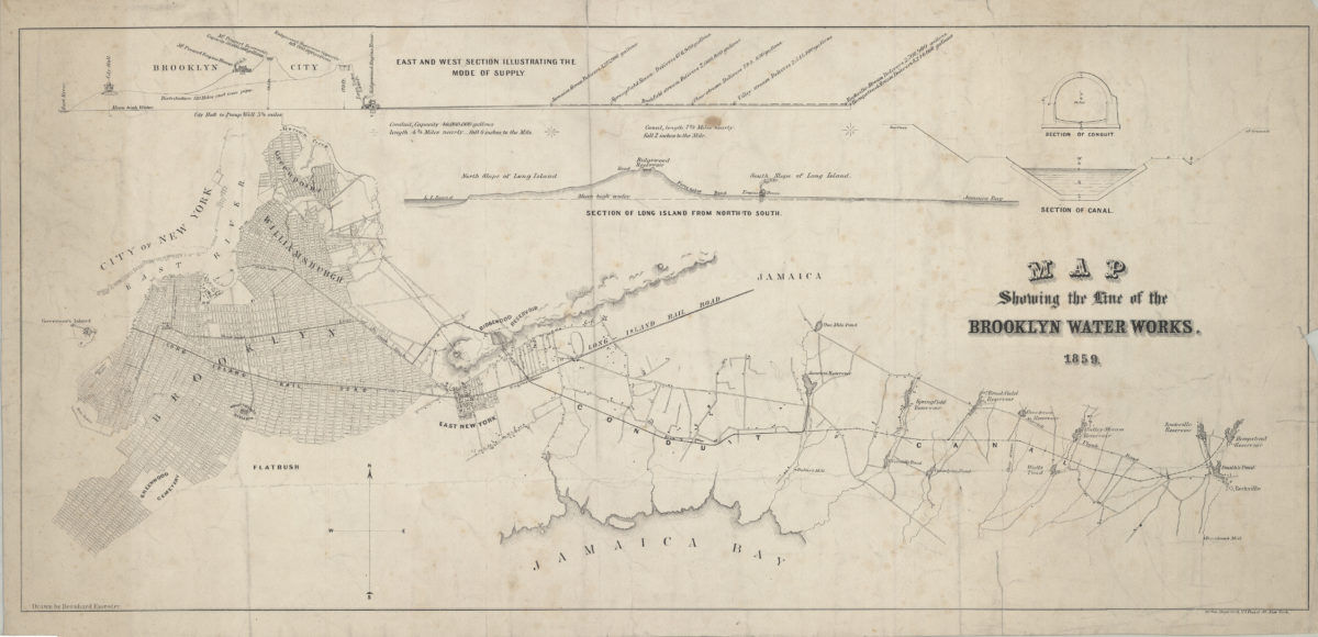
Map showing the line of the Brooklyn Water Works: drawn by Bernhard Essroger
Map showing the line of the Brooklyn Water Works: drawn by Bernhard Essroger
1859
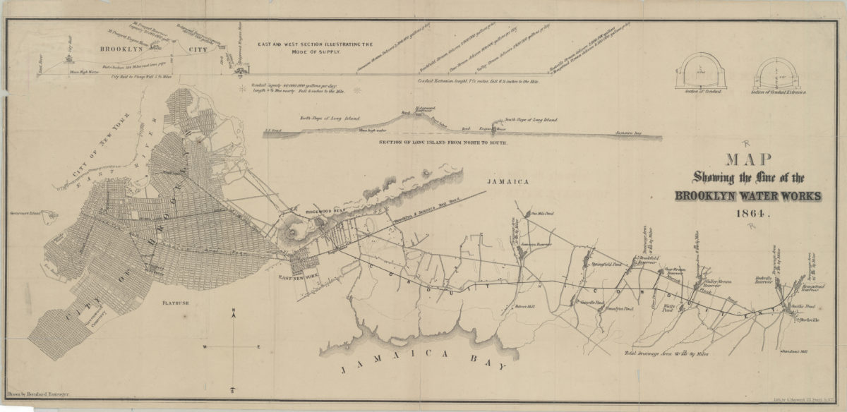
Map showing the line of the Brooklyn Water Works: drawn by Bernhard Essroger
Map showing the line of the Brooklyn Water Works: drawn by Bernhard Essroger
1864
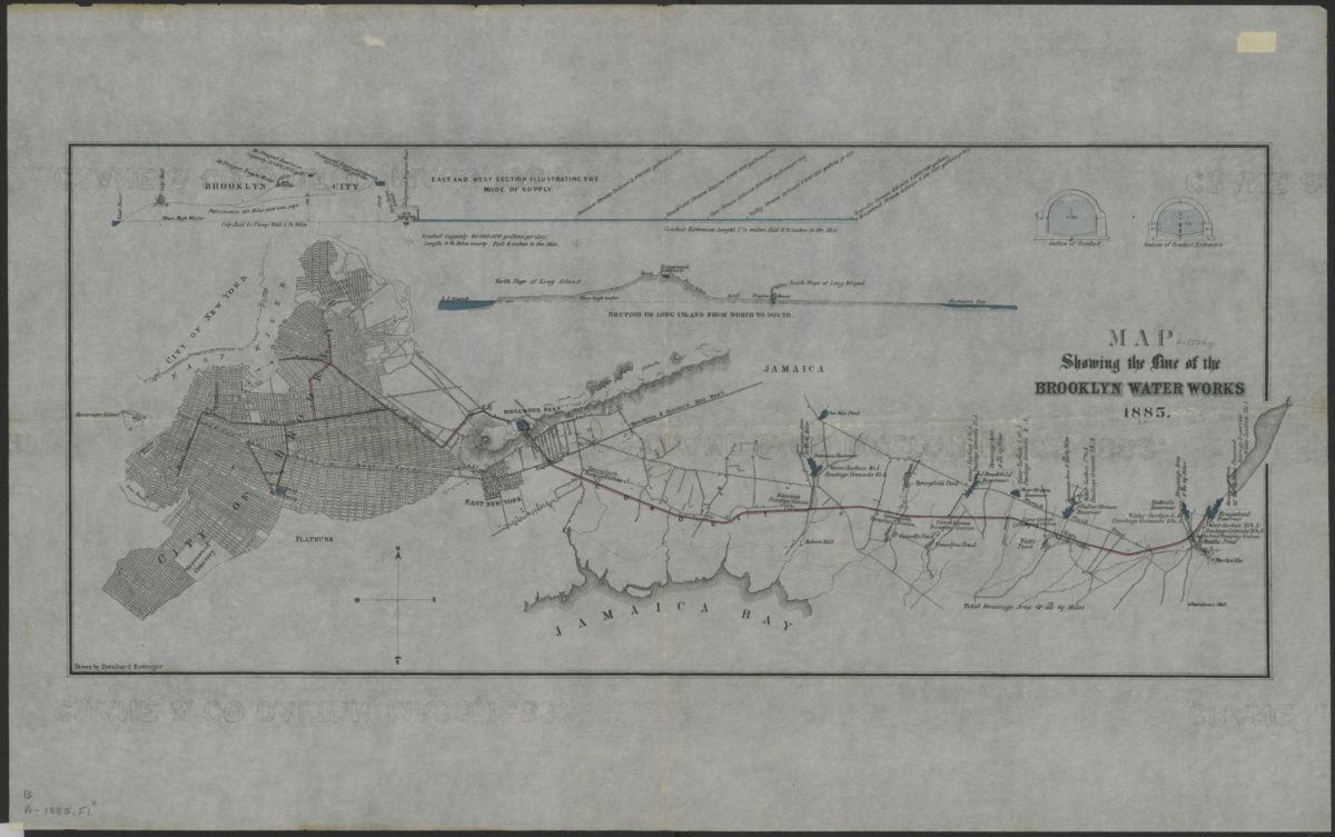
Map showing the line of the Brooklyn Water Works: drawn by Bernhard Essroger
Map showing the line of the Brooklyn Water Works: drawn by Bernhard Essroger
1885
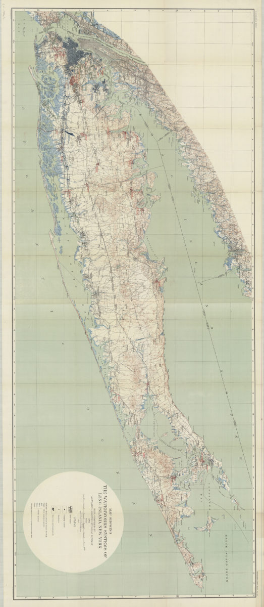
Map showing the waterworks systems of Long Island, New York: data compiled by A.C. Veatch, assisted by Isaiah Bowman, 1904
Map showing the waterworks systems of Long Island, New York: data compiled by A.C. Veatch, assisted by Isaiah Bowman, 1904
1904
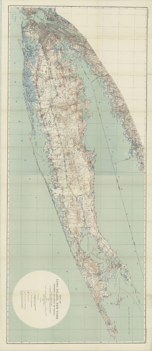
Map of Long Island, New York: showing location of wells: data compiled by A.C. Veatch, assisted by Isaiah Bowman
Map of Long Island, New York: showing location of wells: data compiled by A.C. Veatch, assisted by Isaiah Bowman
1904