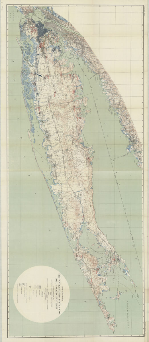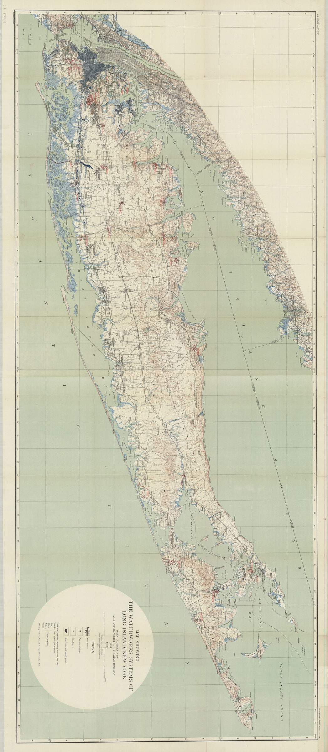
Map showing the waterworks systems of Long Island, New York: data compiled by A.C. Veatch, assisted by Isaiah Bowman, 1904 1904
Map No. L.I.-1904a.Fl
Relief shown by contours and spot heights. Shows water mains, pumping stations, standpipes, and reservoirs and supply ponds. “This map reduced from U.S. Geological Survey atlas sheets.”
Map area shown
Genre
Public utility mapsRelation
Full catalog recordSize
69 × 160 cmDownload
Low Resolution Image
Creator
Veatch, A. C.,Publisher
Brooklyn Historical SocietyCitation
Map showing the waterworks systems of Long Island, New York: data compiled by A.C. Veatch, assisted by Isaiah Bowman, 1904; 1904, Map Collection, L.I.-1904a.Fl; Brooklyn Historical Society.Scale
Scale 1:126,720Loading zoom image...