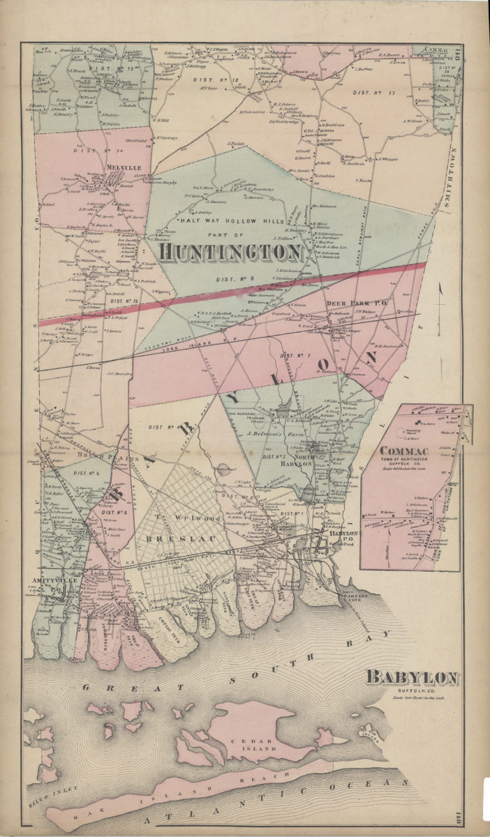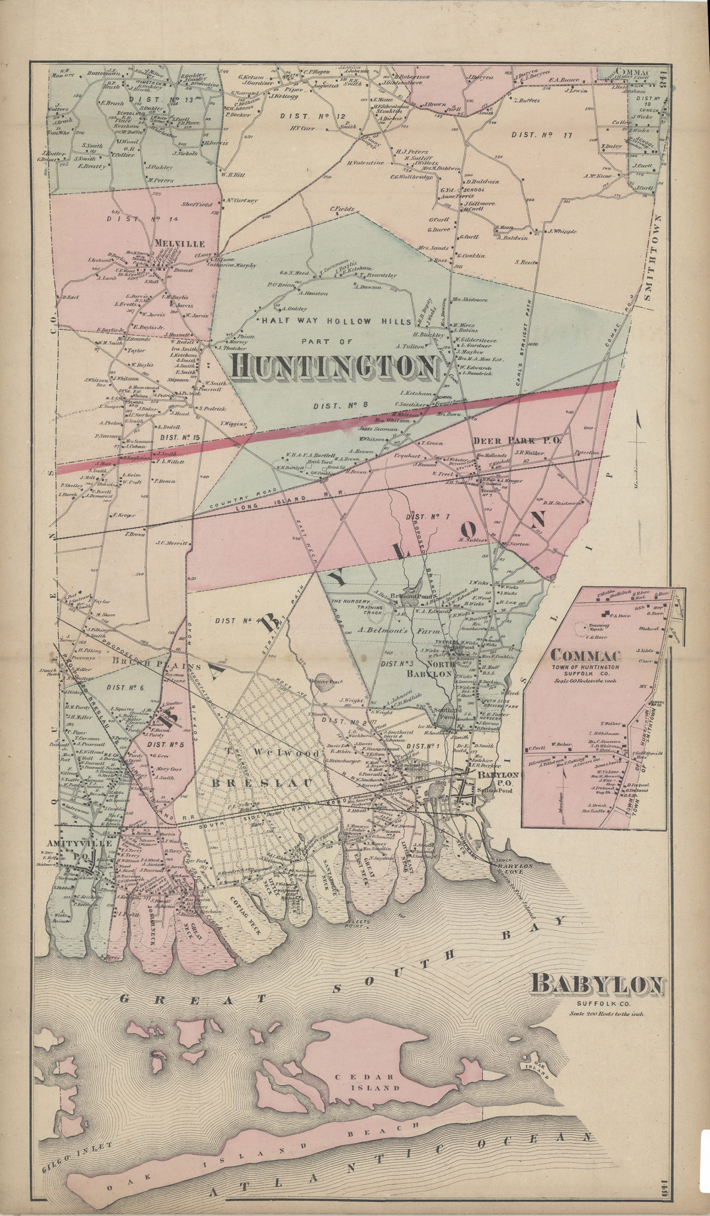

Babylon, Suffolk Co [1873]
Map No. L.I.-[1873].Fl
Covers area east from the Queens County line to Babylon Cove and north to Commac. Shows districts, railroads, training tracks, hotels, schools, public buildings and names of property owners. Extracted from: Atlas of Long Island, New York. New York : Beers, Comstock & Cline, 1873, p. 147-150. Includes inset continuation map. Inset continuation map: Commac, town of Huntington, Suffolk Co. (Scale 1:11,880). On verso: Smithtown (Scale [ca. 1:52,800]) — Smithtown Branch, town of Smithtown (Scale [ca. 1:7,920]) — Smithtown, town of Smithtown, Suffolk Co. (Scale [ca. 1:7,920]) — Babylon, town of Babylon, Suffolk Co. (Scale [ca. 1:5,400]).
Subjects
Places
Map area shown
Genre
Cadastral mapsRelation
Full catalog recordSize
67 × 40 cmDownload
Low Resolution Image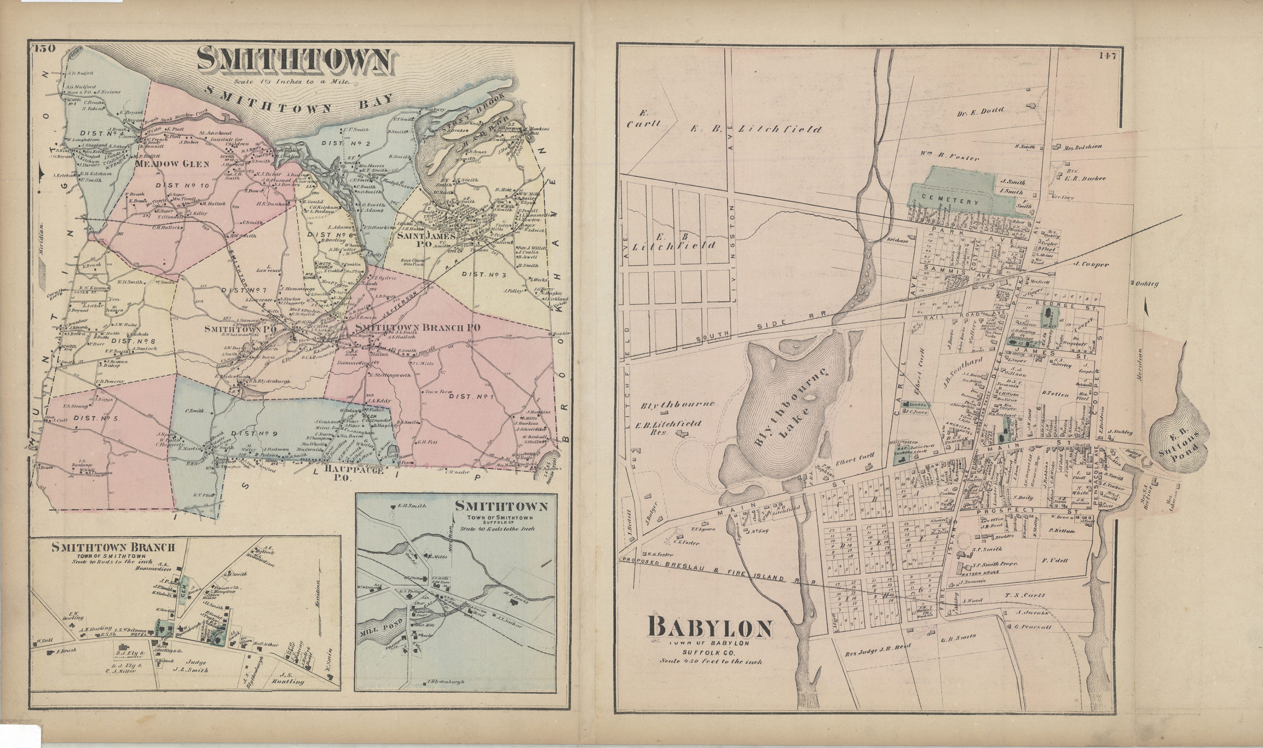
Creator
Beers, F. W.; Beers, Comstock & Cline,Publisher
Brooklyn Historical SocietyCitation
Babylon, Suffolk Co; [1873], Map Collection, L.I.-[1873].Fl; Brooklyn Historical Society.Scale
Scale [1:39,600] 1 in toLoading zoom image...