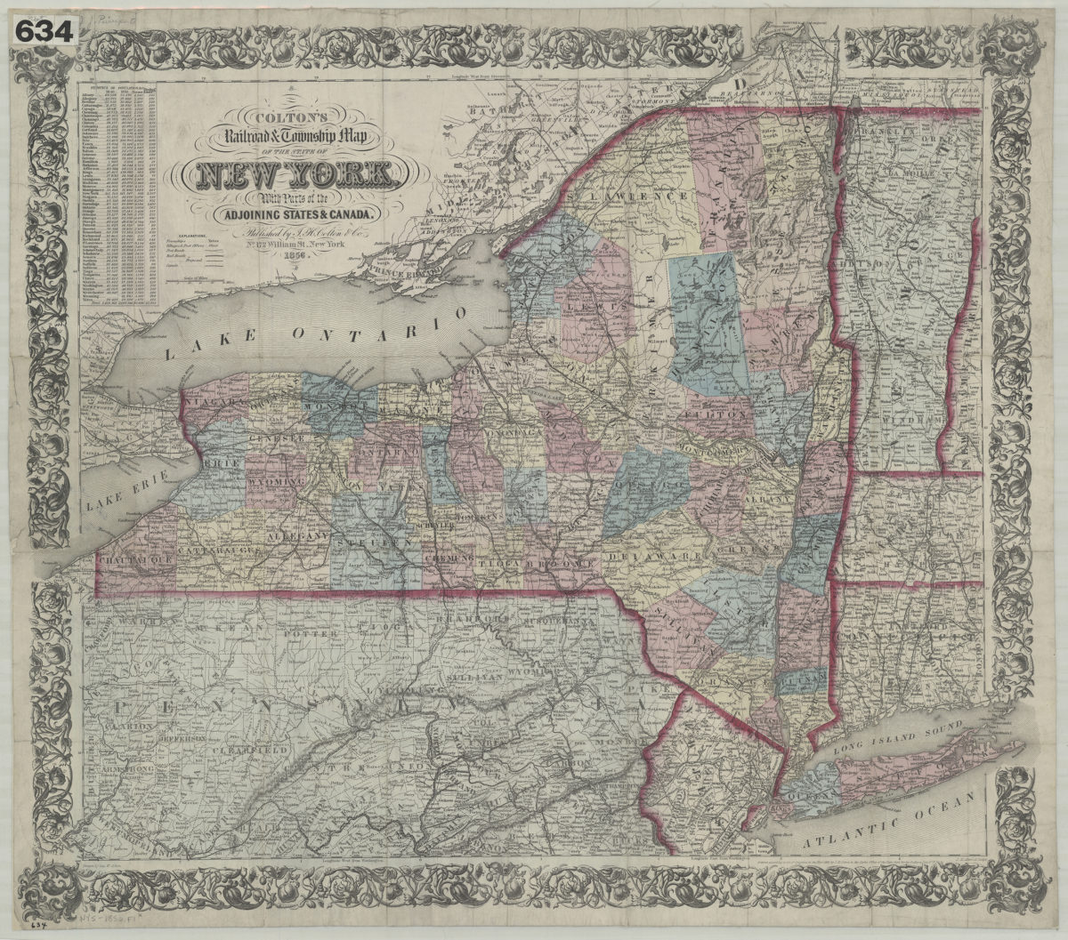
Colton’s railroad & township map of the state of New York: with parts of the adjoining states & Canada: drawn by Geo. W. Colton 1856; [ca. 1852]
Map No. NYS-1856.Fl
Also covers portions of Pennsylvania, New Jersey, Connecticut, Massachusetts, Vermont, New Hampshire, Ontario and Quebec. Shows counties. Relief shown by hachures. Prime meridians: Greenwich and Washington. “Entered according to Act of Congress in … 1852, by J.H. Colton in … the Southern Dist. of N. York.” New York colored by county borders of states outlined in red. Includes population statistics by county, and key explaining symbols for towns, villages and post offices, post roads, existing and proposed railroads, and canals. BHS copy mounted on linen.
Map area shown
Relation
Full catalog recordSize
59 × 72 cmDownload
Low Resolution Image
Creator
Colton, G. Woolworth,Publisher
Brooklyn Historical SocietyCitation
Colton’s railroad & township map of the state of New York: with parts of the adjoining states & Canada: drawn by Geo. W. Colton; 1856; [ca. 1852], Map Collection, NYS-1856.Fl; Brooklyn Historical Society.Scale
Scale: [ca. 1:990,000]Loading zoom image...