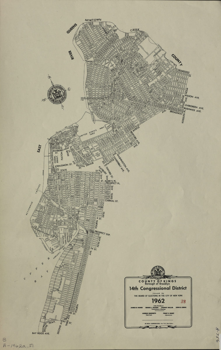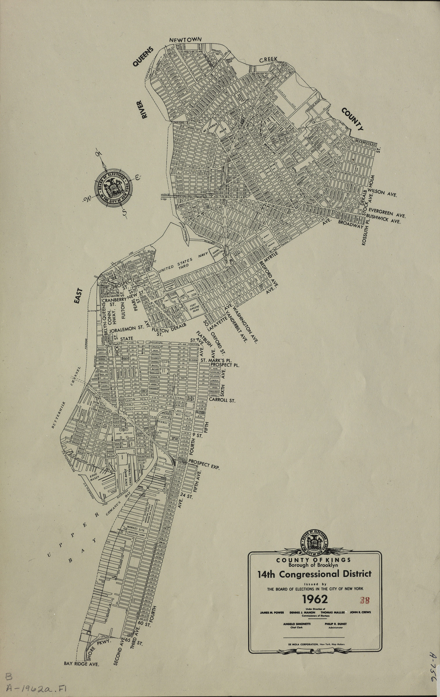
County of Kings, Borough of Brooklyn, 14th Congressional District: issued by the Board of Elections in the City of New York 1962
Map No. B A-1962a.Fl
The 14th Congressional District encompassed parts of the Greenpoint, Williamsburg, Bedford-Stuyvesant, Brooklyn Navy Yard, Clinton Hill, Fort Greene, Downtown Brooklyn, Brooklyn Heights, Cobble Hill, Boerum Hill, Red Hook, Gowanus and Sunset Park neighborhoods.
Subjects
Places
- Bedford-Stuyvesant (New York, N.Y.)
- Boerum Hill (New York, N.Y.)
- Brooklyn (New York, N.Y.)
- Brooklyn Heights (New York, N.Y.)
- Clinton Hill (New York, N.Y.)
- Cobble Hill (New York, N.Y.)
- Downtown Brooklyn (New York, N.Y.)
- Fort Greene (New York, N.Y.)
- Gowanus (New York, N.Y.)
- Greenpoint (New York, N.Y.)
- Red Hook (New York, N.Y.)
- Sunset Park (New York, N.Y.)
- Williamsburg (New York, N.Y.)
Map area shown
Genre
Zoning mapsRelation
Full catalog recordSize
46 × 29 cmDownload
Low Resolution Image
Creator
New York (N.Y.).; Board of Elections,Publisher
Brooklyn Historical SocietyCitation
County of Kings, Borough of Brooklyn, 14th Congressional District: issued by the Board of Elections in the City of New York; 1962, Map Collection, B A-1962a.Fl; Brooklyn Historical Society.Scale
Scale not givenLoading zoom image...