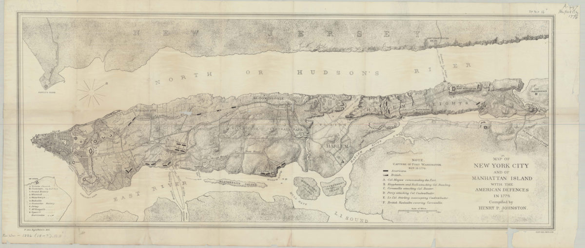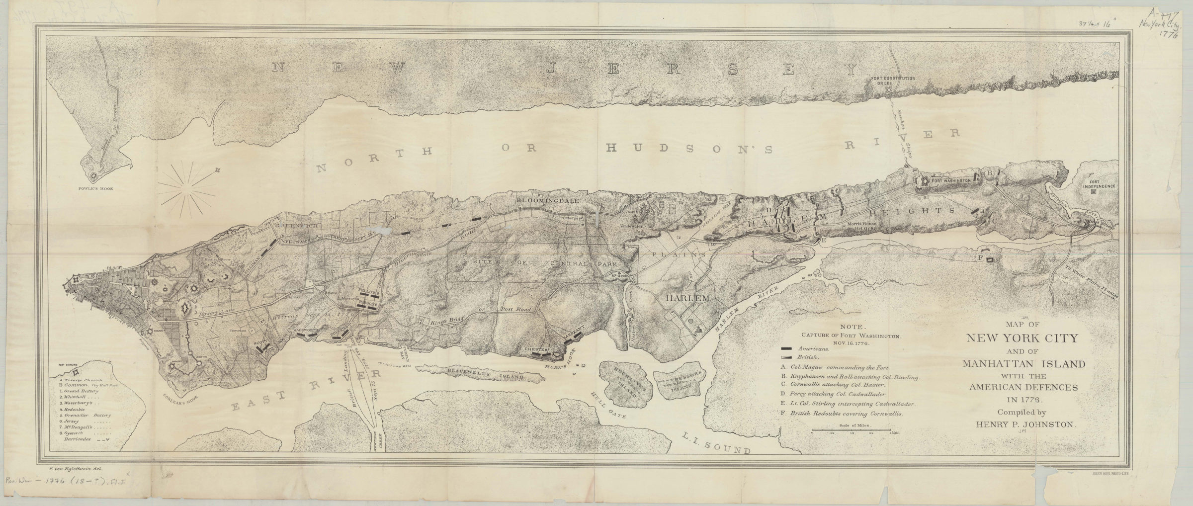
Map of New York City and of Manhattan Island with the American defences in 1776: compiled by Henry P. Johnston ; F. von Egloffstein del [18??]
Map No. Rev. War-1776 (18--?).Fl.Folio
Also covers Blackwell’s Island, Buchanan’s (now Ward’s) Island, Montressor’s (now Randall’s) Island, and a portion of New Jersey. Shows American and British troop movements, forts, batteries, barricades, and sites of action. Does not cover the entirety of Queens, Brooklyn, or Staten Island. Relief shown by hachures. Oriented with north to the upper right. Includes indexes, note and key.
Map area shown
Genre
Military mapsRelation
Full catalog recordSize
34 × 86 cmDownload
Low Resolution Image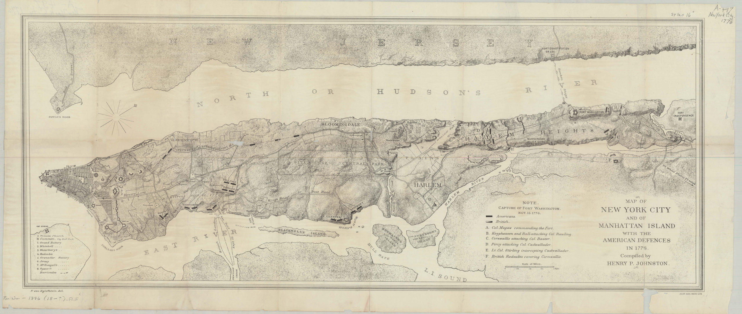
Creator
Johnston, Henry Phelps,Publisher
Brooklyn Historical SocietyCitation
Map of New York City and of Manhattan Island with the American defences in 1776: compiled by Henry P. Johnston ; F. von Egloffstein del; [18??], Map Collection, Rev. War-1776 (18--?).Fl.Folio; Brooklyn Historical Society.Scale
Scale [ca. 1:25,344]Loading zoom image...