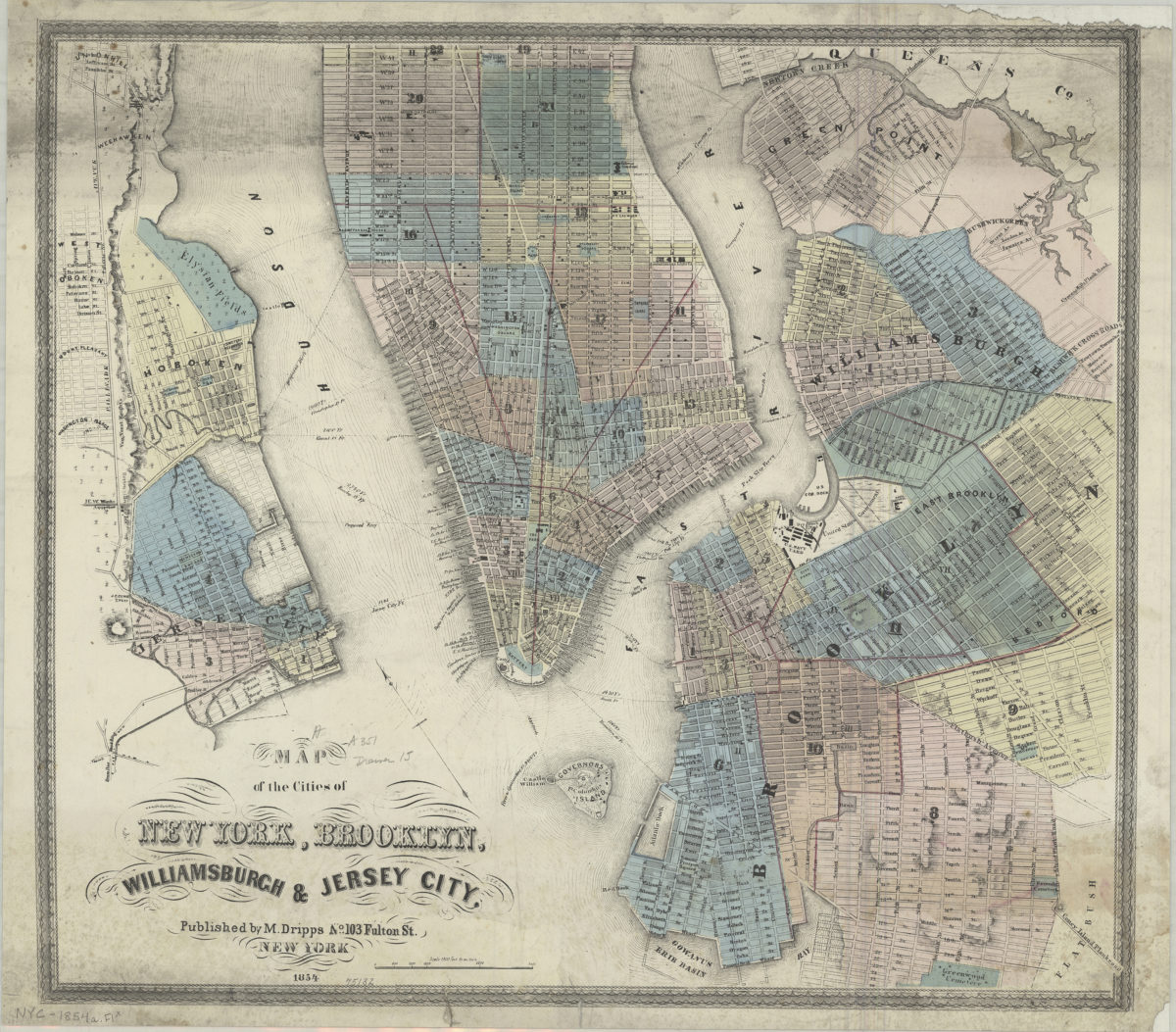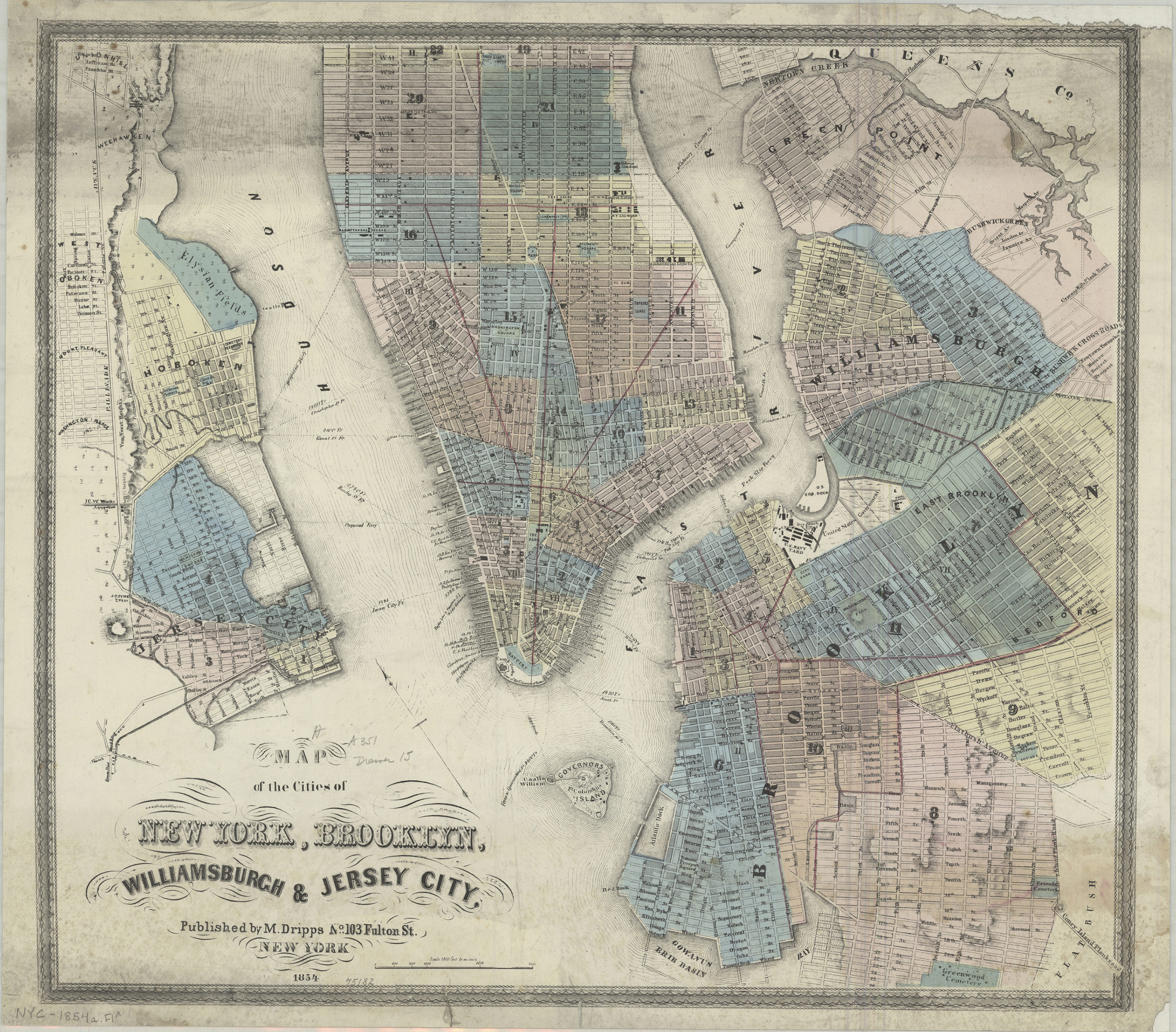
Map of the cities of New York, Brooklyn, Williamsburgh & Jersey City 1854
Map No. NYC-1854a.Fl c.2
Covers Manhattan north to 42nd St. and Brooklyn south to Greenwood Cemetery. Shows wards, piers, and ferry lines. Relief shown by hachures. Oriented with north to the upper left. Cover title appears in gilt on front of map cover. BHS copy missing cover, mounted on linen.
Subjects
Places
Map area shown
Genre
MapRelation
Full catalog recordSize
47 × 54 cmDownload
Low Resolution Image
Creator
Dripps, M.,Publisher
Brooklyn Historical SocietyCitation
Map of the cities of New York, Brooklyn, Williamsburgh & Jersey City; 1854, Map Collection, NYC-1854a.Fl c.2; Brooklyn Historical Society.Scale
Scale [1:21,600] 1 in toLoading zoom image...