New York (U-9) sectional aeronautical chart: compiled and printed at Washington D.C. by the U.S. Coast and Geodetic Survey 1940
Map No. NYS-1940.FL.O
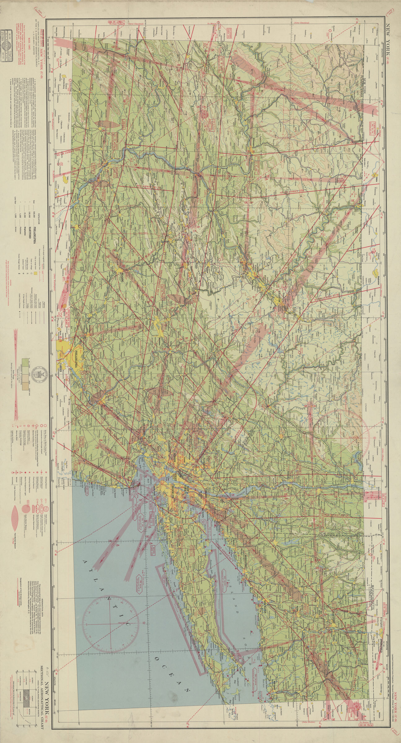
Shows New York City region, New Jersey north from Lakehurst, Connecticut, and most of Pennsylvania. Relief shown by contours, spot heights, and gradient tints. Includes text, index to air markers, and index diagram to adjoining sheets. “Mar. 1940.”
Map area shown
Genre
MapRelation
Full catalog recordSize
52 × 108 cmDownload
Low Resolution Image
Creator
U.S. Coast and Geodetic Survey,Publisher
Brooklyn Historical SocietyCitation
New York (U-9) sectional aeronautical chart: compiled and printed at Washington D.C. by the U.S. Coast and Geodetic Survey; 1940, Map Collection, NYS-1940.FL.O; Brooklyn Historical Society.Scale
Scale [ca. 1:500,000]Loading zoom image... 