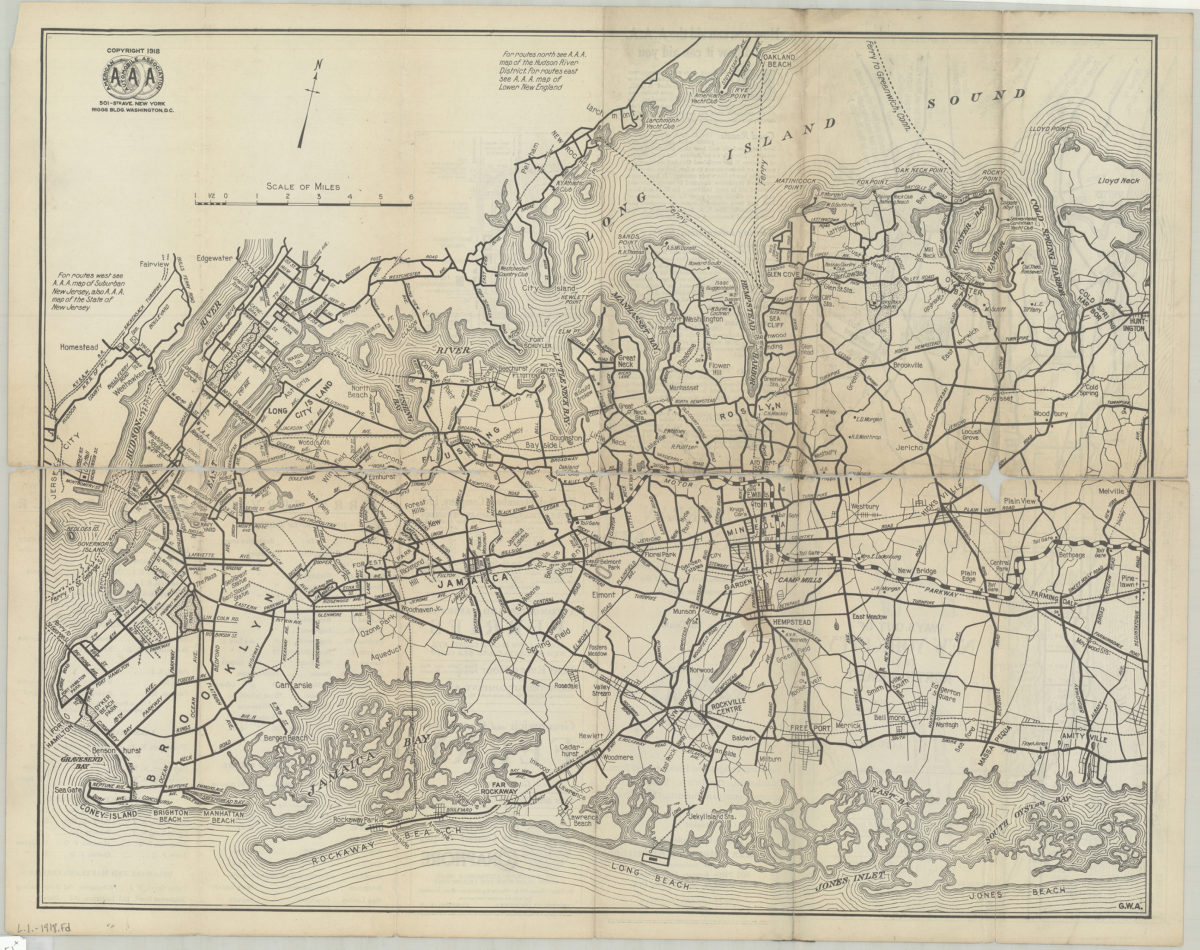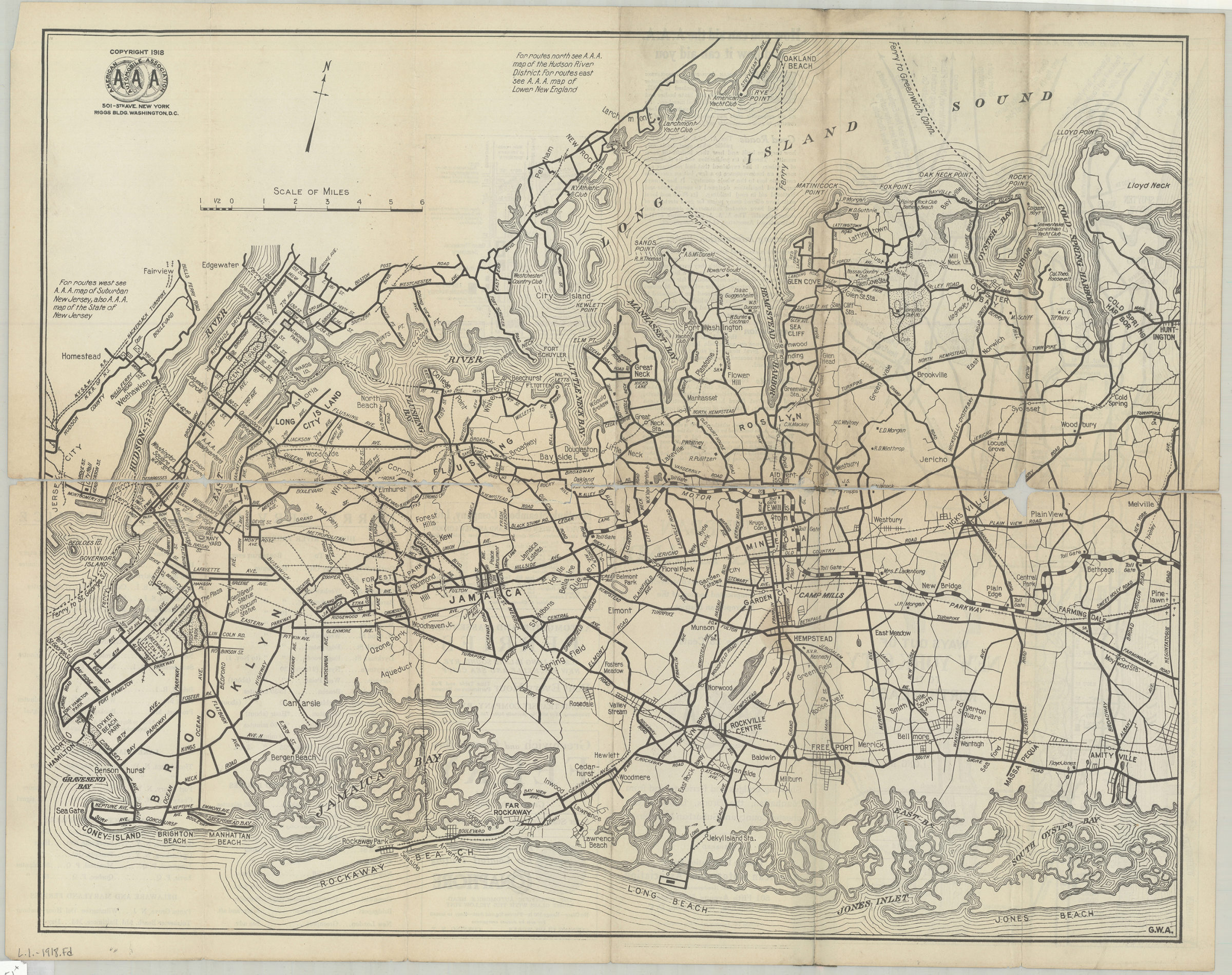
Suburban Long Island: detail of routes in a heavily-traveled and complicated section of the metropolitan district, showing bridges and ferries to and from Manhattan, the Bronx, Lower Westchester County and Suburban New Jersey [ca. 1918]
Map No. L.I.-1918.Fl
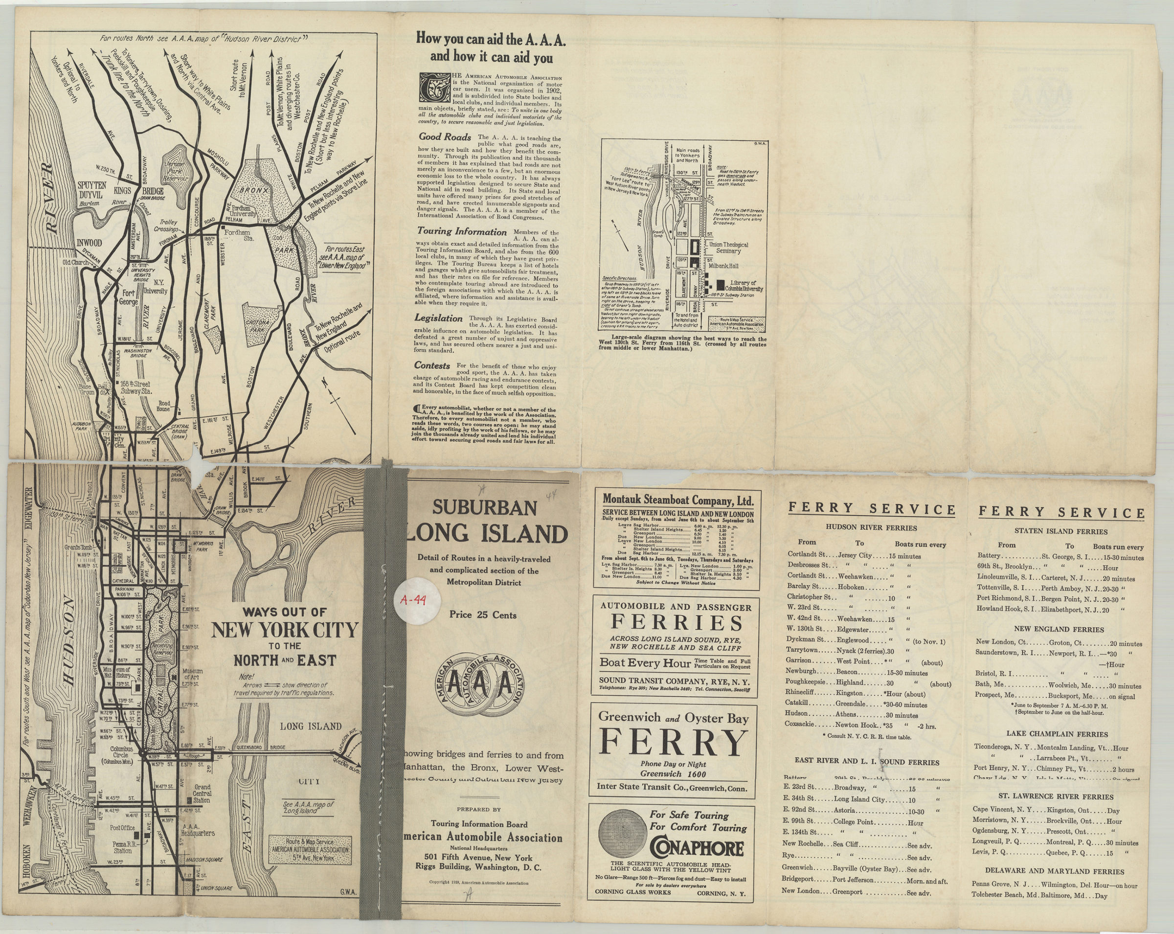
Panel title. “G.W.A.” Includes notes and AAA emblem. On verso: text, advertisements, guide to ferry service, and two ancillary maps: Ways out of New York City to the north and east — Large-scale diagram showing the best ways to reach the West 130th Street ferry from 116th Street.
Map area shown
Relation
Full catalog recordSize
45 × 57 cmDownload
Low Resolution Image
Creator
American Automobile Association,Publisher
Brooklyn Historical SocietyCitation
Suburban Long Island: detail of routes in a heavily-traveled and complicated section of the metropolitan district, showing bridges and ferries to and from Manhattan, the Bronx, Lower Westchester County and Suburban New Jersey; [ca. 1918], Map Collection, L.I.-1918.Fl; Brooklyn Historical Society.Scale
Scale [ca. 1:100,000]Loading zoom image...