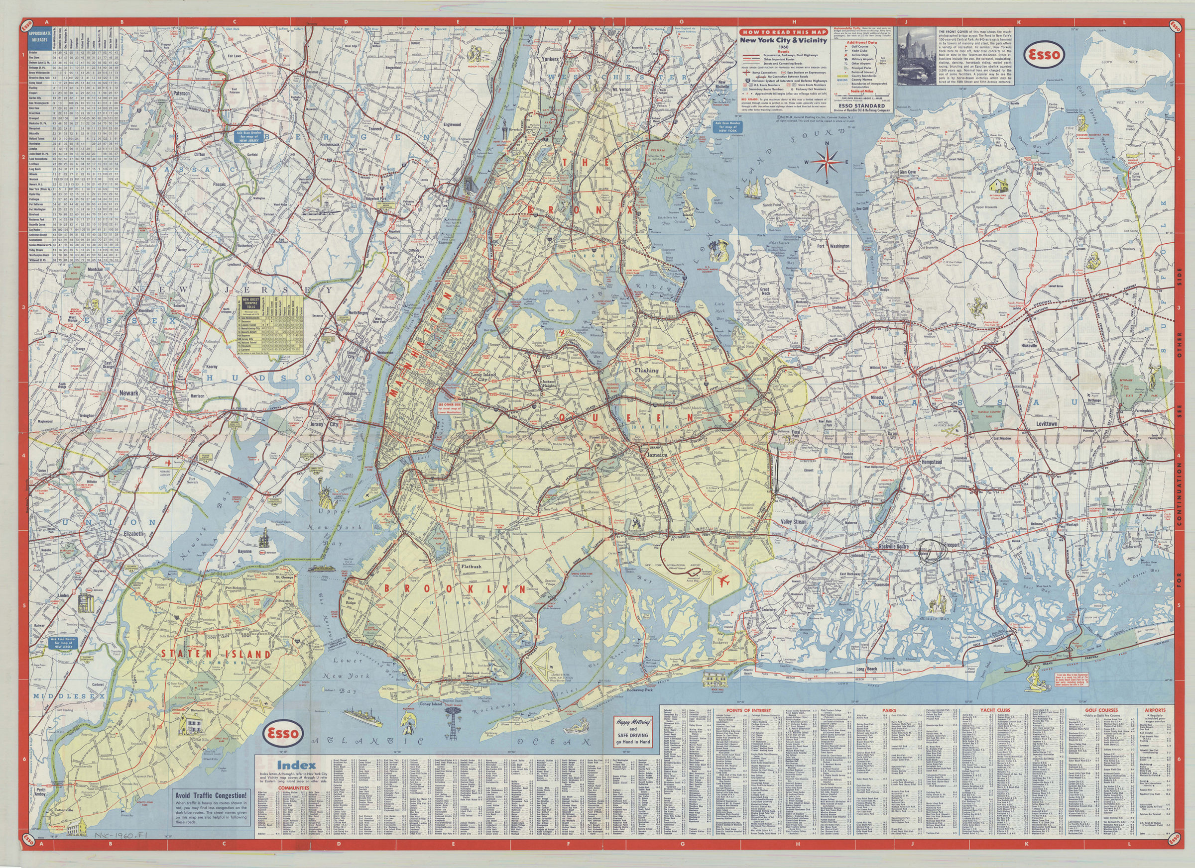
New York City & vicinity,1960: General Drafting Company ; [prepared for] Esso Standard 1960
Map No. NYC-1960.Fl
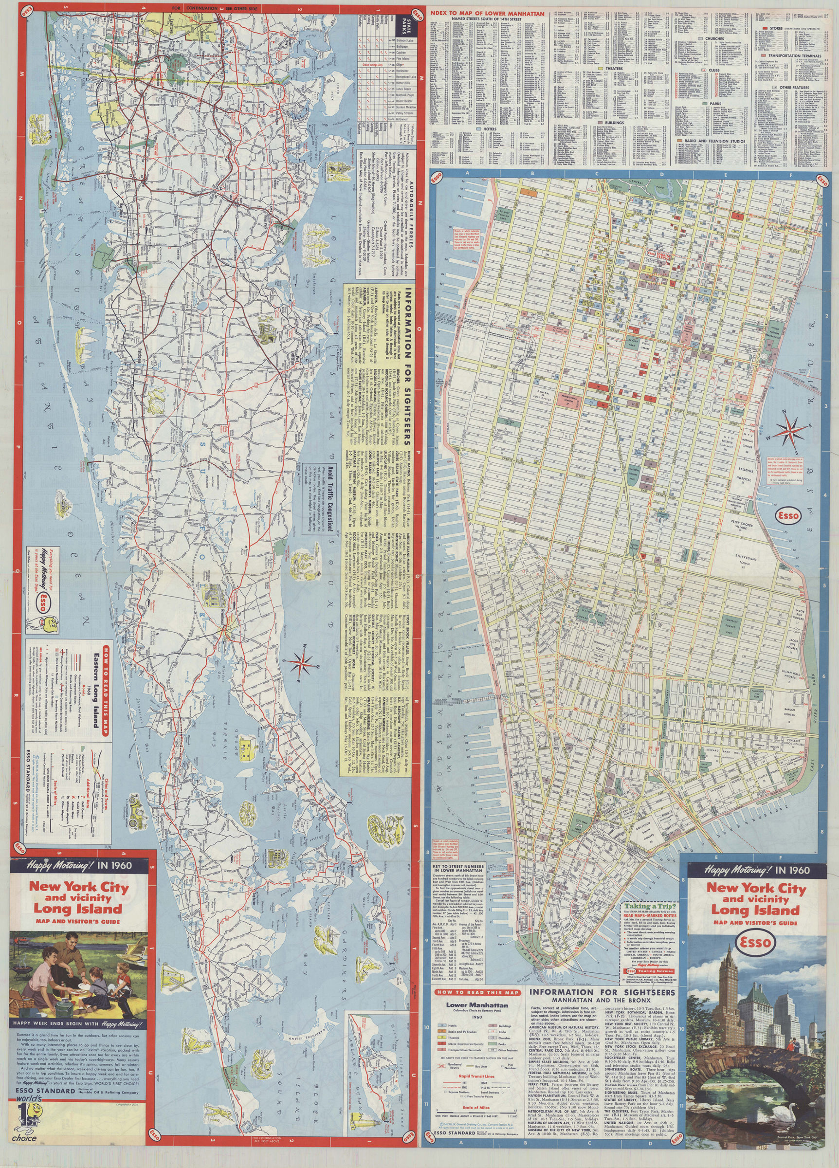
Road map covers New York Metropolitan area, including portions of New Jersey, Westchester County, and western Long Island. Index to streets, communities, and points of interest. Includes mileage chart. Maps on verso: Eastern Long Island — Lower Manhattan, Columbus Circle to Battery Park. Also on verso: index, state parks table, text, and panel.
Subjects
Places
Map area shown
Genre
Road mapsRelation
Full catalog recordSize
61 × 85 cmDownload
Low Resolution Image
Creator
General Drafting Company,Publisher
Brooklyn Historical SocietyCitation
New York City & vicinity,1960: General Drafting Company ; [prepared for] Esso Standard; 1960, Map Collection, NYC-1960.Fl; Brooklyn Historical Society.Scale
Scale 1:166,000Loading zoom image... 