Center for Brooklyn History
Map Collections
Search
About
Othmer Library & Archives
Submit search query
Refine 3 records
Clear filters
3
Location
Brooklyn (New York, N.Y.)
891
New York (N.Y.)
164
New York (State)
95
New York Harbor (N.Y. and N.J.)
16
Subject
Long Island, Battle of, New York, N.Y. , 1776
7
Date
18th Century
12
or enter range:
from
to
Genres
Cadastral maps
597
Early maps
35
Early works
3
Military maps
23
Sort by:
Date (earliest)
Date (most recent)
A plan of the city of New-York & its environs: to Greenwich, on the North or Hudsons River, and to Crown Point, on the East or Sound River, shewing the several streets, publick buildings, docks, fort & battery,
A plan of the city of New-York & its environs: to Greenwich, on the North or Hudsons River, and to Crown Point, on the East or Sound River, shewing the several streets, publick buildings, docks, fort & battery,
1775
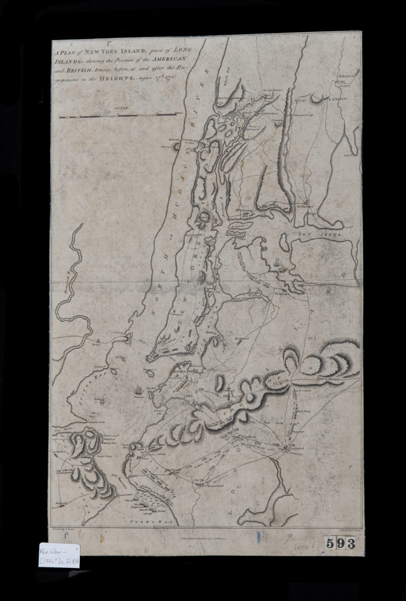
A plan of New York Island, part of Long Island &c., shewing the position of the American and British armies before, at, and after the Engagement on the Heights, August 27th, 1776: drawn by S. Lewis
A plan of New York Island, part of Long Island &c., shewing the position of the American and British armies before, at, and after the Engagement on the Heights, August 27th, 1776: drawn by S. Lewis
[1776]
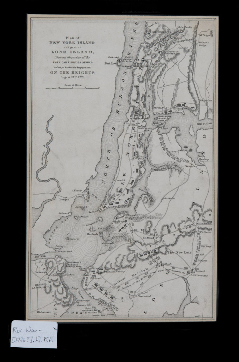
Plan of New York Island and part of Long Island, showing the position of the American & British armies before, at, & after the Engagement on the Heights, August 27th, 1776
Plan of New York Island and part of Long Island, showing the position of the American & British armies before, at, & after the Engagement on the Heights, August 27th, 1776
[1776]