Center for Brooklyn History
Map Collections
Search
About
Othmer Library & Archives
Submit search query
Refine 4 records
Clear filters
2
Location
New York (N.Y.)
164
New York (State)
95
New York Bight (N.J. and N.Y.)
1
New York Harbor (N.Y. and N.J.)
16
New York Region
5
Subject
Harbors
11
Date
18th Century
12
or enter range:
from
to
Genres
Bathymetric maps
94
Cadastral maps
597
Early maps
35
Early works
3
Nautical charts
30
Sort by:
Date (earliest)
Date (most recent)
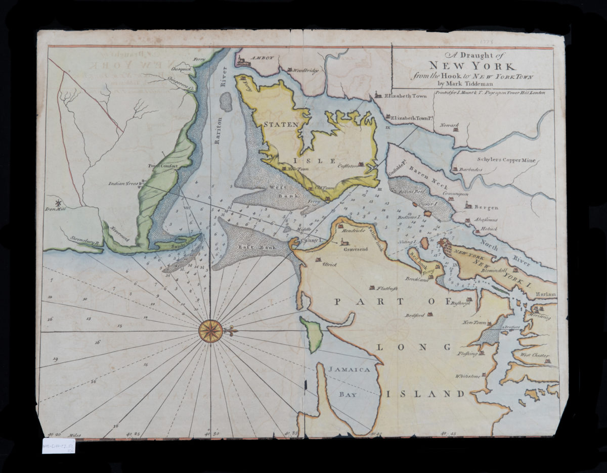
A draught of New York from the Hook to New York Town: by Mark Tiddeman
A draught of New York from the Hook to New York Town: by Mark Tiddeman
[1773-1780]
A plan of the city of New-York & its environs: to Greenwich, on the North or Hudsons River, and to Crown Point, on the East or Sound River, shewing the several streets, publick buildings, docks, fort & battery,
A plan of the city of New-York & its environs: to Greenwich, on the North or Hudsons River, and to Crown Point, on the East or Sound River, shewing the several streets, publick buildings, docks, fort & battery,
1775
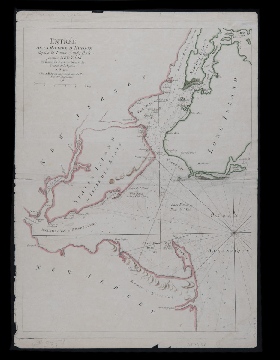
Entrée de la riviere d’Hudson depuis la Pointe Sandy Hook jusqu’a New York, les bancs, les sondes, les guides &c.: traduit de l’Anglais
Entrée de la riviere d’Hudson depuis la Pointe Sandy Hook jusqu’a New York, les bancs, les sondes, les guides &c.: traduit de l’Anglais
1778
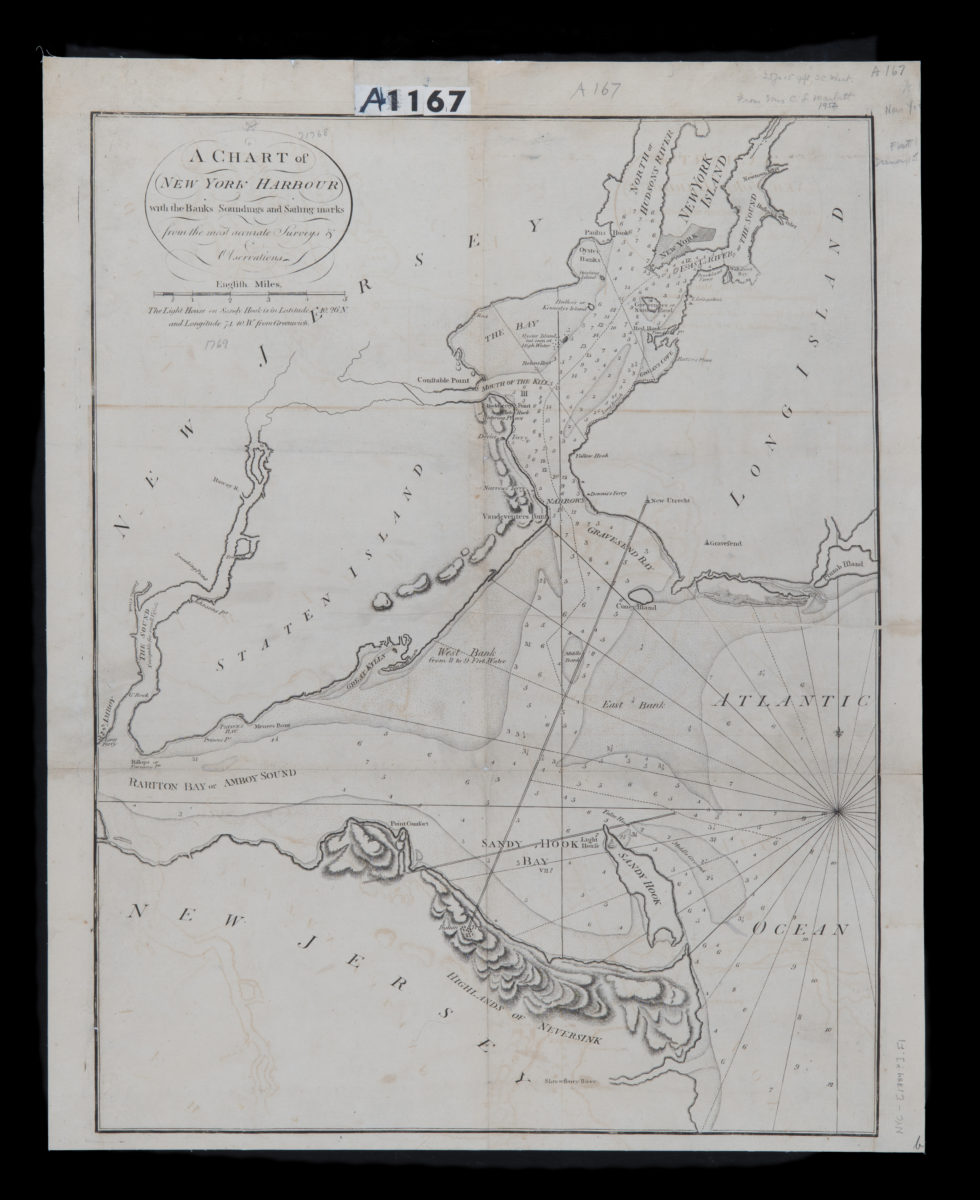
A chart of New York Harbour: with the banks, soundings and sailing marks from the most accurate surveys & observations
A chart of New York Harbour: with the banks, soundings and sailing marks from the most accurate surveys & observations
[1784]